Show All Information
Cortes Island Bylaw No. 2454, to amend Schedule A-1 "The Plan Map" to reflect the Official Community Plan
Part Of
Regional Director of Area I (Cortes Island) fonds
Description Level
File
Material Type
textual records
cartographic material
Accession Number
2004.004
Date Range
1995-2002
Scope and Content
File contains a copy of the bylaw and map of 1995, a summary of the changes (meant to reconcile 25 year gap between the previous zoning bylaws and the current OCP), and a completion and adoption strategy.
Show All Information
Cortes Island historical information
Part Of
Doreen Thompson fonds
Description Level
File
Material Type
textual records
Accession Number
2006.001
Scope and Content
File contains a photocopy image of the Peter Police homestead at Carrington Lagoon, handwritten stories by Bud Dewar, an article about Ned Breeze, a photocopy of Gary and Velma Bergman at the Whaletown store, and a list of Seaford School.
Part Of
Doreen Thompson fonds
Description Level
File
Fonds Number
2006.001
Series Number
2
File Number
4
Accession Number
2006.001
Material Type
textual records
Scope and Content
File contains a photocopy image of the Peter Police homestead at Carrington Lagoon, handwritten stories by Bud Dewar, an article about Ned Breeze, a photocopy of Gary and Velma Bergman at the Whaletown store, and a list of Seaford School.
Storage Range
1-24
Name Access
Thompson, Doreen
Show less information
Show All Information
Cortes Island Historic Committee
Part Of
May and Elmer Ellingsen fonds
Description Level
File
Material Type
textual records
Date Range
[ca. 1976]
Scope and Content
File contains an account by May Ellingsen of the activities of the Cortes Island Historic Committee, the forerunner of the Cortes Island Museum & Archives Society.
Part Of
May and Elmer Ellingsen fonds
Description Level
File
Fonds Number
2007.001
Series Number
9
File Number
1
Material Type
textual records
Date Range
[ca. 1976]
Scope and Content
File contains an account by May Ellingsen of the activities of the Cortes Island Historic Committee, the forerunner of the Cortes Island Museum & Archives Society.
Storage Location
7-49
Storage Range
7-49
Show less information
Show All Information
Cortes Island map
Part Of
Doreen Thompson fonds
Description Level
File
Material Type
cartographic material
Accession Number
2006.001
Date Range
[196?]
Scope and Content
File contains a map of Cortes Island showing quarter-sections with preemption names.
Show All Information
Cortes Island - showing places of interest to our visitors by George Griffin, hand drawn map.
Show All Information
Cortes Island subdivision map
Part Of
Gilean Douglas fonds
Description Level
File
Material Type
cartographic material
Date Range
2001
Scope and Content
Map produced by the Regional District of Comox-Strathcona showing lots with their plan numbers.
Part Of
Gilean Douglas fonds
Description Level
File
Fonds Number
1999.001
Series Number
16
File Number
6
Material Type
cartographic material
Date Range
2001
Physical Description
38 x 36.25 in (96.5 x 92 cm.)
Scope and Content
Map produced by the Regional District of Comox-Strathcona showing lots with their plan numbers.
Storage Location
Map box
Name Access
Douglas, Gilean
Show less information
Show All Information
Cortes Island zoning map, including rezoning requests and four partial maps of Cortes Island showing specific subdivision proposals
Show All Information
Cortes Island zoning maps
Part Of
Regional Director of Area I (Cortes Island) fonds
Description Level
File
Fonds Number
2002.001.3
Sous Fonds Number
3
Series Number
2
File Number
38
Accession Number
2004.004
Material Type
cartographic material
Date Range
1990
Custodial History
File contains zoning maps for Bylaw 41, Electoral Area I, Schedules A1-A7 with revisions to 1999. There is a map of the whole island and larger scale maps of island areas.
Storage Location
Map cabinet (4-14)
Storage Range
Map cabinet (4-14)
Name Access
Sirk, George
Geographic Access
Cortes Island
Show less information
Show All Information
"Cortes Official Community Plan Draft, Sept 1994" with a list of agency referral forms and draft Plan Map Schedules A and B
Show All Information
David Guthrie's map of early Cortes Island property owners
Part Of
CIMAS audiovisual collection
Description Level
Item
Material Type
multiple media
Accession Number
2019.013
Date Range
[200?]
Scope and Content
CD of a map of early Cortes property owners; a copy of the map is in the map cabinet.
Part Of
CIMAS audiovisual collection
Description Level
Item
Creator
Guthrie, David
Series Number
2
Item Number
2019.013.006
Accession Number
2019.013
Material Type
multiple media
Date Range
[200?]
Physical Description
1 CD
Scope and Content
CD of a map of early Cortes property owners; a copy of the map is in the map cabinet.
Storage Location
CD/DVD album
Geographic Access
Cortes Island
Show less information
Show All Information
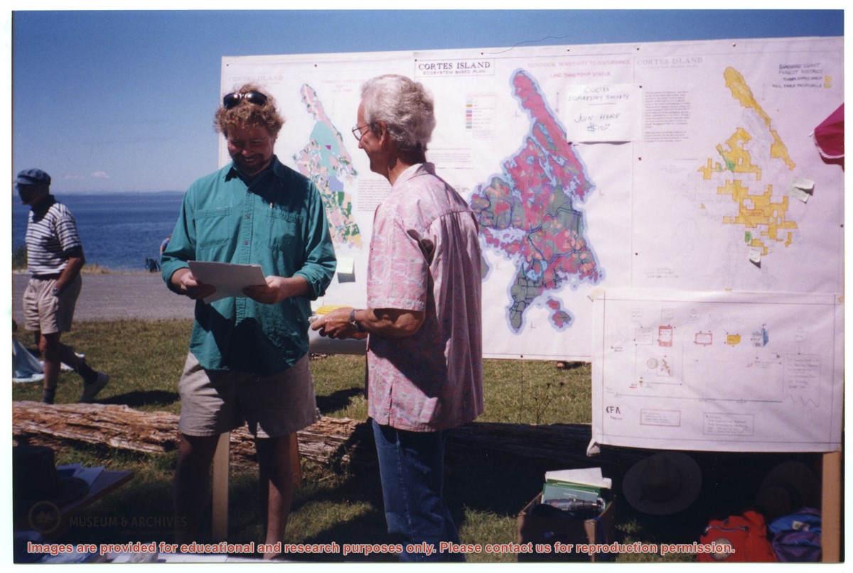
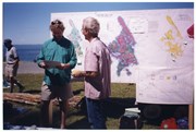
David Shipway and Bruce Ellingsen in front of CES map display at Smelt Bay
Show All Information
David Shipway (L) and Bruce Ellingen in front of CES map display, Smelt Bay
Show All Information
Distribution of Population of Canada
Part Of
Gilean Douglas fonds
Description Level
File
Material Type
cartographic material
Date Range
1961
Scope and Content
This map was prepared from Census 1961 data by the Dominion Bureau of Statistics for the Canada Year Book.
Part Of
Gilean Douglas fonds
Description Level
File
Fonds Number
1999.001
Series Number
16
File Number
9
Material Type
cartographic material
Date Range
1961
Physical Description
37.5 x 28.5 inches (95 x 72 cm)
Scope and Content
This map was prepared from Census 1961 data by the Dominion Bureau of Statistics for the Canada Year Book.
Storage Location
Map box
Storage Range
Map box
Name Access
Douglas, Gilean
Show less information
Show All Information
Electrical service: BC Hydro maps and contracts
Part Of
May and Elmer Ellingsen fonds
Description Level
File
Material Type
textual records
Date Range
1984-1985
Scope and Content
File contains BC Hydro maps and contracts with Elmer Ellingsen.
Show All Information
Electrical service: Maps and plans for BC Hydro pole installation and subdivisions
Part Of
May and Elmer Ellingsen fonds
Description Level
File
Material Type
textual records
Date Range
1969-1980
Scope and Content
File contains maps and plans for the installation of power poles, subdivisions, and the school property.
Part Of
May and Elmer Ellingsen fonds
Description Level
File
Fonds Number
2007.001
Series Number
8
File Number
46
Material Type
textual records
Date Range
1969-1980
Scope and Content
File contains maps and plans for the installation of power poles, subdivisions, and the school property.
Storage Location
7-46
Storage Range
7-46
Show less information
Show All Information
Electrical service: road construction standards; maps for electrical pole placement
Part Of
May and Elmer Ellingsen fonds
Description Level
File
Material Type
textual records
Date Range
1980-1986
Scope and Content
File contains a guide to road constructions standards, and a map for the placement of electrical poles for B.C. Hydro.
Part Of
May and Elmer Ellingsen fonds
Description Level
File
Fonds Number
2007.001
Series Number
8
File Number
47
Material Type
textual records
Date Range
1980-1986
Scope and Content
File contains a guide to road constructions standards, and a map for the placement of electrical poles for B.C. Hydro.
Storage Location
7-47
Storage Range
7-47
Show less information
Show All Information
Hand-drawn map of Manson's Lagoon area
Part Of
Doreen Thompson fonds
Description Level
File
Material Type
cartographic material
Accession Number
2006.001
Date Range
[ca. 2005]
Scope and Content
File contains a map showing the names of property owners in the area.
Show All Information
Hand-drawn map of Whaletown
Part Of
Doreen Thompson fonds
Description Level
File
Material Type
cartographic material
Accession Number
2006.001
Date Range
[199-]
Scope and Content
File contains a map of the Whaletown area of Cortes Island with information on preemptions and title changes written in.
Part Of
Doreen Thompson fonds
Description Level
File
Fonds Number
2006.001
Series Number
3
File Number
2
Accession Number
2006.001
Material Type
cartographic material
Date Range
[199-]
Scope and Content
File contains a map of the Whaletown area of Cortes Island with information on preemptions and title changes written in.
Storage Location
Oversize box
Storage Range
Oversize box
Name Access
Thompson, Doreen
Show less information
Show All Information
Historical Information series
Part Of
Doreen Thompson fonds
Description Level
Series
Material Type
textual records
Accession Number
2006.001
Scope and Content
Series consists of material pertaining to Cortes Island history and includes correspondence, notes, photographs, ephemera, clippings and two CDs.
Show All Information
Historic trading posts and territories of the governor & company of adventurers of England trading into Hudson's Bay
Part Of
Gilean Douglas fonds
Description Level
File
Material Type
cartographic material
Date Range
[1950 orig; reproduction 19??]
Scope and Content
A black and white reproduction of part of a full-colour pictorial map published by the Hudson's Bay Company.
Part Of
Gilean Douglas fonds
Description Level
File
Creator
Dinickel, Eric
Fonds Number
1999.001
Series Number
16
File Number
13
Material Type
cartographic material
Date Range
[1950 orig; reproduction 19??]
Physical Description
1 map : 13.5 x 17.75 inches
Scope and Content
A black and white reproduction of part of a full-colour pictorial map published by the Hudson's Bay Company.
Storage Location
Map box
Storage Range
Map box
Name Access
Douglas, Gilean
Show less information