Show All Information
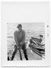
Al Taylor of Read Island
Part Of
Gilean Douglas fonds
Description Level
Item
Material Type
graphic material
Date Range
[ca. 1959]
Scope and Content
Photograph of Al Taylor, a friend of Gilean Douglas who lived on Read Island.
Part Of
Gilean Douglas fonds
Description Level
Item
Fonds Number
1999.001
Series Number
18
Item Number
1999.001.0112
Material Type
graphic material
Date Range
[ca. 1959]
Physical Description
1 photograph print: b&w; 7.5 x 10.5 cm
Scope and Content
Photograph of Al Taylor, a friend of Gilean Douglas who lived on Read Island.
Show less information
Show All Information
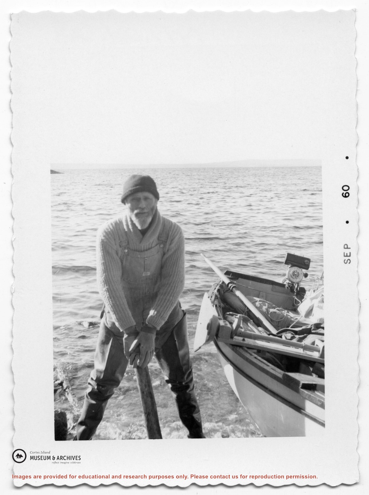
Al Taylor of Read Island
Part Of
Gilean Douglas fonds
Description Level
Item
Material Type
graphic material
Date Range
1960
Scope and Content
Photograph of Al Taylor, a friend of Gilean Douglas who lived on Read Island.
Part Of
Gilean Douglas fonds
Description Level
Item
Fonds Number
1999.001
Series Number
18
Item Number
1999.001.0268
Material Type
graphic material
Date Range
1960
Physical Description
1 photograph print: b&w; 5.5 x 8 cm
Scope and Content
Photograph of Al Taylor, a friend of Gilean Douglas who lived on Read Island.
Show less information
Show All Information
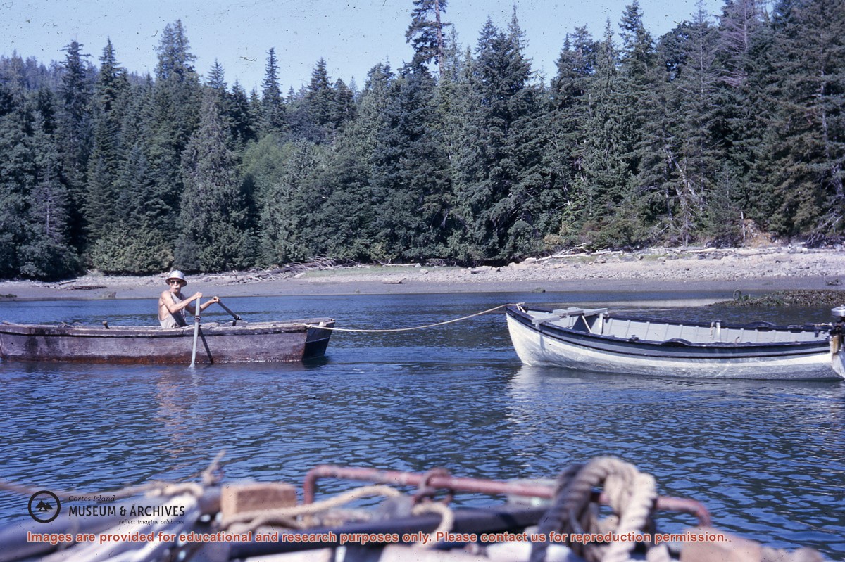
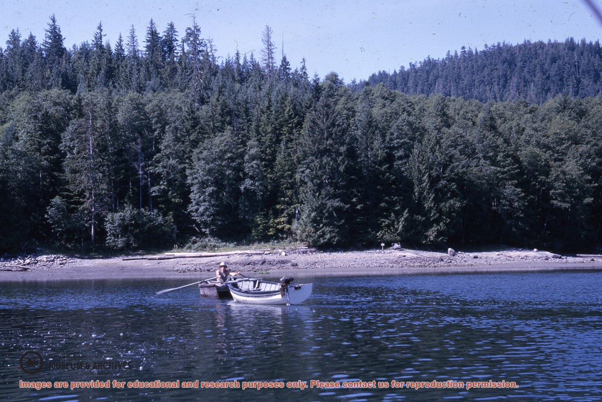
Al Taylor, rowing a boat and towing another boat, Read Island
Part Of
Gilean Douglas fonds
Description Level
Item
Fonds Number
1999.001
Series Number
18
Item Number
1999.001.2341
Material Type
graphic material
Date Range
1965
Physical Description
1 colour slide, 5 x 5 cm
Storage Location
Slide box 1
Geographic Access
Read Island
Show less information
Show All Information
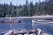
Al Taylor, rowing a boat and towing another boat, Read Island
Part Of
Gilean Douglas fonds
Description Level
Item
Fonds Number
1999.001
Series Number
18
Item Number
1999.001.2342
Material Type
graphic material
Date Range
1965
Physical Description
1 colour slide, 5 x 5 cm
Storage Location
Slide box 1
Geographic Access
Read Island
Show less information
Show All Information
Ancient map of Canada
Part Of
Gilean Douglas fonds
Description Level
File
Material Type
cartographic material
Date Range
[197?; orig. 1550]
Scope and Content
A reproduction of a map made by Pierre Desceliers, a cartographer-artist working near Dieppe, after Jacques Cartier's explorations.
Part Of
Gilean Douglas fonds
Description Level
File
Fonds Number
1999.001
Series Number
16
File Number
12
Material Type
cartographic material
Date Range
[197?; orig. 1550]
Physical Description
1 map : 21.75 x 17.25 inches
Scope and Content
A reproduction of a map made by Pierre Desceliers, a cartographer-artist working near Dieppe, after Jacques Cartier's explorations.
Storage Location
Map box
Storage Range
Map box
Name Access
Douglas, Gilean
Show less information
Show All Information
Animals, Cortes
Part Of
CIMAS information files
Description Level
File
Date Range
1989-2016
Scope and Content
Clippings, emails, and pamphlets with general info on local animals, 1989-2016
Part Of
CIMAS information files
Description Level
File
Series Number
1
File Number
4
Date Range
1989-2016
Scope and Content
Clippings, emails, and pamphlets with general info on local animals, 1989-2016
Storage Range
Drawer 1
Show less information
Show All Information
Annabelle Herbert and Gloria Jorg disembarking at Mittlenatch Island
Show All Information
Annica de Trey trekking in the Himalayas, representing the Cortes Walking Group
Show All Information
Annica de Trey trekking in the Himalayas, representing the Cortes Walking Group
Show All Information
Annotated Cortes Island map
Part Of
Gilean Douglas fonds
Description Level
File
Material Type
cartographic material
Date Range
1969
Scope and Content
The base map is a zoning map produced by the Regional District of Comox-
Strathcona for the Cortes Island Land Use Project (Aug 1969). Edwards used
coloured pencil to show land and foreshore zones, and transferred information
about early preemptions and old roads and trails from an earlier map (see
Donald Palmer fonds, 2020.002.011, map of Cortes Island, Sayward District, ca.
1915).
Part Of
Gilean Douglas fonds
Description Level
File
Fonds Number
1999.001
Series Number
16
File Number
8
Material Type
cartographic material
Date Range
1969
Physical Description
42 x 67 inches (107 x 170 cm)
Scope and Content
The base map is a zoning map produced by the Regional District of Comox-
Strathcona for the Cortes Island Land Use Project (Aug 1969). Edwards used
coloured pencil to show land and foreshore zones, and transferred information
about early preemptions and old roads and trails from an earlier map (see
Donald Palmer fonds, 2020.002.011, map of Cortes Island, Sayward District, ca.
1915).
Storage Location
Map box
Storage Range
Map box
Name Access
Douglas, Gilean
Show less information
Show All Information
Annual report of Cortes Island School
Part Of
May and Elmer Ellingsen fonds
Description Level
File
Material Type
textual records
Date Range
1913-1915
Scope and Content
File contains an over-size sheet containing the Annual Report of the Cortes Island School, filled out by Miss Lettice, and a letter to the Supt. of Education from Robert Froud. [check]
Part Of
May and Elmer Ellingsen fonds
Description Level
File
Fonds Number
2007.001
Series Number
5.2
File Number
24
Material Type
textual records
Date Range
1913-1915
Scope and Content
File contains an over-size sheet containing the Annual Report of the Cortes Island School, filled out by Miss Lettice, and a letter to the Supt. of Education from Robert Froud. [check]
Storage Location
5-24
Storage Range
5-24
Show less information
Show All Information
APC correspondence re: zoning error on District lot 307 on Cortes Bay
Show All Information
Application to the Local Initiatives Program for a grant for a Cortes heritage project
Part Of
May and Elmer Ellingsen fonds
Description Level
File
Material Type
textual records
Date Range
1976-1977
Scope and Content
File contains an application for funding for a Cortes Island heritage project.
Show All Information
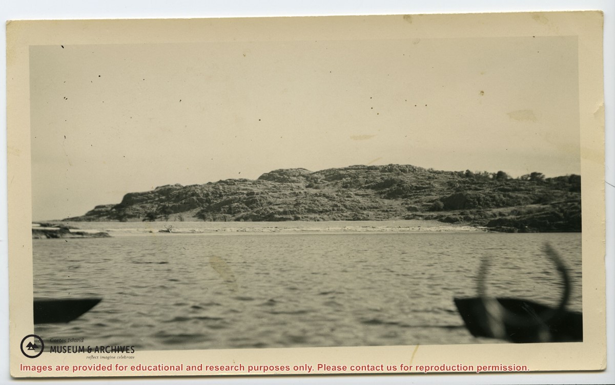
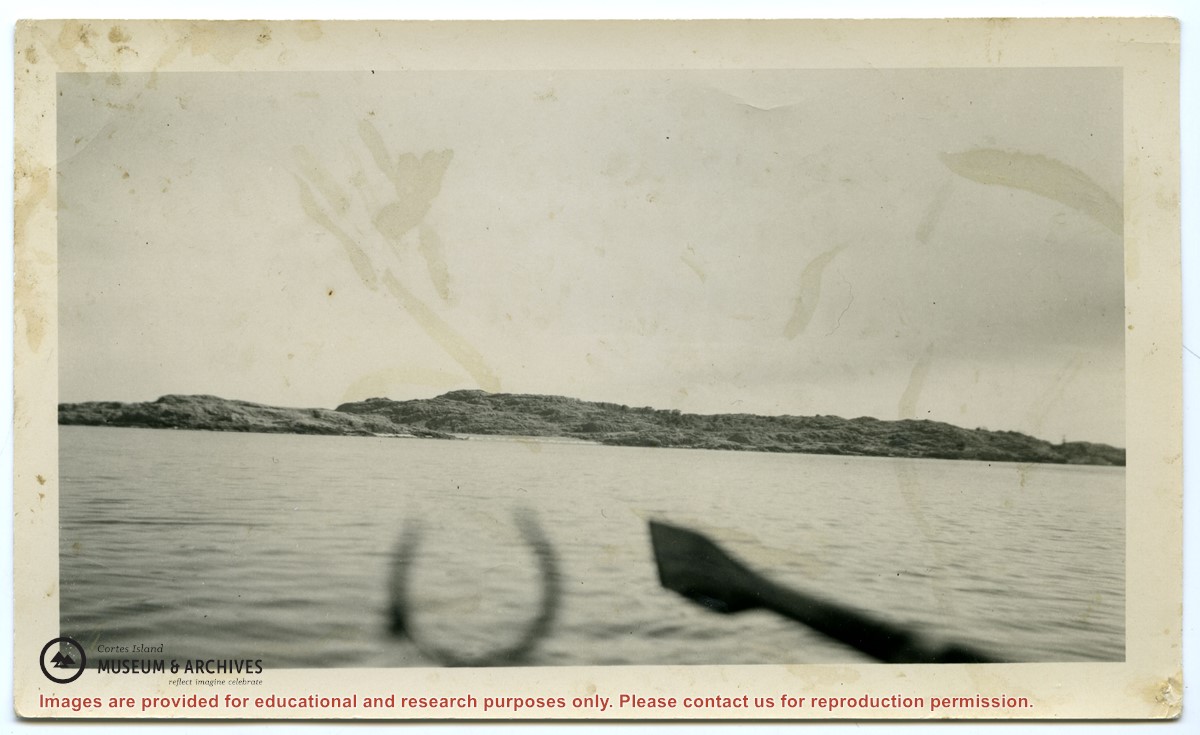
Approaching Mittlenatch Island
Part Of
May and Elmer Ellingsen fonds
Description Level
Item
Material Type
graphic material
Date Range
[ca. 1929]
Scope and Content
Photograph taken from a rowboat approaching Mittlenatch Island. (see #2007.001.030)
Part Of
May and Elmer Ellingsen fonds
Description Level
Item
Fonds Number
2007.001
Series Number
13
Item Number
2007.001.010
Material Type
graphic material
Date Range
[ca. 1929]
Physical Description
1 photograph print: b&w: 13 x 8 cm
Scope and Content
Photograph taken from a rowboat approaching Mittlenatch Island. (see #2007.001.030)
Storage Location
Photograph Box 4
Geographic Access
Mittlenatch Island
Show less information
Show All Information
Approaching Mittlenatch Island
Part Of
May and Elmer Ellingsen fonds
Description Level
Item
Material Type
graphic material
Date Range
[ca. 1929]
Scope and Content
Photograph of Mittlenatch Island from the water. (See #2007.001.010)
Part Of
May and Elmer Ellingsen fonds
Description Level
Item
Fonds Number
2007.001
Series Number
13
Item Number
2007.001.030
Material Type
graphic material
Date Range
[ca. 1929]
Physical Description
1 photograph print: b&w: 12.5 x 7 cm
Scope and Content
Photograph of Mittlenatch Island from the water. (See #2007.001.010)
Storage Location
Photograph Box 4
Geographic Access
Mittlenatch Island
Show less information
Show All Information
Aquaculture: Material relating to amendment to Cortes Aquaculture By-law
Show All Information
Aquaculture: Material relating to amendment to Cortes Aquaculture By-law
Show All Information
Aquaculture: Materials relating to Cortes Aquaculture By-law
Show All Information
Aquaculture: Materials relating to Cortes Aquaculture By-law
Show All Information
Aquaculture: Materials relating to Cortes Aquaculture By-law