Show All Information
Lot number maps of Cortes Island
Part Of
Doreen Thompson fonds
Description Level
File
Material Type
cartographic material
Accession Number
2006.001
Date Range
[19-?]
Show All Information
Hydro maps, cover letter and four of five maps showing location of hydro distribution lines on Cortes Island
Show All Information
Cortes Island zoning map, including rezoning requests and four partial maps of Cortes Island showing specific subdivision proposals
Show All Information
Cortes Island - showing places of interest to our visitors by George Griffin, hand drawn map.
Show All Information
Cortes Island zoning maps
Part Of
Regional Director of Area I (Cortes Island) fonds
Description Level
File
Fonds Number
2002.001.3
Sous Fonds Number
3
Series Number
2
File Number
38
Accession Number
2004.004
Material Type
cartographic material
Date Range
1990
Custodial History
File contains zoning maps for Bylaw 41, Electoral Area I, Schedules A1-A7 with revisions to 1999. There is a map of the whole island and larger scale maps of island areas.
Storage Location
Map cabinet (4-14)
Storage Range
Map cabinet (4-14)
Name Access
Sirk, George
Geographic Access
Cortes Island
Show less information
Show All Information
Maps of Cortes Island and Read Island
Part Of
May and Elmer Ellingsen fonds
Description Level
File
Material Type
textual records
Date Range
[1949?]
Scope and Content
File contains blue copies of maps showing property lot lines on Cortes Island and Read Island.
Part Of
May and Elmer Ellingsen fonds
Description Level
File
Fonds Number
2007.001
Series Number
10
File Number
3
Material Type
textual records
Date Range
[1949?]
Scope and Content
File contains blue copies of maps showing property lot lines on Cortes Island and Read Island.
Storage Location
7-66
Storage Range
7-66
Show less information
Show All Information
Maps of Cortes Island & surrounding area
Part Of
May and Elmer Ellingsen fonds
Description Level
File
Accession Number
2019.002
Date Range
1994
Scope and Content
File contains four (4) maps, one with handwritten notations of old homesteads.
Part Of
May and Elmer Ellingsen fonds
Description Level
File
Fonds Number
2007.001
Series Number
10
File Number
8
Accession Number
2019.002
Date Range
1994
Scope and Content
File contains four (4) maps, one with handwritten notations of old homesteads.
Storage Location
Map cabinet
Storage Range
Map cabinet
Show less information
Show All Information
Zoning maps of Cortes Island: Regional District of Comox-Strathcona zoning maps
Show All Information
"Cortes Island" informational booklet
Part Of
CIMAS ephemera collection
Description Level
File
Material Type
ephemera
Date Range
[ca. 198?]
Scope and Content
File contains an informational booklet created by the Friends of Cortes through a grant from Canada Works. Topics include island geography, social and natural history, place names and tourist education.
Part Of
CIMAS ephemera collection
Description Level
File
File Number
39
Material Type
ephemera
Date Range
[ca. 198?]
Physical Description
1 booklet : 12 pages
Custodial History
Found in files.
Scope and Content
File contains an informational booklet created by the Friends of Cortes through a grant from Canada Works. Topics include island geography, social and natural history, place names and tourist education.
Storage Location
Ephemera box
Storage Range
Ephemera box
Show less information
Show All Information
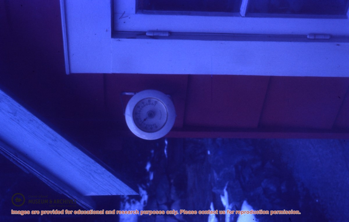
Thermometer on the Weiler house showing a reading of 0° Fahrenheit
Show All Information
Cortes Island house (ID)
Part Of
Gilean Douglas fonds
Description Level
Item
Fonds Number
1999.001
Series Number
18
Item Number
1999.001.2005
Material Type
graphic material
Date Range
1949
Physical Description
1 colour slide, 5 x 5 cm
Storage Location
Slide box 1
Geographic Access
Cortes Island
Show less information
Show All Information
Cortes Island map
Part Of
Doreen Thompson fonds
Description Level
File
Material Type
cartographic material
Accession Number
2006.001
Date Range
[196?]
Scope and Content
File contains a map of Cortes Island showing quarter-sections with preemption names.
Show All Information
Maps of Hernando Island
Part Of
May and Elmer Ellingsen fonds
Description Level
File
Material Type
cartographic material
textual records
Date Range
[190?] - 1955
Scope and Content
File contains five maps of Hernando Island: two showing plans of pre-emptions, 1891-1892; two copies of an old hand-drawn map, 1955; and one map of a later proposed development (undated). Some maps have notes on homesteads.
Part Of
May and Elmer Ellingsen fonds
Description Level
File
Fonds Number
2007.001
Series Number
10
File Number
1
Material Type
cartographic material textual records
Date Range
[190?] - 1955
Scope and Content
File contains five maps of Hernando Island: two showing plans of pre-emptions, 1891-1892; two copies of an old hand-drawn map, 1955; and one map of a later proposed development (undated). Some maps have notes on homesteads.
Storage Location
7-64
Storage Range
7-64
Geographic Access
Hernando Island
Show less information
Show All Information
"Signs of Cortes" booklet
Part Of
CIMAS ephemera collection
Description Level
File
Material Type
textual records
graphic material
Date Range
[ca. 1990s]
Scope and Content
File contains a booklet with colour photographs of roadside signs on Cortes Island.
Show All Information
Zoning map of Cortes Island
Show All Information
Topographic map of Cortes Island
Part Of
Doreen Thompson fonds
Description Level
File
Material Type
cartographic material
Accession Number
2006.001
Date Range
[197?]
Scope and Content
File contains a map issued by the Dept. of Lands, Forests & Water Resources.
Show All Information
Cortes Island subdivision map
Part Of
Gilean Douglas fonds
Description Level
File
Material Type
cartographic material
Date Range
2001
Scope and Content
Map produced by the Regional District of Comox-Strathcona showing lots with their plan numbers.
Part Of
Gilean Douglas fonds
Description Level
File
Fonds Number
1999.001
Series Number
16
File Number
6
Material Type
cartographic material
Date Range
2001
Physical Description
38 x 36.25 in (96.5 x 92 cm.)
Scope and Content
Map produced by the Regional District of Comox-Strathcona showing lots with their plan numbers.
Storage Location
Map box
Name Access
Douglas, Gilean
Show less information
Show All Information
Annotated Cortes Island map
Part Of
Gilean Douglas fonds
Description Level
File
Material Type
cartographic material
Date Range
1969
Scope and Content
The base map is a zoning map produced by the Regional District of Comox-
Strathcona for the Cortes Island Land Use Project (Aug 1969). Edwards used
coloured pencil to show land and foreshore zones, and transferred information
about early preemptions and old roads and trails from an earlier map (see
Donald Palmer fonds, 2020.002.011, map of Cortes Island, Sayward District, ca.
1915).
Part Of
Gilean Douglas fonds
Description Level
File
Fonds Number
1999.001
Series Number
16
File Number
8
Material Type
cartographic material
Date Range
1969
Physical Description
42 x 67 inches (107 x 170 cm)
Scope and Content
The base map is a zoning map produced by the Regional District of Comox-
Strathcona for the Cortes Island Land Use Project (Aug 1969). Edwards used
coloured pencil to show land and foreshore zones, and transferred information
about early preemptions and old roads and trails from an earlier map (see
Donald Palmer fonds, 2020.002.011, map of Cortes Island, Sayward District, ca.
1915).
Storage Location
Map box
Storage Range
Map box
Name Access
Douglas, Gilean
Show less information
Show All Information
Map of Cortes Island, Sayward District
Part Of
Donald Palmer fonds
Description Level
Item
Material Type
cartographic material
Date Range
[ca. 1915?]
Scope and Content
This large (6 feet by 3 feet) map of Cortes Island shows preemptions to about 1915, roads and trails. Map had been folded for storage.
Part Of
Donald Palmer fonds
Description Level
Item
Creator
Palmer, Donald
Fonds Number
2020.002
Item Number
2020.002.011
Material Type
cartographic material
Date Range
[ca. 1915?]
Physical Description
1 map : 188 x 92 cm
Scope and Content
This large (6 feet by 3 feet) map of Cortes Island shows preemptions to about 1915, roads and trails. Map had been folded for storage.
Show less information
Show All Information
Map of Cortes Island REFILED?? check
Part Of
May and Elmer Ellingsen fonds
Description Level
File
Material Type
textual records
Date Range
1963
Scope and Content
File contains a photo-copy of a hand-drawn map of Cortes Island.