Show All Information
Cortes Island subdivision map
Part Of
Gilean Douglas fonds
Description Level
File
Material Type
cartographic material
Date Range
2001
Scope and Content
Map produced by the Regional District of Comox-Strathcona showing lots with their plan numbers.
Part Of
Gilean Douglas fonds
Description Level
File
Fonds Number
1999.001
Series Number
16
File Number
6
Material Type
cartographic material
Date Range
2001
Physical Description
38 x 36.25 in (96.5 x 92 cm.)
Scope and Content
Map produced by the Regional District of Comox-Strathcona showing lots with their plan numbers.
Storage Location
Map box
Name Access
Douglas, Gilean
Show less information
Show All Information
British Columbia Department of Lands map of Southwestern Districts of BC
Part Of
Gilean Douglas fonds
Description Level
File
Material Type
cartographic material
Date Range
1925
Scope and Content
Coloured map of southwestern BC showing municipalities, geographical features, land and sea routes, natural resources, etc. The back of the map is fully printed with information about BC and suggested travel itineraries.
Map needs preservation: edges are frayed and there are several tears.
Part Of
Gilean Douglas fonds
Description Level
File
Fonds Number
1999.001
Series Number
16
File Number
7
Material Type
cartographic material
Date Range
1925
Physical Description
38 x 36.25 in (31.5 x 80 cm)
Scope and Content
Coloured map of southwestern BC showing municipalities, geographical features, land and sea routes, natural resources, etc. The back of the map is fully printed with information about BC and suggested travel itineraries.
Map needs preservation: edges are frayed and there are several tears.
Storage Location
Map box
Storage Range
Map box
Name Access
Douglas, Gilean
Show less information
Show All Information
Annotated Cortes Island map
Part Of
Gilean Douglas fonds
Description Level
File
Material Type
cartographic material
Date Range
1969
Scope and Content
The base map is a zoning map produced by the Regional District of Comox-
Strathcona for the Cortes Island Land Use Project (Aug 1969). Edwards used
coloured pencil to show land and foreshore zones, and transferred information
about early preemptions and old roads and trails from an earlier map (see
Donald Palmer fonds, 2020.002.011, map of Cortes Island, Sayward District, ca.
1915).
Part Of
Gilean Douglas fonds
Description Level
File
Fonds Number
1999.001
Series Number
16
File Number
8
Material Type
cartographic material
Date Range
1969
Physical Description
42 x 67 inches (107 x 170 cm)
Scope and Content
The base map is a zoning map produced by the Regional District of Comox-
Strathcona for the Cortes Island Land Use Project (Aug 1969). Edwards used
coloured pencil to show land and foreshore zones, and transferred information
about early preemptions and old roads and trails from an earlier map (see
Donald Palmer fonds, 2020.002.011, map of Cortes Island, Sayward District, ca.
1915).
Storage Location
Map box
Storage Range
Map box
Name Access
Douglas, Gilean
Show less information
Show All Information
Distribution of Population of Canada
Part Of
Gilean Douglas fonds
Description Level
File
Material Type
cartographic material
Date Range
1961
Scope and Content
This map was prepared from Census 1961 data by the Dominion Bureau of Statistics for the Canada Year Book.
Part Of
Gilean Douglas fonds
Description Level
File
Fonds Number
1999.001
Series Number
16
File Number
9
Material Type
cartographic material
Date Range
1961
Physical Description
37.5 x 28.5 inches (95 x 72 cm)
Scope and Content
This map was prepared from Census 1961 data by the Dominion Bureau of Statistics for the Canada Year Book.
Storage Location
Map box
Storage Range
Map box
Name Access
Douglas, Gilean
Show less information
Show All Information
Ancient map of Canada
Part Of
Gilean Douglas fonds
Description Level
File
Material Type
cartographic material
Date Range
[197?; orig. 1550]
Scope and Content
A reproduction of a map made by Pierre Desceliers, a cartographer-artist working near Dieppe, after Jacques Cartier's explorations.
Part Of
Gilean Douglas fonds
Description Level
File
Fonds Number
1999.001
Series Number
16
File Number
12
Material Type
cartographic material
Date Range
[197?; orig. 1550]
Physical Description
1 map : 21.75 x 17.25 inches
Scope and Content
A reproduction of a map made by Pierre Desceliers, a cartographer-artist working near Dieppe, after Jacques Cartier's explorations.
Storage Location
Map box
Storage Range
Map box
Name Access
Douglas, Gilean
Show less information
Show All Information
Map of northern Canada
Part Of
Gilean Douglas fonds
Description Level
File
Material Type
cartographic material
Date Range
[197?]
Scope and Content
Pictorial map of northern Canada, showing resources, wildlife and history. Printed in b&w with one colour (blue).
Part Of
Gilean Douglas fonds
Description Level
File
Fonds Number
1999.001
Series Number
16
File Number
10
Material Type
cartographic material
Date Range
[197?]
Physical Description
1 map : 33.5 x 16.5 inches
Scope and Content
Pictorial map of northern Canada, showing resources, wildlife and history. Printed in b&w with one colour (blue).
Storage Location
Map box
Storage Range
Map box
Name Access
Douglas, Gilean
Show less information
Show All Information
"The Queen's Realm, Past and Present"
Part Of
Gilean Douglas fonds
Description Level
File
Material Type
cartographic material
Date Range
1953
Scope and Content
Map of the British Empire, drawn by Eric Dinickel for publication in the June, 1953 issue of Maclean’s (the month of the coronation of Queen Elizabeth II). Printed in full colour.
Part Of
Gilean Douglas fonds
Description Level
File
Creator
Aldwinckle, Eric
Fonds Number
1999.001
Series Number
16
File Number
11
Material Type
cartographic material
Date Range
1953
Physical Description
1 map : 27.25 x 18.75 inches
Scope and Content
Map of the British Empire, drawn by Eric Dinickel for publication in the June, 1953 issue of Maclean’s (the month of the coronation of Queen Elizabeth II). Printed in full colour.
Storage Location
Map box
Storage Range
Map box
Name Access
Douglas, Gilean
Show less information
Show All Information
Historic trading posts and territories of the governor & company of adventurers of England trading into Hudson's Bay
Part Of
Gilean Douglas fonds
Description Level
File
Material Type
cartographic material
Date Range
[1950 orig; reproduction 19??]
Scope and Content
A black and white reproduction of part of a full-colour pictorial map published by the Hudson's Bay Company.
Part Of
Gilean Douglas fonds
Description Level
File
Creator
Dinickel, Eric
Fonds Number
1999.001
Series Number
16
File Number
13
Material Type
cartographic material
Date Range
[1950 orig; reproduction 19??]
Physical Description
1 map : 13.5 x 17.75 inches
Scope and Content
A black and white reproduction of part of a full-colour pictorial map published by the Hudson's Bay Company.
Storage Location
Map box
Storage Range
Map box
Name Access
Douglas, Gilean
Show less information
Show All Information
Ephemera from the 1920s
Part Of
Gilean Douglas fonds
Description Level
File
Material Type
graphic material
Date Range
1920; 1929
Scope and Content
File contains daily menus from the US Disciplinary Barracks on Alcatraz Island (1929) and two pamphlets on venereal disease (1920).
Part Of
Gilean Douglas fonds
Description Level
File
Fonds Number
1999.001
Series Number
14
File Number
22
Material Type
graphic material
Date Range
1920; 1929
Scope and Content
File contains daily menus from the US Disciplinary Barracks on Alcatraz Island (1929) and two pamphlets on venereal disease (1920).
Storage Location
6-27
Storage Range
6-27
Show less information
Show All Information
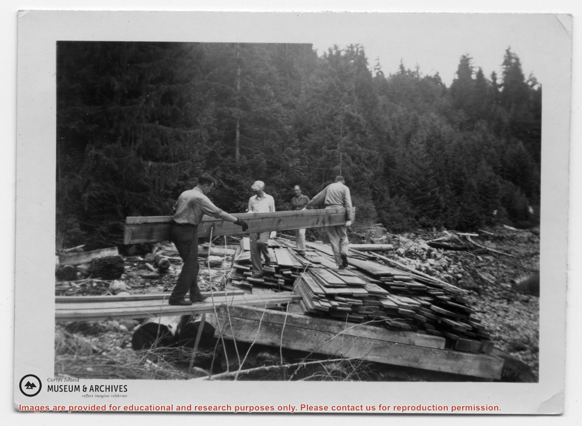
Men loading lumber for building the Whaletown clinic
Part Of
Gilean Douglas fonds
Description Level
Item
Material Type
graphic material
Date Range
[ca. 1950]
Scope and Content
Photograph labelled "Rendezvous Patrol. A work bee of men from Whaletown, loading lumber onto a float left dry at low tide. The lumber, to be used for the Clinic Building, was loaded, and then floated off the beach at high tide and towed home."
Part Of
Gilean Douglas fonds
Description Level
Item
Fonds Number
1999.001
Series Number
18
Item Number
1999.001.1127
Material Type
graphic material
Date Range
[ca. 1950]
Physical Description
1 photograph print: b&w, 8.5 x 6 cm
Scope and Content
Photograph labelled "Rendezvous Patrol. A work bee of men from Whaletown, loading lumber onto a float left dry at low tide. The lumber, to be used for the Clinic Building, was loaded, and then floated off the beach at high tide and towed home."
Subject Access
Columbia Coast Mission Health care
Geographic Access
Whaletown
Show less information
Show All Information
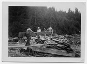
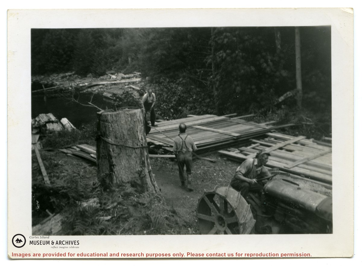
Men pulling lumber for the Whaletown clinic up from the beach
Part Of
Gilean Douglas fonds
Description Level
Item
Material Type
graphic material
Date Range
[ca. 1950]
Show All Information
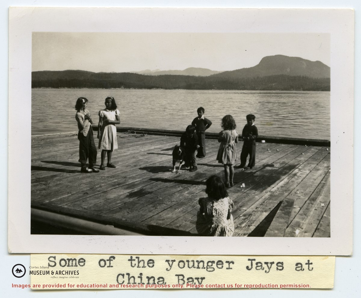
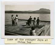
"Some of the younger Jays at China Bay" - children on a float
Part Of
Gilean Douglas fonds
Description Level
Item
Material Type
graphic material
Date Range
[ca. 1950]
Show All Information
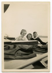
Kathleen (Kay) Boas and two children on the "Rendezvous"
Part Of
Gilean Douglas fonds
Description Level
Item
Material Type
graphic material
Date Range
[ca. 1950]
Show All Information
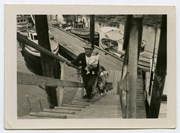
"Patients from Mansons" - man carrying a child up the ramp at the Manson's Landing wharf
Part Of
Gilean Douglas fonds
Description Level
Item
Material Type
graphic material
Date Range
[ca. 1950]
Show All Information
A sling being lowered from the "Rendezvous"
Part Of
Gilean Douglas fonds
Description Level
Item
Material Type
graphic material
Date Range
[ca. 1950]
Show All Information
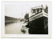
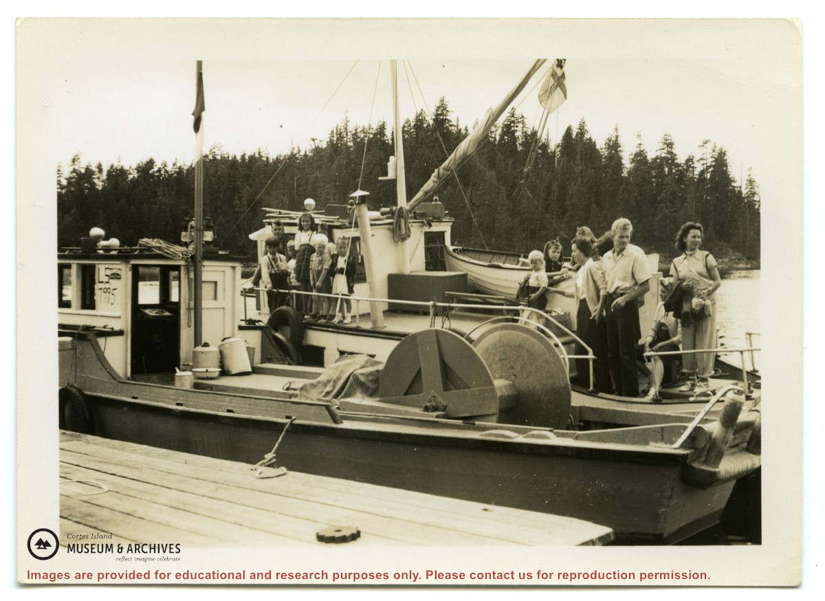
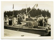
Group of people on the deck of the "Rendezvous"
Part Of
Gilean Douglas fonds
Description Level
Item
Material Type
graphic material
Date Range
[ca. 1950]
Scope and Content
Photograph labelled on the back "Picnic crew landing at Welde's (handwriting unclear) home." Inscription by Mr. or Mrs. Boas.
Part Of
Gilean Douglas fonds
Description Level
Item
Fonds Number
1999.001
Series Number
18
Item Number
1999.001.1133
Material Type
graphic material
Date Range
[ca. 1950]
Physical Description
1 photograph print: b&w, 8.5 x 6 cm
Scope and Content
Photograph labelled on the back "Picnic crew landing at Welde's (handwriting unclear) home." Inscription by Mr. or Mrs. Boas.
Subject Access
Columbia Coast Mission
Show less information
Show All Information
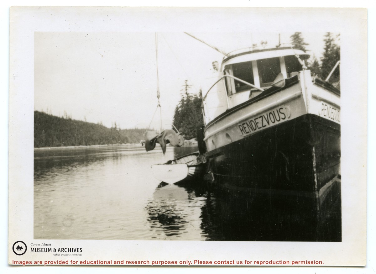
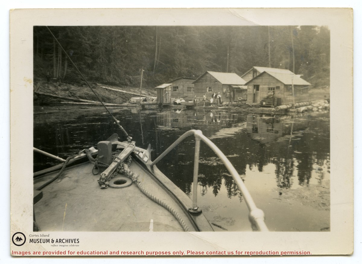
The "Rendezvous" approaching a float camp
Part Of
Gilean Douglas fonds
Description Level
Item
Material Type
graphic material
Date Range
[ca. 1950]
Scope and Content
Photograph has a caption by Gilean Douglas: "Rendezvous Patrol. The good ship noses into a floating logging camp, where patients are waiting to be taken to the medical, dental clinic held at Whaletown in the mission house."
Part Of
Gilean Douglas fonds
Description Level
Item
Fonds Number
1999.001
Series Number
18
Item Number
1999.001.1134
Material Type
graphic material
Date Range
[ca. 1950]
Physical Description
1 photograph print: b&w, 8.5 x 6 cm
Scope and Content
Photograph has a caption by Gilean Douglas: "Rendezvous Patrol. The good ship noses into a floating logging camp, where patients are waiting to be taken to the medical, dental clinic held at Whaletown in the mission house."
Subject Access
Logging Columbia Coast Mission Health care
Geographic Access
Whaletown
Show less information
Show All Information
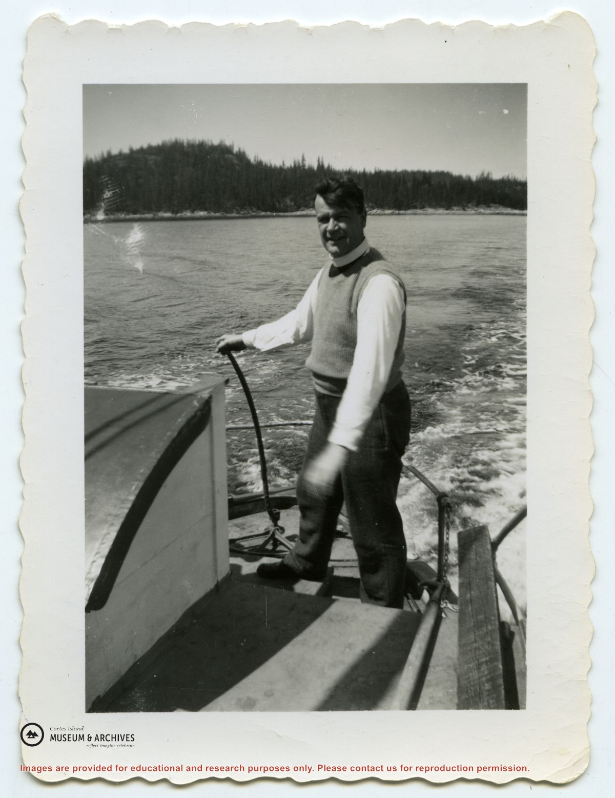
Rev. Rollo Boas steering the "Rendezvous"
Part Of
Gilean Douglas fonds
Description Level
Item
Material Type
graphic material
Date Range
[ca. 1950]
Scope and Content
Photograph has a caption by Gilean Douglas on the back: "Mr. Bowes (sic) emergency steering apparatus - only used once."
Part Of
Gilean Douglas fonds
Description Level
Item
Fonds Number
1999.001
Series Number
18
Item Number
1999.001.1135
Material Type
graphic material
Date Range
[ca. 1950]
Physical Description
1 photograph print: b&w, 8.5 x 6 cm
Scope and Content
Photograph has a caption by Gilean Douglas on the back: "Mr. Bowes (sic) emergency steering apparatus - only used once."
Subject Access
Columbia Coast Mission
Show less information
Show All Information
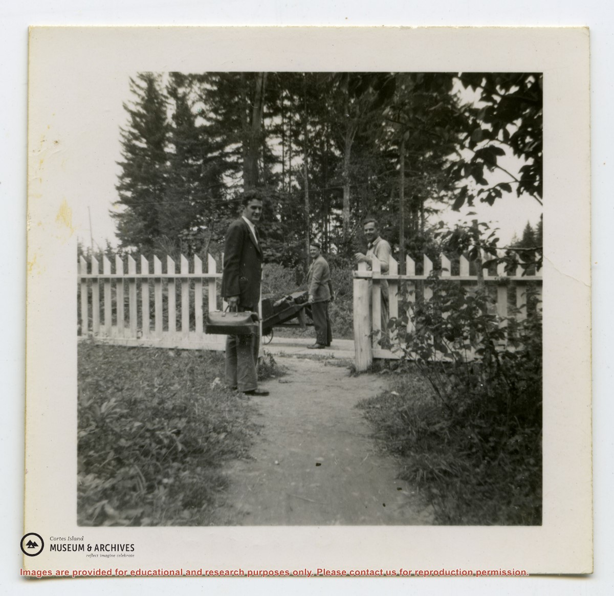
Dr. Margetts and Rev. Boas, with a hand cart, at the gate of the mission house in Whaletown
Part Of
Gilean Douglas fonds
Description Level
Item
Material Type
graphic material
Date Range
[ca. 1950]
Scope and Content
The medical and dental clinic established by Boas was held twice a month. Every second Friday, Dr. Bathurst Hall and Dr. Phillip Margetts travelled from Campbell River to Heriot Bay by water and land taxi, and were ferried from there to Whaletown in the "Rendezvous".
Part Of
Gilean Douglas fonds
Description Level
Item
Fonds Number
1999.001
Series Number
18
Item Number
1999.001.1136
Material Type
graphic material
Date Range
[ca. 1950]
Physical Description
1 photograph print: b&w, 5 x 5 cm
Scope and Content
The medical and dental clinic established by Boas was held twice a month. Every second Friday, Dr. Bathurst Hall and Dr. Phillip Margetts travelled from Campbell River to Heriot Bay by water and land taxi, and were ferried from there to Whaletown in the "Rendezvous".
Subject Access
Columbia Coast Mission
Geographic Access
Whaletown
Show less information
Show All Information
Two men standing on a log walkway joining a float to the shore; buildings on shore in the background
Part Of
Gilean Douglas fonds
Description Level
Item
Material Type
graphic material
Date Range
[ca. 1950]
Scope and Content
Photograph labelled on the back: "Going ashore with Marten Winghen (? handwriting unclear), Okisollo Channel
Part Of
Gilean Douglas fonds
Description Level
Item
Fonds Number
1999.001
Series Number
18
Item Number
1999.001.1137
Material Type
graphic material
Date Range
[ca. 1950]
Physical Description
1 photograph print: b&w, 8.5 x 6 cm
Scope and Content
Photograph labelled on the back: "Going ashore with Marten Winghen (? handwriting unclear), Okisollo Channel
Subject Access
Columbia Coast Mission
Show less information