Show All Information
Cortes Island subdivision map
Part Of
Gilean Douglas fonds
Description Level
File
Material Type
cartographic material
Date Range
2001
Scope and Content
Map produced by the Regional District of Comox-Strathcona showing lots with their plan numbers.
Part Of
Gilean Douglas fonds
Description Level
File
Fonds Number
1999.001
Series Number
16
File Number
6
Material Type
cartographic material
Date Range
2001
Physical Description
38 x 36.25 in (96.5 x 92 cm.)
Scope and Content
Map produced by the Regional District of Comox-Strathcona showing lots with their plan numbers.
Storage Location
Map box
Name Access
Douglas, Gilean
Show less information
Show All Information
British Columbia Department of Lands map of Southwestern Districts of BC
Part Of
Gilean Douglas fonds
Description Level
File
Material Type
cartographic material
Date Range
1925
Scope and Content
Coloured map of southwestern BC showing municipalities, geographical features, land and sea routes, natural resources, etc. The back of the map is fully printed with information about BC and suggested travel itineraries.
Map needs preservation: edges are frayed and there are several tears.
Part Of
Gilean Douglas fonds
Description Level
File
Fonds Number
1999.001
Series Number
16
File Number
7
Material Type
cartographic material
Date Range
1925
Physical Description
38 x 36.25 in (31.5 x 80 cm)
Scope and Content
Coloured map of southwestern BC showing municipalities, geographical features, land and sea routes, natural resources, etc. The back of the map is fully printed with information about BC and suggested travel itineraries.
Map needs preservation: edges are frayed and there are several tears.
Storage Location
Map box
Storage Range
Map box
Name Access
Douglas, Gilean
Show less information
Show All Information
Annotated Cortes Island map
Part Of
Gilean Douglas fonds
Description Level
File
Material Type
cartographic material
Date Range
1969
Scope and Content
The base map is a zoning map produced by the Regional District of Comox-
Strathcona for the Cortes Island Land Use Project (Aug 1969). Edwards used
coloured pencil to show land and foreshore zones, and transferred information
about early preemptions and old roads and trails from an earlier map (see
Donald Palmer fonds, 2020.002.011, map of Cortes Island, Sayward District, ca.
1915).
Part Of
Gilean Douglas fonds
Description Level
File
Fonds Number
1999.001
Series Number
16
File Number
8
Material Type
cartographic material
Date Range
1969
Physical Description
42 x 67 inches (107 x 170 cm)
Scope and Content
The base map is a zoning map produced by the Regional District of Comox-
Strathcona for the Cortes Island Land Use Project (Aug 1969). Edwards used
coloured pencil to show land and foreshore zones, and transferred information
about early preemptions and old roads and trails from an earlier map (see
Donald Palmer fonds, 2020.002.011, map of Cortes Island, Sayward District, ca.
1915).
Storage Location
Map box
Storage Range
Map box
Name Access
Douglas, Gilean
Show less information
Show All Information
Distribution of Population of Canada
Part Of
Gilean Douglas fonds
Description Level
File
Material Type
cartographic material
Date Range
1961
Scope and Content
This map was prepared from Census 1961 data by the Dominion Bureau of Statistics for the Canada Year Book.
Part Of
Gilean Douglas fonds
Description Level
File
Fonds Number
1999.001
Series Number
16
File Number
9
Material Type
cartographic material
Date Range
1961
Physical Description
37.5 x 28.5 inches (95 x 72 cm)
Scope and Content
This map was prepared from Census 1961 data by the Dominion Bureau of Statistics for the Canada Year Book.
Storage Location
Map box
Storage Range
Map box
Name Access
Douglas, Gilean
Show less information
Show All Information
Ancient map of Canada
Part Of
Gilean Douglas fonds
Description Level
File
Material Type
cartographic material
Date Range
[197?; orig. 1550]
Scope and Content
A reproduction of a map made by Pierre Desceliers, a cartographer-artist working near Dieppe, after Jacques Cartier's explorations.
Part Of
Gilean Douglas fonds
Description Level
File
Fonds Number
1999.001
Series Number
16
File Number
12
Material Type
cartographic material
Date Range
[197?; orig. 1550]
Physical Description
1 map : 21.75 x 17.25 inches
Scope and Content
A reproduction of a map made by Pierre Desceliers, a cartographer-artist working near Dieppe, after Jacques Cartier's explorations.
Storage Location
Map box
Storage Range
Map box
Name Access
Douglas, Gilean
Show less information
Show All Information
Map of northern Canada
Part Of
Gilean Douglas fonds
Description Level
File
Material Type
cartographic material
Date Range
[197?]
Scope and Content
Pictorial map of northern Canada, showing resources, wildlife and history. Printed in b&w with one colour (blue).
Part Of
Gilean Douglas fonds
Description Level
File
Fonds Number
1999.001
Series Number
16
File Number
10
Material Type
cartographic material
Date Range
[197?]
Physical Description
1 map : 33.5 x 16.5 inches
Scope and Content
Pictorial map of northern Canada, showing resources, wildlife and history. Printed in b&w with one colour (blue).
Storage Location
Map box
Storage Range
Map box
Name Access
Douglas, Gilean
Show less information
Show All Information
"The Queen's Realm, Past and Present"
Part Of
Gilean Douglas fonds
Description Level
File
Material Type
cartographic material
Date Range
1953
Scope and Content
Map of the British Empire, drawn by Eric Dinickel for publication in the June, 1953 issue of Maclean’s (the month of the coronation of Queen Elizabeth II). Printed in full colour.
Part Of
Gilean Douglas fonds
Description Level
File
Creator
Aldwinckle, Eric
Fonds Number
1999.001
Series Number
16
File Number
11
Material Type
cartographic material
Date Range
1953
Physical Description
1 map : 27.25 x 18.75 inches
Scope and Content
Map of the British Empire, drawn by Eric Dinickel for publication in the June, 1953 issue of Maclean’s (the month of the coronation of Queen Elizabeth II). Printed in full colour.
Storage Location
Map box
Storage Range
Map box
Name Access
Douglas, Gilean
Show less information
Show All Information
Historic trading posts and territories of the governor & company of adventurers of England trading into Hudson's Bay
Part Of
Gilean Douglas fonds
Description Level
File
Material Type
cartographic material
Date Range
[1950 orig; reproduction 19??]
Scope and Content
A black and white reproduction of part of a full-colour pictorial map published by the Hudson's Bay Company.
Part Of
Gilean Douglas fonds
Description Level
File
Creator
Dinickel, Eric
Fonds Number
1999.001
Series Number
16
File Number
13
Material Type
cartographic material
Date Range
[1950 orig; reproduction 19??]
Physical Description
1 map : 13.5 x 17.75 inches
Scope and Content
A black and white reproduction of part of a full-colour pictorial map published by the Hudson's Bay Company.
Storage Location
Map box
Storage Range
Map box
Name Access
Douglas, Gilean
Show less information
Show All Information
"My Him Book"
Part Of
Gilean Douglas fonds
Description Level
File
Material Type
textual records
Date Range
1924-[ca. 1970s]
Scope and Content
A small 36 page notebook (4 x 6 inches); cover is blue with a gilt art nouveau design. There are pages for "First Hims", "Childhood Hims" etc. in which Douglas has listed her significant relationships, from her childhood through the years on Cortes Island.
Part Of
Gilean Douglas fonds
Description Level
File
Fonds Number
1999.001
Series Number
12
File Number
7
Material Type
textual records
Date Range
1924-[ca. 1970s]
Scope and Content
A small 36 page notebook (4 x 6 inches); cover is blue with a gilt art nouveau design. There are pages for "First Hims", "Childhood Hims" etc. in which Douglas has listed her significant relationships, from her childhood through the years on Cortes Island.
Storage Location
5-55.1
Storage Range
5-55.1
Name Access
Douglas, Gilean
Show less information
Show All Information
William M. Douglas notebooks
Part Of
Gilean Douglas fonds
Description Level
File
Material Type
textual records
Date Range
1889-[ca.1910]
Scope and Content
File contains six small leather-bound memo books with entries and jottings by Wm. Douglas which include such things as household accounts, trip diaries, appointments, and golf scores.
Part Of
Gilean Douglas fonds
Description Level
File
Fonds Number
1999.001
Series Number
12
File Number
8
Material Type
textual records
Date Range
1889-[ca.1910]
Scope and Content
File contains six small leather-bound memo books with entries and jottings by Wm. Douglas which include such things as household accounts, trip diaries, appointments, and golf scores.
Storage Location
5-55.2
Storage Range
5-55.2
Name Access
Douglas, William Douglas, Gilean
Show less information
Show All Information
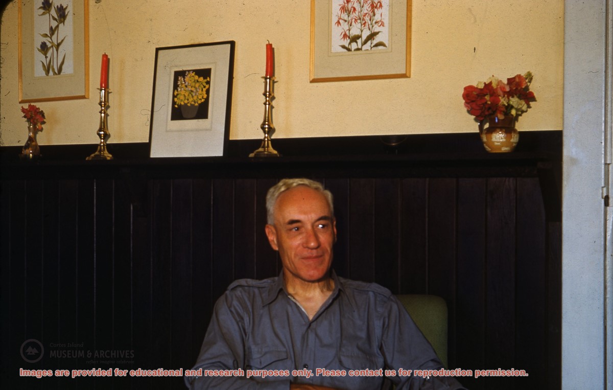
Man seated in chair, in the Channel Rock living room (ID)
Part Of
Gilean Douglas fonds
Description Level
Item
Material Type
graphic material
Date Range
[ca. 1949]
Show All Information
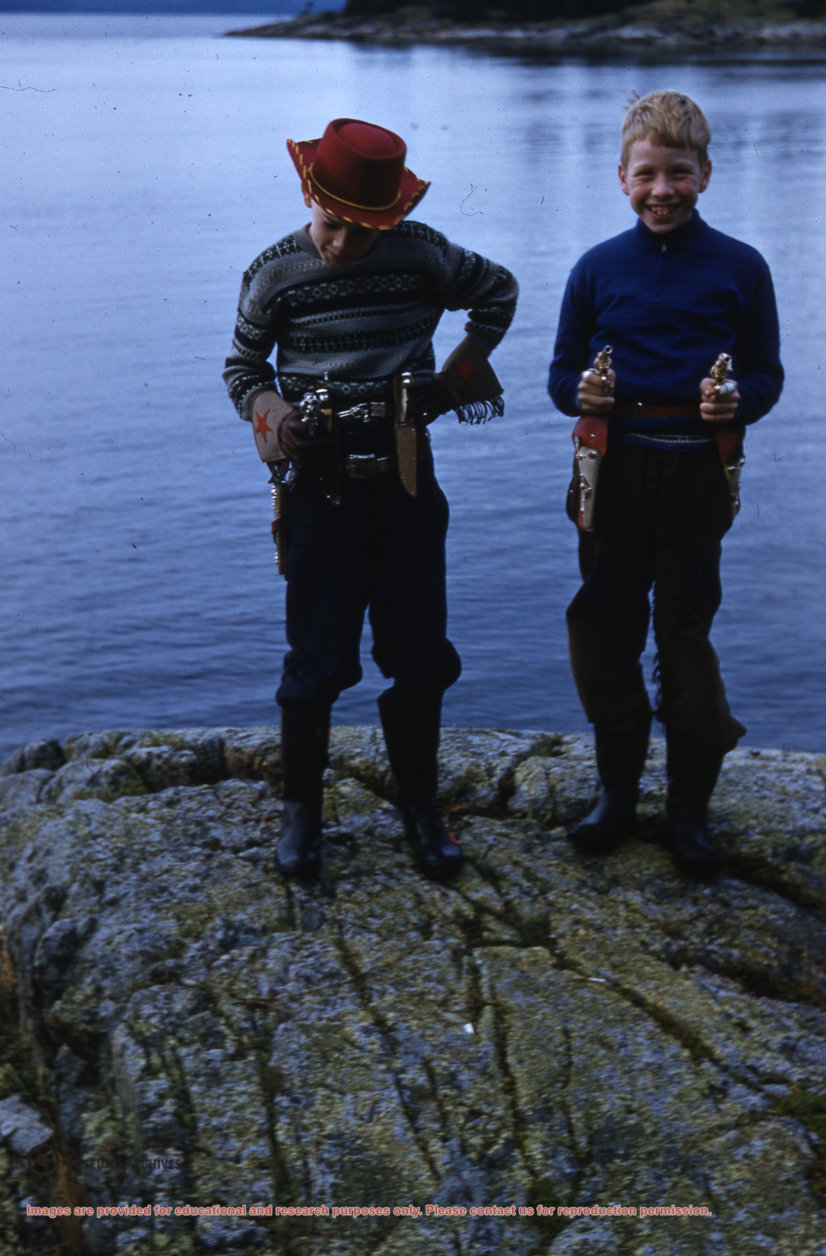
Two boys (Dennis Newsham and Andy Robertson (ID) ) with toy guns and holsters
Part Of
Gilean Douglas fonds
Description Level
Item
Material Type
graphic material
Date Range
[195-]
Show All Information
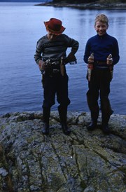
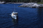
The "Oliver Clark" approaching Channel Rock
Part Of
Gilean Douglas fonds
Description Level
Item
Material Type
graphic material
Date Range
[195-]
Show All Information
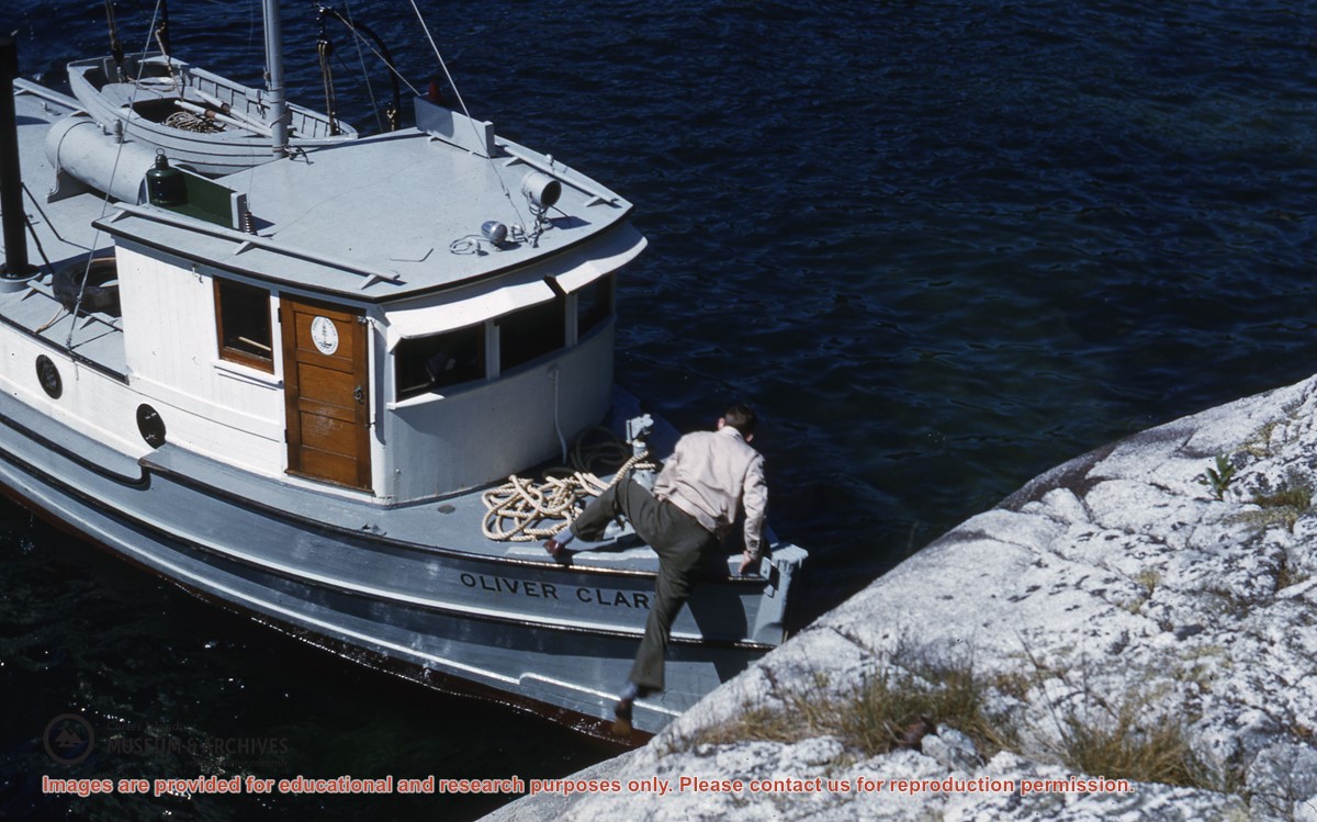
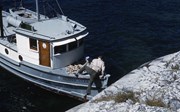
A man boarding the "Oliver Clark" at Channel Rock
Part Of
Gilean Douglas fonds
Description Level
Item
Material Type
graphic material
Date Range
[195-]
Show All Information
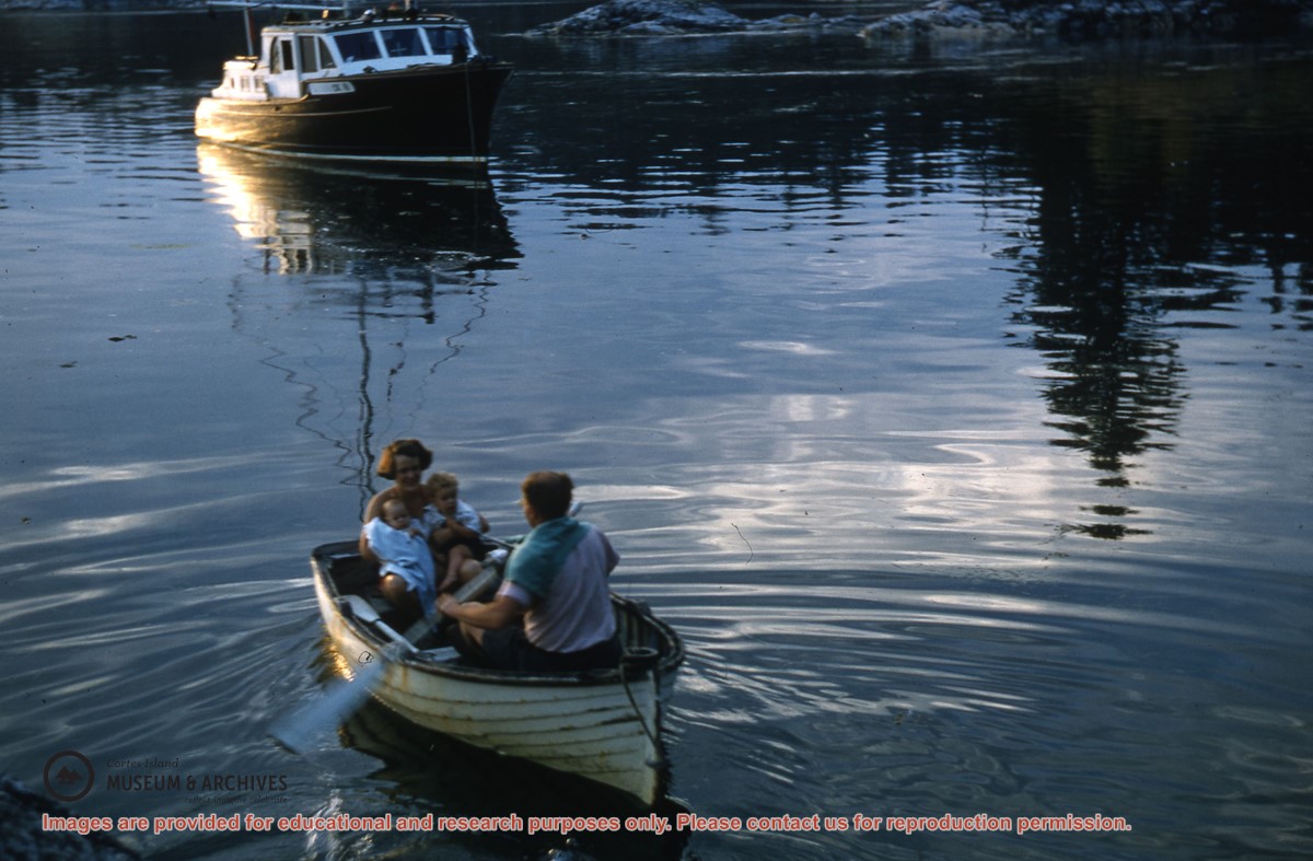
The Titus family in their dinghy at Channel Rock
Part Of
Gilean Douglas fonds
Description Level
Item
Material Type
graphic material
Date Range
[195-]
Scope and Content
Photograph of Joan Titus, the Rev. Joe Titus, and their two children.
Show All Information
Rev. Joe Titus rowing his wife Joan and their two children to the "John Antle"
Part Of
Gilean Douglas fonds
Description Level
Item
Material Type
graphic material
Date Range
[195-]
Show All Information
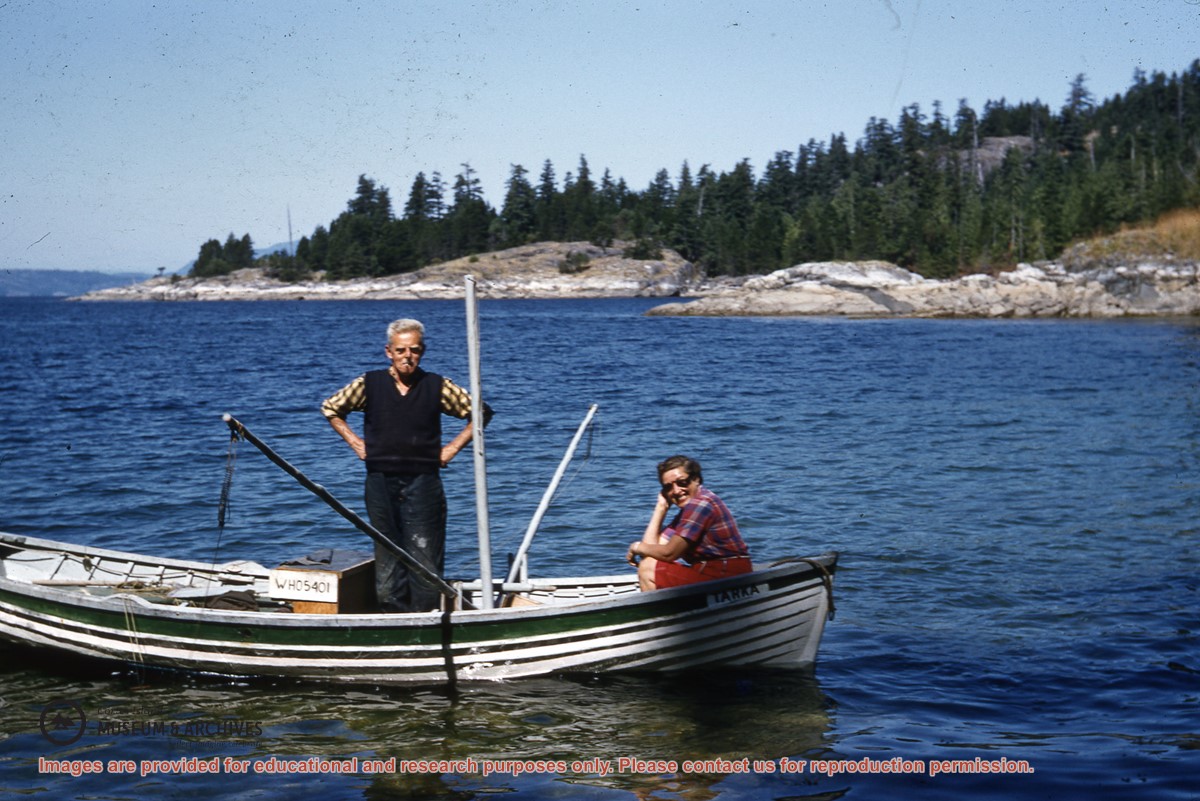
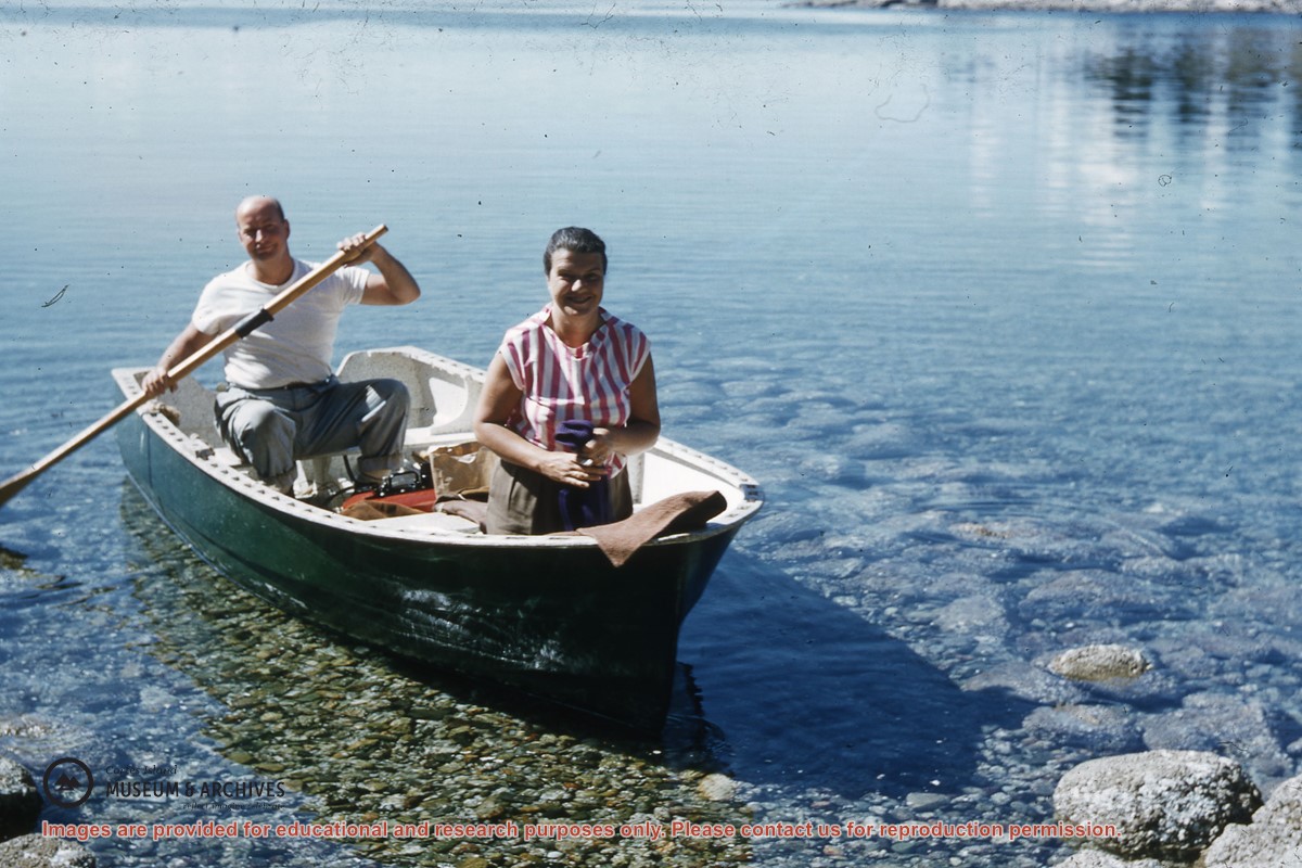
A man and woman in a boat, "Tarka" (ID)
Part Of
Gilean Douglas fonds
Description Level
Item
Material Type
graphic material
Date Range
[195-]
Show All Information
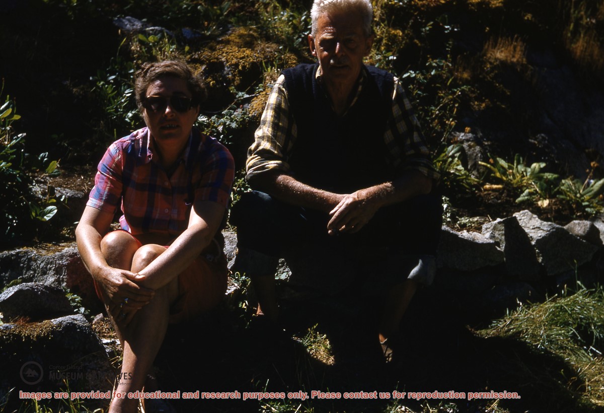
Woman and man sitting on the rocks at Channel Rock (ID) (same as #1999.001.2019)
Part Of
Gilean Douglas fonds
Description Level
Item
Material Type
graphic material
Date Range
[195-]
Show All Information
Man and woman in a small motor boat at Channel Rock (ID)
Part Of
Gilean Douglas fonds
Description Level
Item
Material Type
graphic material
Date Range
[195-]
Show All Information
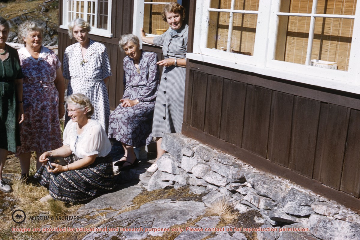
Group of women standing in front of the cabin at Channel Rock
Part Of
Gilean Douglas fonds
Description Level
Item
Material Type
graphic material
Date Range
[195-]
Scope and Content
Left to Right: Mrs Louisa Kendrick, Mrs Ruth Byers, Mrs Jessie Thornton, ?(ID), Mrs Gilean Douglas; seated, Mrs Meg Shaw
Part Of
Gilean Douglas fonds
Description Level
Item
Fonds Number
1999.001
Series Number
18
Item Number
1999.001.2022
Material Type
graphic material
Date Range
[195-]
Physical Description
1 colour slide, 5 x 5 cm
Scope and Content
Left to Right: Mrs Louisa Kendrick, Mrs Ruth Byers, Mrs Jessie Thornton, ?(ID), Mrs Gilean Douglas; seated, Mrs Meg Shaw
Storage Location
Slide box 1
Name Access
Channel Rock
Subject Access
Women's Institute
Geographic Access
Cortes Island
Show less information