Show All Information
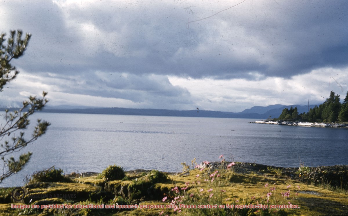
View towards Vancouver Island from Channel Rock
Part Of
Gilean Douglas fonds
Description Level
Item
Material Type
graphic material
Date Range
1958-1959
Show All Information
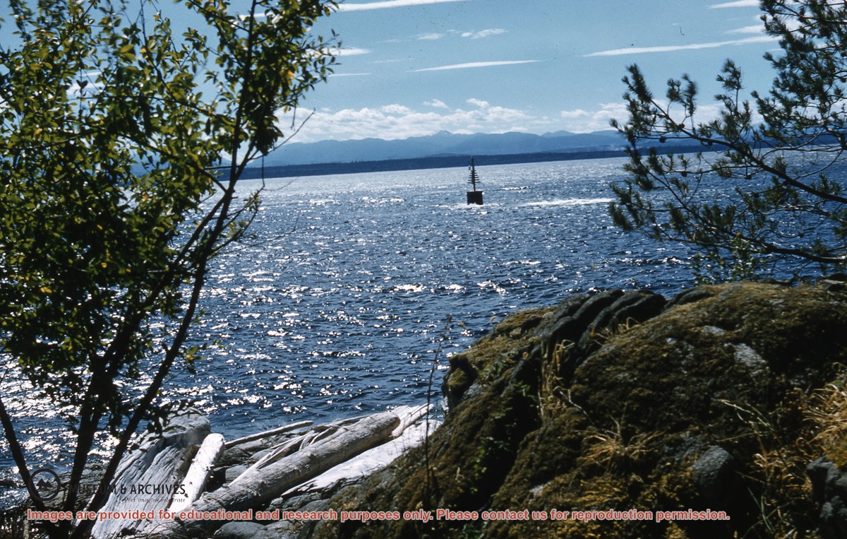
View of the channel marker, looking towards Vancouver Island
Part Of
Gilean Douglas fonds
Description Level
Item
Material Type
graphic material
Date Range
1957-1958
Show All Information
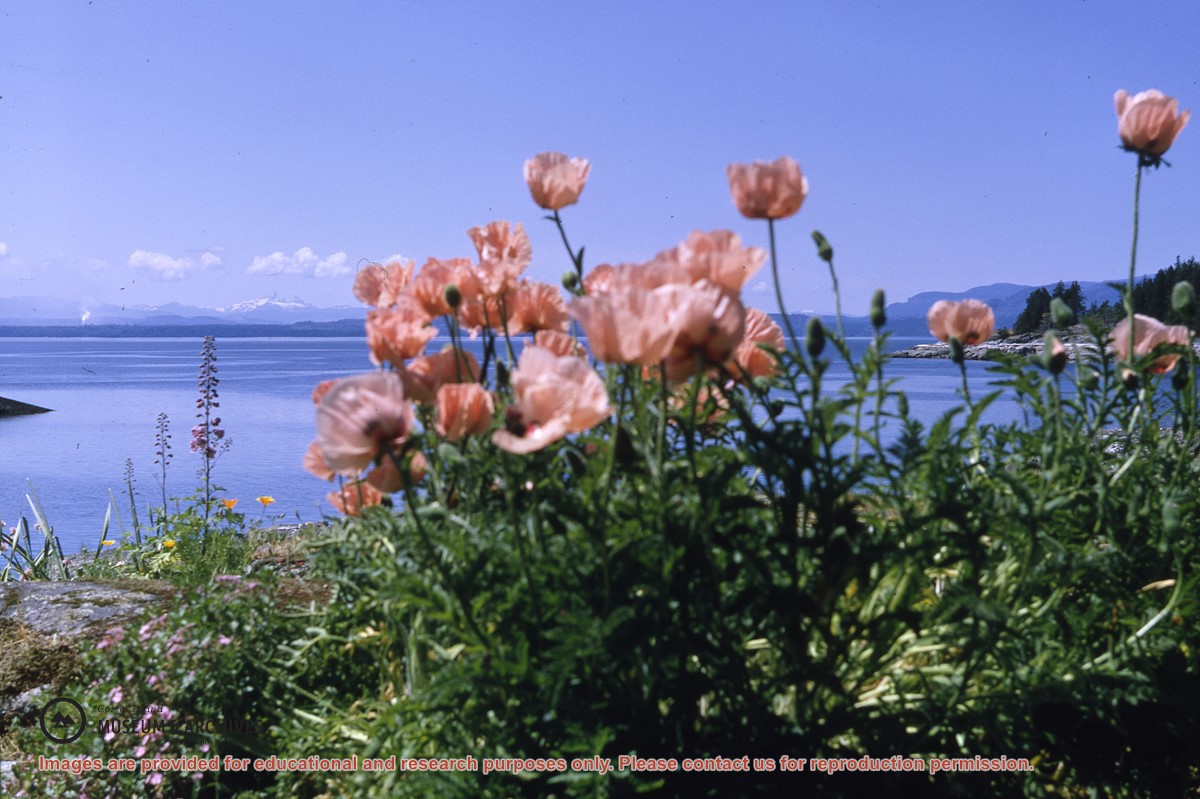
Oriental poppies silhouetted against a view towards the mountains of Vancouver Island, Channel Rock
Show All Information
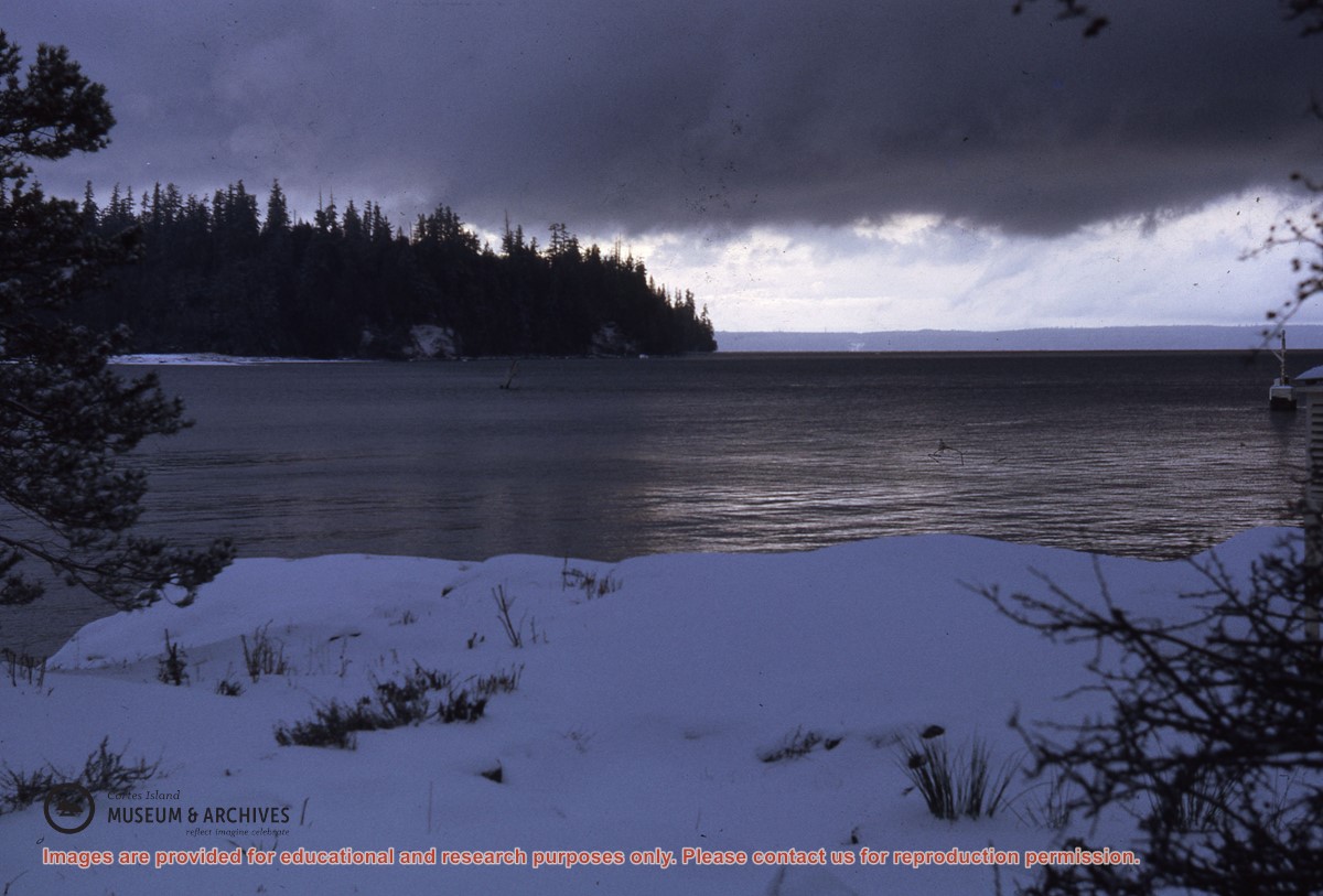
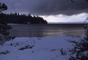
View towards Marina and Vancouver Islands from Channel Rock on a snowy day
Show All Information
Grant application to the Vancouver Foundation to finish and furnish the Playschool
Part Of
Southern Cortes Community Association fonds
Description Level
File
Material Type
textual records
Accession Number
2000.001
Date Range
1978-1980
Scope and Content
File contains a grant application, correspondence and a floor plan.
Show All Information
David Guthrie's map of early Cortes Island property owners
Part Of
CIMAS audiovisual collection
Description Level
Item
Material Type
multiple media
Accession Number
2019.013
Date Range
[200?]
Scope and Content
CD of a map of early Cortes property owners; a copy of the map is in the map cabinet.
Part Of
CIMAS audiovisual collection
Description Level
Item
Creator
Guthrie, David
Series Number
2
Item Number
2019.013.006
Accession Number
2019.013
Material Type
multiple media
Date Range
[200?]
Physical Description
1 CD
Scope and Content
CD of a map of early Cortes property owners; a copy of the map is in the map cabinet.
Storage Location
CD/DVD album
Geographic Access
Cortes Island
Show less information
Show All Information
Cortes Island zoning maps
Part Of
Regional Director of Area I (Cortes Island) fonds
Description Level
File
Fonds Number
2002.001.3
Sous Fonds Number
3
Series Number
2
File Number
38
Accession Number
2004.004
Material Type
cartographic material
Date Range
1990
Custodial History
File contains zoning maps for Bylaw 41, Electoral Area I, Schedules A1-A7 with revisions to 1999. There is a map of the whole island and larger scale maps of island areas.
Storage Location
Map cabinet (4-14)
Storage Range
Map cabinet (4-14)
Name Access
Sirk, George
Geographic Access
Cortes Island
Show less information
Show All Information
Cortes Island Bylaw No. 2454, to amend Schedule A-1 "The Plan Map" to reflect the Official Community Plan
Part Of
Regional Director of Area I (Cortes Island) fonds
Description Level
File
Material Type
textual records
cartographic material
Accession Number
2004.004
Date Range
1995-2002
Scope and Content
File contains a copy of the bylaw and map of 1995, a summary of the changes (meant to reconcile 25 year gap between the previous zoning bylaws and the current OCP), and a completion and adoption strategy.
Show All Information
Maps
Part Of
Gilean Douglas fonds
Description Level
Series
Material Type
cartographic material
graphic material
Date Range
1929; [194?]-1979
Scope and Content
Series consists of maps of British Columbia showing land use and topography, and pictorial maps showing the history and literature of Canada.
Other Title Info
Title based on contents of the series.
Part Of
Gilean Douglas fonds
Description Level
Series
Fonds Number
1999.001
Series Number
16
Material Type
cartographic material graphic material
Date Range
1929; [194?]-1979
Physical Description
8 maps
Scope and Content
Series consists of maps of British Columbia showing land use and topography, and pictorial maps showing the history and literature of Canada.
Storage Range
6-26 - 6-27; map box
Name Access
Douglas, Gilean
Geographic Access
Cortes Island
Show less information
Show All Information
Maps
Part Of
Cortes Ecoforestry Society fonds
Description Level
File
Material Type
textual records
Accession Number
2017.011
Date Range
ca. 2005
Scope and Content
File contains maps of Hank's Beach and surrounding area.
Show All Information
Maps and plans
Part Of
Cortes Island Seniors' Building Society fonds
Description Level
Series
Material Type
textual records
Accession Number
2013.005
Date Range
[ca. 1980s]-1995
Scope and Content
Series contains a map of Cortes and a plan of the proposed Seniors Facility
Show All Information
"The Plan Map"- Schedule A-1 and A-2 for Bylaw No. 1740 Cortes Official Community Plan Bylaw 1995
Show All Information
"Cortes Official Community Plan Draft, Sept 1994" with a list of agency referral forms and draft Plan Map Schedules A and B
Show All Information
Maps of proposed boundaries of Von Donop Marine Park
Show All Information
"1:10,000 Composite Mapping for Planning Department of RDCS"
Part Of
Regional Director of Area I (Cortes Island) fonds
Description Level
File
Material Type
textual records
cartographic material
Accession Number
2004.004
Date Range
[198?]
Scope and Content
File contains one book of composite maps of Cortes Island properties in a cerlox binding.
Show All Information
"1:10,000 Composite Mapping for Planning Department of RDCS, June 1987"
Part Of
Regional Director of Area I (Cortes Island) fonds
Description Level
File
Material Type
textual records
cartographic material
Accession Number
2004.004
Date Range
1987
Scope and Content
File contains one book of composite maps of Cortes Island properties in a cerlox binding.
Show All Information
"1:10,000 Composite Mapping for Planning Department of RDCS, September 1990"
Part Of
Regional Director of Area I (Cortes Island) fonds
Description Level
File
Material Type
textual records
cartographic material
Accession Number
2004.004
Date Range
1990
Scope and Content
File contains one book of composite maps of Cortes Island properties in a cerlox binding, with annotations.
Show All Information
Cortes Island Day
Part Of
Whaletown Community Club fonds
Description Level
File
Material Type
textual records
Accession Number
2003.003
Date Range
1958-1984
Scope and Content
File consists of corrrespondence, financial statements, planning notes, lists of volunteers, food and supplies generated in the course of Whaletown Community Club participation in the annual Cortes Day barbecue and dance.
Part Of
Whaletown Community Club fonds
Description Level
File
Creator
Whaletown Community Club
Fonds Number
2003.003
Series Number
5
File Number
1
Accession Number
2003.003
Material Type
textual records
Date Range
1958-1984
Physical Description
1 folder of textual records including 1 scribbler notebook
Scope and Content
File consists of corrrespondence, financial statements, planning notes, lists of volunteers, food and supplies generated in the course of Whaletown Community Club participation in the annual Cortes Day barbecue and dance.
Storage Location
1-47
Storage Range
1-47
Name Access
Whaletown Community Club
Subject Access
Community Associations
Geographic Access
Cortes Island
Show less information
Show All Information
Trip to Mittlenatch Island
Part Of
Cortes Walking Group fonds
Description Level
Item
Material Type
graphic material
Date Range
2002
Scope and Content
Note: out of sequence
Show All Information
Cortes Island parks
Part Of
Regional Director of Area I (Cortes Island) fonds
Description Level
File
Material Type
textual records
Accession Number
2004.004
Date Range
1996-2003
Scope and Content
File contains correspondence, species inventories of Cortes Island parks, financial information, a report by Fred and Ruth Zwickel on Manson's Spit which includes photographs of erosion (2000), and one clipping.
Part Of
Regional Director of Area I (Cortes Island) fonds
Description Level
File
Fonds Number
2002.001.3
Sous Fonds Number
3
Series Number
6
File Number
20
Accession Number
2004.004
Material Type
textual records
Date Range
1996-2003
Scope and Content
File contains correspondence, species inventories of Cortes Island parks, financial information, a report by Fred and Ruth Zwickel on Manson's Spit which includes photographs of erosion (2000), and one clipping.
Storage Location
5-42
Storage Range
5-42
Name Access
Sirk, George
Geographic Access
Cortes Island
Show less information