File contains photocopies of the original Crown Grants and subsequent title changes with plan maps.
To Moses Ireland: 1893, Crown Grant for the W 1/2 of the SW 1/4 of Section 35 and the fractional SE 1/4 of Section 35 (161 acres around Whaletown Bay
To George Alderson: 1961, Crown Grant for Lot 3 of Section 34
File contains a key map which was pasted on the front of the envelope indicating the areas researched for Files 12-16; notes on the titles; photocopies of Crown Grants and subsequent title information for:
BC Buildings Corp: 1982, Crown Grant for Block A of SW 1/4 of Sec. 25 (Highways Maintenance Yard)
District Lot 871 (40 acres between Carrington and Coulter Bays): to James Frederick McManus, 1919
To Ernest Henry Vaughn: 1922, Crown Grant for NE 1/4 and NW 1/4 of NE 1/4 of Sec. 24; SE 1/4 of SW 1/4 and SW 1/4 of SE 1/4 of Sec 31
Herbert Proctor: 1928 for fractional SW 1/4 of Sec. 41, bordering Tork Reserve; 159 acres for $159.00 (orig. Crown Grant to Herbert Proctor in 1922)
To William Cowan: 1937, E 1/2 of SE 1/4 of Sec. 26, 89 acres
(Files 12 through 16 are from the same envelope.)
File contains a photocopied part of a map showing the locations of researched property in the Whaletown Lagoon and Whaletown Harbour area. The map is glued to an envelope which has a list of Crown grants and other conveyances on the back.
It contains photocopies of original land grants and other conveyances for the following:
Moses Ireland: 1893, Crown Grant for the W 1/2 of SW 1/4 of Sec 35 and W 1/2 of the SW 1/4 of Section 34
Joseph Youart: 1900, Crown Grant for Fractional NE 1/4 of Sec 35 (sold to Alice Robertson in 1908; "Burnside" is still in the Robertson family).
Nicholas Thompson: 1920, Crown Grant for the Fractional SW 1/4 of Sec 35
Charles Strange: 1914, Crown Grant for the NW 1/4 of Sec 35
File contains information on subdivision and title changes, and a photocopy of the original Crown grant, in the Whaletown Lagoon area, to:
Samuel Thompson: 1894, Crown Grant for SW 1/4 of Section 35 and NW 1/4 of Section 34, 160 acres
File also contains four maps (stored in the Map Cabinet):
1) Subdivision map of part of NE 1/4 of Sec. 34 and part of NE 1/4 of Sec. 34, 1995
2) Subdivision Plan of NW 1/4 of Sec. 34 and NE 1/4 of Sec. 34 and part of E 1/2 of SE 1/2 of Sec. 34, 1995
3) Subdivision Plan of Lot A, NW 1/4 of Sec. 34, 1976
4) Subdivision Plan of part of NW 1/4 of Section 34, 1994
(Files 9 and 10 are from the same envelope.)
Email from Richard Lawton with aerial photographs and map of the Lawton land between Beasley and Cemetery Road, from a meeting on July 18, 2008. 10-part series of articles written by Lawton entitled "The End of an Era," published in the Cortes Marketer, 2013
Email from Richard Lawton with aerial photographs and map of the Lawton land between Beasley and Cemetery Road, from a meeting on July 18, 2008. 10-part series of articles written by Lawton entitled "The End of an Era," published in the Cortes Marketer, 2013
File contains a photocopied section map of the northern part of Cortes Island (from just south of Gorge Harbour), coloured to indicate areas for which a Crown Grant was located and areas of ungranted Crown land which still appear to be owned by the government. Scale is 1 mile to 1 inch.
File contains a photocopied section map of the northern part of Cortes Island (from just south of Gorge Harbour), coloured to indicate areas for which a Crown Grant was located and areas of ungranted Crown land which still appear to be owned by the government. Scale is 1 mile to 1 inch.
From the "Out of the Archives" program: "When Linnaea was established, Robert Cabot commissioned Cortes Cinema to produce a film abot the Turtle Island Land Steward Society. The day-to-day life of the farm is documented as is the Hansen's move across the road to their new property. Ken, Hazel and Flo (Hazel's mom) are all in the film helping to clear land on yet another farm! Using Bear Air (Barry Miles), aerial footage of the farm and the island is also in the film. A gliimpse into the past. With sound and narration. On 16mm.
Music: Glen Dias / Narration: Peter Gibson
Cast: Thousands of cows!"
File contains correspondence with Dan Campbell and a copy of the articles of incorporation of the Turtle Island Land Stewardship Society (Title holder for Linnaea Farm).
File contains correspondence with Dan Campbell and a copy of the articles of incorporation of the Turtle Island Land Stewardship Society (Title holder for Linnaea Farm).
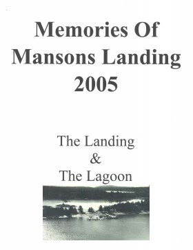
Memories of Mansons Landing 2005: The Landing and the Lagoon
Binder contains interviews, stories and pictures from Ken Summers, Bert and Victoria Summers, Ann Barton, Hiram (Buster) and Mabel Christiansen, Otis (Christiansen) Coulter, George and Rosemary (Gavin) Hawkins, Bob Martineau and Fred Reedel.
It was created as part of the Memories of Manson's Landing Exhibit, curated and mounted by Doreen Thompson.
File contains materials related to a 1999 proposal by Cortes Ecoforestry Society to buy forest lands owned by MacMillan Bloedel, including proposals, correspondence, notes, publications, and other supporting documents.
File contains materials related to a 1999 proposal by Cortes Ecoforestry Society to buy forest lands owned by MacMillan Bloedel, including proposals, correspondence, notes, publications, and other supporting documents.