File contains a page of notes, and photocopies of a tax sale notice (1938) and list of properties forfeited for non-payment of taxes, Crown Grants and other title information for the following:
William Walter James: 1926, Crown Grant for NW 1/4 of Sec. 38; 156 acres for $1.00; forfeited to Crown in 1939
Tom Albinson: 1919, Crown Grant for Lot 867; forfeited in 1927
Sadie McMurray: 1917, NE 1/4 of Sec. 39; 160 acres for $160
Peter Police: 1925, fractional NW 1/4 of Sec. 39; 103 acres for $1.00
(Files 12 through 16 are from the same envelope.)
File contains a Key Map to the sections covered in Files 17-19; a list of the sections researched and two pages of notes.
It contains photocopies of Crown Grants and subsequent title changes for the following:
Charles Allen: 1908, Crown Grant for part of NE 1/4 of Sec. 21 lying north of Gorge Harbour (property known as Bute Ranch); 46 acres for $46.00
Bernard Robinson Allen: 1919, Crown Grant for NW 1/4 of Sec. 21; 162 acres for $247.00
Charles Allen: 1905, Crown Grant for SE 1/4 of Sec. 34
(Files 17 through 19 are from the same envelope.)
File contains information for the following properties:
Frederick James Smith: 1921, Crown Grant for SE 1/4 of Sec. 33; 160 acres for $1.00
Charles Allen: 1912, Crown Grant for SW 1/4 of Sec. 33; 160 acres for $160.
George Robson: 1907, Crown Grant for NW 1/4 of Sec. 21; $247.00 for 142 acres.
(Files 17 through 19 are from the same envelope.)
File contains information for the following properties:
E. H. Vaughn: 1893, Crown Grant for fractional N 1/2 of Sec. 22; 90 acres for $90.00.
James P. Allen: 1913, Crown Grant for NW 34 acres of Sec. 23; $170.00
Bernard Robinson Allen: 1919, Crown Grant for SW 1/4 of Sec. 23, 159 acres
Charles Allen: 1912, Crown Grant for SW 1/4 of Sec. 33; 160 acres for $160.00
Harold Marshall Wood: Crown Grant for E 1/2 of NE 1/4 of Sec. 46 (east of Carrington Bay); 81 acres for $1.00.
File contains the following maps, stored in the Map Cabinet:
Subdivision Plan of parcel C & E, NW 1/4 of Sec. 21, 1976
Subdivision of the fractional NE 1/4 of Sec 21, 1966; with names of property owners penciled in
Subdivision Plan of Parcel C and part of Parcel E of fractional NE 1/4 of Sec. 21, 1975
Subdivision Plan of fractional NE 1/4 of Sec. 21 and W 1/2 of SW 1/4 of Sec. 34
(Files 17 through 19 are from the same envelope.)
File contains a key map and list for the areas researched and information on the following:
George Herbert Wailes: 1920, Crown Grant for fractional SW 1/4 of Sec. 48; 48 acres for $217; with a tax sale notice, 1939
Ina Vernon Munro: 1920, Crown Grant for NE 1/4 of Sec. 37; 161 acres; includes a sale to Hawkins and a forfeit in 1939
Allan Olmsted: 1939, Crown Grant for SW 1/4 of Sec. 37
Ira Furry: 1911, Crown Grant for W 1/2 of SE 1/4 of Sec. 33
Walter Malcolm: 1919, Crown Grant for fractional SW 1/4 of Sec. 36
Frank Leslie Tooker: 1926, Crown Grant for N 1/2 of Sec. 36, 124 acres
Ira Furry: 1897, Crown Grant for SE 1/4 of Sec 36; 160 acres for $160.00.
Donald McDonald: 1926, Crown Grant for fractional NW 1/2 of Sec. 37; 144 acres for $1.00
File contains a map and notes, and information on the following:
Mabel Huck: 1920, Crown Grant for NE 1/4 of Sec. 40; file shows the original grant, a tax sale forfeit in 1939, a regrant in 1957 with immediate sale to MacMillan/Bloedel.
William Barrett: 1916, Crown Grant for NW 1/4 of Sec. 40; $160 for 160 acres.
Herbert Benjamin Middleton: 1916, Crown Grant for SW 1/4 of Sec. 40, 168 acres for $168.00
August Teuber: 1904, Crown Grant for SE 14 of Sec. 40; 160 acres for $160.00.
File contains agendas, minutes, notes and background material relating to the first, second and third meetings between CILAC and the Klahoose First Nation.
File contains agendas, minutes, notes and background material relating to the first, second and third meetings between CILAC and the Klahoose First Nation.
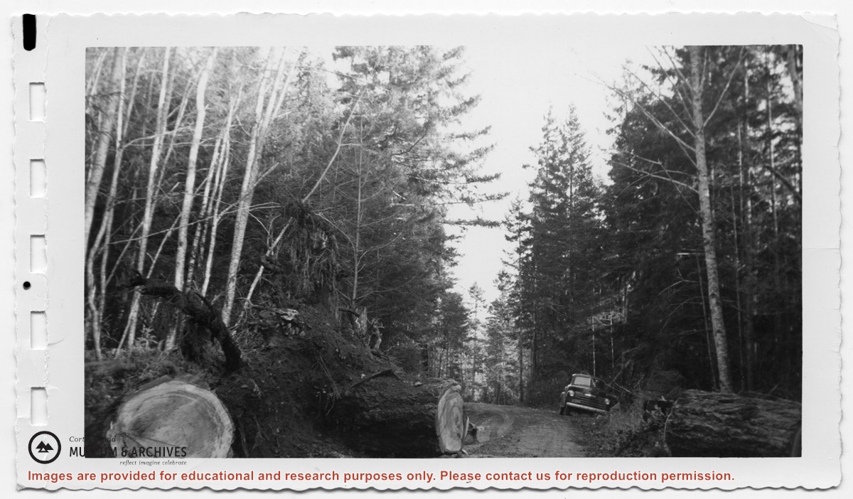
Truck parked to the side of the road at Clinic Hill in Whaletown; a large first-growth fir has fallen across the road and a section of the log has been cut out to clear the road