File contains five maps of Hernando Island: two showing plans of pre-emptions, 1891-1892; two copies of an old hand-drawn map, 1955; and one map of a later proposed development (undated). Some maps have notes on homesteads.
File contains five maps of Hernando Island: two showing plans of pre-emptions, 1891-1892; two copies of an old hand-drawn map, 1955; and one map of a later proposed development (undated). Some maps have notes on homesteads.
File contains maps of Bute Inlet (1970), Cortes Island/Read Island and surrounding area (ca. 1950), Powell River (1968) and Cortes Island zoning maps (Jan 1974).
File contains maps of Bute Inlet (1970), Cortes Island/Read Island and surrounding area (ca. 1950), Powell River (1968) and Cortes Island zoning maps (Jan 1974).
File contains a help-wanted ad for ferry positions and the third section of the Campbell River Upper Islander (Nov. 26, 1969) with a photo-story on the inaugural trip of the Cortes ferry. On page 3 is "Cortes Grapevine" with an account of Andy and Susan Ellingsen's wedding.
File contains a help-wanted ad for ferry positions and the third section of the Campbell River Upper Islander (Nov. 26, 1969) with a photo-story on the inaugural trip of the Cortes ferry. On page 3 is "Cortes Grapevine" with an account of Andy and Susan Ellingsen's wedding.
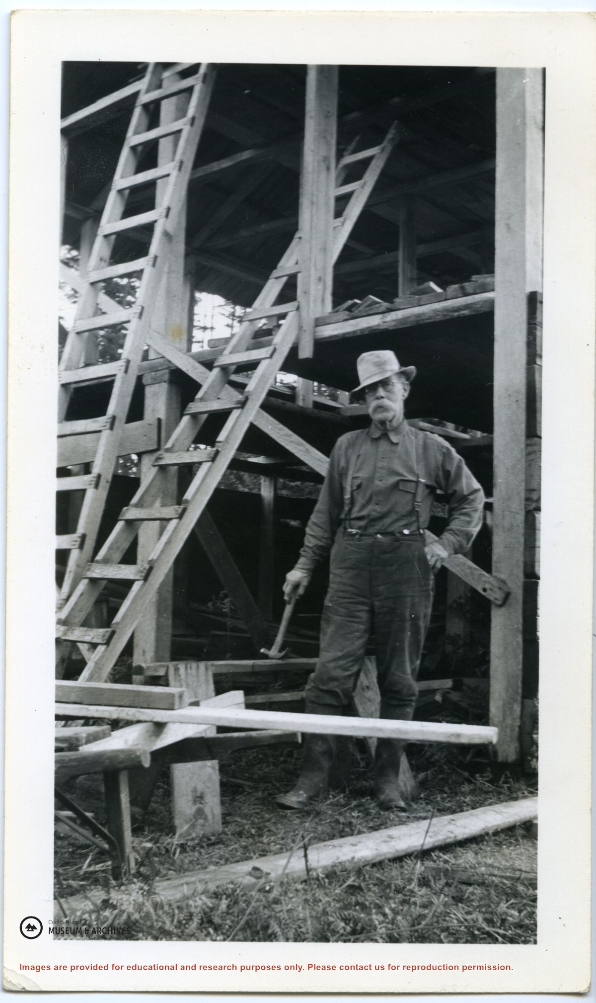
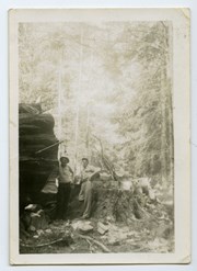
Photograph of Jack Manson (near log) and Jack Parry standing near a huge log and stump on the old road from Ken and Hazel Hansen's farm on Gunflint Lake to Cortes Bay.
Photograph of Jack Manson (near log) and Jack Parry standing near a huge log and stump on the old road from Ken and Hazel Hansen's farm on Gunflint Lake to Cortes Bay.
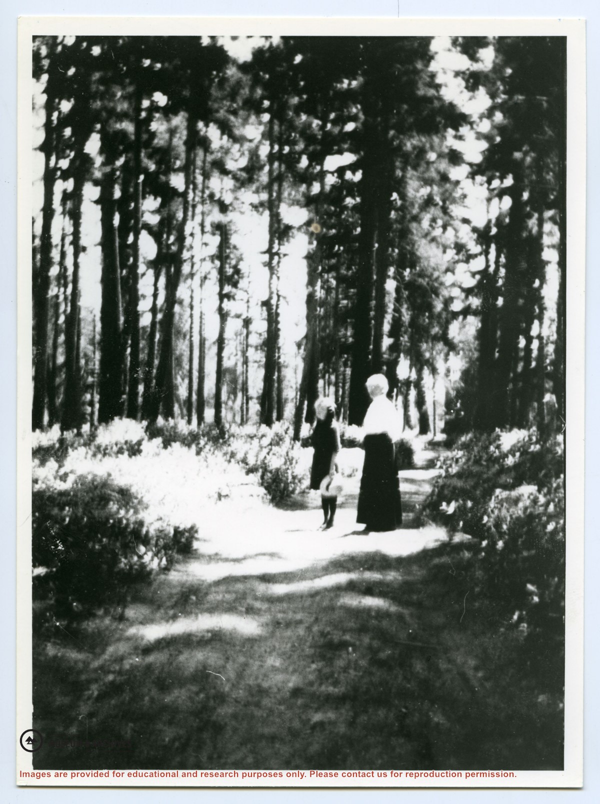
"This shows the main road between Hague Lake and the Hague home property. Walking along the road are Mabel Lowe (L) and grandmother Mrs. Hague. The road had just been put in where there was only a trail before." (from May Ellingsen Historic Photographs: Album 2, p. 17) (Also in collection as 2004.005.004)
"This shows the main road between Hague Lake and the Hague home property. Walking along the road are Mabel Lowe (L) and grandmother Mrs. Hague. The road had just been put in where there was only a trail before." (from May Ellingsen Historic Photographs: Album 2, p. 17) (Also in collection as 2004.005.004)
File contains hand-drawn maps from the early 1900s. There are two copies of the plan of part of SW 1/4 of Section 34; a plan of Gorge Harbour with names of owners written in; and a plan showing part of Read Island.
File contains hand-drawn maps from the early 1900s. There are two copies of the plan of part of SW 1/4 of Section 34; a plan of Gorge Harbour with names of owners written in; and a plan showing part of Read Island.


.jpg?width=1200&404=no-img.jpg&watermark=wmk)
.jpg?width=1200&404=no-img.jpg&watermark=wmk)
.jpg?width=1200&404=no-img.jpg&watermark=wmk)
.jpg?width=1200&404=no-img.jpg&watermark=wmk)
.jpg?width=1200&404=no-img.jpg&watermark=wmk)
.jpg?width=1200&404=no-img.jpg&watermark=wmk)
.jpg?width=1200&404=no-img.jpg&watermark=wmk)
.jpg?width=1200&404=no-img.jpg&watermark=wmk)
.jpg?width=1200&404=no-img.jpg&watermark=wmk)
.jpg?width=1200&404=no-img.jpg&watermark=wmk)
.jpg?width=1200&404=no-img.jpg&watermark=wmk)
.jpg?width=1200&404=no-img.jpg&watermark=wmk)
.jpg?width=180&404=no-img.jpg)