Coloured map of southwestern BC showing municipalities, geographical features, land and sea routes, natural resources, etc. The back of the map is fully printed with information about BC and suggested travel itineraries.
Map needs preservation: edges are frayed and there are several tears.
Coloured map of southwestern BC showing municipalities, geographical features, land and sea routes, natural resources, etc. The back of the map is fully printed with information about BC and suggested travel itineraries.
Map needs preservation: edges are frayed and there are several tears.
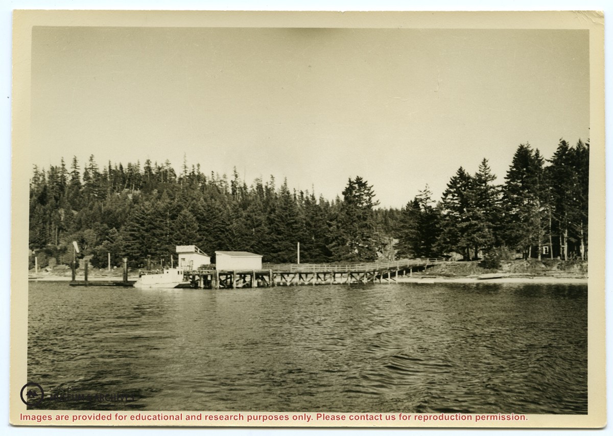
Photograph of the Manson's Landing wharf, taken from the water at high tide. It includes the oil and wharf sheds on the dock, an unknown scow boat with cabin at the float and the store ashore. Note: telephone poles from the original phone line across the mouth of the lagoon; higher banks along the shoreline.
Photograph of the Manson's Landing wharf, taken from the water at high tide. It includes the oil and wharf sheds on the dock, an unknown scow boat with cabin at the float and the store ashore. Note: telephone poles from the original phone line across the mouth of the lagoon; higher banks along the shoreline.
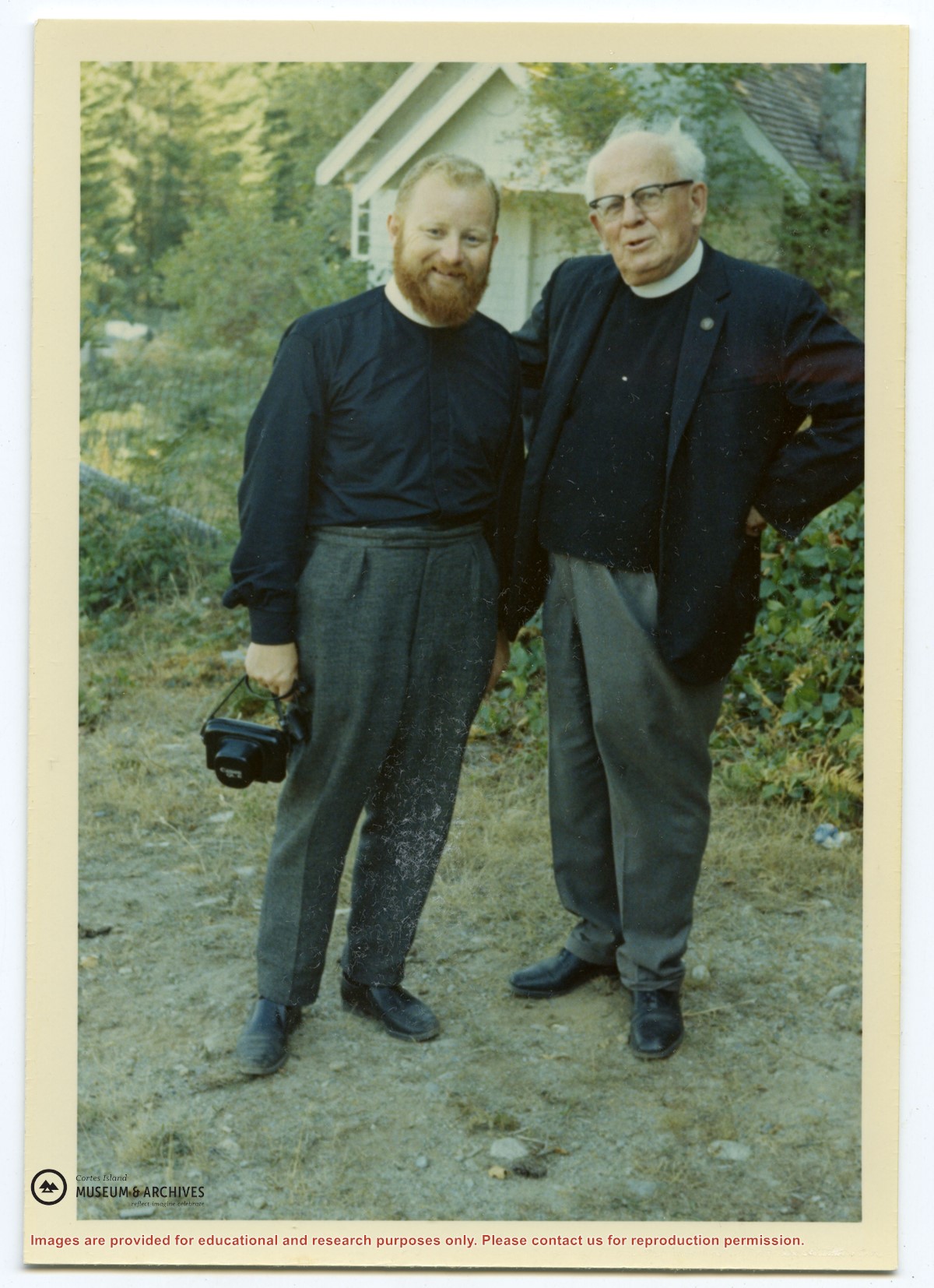
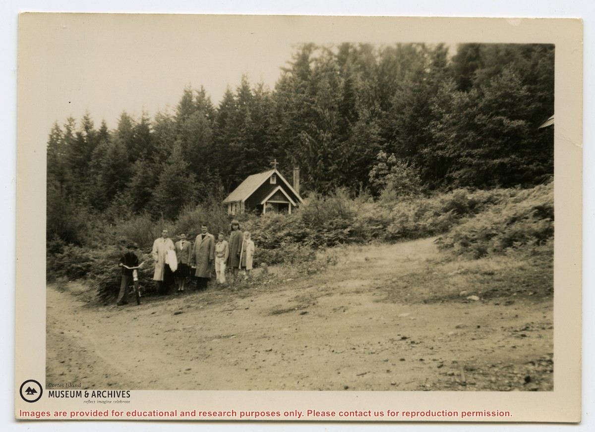
Photograph of Rev. Rollo Boas (middle), Mr. and Mrs. J. Maunsell and four children, including a boy on a bicycle, standing in a field. St. James Church is in its clearing in the background; the road in front.
Photograph of Rev. Rollo Boas (middle), Mr. and Mrs. J. Maunsell and four children, including a boy on a bicycle, standing in a field. St. James Church is in its clearing in the background; the road in front.
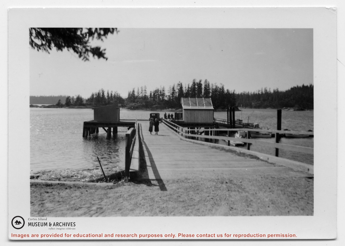
Photograph of Manson's Landing wharf, with Cat and Kitten Islands in the bacckground. Their are two sheds at the end of the dock above the ramp, and an old car is parked beside them. (date?)
Photograph of Manson's Landing wharf, with Cat and Kitten Islands in the bacckground. Their are two sheds at the end of the dock above the ramp, and an old car is parked beside them. (date?)
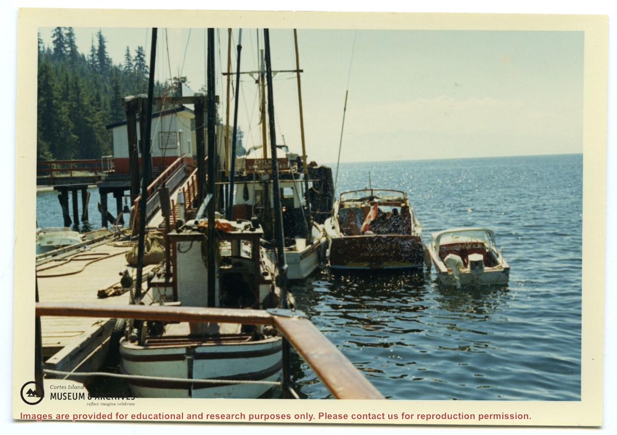
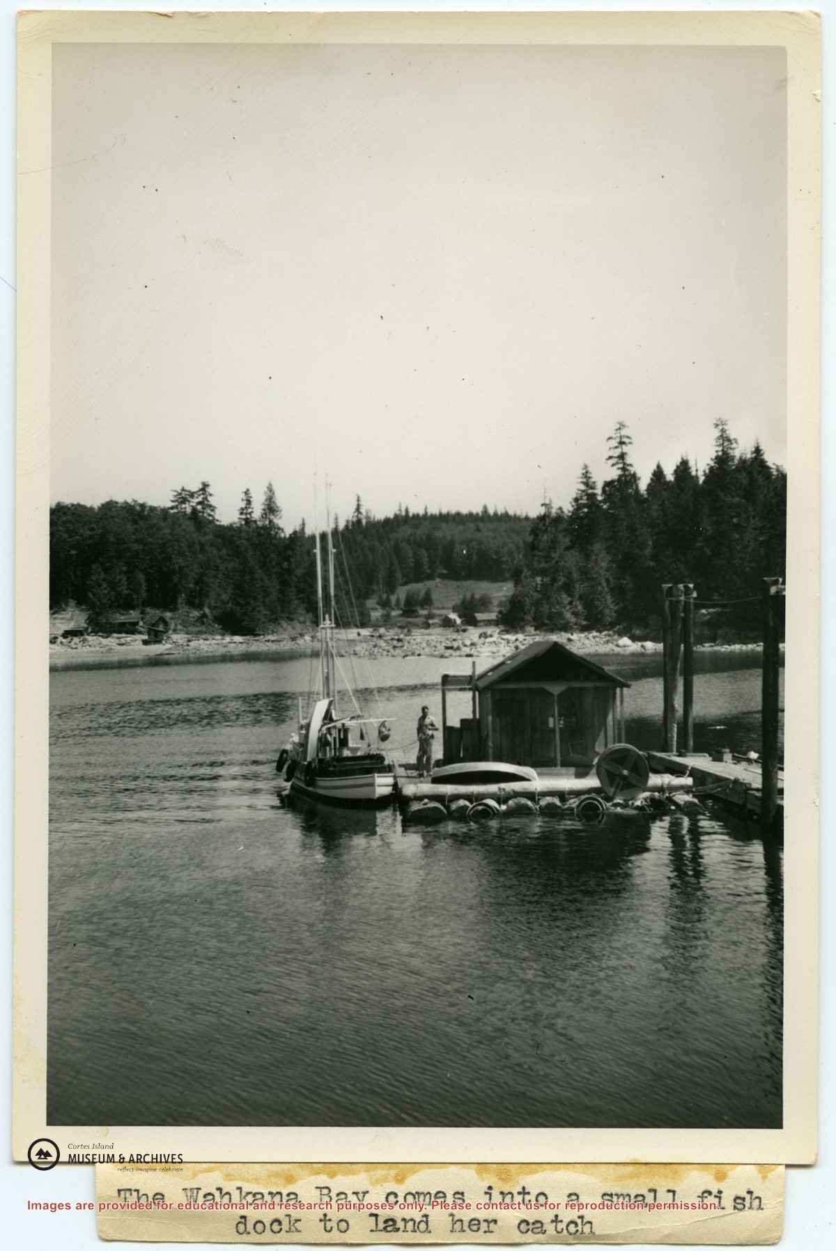
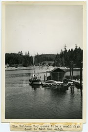
Photograph of Ken Slater's boat "Wahkana Bay" beside the fish scow at the end of the Whaletown dock. The buildings on the opposite side of Whaletown Bay may be seen in the background.
Photograph of Ken Slater's boat "Wahkana Bay" beside the fish scow at the end of the Whaletown dock. The buildings on the opposite side of Whaletown Bay may be seen in the background.
Binder contains interviews, stories and pictures from Etta (McKay) Byers, Bert and Penny Hansen, Peggy Pyner, Frank Hayes, Vida (Trousdale) Hodgson, Bob Milton, Lorne Musclow, and Elton Anderson.
It was created as part of the Memories of Manson's Landing Exhibit, curated and mounted by Doreen Thompson.
Binder contains interviews, stories and pictures from Ginny and Bruce Ellingsen, the Lambert family, Dolly (Jeffery) Hansen and Maryann McCoy, with additional historic photographs of Smelt Bay from the early to the late 1900s at the back. It was created as part of the Memories of Manson's Landing Exhibit, curated and mounted by Doreen Thompson.
Binder contains interviews, stories and pictures from Ginny and Bruce Ellingsen, the Lambert family, Dolly (Jeffery) Hansen and Maryann McCoy, with additional historic photographs of Smelt Bay from the early to the late 1900s at the back. It was created as part of the Memories of Manson's Landing Exhibit, curated and mounted by Doreen Thompson.
Binder contains interviews, stories and photographs relating to schools in Mansons Landing. It was created as part of the Memories of Manson's Landing Exhibit, curated and mounted by Doreen Thompson.
Binder contains interviews, stories and photographs relating to schools in Mansons Landing. It was created as part of the Memories of Manson's Landing Exhibit, curated and mounted by Doreen Thompson.