File contains correspondence, CSRD staff reports and notes from a public hearing regarding a proposed rezoning application for water-access only land on Gorge Harbour.
File contains correspondence, CSRD staff reports and notes from a public hearing regarding a proposed rezoning application for water-access only land on Gorge Harbour.
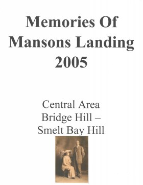
Memories of Mansons Landing 2005 – Central Area – Bridge Hill and Smelt Bay Hill
Binder contains interviews, stories and pictures from Mary and Bill Block, Larry Borland, May (Freeman) Ellingsen, Wilf Freeman, the Froud family, Robbie Graham, Bill Guthrie, Gloria Morrisette, Jean (Reford) MacDonald and Beth (Martin) Slater.
It was created as part of the Memories of Manson's Landing Exhibit, curated and mounted by Doreen Thompson.
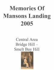
Binder contains interviews, stories, clippings and photographs documenting the social history of the Green Valley/Bluejay Lake area. It was created as part of the Windows on Whaletown Exhibit, curated and mounted by Doreen Thompson.
Binder contains interviews, stories, clippings and photographs documenting the social history of the Green Valley/Bluejay Lake area. It was created as part of the Windows on Whaletown Exhibit, curated and mounted by Doreen Thompson.
Binder contains interviews, stories and pictures from Etta (McKay) Byers, Bert and Penny Hansen, Peggy Pyner, Frank Hayes, Vida (Trousdale) Hodgson, Bob Milton, Lorne Musclow, and Elton Anderson.
It was created as part of the Memories of Manson's Landing Exhibit, curated and mounted by Doreen Thompson.
Series contains information on historic Crown Grants and subsequent title changes compiled by Doreen Thompson during her research for the CIMAS Windows on Whaletown exhibit in 1999. The area covered includes the northern part of Cortes Island, from just south of Gorge Harbour. Material includes maps, photocopies of original Crown Grants and other title documents, lists of subdivisions, and notes on changes of title.
Records were organized by Section or Plan number in large envelopes with a cover map and notes about the properties researched on the envelope back. They trace the ownership of parcels of land from the first grant or purchase from the Crown to 1999. Original order has been maintained.
File contains a photocopied section map of the northern part of Cortes Island (from just south of Gorge Harbour), coloured to indicate areas for which a Crown Grant was located and areas of ungranted Crown land which still appear to be owned by the government. Scale is 1 mile to 1 inch.
File contains a photocopied section map of the northern part of Cortes Island (from just south of Gorge Harbour), coloured to indicate areas for which a Crown Grant was located and areas of ungranted Crown land which still appear to be owned by the government. Scale is 1 mile to 1 inch.
File contains a photocopied part of a map showing the locations of researched property in the Whaletown Lagoon and Whaletown Harbour area. The map is glued to an envelope which has a list of Crown grants and other conveyances on the back.
It contains photocopies of original land grants and other conveyances for the following:
Moses Ireland: 1893, Crown Grant for the W 1/2 of SW 1/4 of Sec 35 and W 1/2 of the SW 1/4 of Section 34
Joseph Youart: 1900, Crown Grant for Fractional NE 1/4 of Sec 35 (sold to Alice Robertson in 1908; "Burnside" is still in the Robertson family).
Nicholas Thompson: 1920, Crown Grant for the Fractional SW 1/4 of Sec 35
Charles Strange: 1914, Crown Grant for the NW 1/4 of Sec 35