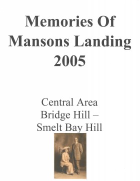
Memories of Mansons Landing 2005 – Central Area – Bridge Hill and Smelt Bay Hill
Binder contains interviews, stories and pictures from Mary and Bill Block, Larry Borland, May (Freeman) Ellingsen, Wilf Freeman, the Froud family, Robbie Graham, Bill Guthrie, Gloria Morrisette, Jean (Reford) MacDonald and Beth (Martin) Slater.
It was created as part of the Memories of Manson's Landing Exhibit, curated and mounted by Doreen Thompson.
File contains a key map which was pasted on the front of the envelope indicating the areas researched for Files 12-16; notes on the titles; photocopies of Crown Grants and subsequent title information for:
BC Buildings Corp: 1982, Crown Grant for Block A of SW 1/4 of Sec. 25 (Highways Maintenance Yard)
District Lot 871 (40 acres between Carrington and Coulter Bays): to James Frederick McManus, 1919
To Ernest Henry Vaughn: 1922, Crown Grant for NE 1/4 and NW 1/4 of NE 1/4 of Sec. 24; SE 1/4 of SW 1/4 and SW 1/4 of SE 1/4 of Sec 31
Herbert Proctor: 1928 for fractional SW 1/4 of Sec. 41, bordering Tork Reserve; 159 acres for $159.00 (orig. Crown Grant to Herbert Proctor in 1922)
To William Cowan: 1937, E 1/2 of SE 1/4 of Sec. 26, 89 acres
(Files 12 through 16 are from the same envelope.)
File contains a map and notes, and information on the following:
Mabel Huck: 1920, Crown Grant for NE 1/4 of Sec. 40; file shows the original grant, a tax sale forfeit in 1939, a regrant in 1957 with immediate sale to MacMillan/Bloedel.
William Barrett: 1916, Crown Grant for NW 1/4 of Sec. 40; $160 for 160 acres.
Herbert Benjamin Middleton: 1916, Crown Grant for SW 1/4 of Sec. 40, 168 acres for $168.00
August Teuber: 1904, Crown Grant for SE 14 of Sec. 40; 160 acres for $160.00.
This file contains the handbook given to APC members. It includes Regional District administrative information and copies of bylaws pertaining to Cortes Island.
This file contains the handbook given to APC members. It includes Regional District administrative information and copies of bylaws pertaining to Cortes Island.
A list of questions and answers about the location, access, geographical features, buildings, and other details of the condition of the Channel Rock property prior to its purchase by Douglas, in the handwriting of Philip Major Douglas; a sketch of the floor plan of the cabin
A list of questions and answers about the location, access, geographical features, buildings, and other details of the condition of the Channel Rock property prior to its purchase by Douglas, in the handwriting of Philip Major Douglas; a sketch of the floor plan of the cabin
Series consists of material generated and collected by Douglas during her term on the Comox-Strathcona Regional Board. Douglas served as Alternate Director from 1968 to 1973, and as Director from 1973 to 1978. During this time, island residents were actively involved in the formulation of Cortes' first Official Settlement Plan and Zoning By-law. Series includes reports, correspondence, notes, copies of studies, Regional District by-laws and drafts of by-laws, including the Official Settlement Plan. It also contains materials on community organizations generated after her term which she collected because of a continuing interest in local government and community planning, and because, as a former Director, she was often consulted on island issues.
Series consists of material generated and collected by Douglas during her term on the Comox-Strathcona Regional Board. Douglas served as Alternate Director from 1968 to 1973, and as Director from 1973 to 1978. During this time, island residents were actively involved in the formulation of Cortes' first Official Settlement Plan and Zoning By-law. Series includes reports, correspondence, notes, copies of studies, Regional District by-laws and drafts of by-laws, including the Official Settlement Plan. It also contains materials on community organizations generated after her term which she collected because of a continuing interest in local government and community planning, and because, as a former Director, she was often consulted on island issues.
Series consists of a variety of material relating to Douglas's life at Channel Rock, her 135 acre waterfront homestead. Channel Rock was located on the outside of Gorge Harbour, directly across from Shark Spit on Marina Island. It had no road access and could be reached only by walking trail or boat. Douglas lived in a simple cabin overlooking the water with no electrical power, although she did have a telephone. Series includes the daily journal that her husband, Philip Major Douglas, kept during the year that he lived on Cortes prior to Douglas's arrival; household account statements from the early 1950s; lists and inventories of Douglas's library, photographs, research files and household items; a resumé of Douglas's long-time caretaker David Edwards; bills and receipts for household expenses; Christmas card and gift lists; records of egg, plant and vegetable sales; and garden records including plant lists, planting plans, annotated garden catalog pages and garden catalogs.
Series consists of a variety of material relating to Douglas's life at Channel Rock, her 135 acre waterfront homestead. Channel Rock was located on the outside of Gorge Harbour, directly across from Shark Spit on Marina Island. It had no road access and could be reached only by walking trail or boat. Douglas lived in a simple cabin overlooking the water with no electrical power, although she did have a telephone. Series includes the daily journal that her husband, Philip Major Douglas, kept during the year that he lived on Cortes prior to Douglas's arrival; household account statements from the early 1950s; lists and inventories of Douglas's library, photographs, research files and household items; a resumé of Douglas's long-time caretaker David Edwards; bills and receipts for household expenses; Christmas card and gift lists; records of egg, plant and vegetable sales; and garden records including plant lists, planting plans, annotated garden catalog pages and garden catalogs.