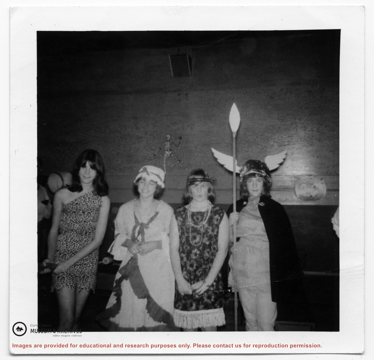
Historical info on the Gorge Harbour Community Hall Society, the building of the Gorge Harbour Hall in 1933, and the Gorge Harbour Young People's Dramatic Socety, 1930s. Clippings about Gorge Hall events, taxes and community resources, 1962-2013. Broadway Musical Comedy itinerary, Gorge Hall, 1972. Vintage looking poster "Songs for Winter," Gorge Hall, undated.
Historical info on the Gorge Harbour Community Hall Society, the building of the Gorge Harbour Hall in 1933, and the Gorge Harbour Young People's Dramatic Socety, 1930s. Clippings about Gorge Hall events, taxes and community resources, 1962-2013. Broadway Musical Comedy itinerary, Gorge Hall, 1972. Vintage looking poster "Songs for Winter," Gorge Hall, undated.
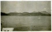
Historical information on Gorge Harbour, people, properties, info dating back to 1898. Clippings with tourist info, proposed Klahoose oyster license, Island Sea Farms aquaculture, and resort upgrades from Dr. Richard and Michelle Glickman, 2007-2019. Gorge Harbour map from Hubert Steghaus, 2008. Floathouse Restaurant menu, 2011. Obituary for Mrs S.E. Corneille, 2016. Info on Gorge Government dock and tree falling, 2017. Gorge Harbour brochures, undated. Poster for talk with sailors Amanda and Barry Glickman at Gorge gazebo, undated. Photos (copies) of Gorge Marina, store and restaurant,1974.
Historical information on Gorge Harbour, people, properties, info dating back to 1898. Clippings with tourist info, proposed Klahoose oyster license, Island Sea Farms aquaculture, and resort upgrades from Dr. Richard and Michelle Glickman, 2007-2019. Gorge Harbour map from Hubert Steghaus, 2008. Floathouse Restaurant menu, 2011. Obituary for Mrs S.E. Corneille, 2016. Info on Gorge Government dock and tree falling, 2017. Gorge Harbour brochures, undated. Poster for talk with sailors Amanda and Barry Glickman at Gorge gazebo, undated. Photos (copies) of Gorge Marina, store and restaurant,1974.
File contains a Key Map to the sections covered in Files 17-19; a list of the sections researched and two pages of notes.
It contains photocopies of Crown Grants and subsequent title changes for the following:
Charles Allen: 1908, Crown Grant for part of NE 1/4 of Sec. 21 lying north of Gorge Harbour (property known as Bute Ranch); 46 acres for $46.00
Bernard Robinson Allen: 1919, Crown Grant for NW 1/4 of Sec. 21; 162 acres for $247.00
Charles Allen: 1905, Crown Grant for SE 1/4 of Sec. 34
(Files 17 through 19 are from the same envelope.)
File contains information for the following properties:
E. H. Vaughn: 1893, Crown Grant for fractional N 1/2 of Sec. 22; 90 acres for $90.00.
James P. Allen: 1913, Crown Grant for NW 34 acres of Sec. 23; $170.00
Bernard Robinson Allen: 1919, Crown Grant for SW 1/4 of Sec. 23, 159 acres
Charles Allen: 1912, Crown Grant for SW 1/4 of Sec. 33; 160 acres for $160.00
Harold Marshall Wood: Crown Grant for E 1/2 of NE 1/4 of Sec. 46 (east of Carrington Bay); 81 acres for $1.00.
File contains the following maps, stored in the Map Cabinet:
Subdivision Plan of parcel C & E, NW 1/4 of Sec. 21, 1976
Subdivision of the fractional NE 1/4 of Sec 21, 1966; with names of property owners penciled in
Subdivision Plan of Parcel C and part of Parcel E of fractional NE 1/4 of Sec. 21, 1975
Subdivision Plan of fractional NE 1/4 of Sec. 21 and W 1/2 of SW 1/4 of Sec. 34
(Files 17 through 19 are from the same envelope.)
File contains a map key to the areas of Sections 17, 18, 19, 22 and 34 (south of Gorge Harbour) which were researched (Information in Files 3-7).
It contains photocopies of original land grants and subsequent conveyances for the following:
Reginald James Smith: 1946, Crown Grant 165414I for fractional SE 1/4 of Sec 23, 1946 (the Thunder Road subdivision at the eastern end of Gorge Harbour).
(Files 3 through 7 are from the same envelope.)
File contains title information and photocopies of land grants and subsequent conveyances for the following:
John Williams: 1914, Crown Grant for the fractional SW 1/4 of Sec 22 and fractional NW 1/4 of Sec 22 (east of Gorge Harbour entrance)
John Williams: 1914, Crown Grant for the fractional SW 1/4 of Sec 22 and frac. NW 1/4 of Sec 18 (west of the Gorge Harbour entrance)
File contains three oversize maps which are stored in the map cabinet: Map of Section 22, Plan VIP52378, Lots A,B,C (blueprint map; 85 cm x 54 cm, 1985); map of Plan 27966 (blueprint map; 55 cm x 43 cm, 1974); photocopy of map of fractional NW 1/4 Sec 17 (55 cm x 43 cm, 1973)
(Files 3 through 7 are from the same envelope.)
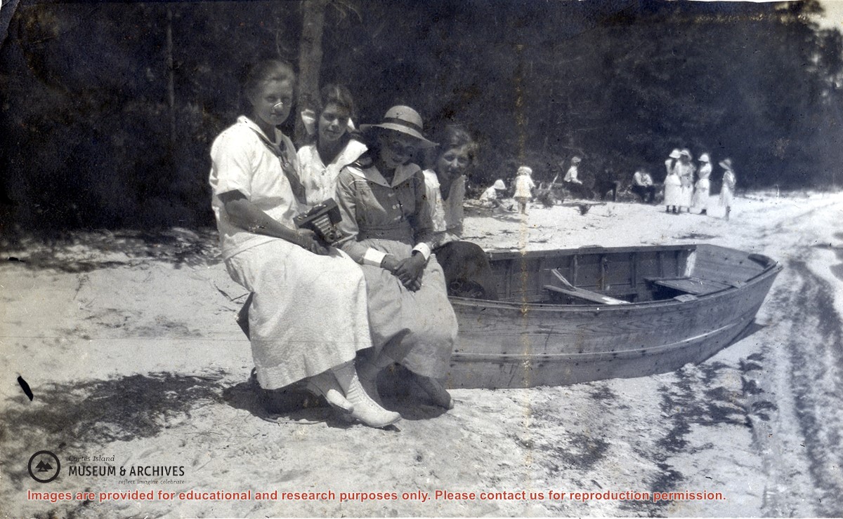
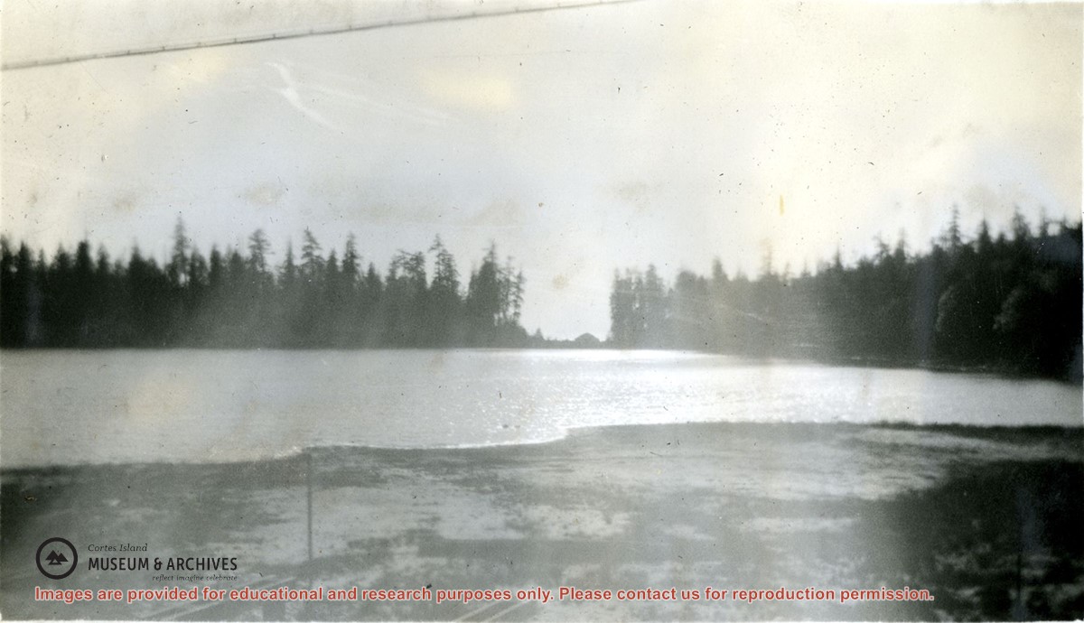
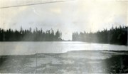
Meg Robertson (Shaw), Margaret Middleton, Margaret Copland and Elsie Allen seated on a beached rowboat at a sandy beach at the lake at Manson's Landing. Other people, including children, can be seen in the background.
Meg Robertson (Shaw), Margaret Middleton, Margaret Copland and Elsie Allen seated on a beached rowboat at a sandy beach at the lake at Manson's Landing. Other people, including children, can be seen in the background.
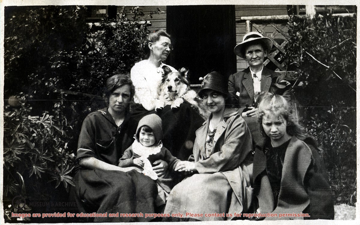
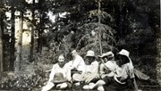
Photograph of a group of people seated on the steps of the home of Charles (Charlie) Allen in the Gorge Harbour (on the site of what is now the Gorge Harbour Marina.) The people are not identified.
Photograph of a group of people seated on the steps of the home of Charles (Charlie) Allen in the Gorge Harbour (on the site of what is now the Gorge Harbour Marina.) The people are not identified.
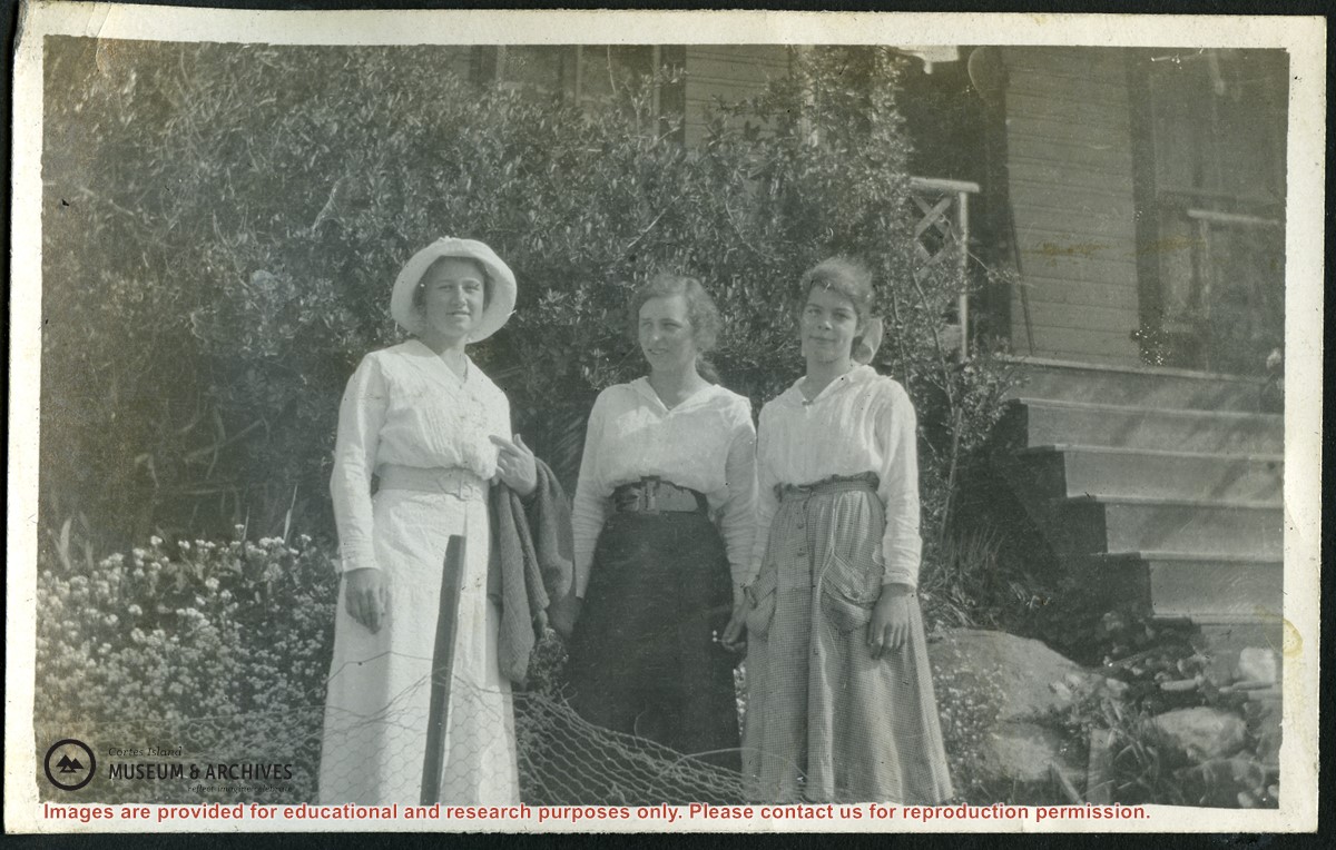
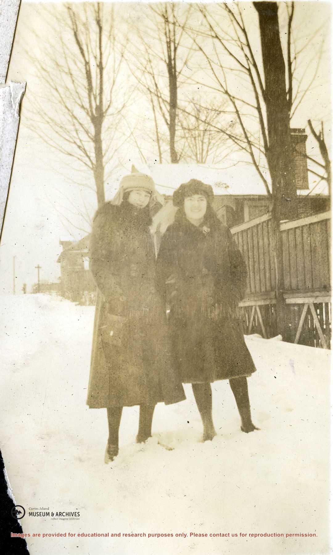
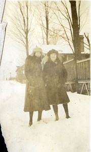
Photograph of Meg Robertson, Elsie Allen and Margaret (Pete) Middleton, standing in front of the stairs up to the Allen's house in Gorge Harbour (now the Gorge Harbour Marina).
Photograph of Meg Robertson, Elsie Allen and Margaret (Pete) Middleton, standing in front of the stairs up to the Allen's house in Gorge Harbour (now the Gorge Harbour Marina).
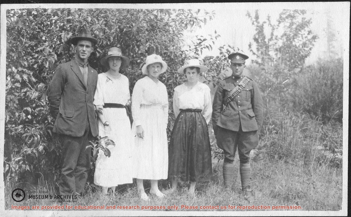
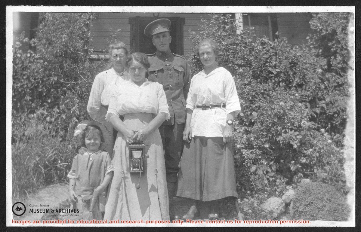
Photograph of (L to R) Lorine, Mrs. Charles Allen, Mrs. Munn, Mr. Munn (in uniform) and Margaret (Meg) Robertson, standing in front of a house bordered with flowering bushes, probably at the Allen homestead, Bute Ranch, on Gorge Harbour.
Photograph of (L to R) Lorine, Mrs. Charles Allen, Mrs. Munn, Mr. Munn (in uniform) and Margaret (Meg) Robertson, standing in front of a house bordered with flowering bushes, probably at the Allen homestead, Bute Ranch, on Gorge Harbour.