Photograph postcard of the Whaletown Church. Originally from the collection of Gilean Douglas.
Note - There is a digital enlargement of this postcard in the oversize box. This same postcard is found in other fonds (Items 2003.002.024 and 2019.023.013).
Photograph postcard of the Whaletown Church. Originally from the collection of Gilean Douglas.
Note - There is a digital enlargement of this postcard in the oversize box. This same postcard is found in other fonds (Items 2003.002.024 and 2019.023.013).
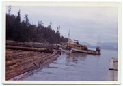
Photograph is labelled on the back: "Tiber Bay. The last of the Cat logging, with the tug "General Caldwell, skipper John Charltown, taking out 2 ections of fir." (From a group of photographs labelled "Frank Tooker photos").
Photograph is labelled on the back: "Tiber Bay. The last of the Cat logging, with the tug "General Caldwell, skipper John Charltown, taking out 2 ections of fir." (From a group of photographs labelled "Frank Tooker photos").
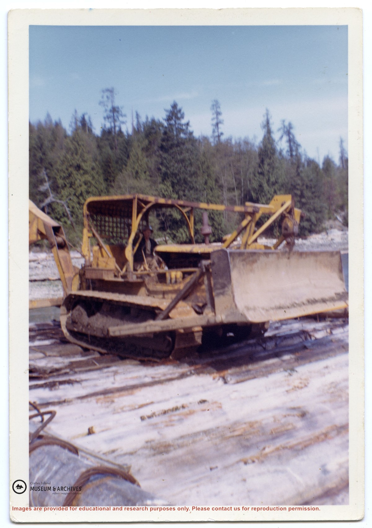
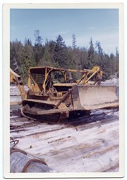
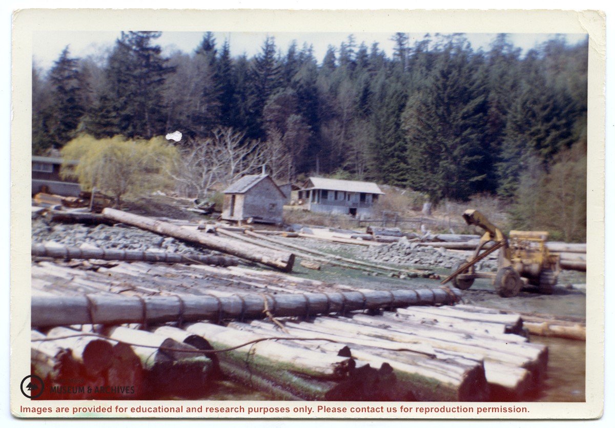
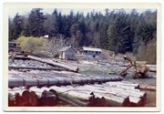
Photograph of a D8 Cat beside a log raft on the beach at Tiber Bay. A house is on the shore, along with a logging trailer and shed. Labelled on the back: "Tiber Bay. The selling out of Tooker Logging at Tiber Bay, loading of machinery." (From a group of photographs labelled "Frank Tooker photos").
Photograph of a D8 Cat beside a log raft on the beach at Tiber Bay. A house is on the shore, along with a logging trailer and shed. Labelled on the back: "Tiber Bay. The selling out of Tooker Logging at Tiber Bay, loading of machinery." (From a group of photographs labelled "Frank Tooker photos").
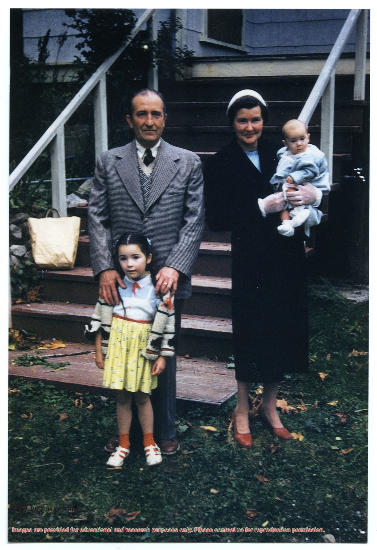
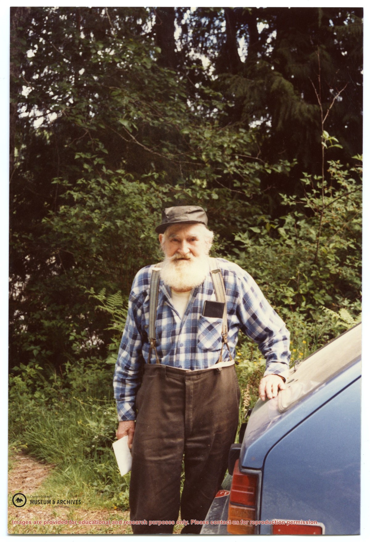
Photograph of Alex McKee standing outside. Notes on a paper with the photograph: "Ann McKee came to Whaletown. Lived in Cousins Thompson's - house burned down early 50's. Moved to Prince Rupert where daughter lived; Mrs. M died. Alec returned early 70s. Lived in a small cabin, fished a bit."
Photograph of Alex McKee standing outside. Notes on a paper with the photograph: "Ann McKee came to Whaletown. Lived in Cousins Thompson's - house burned down early 50's. Moved to Prince Rupert where daughter lived; Mrs. M died. Alec returned early 70s. Lived in a small cabin, fished a bit."
File contains a coloured map with researched properties coloured in, and title information and photocopies of land grants and subsequent conveyances for the following:
Edward James Breeze: 1931, Crown Grant for District Lot 1373 (parts of Section 23 and Section 17, at the southeast end of Gorge Harbour by Anvil Lake)
Frank Harper: 1913, Crown Grant for the NE 96 acres of Section 23 (at the northeast end of Gorge Harbour)
(Files 3 through 7 are from the same envelope.)
File contains information for the following properties:
E. H. Vaughn: 1893, Crown Grant for fractional N 1/2 of Sec. 22; 90 acres for $90.00.
James P. Allen: 1913, Crown Grant for NW 34 acres of Sec. 23; $170.00
Bernard Robinson Allen: 1919, Crown Grant for SW 1/4 of Sec. 23, 159 acres
Charles Allen: 1912, Crown Grant for SW 1/4 of Sec. 33; 160 acres for $160.00
Harold Marshall Wood: Crown Grant for E 1/2 of NE 1/4 of Sec. 46 (east of Carrington Bay); 81 acres for $1.00.
File contains the following maps, stored in the Map Cabinet:
Subdivision Plan of parcel C & E, NW 1/4 of Sec. 21, 1976
Subdivision of the fractional NE 1/4 of Sec 21, 1966; with names of property owners penciled in
Subdivision Plan of Parcel C and part of Parcel E of fractional NE 1/4 of Sec. 21, 1975
Subdivision Plan of fractional NE 1/4 of Sec. 21 and W 1/2 of SW 1/4 of Sec. 34
(Files 17 through 19 are from the same envelope.)
Series contains information on historic Crown Grants and subsequent title changes compiled by Doreen Thompson during her research for the CIMAS Windows on Whaletown exhibit in 1999. The area covered includes the northern part of Cortes Island, from just south of Gorge Harbour. Material includes maps, photocopies of original Crown Grants and other title documents, lists of subdivisions, and notes on changes of title.
Records were organized by Section or Plan number in large envelopes with a cover map and notes about the properties researched on the envelope back. They trace the ownership of parcels of land from the first grant or purchase from the Crown to 1999. Original order has been maintained.
File contains a photocopied section map of the northern part of Cortes Island (from just south of Gorge Harbour), coloured to indicate areas for which a Crown Grant was located and areas of ungranted Crown land which still appear to be owned by the government. Scale is 1 mile to 1 inch.
File contains a photocopied section map of the northern part of Cortes Island (from just south of Gorge Harbour), coloured to indicate areas for which a Crown Grant was located and areas of ungranted Crown land which still appear to be owned by the government. Scale is 1 mile to 1 inch.


.jpg?width=1200&404=no-img.jpg&watermark=wmk)
.jpg?width=1200&404=no-img.jpg&watermark=wmk)
.jpg?width=180&404=no-img.jpg)