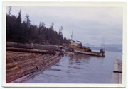
Photograph is labelled on the back: "Tiber Bay. The last of the Cat logging, with the tug "General Caldwell, skipper John Charltown, taking out 2 ections of fir." (From a group of photographs labelled "Frank Tooker photos").
Photograph is labelled on the back: "Tiber Bay. The last of the Cat logging, with the tug "General Caldwell, skipper John Charltown, taking out 2 ections of fir." (From a group of photographs labelled "Frank Tooker photos").
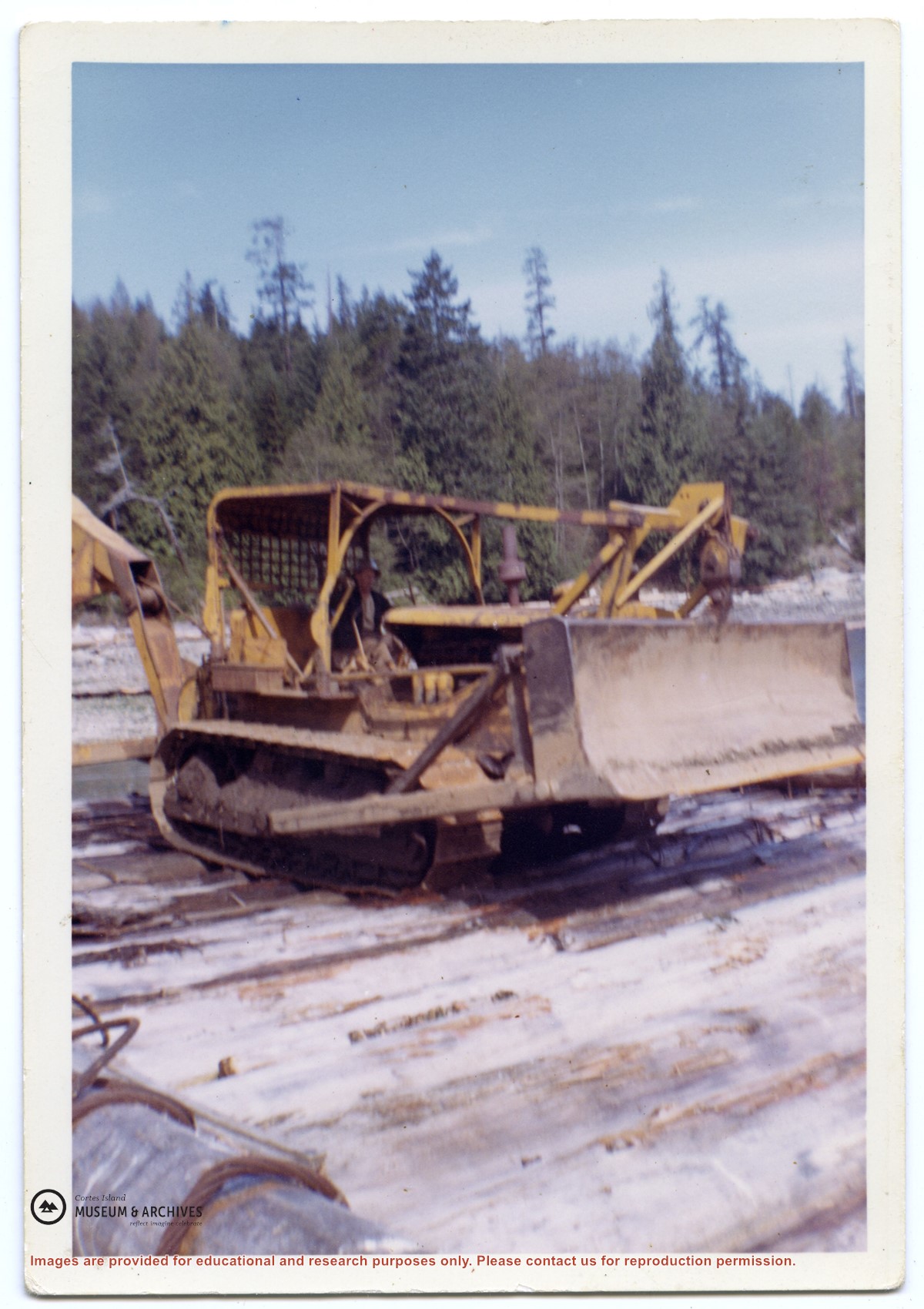
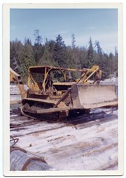
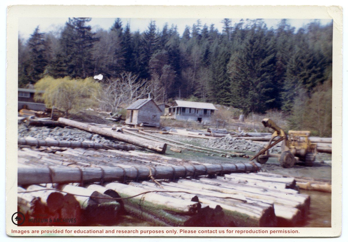
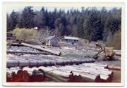
Photograph of a D8 Cat beside a log raft on the beach at Tiber Bay. A house is on the shore, along with a logging trailer and shed. Labelled on the back: "Tiber Bay. The selling out of Tooker Logging at Tiber Bay, loading of machinery." (From a group of photographs labelled "Frank Tooker photos").
Photograph of a D8 Cat beside a log raft on the beach at Tiber Bay. A house is on the shore, along with a logging trailer and shed. Labelled on the back: "Tiber Bay. The selling out of Tooker Logging at Tiber Bay, loading of machinery." (From a group of photographs labelled "Frank Tooker photos").
File contains a bound copy of the first Cortes Island Official Settlement Plan (May 1979) and the first zoning bylaw, "Bylaw 41 Electoral Area I Zoning By-law (Cortes Island) 1970".
File contains a bound copy of the first Cortes Island Official Settlement Plan (May 1979) and the first zoning bylaw, "Bylaw 41 Electoral Area I Zoning By-law (Cortes Island) 1970".
File contains zoning maps for Bylaw 41, Electoral Area I, Schedules A1-A7 with revisions to 1999. There is a map of the whole island and larger scale maps of island areas.
File contains a photocopied section map of the northern part of Cortes Island (from just south of Gorge Harbour), coloured to indicate areas for which a Crown Grant was located and areas of ungranted Crown land which still appear to be owned by the government. Scale is 1 mile to 1 inch.
File contains a photocopied section map of the northern part of Cortes Island (from just south of Gorge Harbour), coloured to indicate areas for which a Crown Grant was located and areas of ungranted Crown land which still appear to be owned by the government. Scale is 1 mile to 1 inch.
File contains a photocopied part of a map showing the locations of researched property in the Whaletown Lagoon and Whaletown Harbour area. The map is glued to an envelope which has a list of Crown grants and other conveyances on the back.
It contains photocopies of original land grants and other conveyances for the following:
Moses Ireland: 1893, Crown Grant for the W 1/2 of SW 1/4 of Sec 35 and W 1/2 of the SW 1/4 of Section 34
Joseph Youart: 1900, Crown Grant for Fractional NE 1/4 of Sec 35 (sold to Alice Robertson in 1908; "Burnside" is still in the Robertson family).
Nicholas Thompson: 1920, Crown Grant for the Fractional SW 1/4 of Sec 35
Charles Strange: 1914, Crown Grant for the NW 1/4 of Sec 35
File contains a map key to the areas of Sections 17, 18, 19, 22 and 34 (south of Gorge Harbour) which were researched (Information in Files 3-7).
It contains photocopies of original land grants and subsequent conveyances for the following:
Reginald James Smith: 1946, Crown Grant 165414I for fractional SE 1/4 of Sec 23, 1946 (the Thunder Road subdivision at the eastern end of Gorge Harbour).
(Files 3 through 7 are from the same envelope.)
File contains title information and photocopies of land grants and subsequent conveyances for the following:
John Williams: 1914, Crown Grant for the fractional SW 1/4 of Sec 22 and fractional NW 1/4 of Sec 22 (east of Gorge Harbour entrance)
John Williams: 1914, Crown Grant for the fractional SW 1/4 of Sec 22 and frac. NW 1/4 of Sec 18 (west of the Gorge Harbour entrance)
File contains three oversize maps which are stored in the map cabinet: Map of Section 22, Plan VIP52378, Lots A,B,C (blueprint map; 85 cm x 54 cm, 1985); map of Plan 27966 (blueprint map; 55 cm x 43 cm, 1974); photocopy of map of fractional NW 1/4 Sec 17 (55 cm x 43 cm, 1973)
(Files 3 through 7 are from the same envelope.)
File contains a photocopy of Crown Grant and documentation of subsequent changes in title for:
William Barrett Lennard: 1928, Crown Grant for the SE and SW 1/4s of Section 23 (on the SE shore of Gorge Harbour)
(Files 3 through 7 are from the same envelope.)
File contains a photocopy of Crown Grant and documentation of subsequent changes in title for:
William Barrett Lennard: 1928, Crown Grant for the SE and SW 1/4s of Section 23 (on the SE shore of Gorge Harbour)
(Files 3 through 7 are from the same envelope.)