Coloured map of southwestern BC showing municipalities, geographical features, land and sea routes, natural resources, etc. The back of the map is fully printed with information about BC and suggested travel itineraries.
Map needs preservation: edges are frayed and there are several tears.
Coloured map of southwestern BC showing municipalities, geographical features, land and sea routes, natural resources, etc. The back of the map is fully printed with information about BC and suggested travel itineraries.
Map needs preservation: edges are frayed and there are several tears.
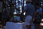
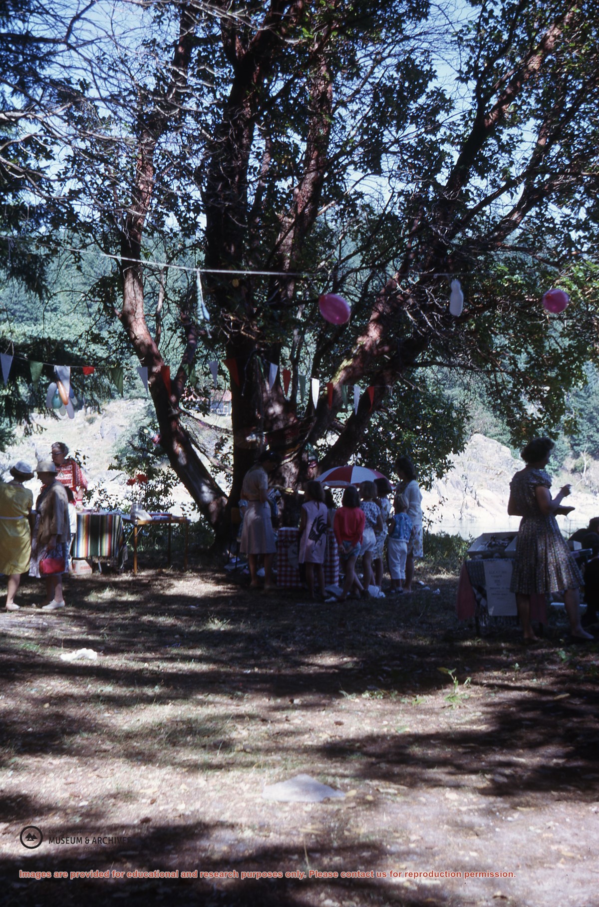
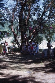
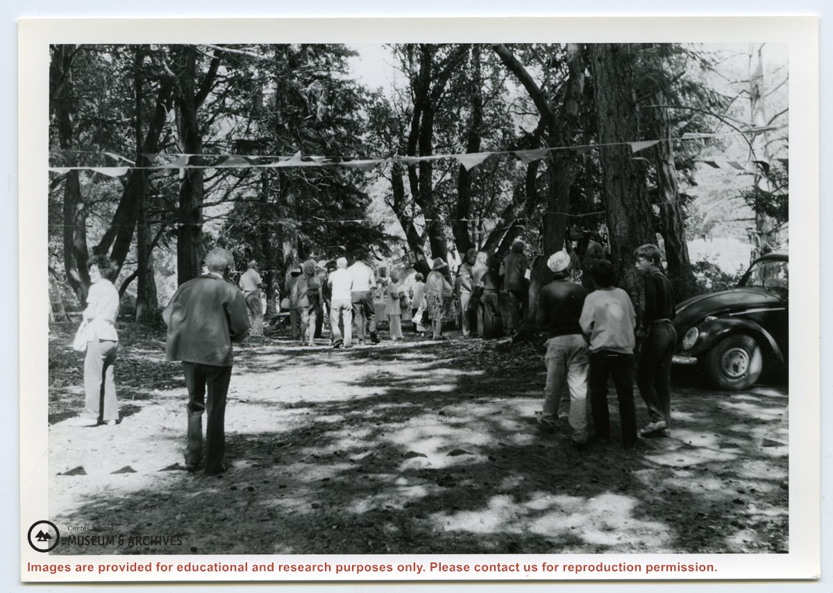
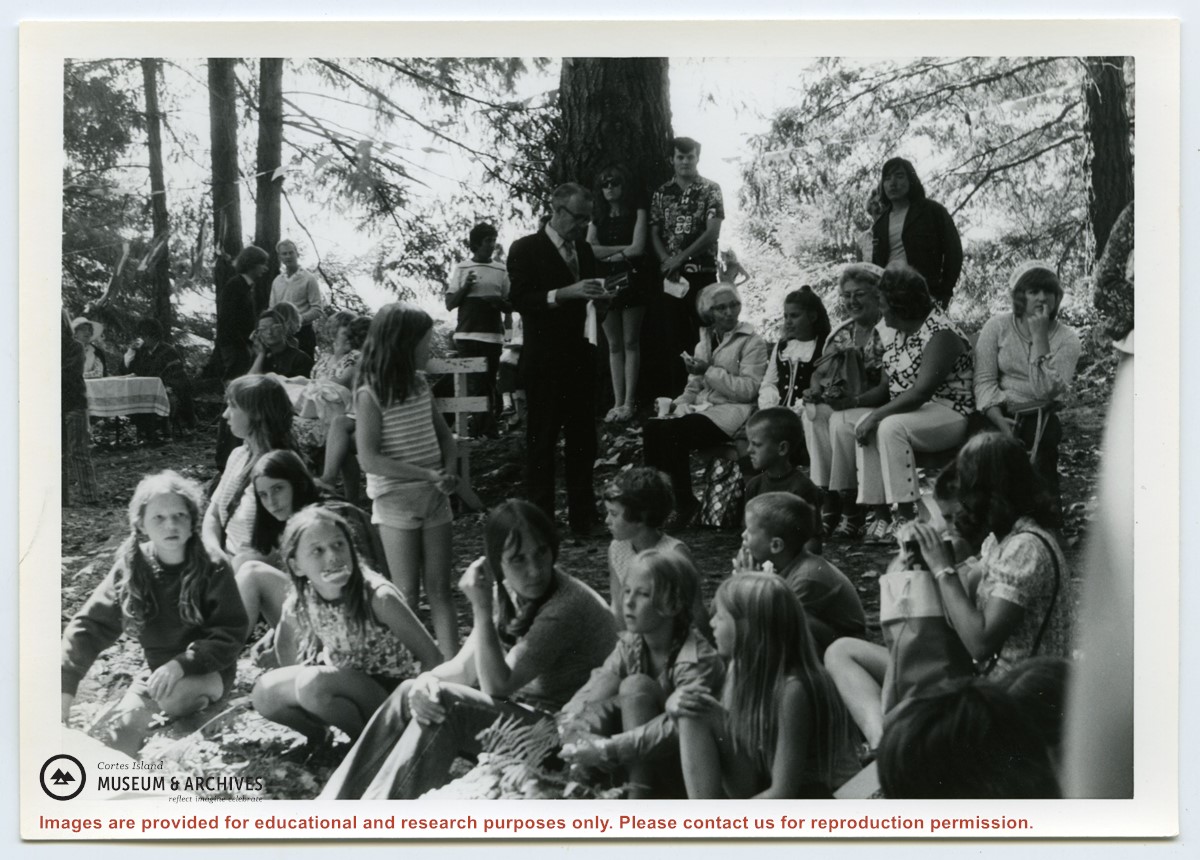
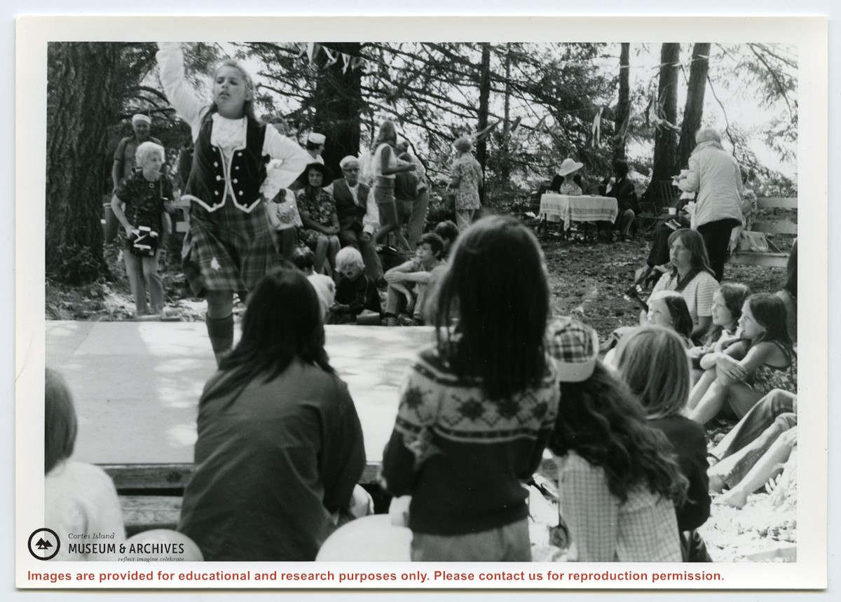
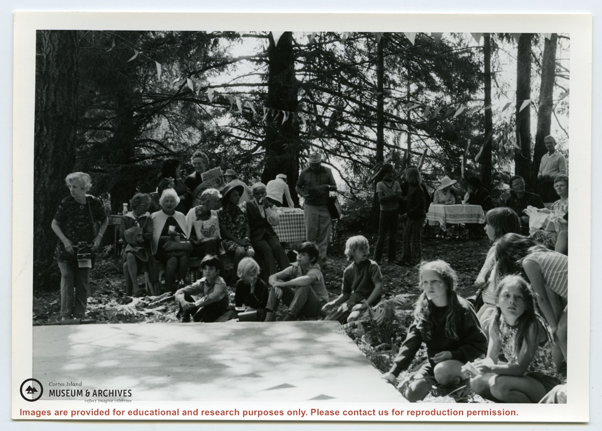
Photograph of people at the Fiesta, including Rev. Rollo Boas (standing, center), Kathleen Boas, Diane and Jimmy Hansen; Debbie and Joan Musclow; Yetta Maibauer and daughter seated center front. (ID)
Photograph of people at the Fiesta, including Rev. Rollo Boas (standing, center), Kathleen Boas, Diane and Jimmy Hansen; Debbie and Joan Musclow; Yetta Maibauer and daughter seated center front. (ID)
Series contains information on historic Crown Grants and subsequent title changes compiled by Doreen Thompson during her research for the CIMAS Windows on Whaletown exhibit in 1999. The area covered includes the northern part of Cortes Island, from just south of Gorge Harbour. Material includes maps, photocopies of original Crown Grants and other title documents, lists of subdivisions, and notes on changes of title.
Records were organized by Section or Plan number in large envelopes with a cover map and notes about the properties researched on the envelope back. They trace the ownership of parcels of land from the first grant or purchase from the Crown to 1999. Original order has been maintained.
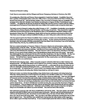
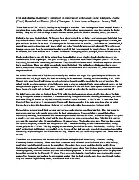
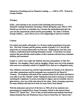
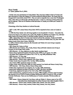
CD (2006.001.041) contains transcripts of interviews with Bert Summers, Beth (Martin) Slater, Betty Jeffery, Bill and Mary Block, Bill Guthrie, Bob Martineau, Don Levey, Frank Hayes, Fred Tomlinson, George Gardner, Heay family, Ken Summers, Otis Coulter, Pat (Fuller) Haines and Violet Herrewig. A Directory List for the CD is in folder 1-41. The transcripts may be viewed on the Archives computer, in the folder "2006.001.041 - Doreen Thompson, interview transcripts".
CD (2006.001.041) contains transcripts of interviews with Bert Summers, Beth (Martin) Slater, Betty Jeffery, Bill and Mary Block, Bill Guthrie, Bob Martineau, Don Levey, Frank Hayes, Fred Tomlinson, George Gardner, Heay family, Ken Summers, Otis Coulter, Pat (Fuller) Haines and Violet Herrewig. A Directory List for the CD is in folder 1-41. The transcripts may be viewed on the Archives computer, in the folder "2006.001.041 - Doreen Thompson, interview transcripts".
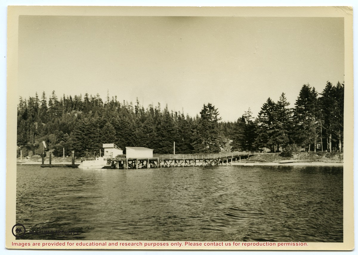
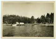
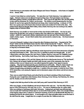
Photograph of the Manson's Landing wharf, taken from the water at high tide. It includes the oil and wharf sheds on the dock, an unknown scow boat with cabin at the float and the store ashore. Note: telephone poles from the original phone line across the mouth of the lagoon; higher banks along the shoreline.
Photograph of the Manson's Landing wharf, taken from the water at high tide. It includes the oil and wharf sheds on the dock, an unknown scow boat with cabin at the float and the store ashore. Note: telephone poles from the original phone line across the mouth of the lagoon; higher banks along the shoreline.

 Slater.pdf?width=280&404=no-doc.jpg)
 Haines.pdf?width=280&404=no-doc.jpg)