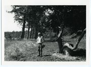
CD (2006.001.041) contains transcripts of interviews with Bert Summers, Beth (Martin) Slater, Betty Jeffery, Bill and Mary Block, Bill Guthrie, Bob Martineau, Don Levey, Frank Hayes, Fred Tomlinson, George Gardner, Heay family, Ken Summers, Otis Coulter, Pat (Fuller) Haines and Violet Herrewig. A Directory List for the CD is in folder 1-41. The transcripts may be viewed on the Archives computer, in the folder "2006.001.041 - Doreen Thompson, interview transcripts".
CD (2006.001.041) contains transcripts of interviews with Bert Summers, Beth (Martin) Slater, Betty Jeffery, Bill and Mary Block, Bill Guthrie, Bob Martineau, Don Levey, Frank Hayes, Fred Tomlinson, George Gardner, Heay family, Ken Summers, Otis Coulter, Pat (Fuller) Haines and Violet Herrewig. A Directory List for the CD is in folder 1-41. The transcripts may be viewed on the Archives computer, in the folder "2006.001.041 - Doreen Thompson, interview transcripts".
Series contains information on historic Crown Grants and subsequent title changes compiled by Doreen Thompson during her research for the CIMAS Windows on Whaletown exhibit in 1999. The area covered includes the northern part of Cortes Island, from just south of Gorge Harbour. Material includes maps, photocopies of original Crown Grants and other title documents, lists of subdivisions, and notes on changes of title.
Records were organized by Section or Plan number in large envelopes with a cover map and notes about the properties researched on the envelope back. They trace the ownership of parcels of land from the first grant or purchase from the Crown to 1999. Original order has been maintained.
File contains a photocopied section map of the northern part of Cortes Island (from just south of Gorge Harbour), coloured to indicate areas for which a Crown Grant was located and areas of ungranted Crown land which still appear to be owned by the government. Scale is 1 mile to 1 inch.
File contains a photocopied section map of the northern part of Cortes Island (from just south of Gorge Harbour), coloured to indicate areas for which a Crown Grant was located and areas of ungranted Crown land which still appear to be owned by the government. Scale is 1 mile to 1 inch.
File contains a key map which was pasted on the front of the envelope indicating the areas researched for Files 12-16; notes on the titles; photocopies of Crown Grants and subsequent title information for:
BC Buildings Corp: 1982, Crown Grant for Block A of SW 1/4 of Sec. 25 (Highways Maintenance Yard)
District Lot 871 (40 acres between Carrington and Coulter Bays): to James Frederick McManus, 1919
To Ernest Henry Vaughn: 1922, Crown Grant for NE 1/4 and NW 1/4 of NE 1/4 of Sec. 24; SE 1/4 of SW 1/4 and SW 1/4 of SE 1/4 of Sec 31
Herbert Proctor: 1928 for fractional SW 1/4 of Sec. 41, bordering Tork Reserve; 159 acres for $159.00 (orig. Crown Grant to Herbert Proctor in 1922)
To William Cowan: 1937, E 1/2 of SE 1/4 of Sec. 26, 89 acres
(Files 12 through 16 are from the same envelope.)
File contains a map and notes, and information on the following:
Mabel Huck: 1920, Crown Grant for NE 1/4 of Sec. 40; file shows the original grant, a tax sale forfeit in 1939, a regrant in 1957 with immediate sale to MacMillan/Bloedel.
William Barrett: 1916, Crown Grant for NW 1/4 of Sec. 40; $160 for 160 acres.
Herbert Benjamin Middleton: 1916, Crown Grant for SW 1/4 of Sec. 40, 168 acres for $168.00
August Teuber: 1904, Crown Grant for SE 14 of Sec. 40; 160 acres for $160.00.
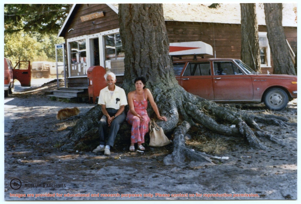
One of a series of 20 photographs documenting the move of the old Manson's Landing store from its position by the wharf in Mansons Landing Provincial Park to the present Museum site on Beasley Rd. The photographs are from an envelope labelled "Moving Museum, Dec. 1995. Moved by Able Transport. Paid for by Elmer and May Ellingsen."
Found in Information Files folder (Cortes Island Museum & Archives info"), Jan. 2021
Scope and Content
One of a series of 20 photographs documenting the move of the old Manson's Landing store from its position by the wharf in Mansons Landing Provincial Park to the present Museum site on Beasley Rd. The photographs are from an envelope labelled "Moving Museum, Dec. 1995. Moved by Able Transport. Paid for by Elmer and May Ellingsen."
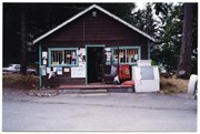
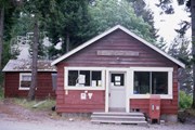
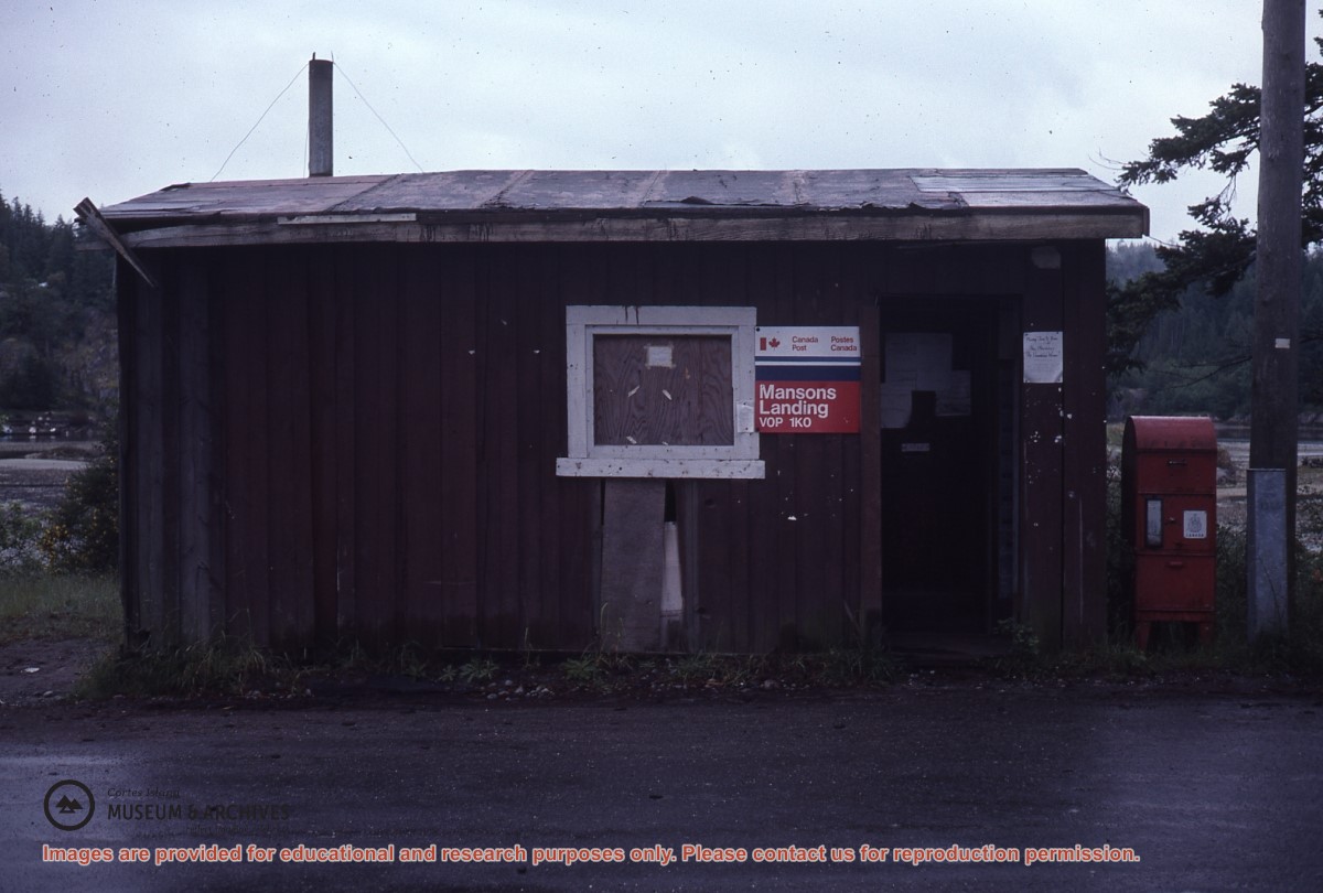
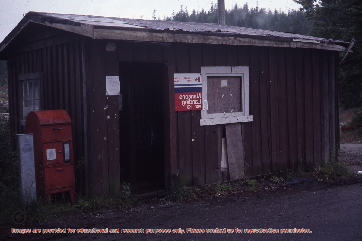
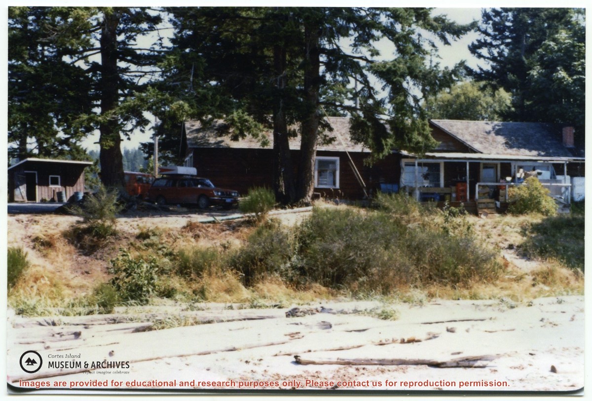
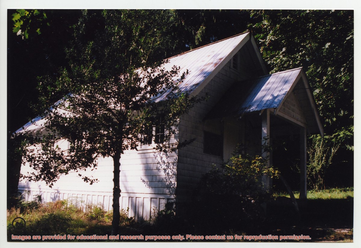
The Manson's Landing store in Mansons Landing Provincial Park. This photograph was taken a few months before the building was moved to Beasley Rd. to become the Cortes Island Museum.
The Manson's Landing store in Mansons Landing Provincial Park. This photograph was taken a few months before the building was moved to Beasley Rd. to become the Cortes Island Museum.
 Slater.pdf?width=280&404=no-doc.jpg)
 Haines.pdf?width=280&404=no-doc.jpg)