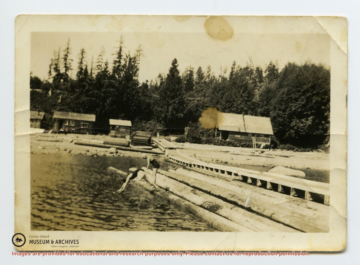
Photo depicts a line of buildings on the shore at Seaford, with a long wharf going into the water. Hazel McKay and Audrey Denny are diving into the water from logs beside the wharf. Photograph is stained and creased.
Photo depicts a line of buildings on the shore at Seaford, with a long wharf going into the water. Hazel McKay and Audrey Denny are diving into the water from logs beside the wharf. Photograph is stained and creased.
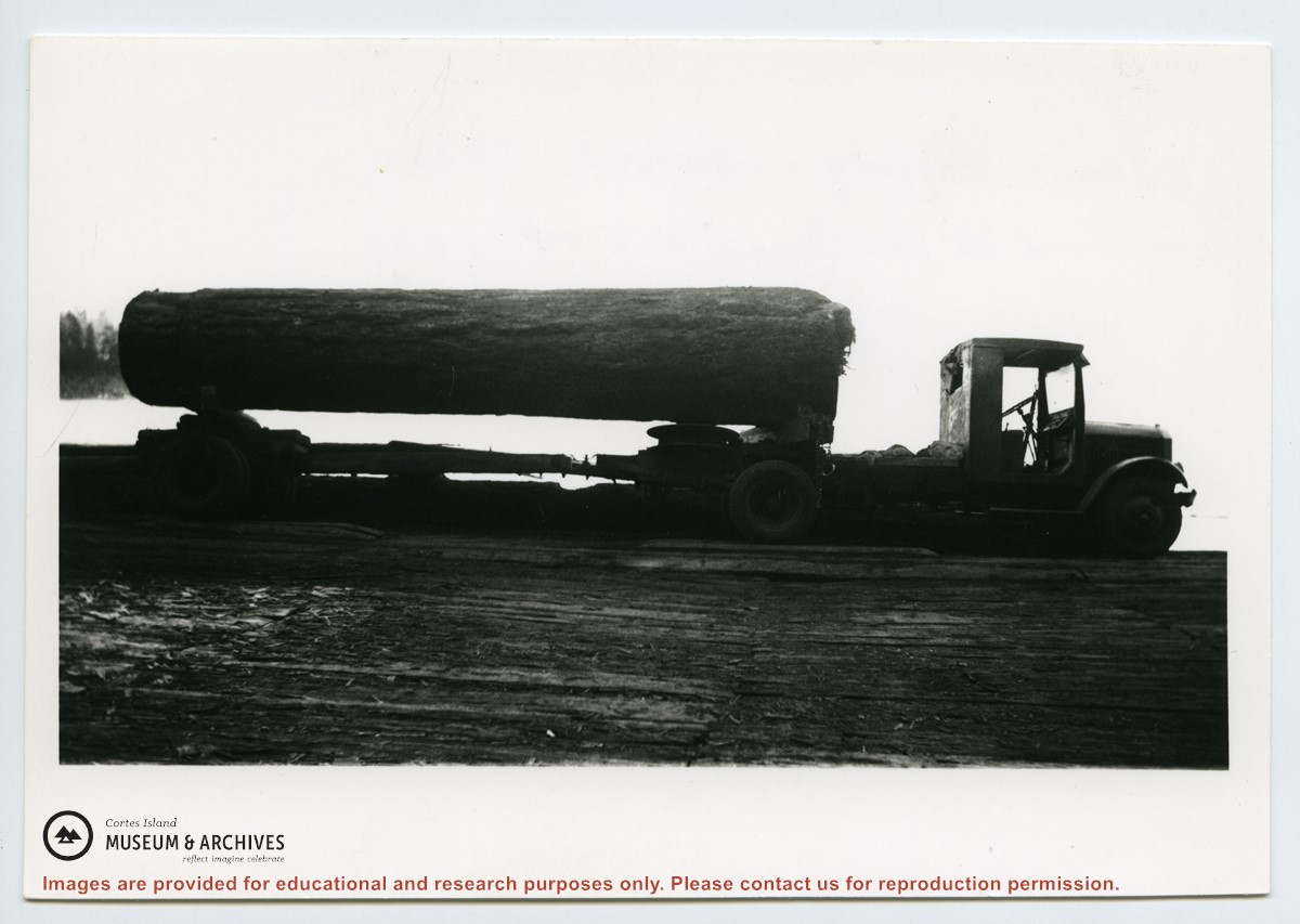
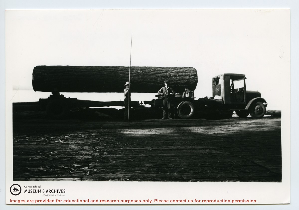
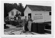
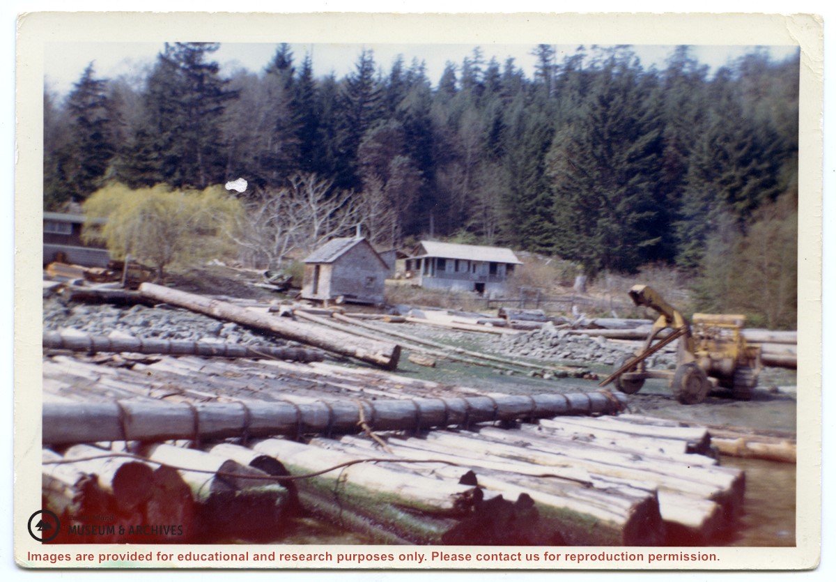
Verso: "Truck logging at Seaford, Cortez Isld. Scotty McKenzie with pike pole. Clarence Byers truck driver. Hayes Anderson truck.
Moved to Von Donop Oct 1st, 1939.
Five families:
1. Henry and Ruth Byers
2. Ervin and Florence McKay
3. Clarence and Etta Byers
4. Scotty and Amy McKenzie
5. Ken and Hazel Hansen
Ervin and Florence were parents of Etta and Hazel.
Henry and Ruth were parents of Amy and Clarence.
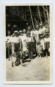
L to R: Art Hayes, Nerine Hayes, Frank Hayes, Florence McKay, Gwen Campbell, Fraser Campbell.
Front: Bobby Hayes, Irene Hayes, Clarence Byers and Queenie the dog.
L to R: Art Hayes, Nerine Hayes, Frank Hayes, Florence McKay, Gwen Campbell, Fraser Campbell.
Front: Bobby Hayes, Irene Hayes, Clarence Byers and Queenie the dog.
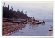
Photograph is labelled on the back: "Tiber Bay. The last of the Cat logging, with the tug "General Caldwell, skipper John Charltown, taking out 2 ections of fir." (From a group of photographs labelled "Frank Tooker photos").
Photograph is labelled on the back: "Tiber Bay. The last of the Cat logging, with the tug "General Caldwell, skipper John Charltown, taking out 2 ections of fir." (From a group of photographs labelled "Frank Tooker photos").
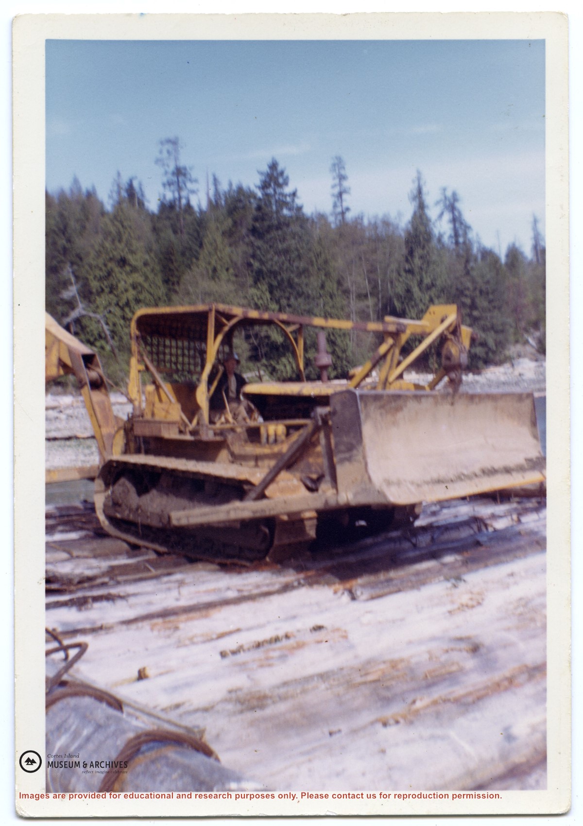
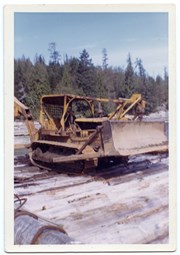
Photograph of a D8 Cat beside a log raft on the beach at Tiber Bay. A house is on the shore, along with a logging trailer and shed. Labelled on the back: "Tiber Bay. The selling out of Tooker Logging at Tiber Bay, loading of machinery." (From a group of photographs labelled "Frank Tooker photos").
Photograph of a D8 Cat beside a log raft on the beach at Tiber Bay. A house is on the shore, along with a logging trailer and shed. Labelled on the back: "Tiber Bay. The selling out of Tooker Logging at Tiber Bay, loading of machinery." (From a group of photographs labelled "Frank Tooker photos").
File contains a hand-drawn map of Hernando Island showing original pre-emptions, with information about settlement, schools and changes of title written on it.
File contains a hand-drawn map of Hernando Island showing original pre-emptions, with information about settlement, schools and changes of title written on it.
File contains two copies of the booklet "Birds of Cortes and Mittlenatch Islands, a checklist with seasonal graphs" by George Sirk, Christian Gronau and Fred Zwickel, published by the authors in 1993.
File contains two copies of the booklet "Birds of Cortes and Mittlenatch Islands, a checklist with seasonal graphs" by George Sirk, Christian Gronau and Fred Zwickel, published by the authors in 1993.
File contains a Cortes Island School yearbook 1994/15. In 1995 Ed Piggott retired after 20 years as the school principal. Yearbook originally belonged to Lorena Teames.
File contains a Cortes Island School yearbook 1994/15. In 1995 Ed Piggott retired after 20 years as the school principal. Yearbook originally belonged to Lorena Teames.
File contains a photocopied section map of the northern part of Cortes Island (from just south of Gorge Harbour), coloured to indicate areas for which a Crown Grant was located and areas of ungranted Crown land which still appear to be owned by the government. Scale is 1 mile to 1 inch.
File contains a photocopied section map of the northern part of Cortes Island (from just south of Gorge Harbour), coloured to indicate areas for which a Crown Grant was located and areas of ungranted Crown land which still appear to be owned by the government. Scale is 1 mile to 1 inch.
File contains a photocopied part of a map showing the locations of researched property in the Whaletown Lagoon and Whaletown Harbour area. The map is glued to an envelope which has a list of Crown grants and other conveyances on the back.
It contains photocopies of original land grants and other conveyances for the following:
Moses Ireland: 1893, Crown Grant for the W 1/2 of SW 1/4 of Sec 35 and W 1/2 of the SW 1/4 of Section 34
Joseph Youart: 1900, Crown Grant for Fractional NE 1/4 of Sec 35 (sold to Alice Robertson in 1908; "Burnside" is still in the Robertson family).
Nicholas Thompson: 1920, Crown Grant for the Fractional SW 1/4 of Sec 35
Charles Strange: 1914, Crown Grant for the NW 1/4 of Sec 35
File contains a map key to the areas of Sections 17, 18, 19, 22 and 34 (south of Gorge Harbour) which were researched (Information in Files 3-7).
It contains photocopies of original land grants and subsequent conveyances for the following:
Reginald James Smith: 1946, Crown Grant 165414I for fractional SE 1/4 of Sec 23, 1946 (the Thunder Road subdivision at the eastern end of Gorge Harbour).
(Files 3 through 7 are from the same envelope.)
File contains title information and photocopies of land grants and subsequent conveyances for the following:
John Williams: 1914, Crown Grant for the fractional SW 1/4 of Sec 22 and fractional NW 1/4 of Sec 22 (east of Gorge Harbour entrance)
John Williams: 1914, Crown Grant for the fractional SW 1/4 of Sec 22 and frac. NW 1/4 of Sec 18 (west of the Gorge Harbour entrance)
File contains three oversize maps which are stored in the map cabinet: Map of Section 22, Plan VIP52378, Lots A,B,C (blueprint map; 85 cm x 54 cm, 1985); map of Plan 27966 (blueprint map; 55 cm x 43 cm, 1974); photocopy of map of fractional NW 1/4 Sec 17 (55 cm x 43 cm, 1973)
(Files 3 through 7 are from the same envelope.)
File contains a photocopy of Crown Grant and documentation of subsequent changes in title for:
William Barrett Lennard: 1928, Crown Grant for the SE and SW 1/4s of Section 23 (on the SE shore of Gorge Harbour)
(Files 3 through 7 are from the same envelope.)
File contains a photocopy of Crown Grant and documentation of subsequent changes in title for:
William Barrett Lennard: 1928, Crown Grant for the SE and SW 1/4s of Section 23 (on the SE shore of Gorge Harbour)
(Files 3 through 7 are from the same envelope.)
File contains a photocopy of Crown Grant and documentation of subsequent changes in title for:
Eliza Breeze: 1920, Crown Grant for Fractional NW 1/4 of Section 18 (east of the entrance to Gorge Harbour)
(Files 3 through 7 are from the same envelope.)
File contains a photocopy of Crown Grant and documentation of subsequent changes in title for:
Eliza Breeze: 1920, Crown Grant for Fractional NW 1/4 of Section 18 (east of the entrance to Gorge Harbour)
(Files 3 through 7 are from the same envelope.)