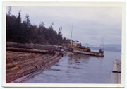
Photograph is labelled on the back: "Tiber Bay. The last of the Cat logging, with the tug "General Caldwell, skipper John Charltown, taking out 2 ections of fir." (From a group of photographs labelled "Frank Tooker photos").
Photograph is labelled on the back: "Tiber Bay. The last of the Cat logging, with the tug "General Caldwell, skipper John Charltown, taking out 2 ections of fir." (From a group of photographs labelled "Frank Tooker photos").
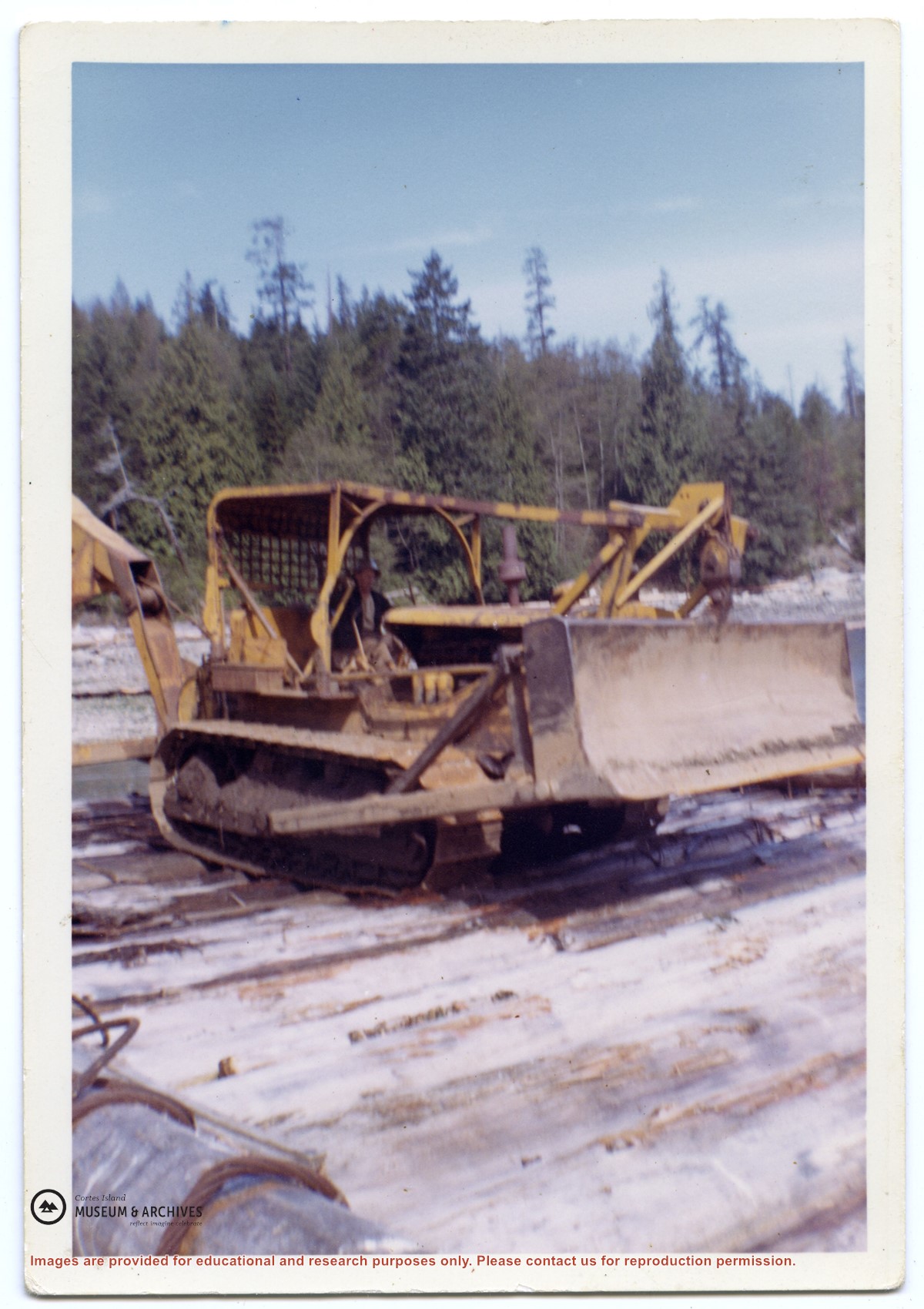
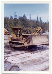
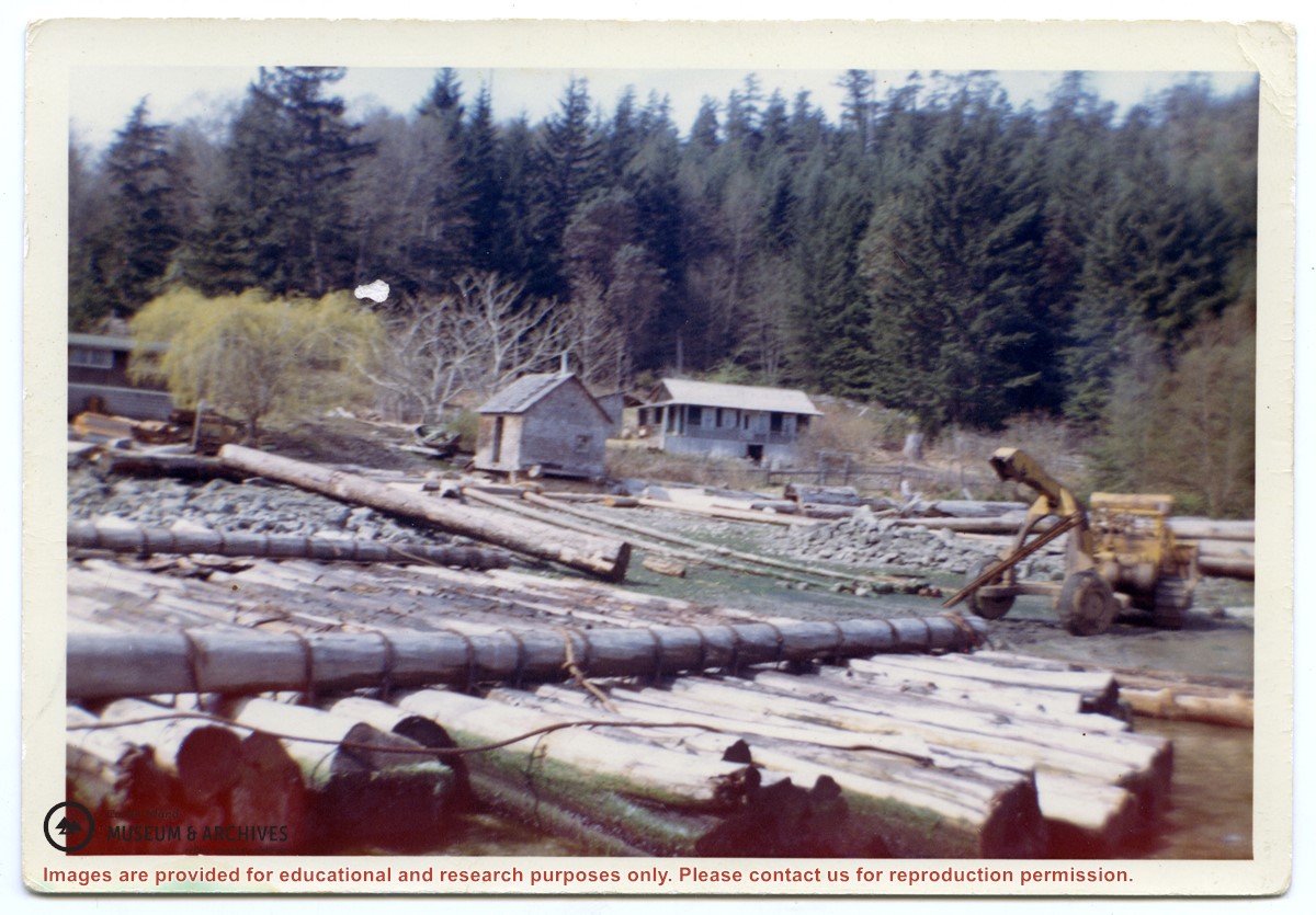
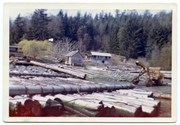
Photograph of a D8 Cat beside a log raft on the beach at Tiber Bay. A house is on the shore, along with a logging trailer and shed. Labelled on the back: "Tiber Bay. The selling out of Tooker Logging at Tiber Bay, loading of machinery." (From a group of photographs labelled "Frank Tooker photos").
Photograph of a D8 Cat beside a log raft on the beach at Tiber Bay. A house is on the shore, along with a logging trailer and shed. Labelled on the back: "Tiber Bay. The selling out of Tooker Logging at Tiber Bay, loading of machinery." (From a group of photographs labelled "Frank Tooker photos").
File contains a photocopied part of a map showing the locations of researched property in the Whaletown Lagoon and Whaletown Harbour area. The map is glued to an envelope which has a list of Crown grants and other conveyances on the back.
It contains photocopies of original land grants and other conveyances for the following:
Moses Ireland: 1893, Crown Grant for the W 1/2 of SW 1/4 of Sec 35 and W 1/2 of the SW 1/4 of Section 34
Joseph Youart: 1900, Crown Grant for Fractional NE 1/4 of Sec 35 (sold to Alice Robertson in 1908; "Burnside" is still in the Robertson family).
Nicholas Thompson: 1920, Crown Grant for the Fractional SW 1/4 of Sec 35
Charles Strange: 1914, Crown Grant for the NW 1/4 of Sec 35
File contains information on subdivision and title changes, and a photocopy of the original Crown grant, in the Whaletown Lagoon area, to:
Samuel Thompson: 1894, Crown Grant for SW 1/4 of Section 35 and NW 1/4 of Section 34, 160 acres
File also contains four maps (stored in the Map Cabinet):
1) Subdivision map of part of NE 1/4 of Sec. 34 and part of NE 1/4 of Sec. 34, 1995
2) Subdivision Plan of NW 1/4 of Sec. 34 and NE 1/4 of Sec. 34 and part of E 1/2 of SE 1/2 of Sec. 34, 1995
3) Subdivision Plan of Lot A, NW 1/4 of Sec. 34, 1976
4) Subdivision Plan of part of NW 1/4 of Section 34, 1994
(Files 9 and 10 are from the same envelope.)
File contains title information to 1991 and a photocopy of the original Crown Grant to:
Nicholas Thompson: 1920, Crown Grant of Fractional SW 1/4 of Section 35; 54 acres on the southwest of Whaletown Bay
File contains a small explanatory map if a 5.5 acre portion of fractional SW 1/4 of Sec. 35, 1949, and a Subdivision Plan map of part of fractional SW 1/4 of Sec. 35, 1957 (stored in the Map Cabinet).
(Files 9 and 10 are from the same envelope.)
File contains photocopies of the original Crown Grants and subsequent title changes with plan maps.
To Moses Ireland: 1893, Crown Grant for the W 1/2 of the SW 1/4 of Section 35 and the fractional SE 1/4 of Section 35 (161 acres around Whaletown Bay
To George Alderson: 1961, Crown Grant for Lot 3 of Section 34
File contains notes, photocopies of Crown Grants and subsequent title changes for:
William John Sheepwash: 1916, Crown Grant for fractional NE 1/4 of Sec. 45; 153 acres for $153
For Block A of District Lot 744:
-to Gwynn Henry Meredith: 1918, Crown Grant for 59 acres for $1
-to Alfred Edward Layton: 1970, Crown Grant for 59 acres for $460
William Carr Smith: 19??, Crown Grant for District Lot 1170 at Von Donop Creek Lagoon; 155 acres for $1.00
Royal Wells Borden: 1937, Crown Grant for NW 1/4 of Sec 38
(Files 12 through 16 are from the same envelope.)
File contains information for Crown Grants and subsequent title changes for:
William John Sheepwash: 1916, Certificate of Title for District Lot 905 (on Von Donop Creek), 9.6 acres
William Black, Walter Black, William Reid Black and Marjory Black: 1930, Crown Grant for District Lot 1168, ca. 68 acres
William John Sheepwash: 1916, Crown Grant for fractional NE 1/4 of Sec. 45; 153 acres for $153.00
John Bruce Manson: 1942, Crown Grant for District Lot 903; 126 acres for $315.00
File also contains a photocopied map of Lot 903 and the NE 1/4 of Sec. 45, and a Subdivision Plan of Lot 1168 and part of blocks A & B, Lot 747 (1982; in the Map folder).
(Files 12 through 16 are from the same envelope.)
DVD of footage shot by George Sirk of Jim Guthrie and his skidder (198-), and building a boat (1990).
Copyright George Sirk; to be used for display and research purposes only.
Copied from George Sirk's VHS tapes with his permission to use the contents for display and research purposes.
Scope and Content
DVD of footage shot by George Sirk of Jim Guthrie and his skidder (198-), and building a boat (1990).
Copyright George Sirk; to be used for display and research purposes only.
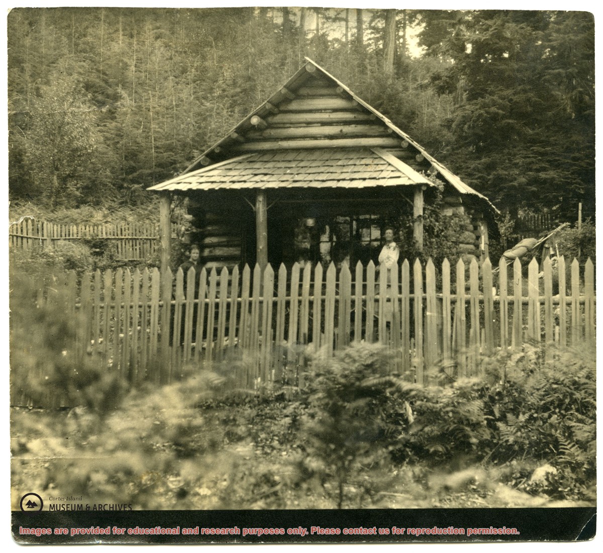
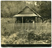
Photograph of a log house with a picket fence around it; a woman is standing on the porch. The picture was once glued into a photograph album. It is possibly a photograph of Mabel Huck's house at "Hell's Half Acre."
Photograph of a log house with a picket fence around it; a woman is standing on the porch. The picture was once glued into a photograph album. It is possibly a photograph of Mabel Huck's house at "Hell's Half Acre."
Historical info on local forestry and early logging practices from as early as the late 1800s. Signed agreement between Elmer Ellingsen and Ernest Anderson, 1948. Invoices and other business documents, including handwritten notes "bills paid to Finning Tractor," for Ernel Logging Company, 1949-1952. West Coast Ballads sheet music written by Victor Couture from poems by Robert E. Swanson (BC Truck Loggers Association), 1969. Clippings and emails with info on historical logging practices and camps, local forestry, accidents, political influence, tourism, protests and controversies, 1958-2020. Excerpt from Goosegrass and Buttercups, D.C. Kirk, undated. Additional keywords: Ripple Rock; tug towed booms from Teakerne Arm; Carrington Lagoon; Squirrel Cove; MTV; the Ellingsen Jack; Forbes Bay; Von Donop; Island Timberlands; Tony Fhunka; Truck Loggers Association; Wildstands/Wild We Stand
Historical info on local forestry and early logging practices from as early as the late 1800s. Signed agreement between Elmer Ellingsen and Ernest Anderson, 1948. Invoices and other business documents, including handwritten notes "bills paid to Finning Tractor," for Ernel Logging Company, 1949-1952. West Coast Ballads sheet music written by Victor Couture from poems by Robert E. Swanson (BC Truck Loggers Association), 1969. Clippings and emails with info on historical logging practices and camps, local forestry, accidents, political influence, tourism, protests and controversies, 1958-2020. Excerpt from Goosegrass and Buttercups, D.C. Kirk, undated. Additional keywords: Ripple Rock; tug towed booms from Teakerne Arm; Carrington Lagoon; Squirrel Cove; MTV; the Ellingsen Jack; Forbes Bay; Von Donop; Island Timberlands; Tony Fhunka; Truck Loggers Association; Wildstands/Wild We Stand
Clippings with info on floathouses, the hermit of Von Donop Channel, the landslide at Spences Bridge, Von Donop Marine Park, Klahoose First Nation, and Doreen Thompson, 1920-2017, and clippings from WNE, 1987-1989. Transcript with info on the Ellingsens in Von Donop Creek, 1946-1950, from interview with May, Elmer, Andy, and Bruce Ellginsen, 2001. Info on logging in Von Donop Creek, 1920s-1960, from a logging meeting in 2001. Info from Von Donop Creek Research and Display for CIMAS, 2001. An envelope with info from Bev Mathews, donated in 2013.
Clippings with info on floathouses, the hermit of Von Donop Channel, the landslide at Spences Bridge, Von Donop Marine Park, Klahoose First Nation, and Doreen Thompson, 1920-2017, and clippings from WNE, 1987-1989. Transcript with info on the Ellingsens in Von Donop Creek, 1946-1950, from interview with May, Elmer, Andy, and Bruce Ellginsen, 2001. Info on logging in Von Donop Creek, 1920s-1960, from a logging meeting in 2001. Info from Von Donop Creek Research and Display for CIMAS, 2001. An envelope with info from Bev Mathews, donated in 2013.