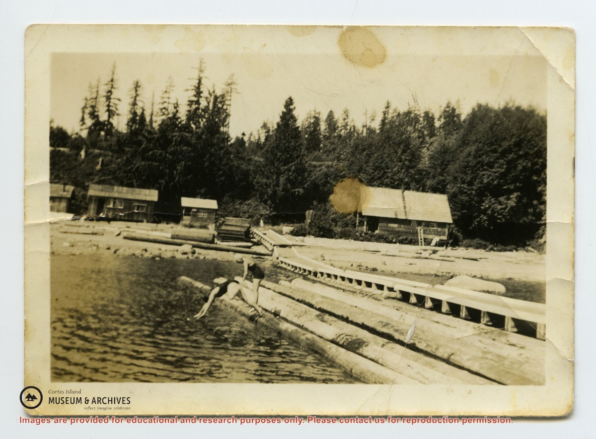
Photo depicts a line of buildings on the shore at Seaford, with a long wharf going into the water. Hazel McKay and Audrey Denny are diving into the water from logs beside the wharf. Photograph is stained and creased.
Photo depicts a line of buildings on the shore at Seaford, with a long wharf going into the water. Hazel McKay and Audrey Denny are diving into the water from logs beside the wharf. Photograph is stained and creased.
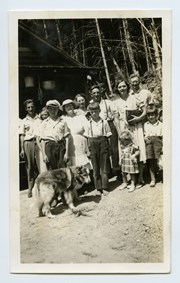
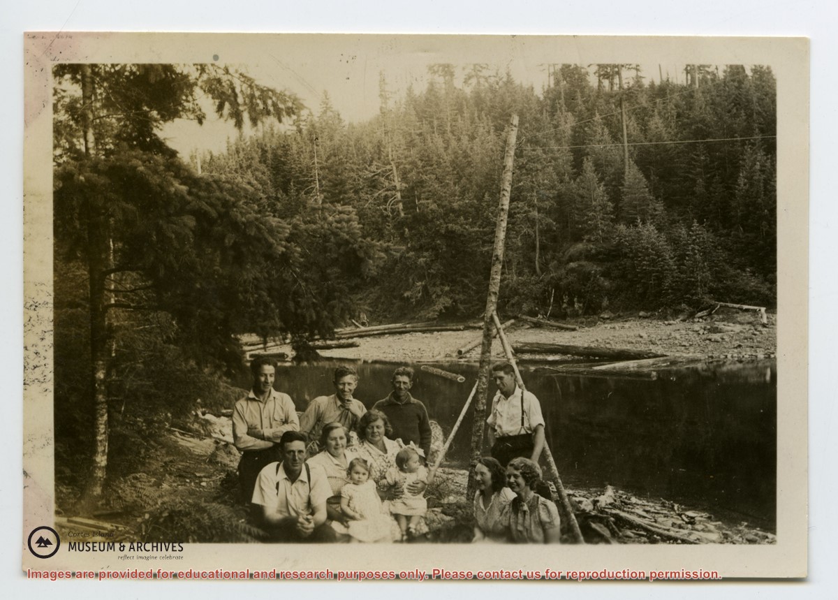
L to R: Art Hayes, Nerine Hayes, Frank Hayes, Florence McKay, Gwen Campbell, Fraser Campbell.
Front: Bobby Hayes, Irene Hayes, Clarence Byers and Queenie the dog.
L to R: Art Hayes, Nerine Hayes, Frank Hayes, Florence McKay, Gwen Campbell, Fraser Campbell.
Front: Bobby Hayes, Irene Hayes, Clarence Byers and Queenie the dog.
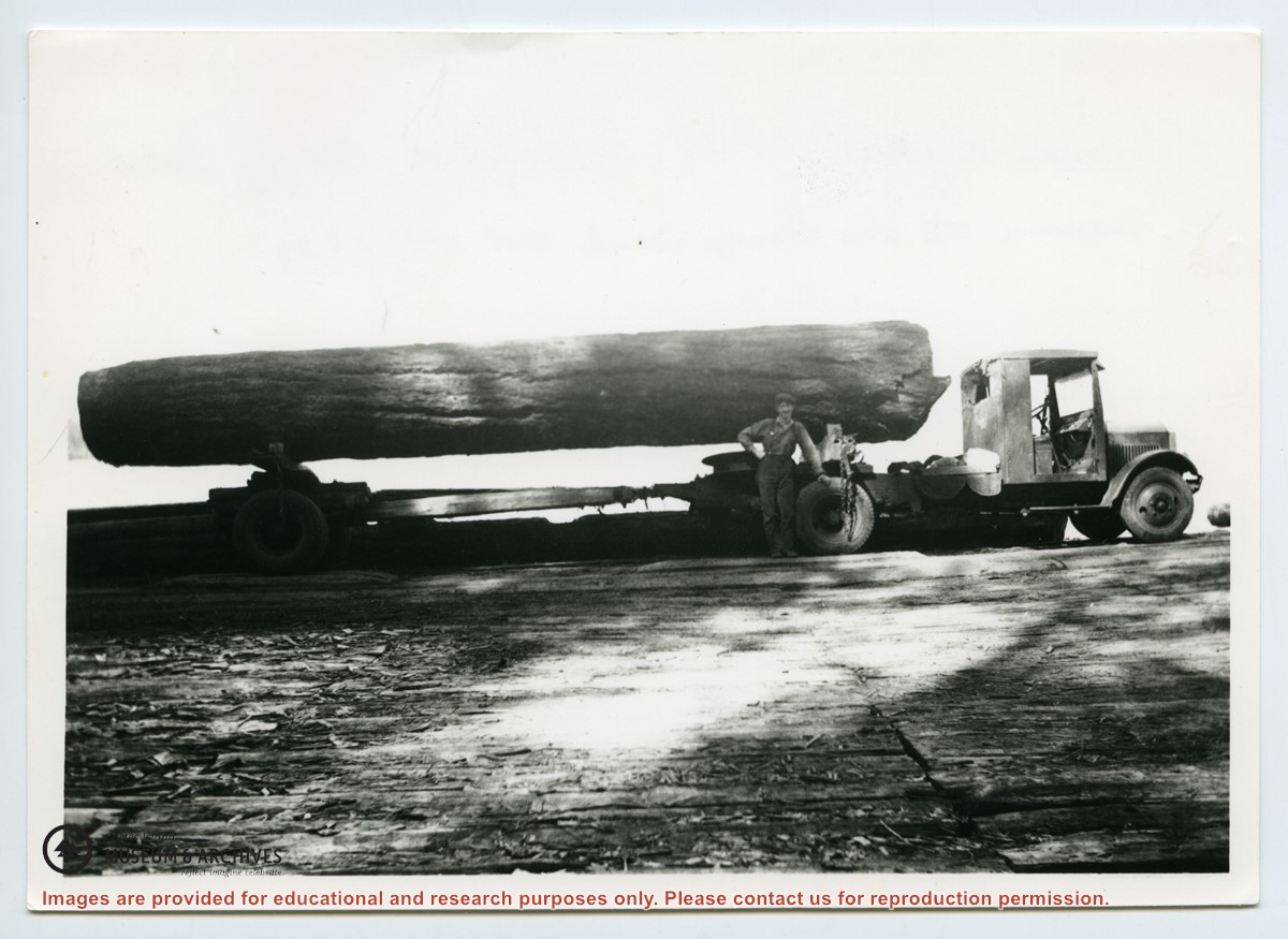
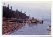
Photograph is labelled on the back: "Tiber Bay. The last of the Cat logging, with the tug "General Caldwell, skipper John Charltown, taking out 2 ections of fir." (From a group of photographs labelled "Frank Tooker photos").
Photograph is labelled on the back: "Tiber Bay. The last of the Cat logging, with the tug "General Caldwell, skipper John Charltown, taking out 2 ections of fir." (From a group of photographs labelled "Frank Tooker photos").
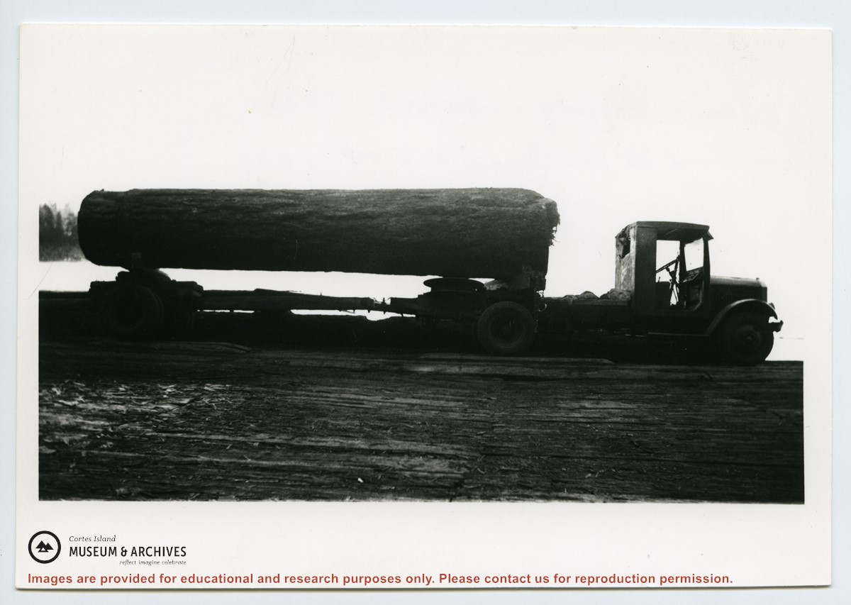
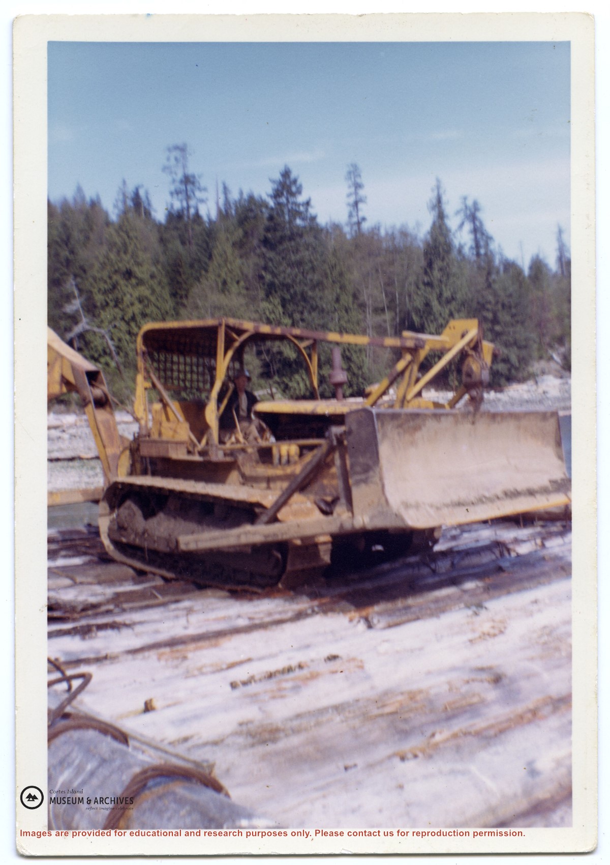
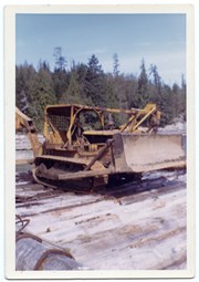
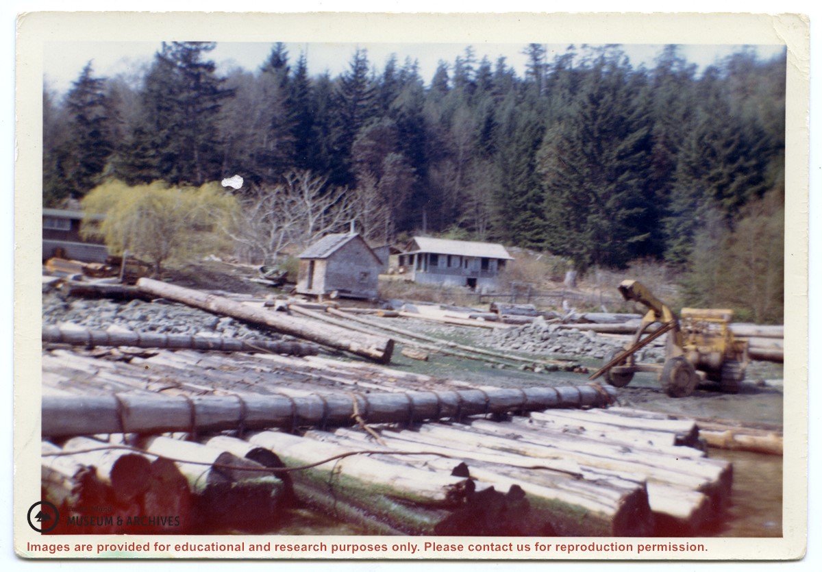
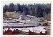
Photograph of a D8 Cat beside a log raft on the beach at Tiber Bay. A house is on the shore, along with a logging trailer and shed. Labelled on the back: "Tiber Bay. The selling out of Tooker Logging at Tiber Bay, loading of machinery." (From a group of photographs labelled "Frank Tooker photos").
Photograph of a D8 Cat beside a log raft on the beach at Tiber Bay. A house is on the shore, along with a logging trailer and shed. Labelled on the back: "Tiber Bay. The selling out of Tooker Logging at Tiber Bay, loading of machinery." (From a group of photographs labelled "Frank Tooker photos").
Scanned photograph of Baron & Nellie Jeffery home at Smelt Bay, 1982. Smelt Bay Master Plan, Province of British Columbia, Ministry of Environment and Parks, 1987. Full issue of The Cottage Magazine, article featuring Smelt Bay midden sites, 1997. Excerpt from Seven Knot Summers, Beth Hill. Post cards and greeting cards featuring Smelt Bay, undated.
Scanned photograph of Baron & Nellie Jeffery home at Smelt Bay, 1982. Smelt Bay Master Plan, Province of British Columbia, Ministry of Environment and Parks, 1987. Full issue of The Cottage Magazine, article featuring Smelt Bay midden sites, 1997. Excerpt from Seven Knot Summers, Beth Hill. Post cards and greeting cards featuring Smelt Bay, undated.
File contains a key map which was pasted on the front of the envelope indicating the areas researched for Files 12-16; notes on the titles; photocopies of Crown Grants and subsequent title information for:
BC Buildings Corp: 1982, Crown Grant for Block A of SW 1/4 of Sec. 25 (Highways Maintenance Yard)
District Lot 871 (40 acres between Carrington and Coulter Bays): to James Frederick McManus, 1919
To Ernest Henry Vaughn: 1922, Crown Grant for NE 1/4 and NW 1/4 of NE 1/4 of Sec. 24; SE 1/4 of SW 1/4 and SW 1/4 of SE 1/4 of Sec 31
Herbert Proctor: 1928 for fractional SW 1/4 of Sec. 41, bordering Tork Reserve; 159 acres for $159.00 (orig. Crown Grant to Herbert Proctor in 1922)
To William Cowan: 1937, E 1/2 of SE 1/4 of Sec. 26, 89 acres
(Files 12 through 16 are from the same envelope.)
File contains photocopies of original Crown Grants, subsequent title changes and maps for:
To Joseph Gregson: 1926, Crown Grant for fractional W 1/2 of Lot 899 and Lot 901 (between Coulter and Carrington Bays), with a water easement for Wailes
To John Nugent McIllree: 1957, Crown Grant of mineral rights to lots at Coulter Bay surveyed as the "Arrow" and "Bullseye" mineral claims
To Hilda Peterson: 1919, Crown Grant for Lot 878, Carrington Bay, 55 acres
(Files 12 through 16 are from the same envelope.)
File contains a page of notes, and photocopies of a tax sale notice (1938) and list of properties forfeited for non-payment of taxes, Crown Grants and other title information for the following:
William Walter James: 1926, Crown Grant for NW 1/4 of Sec. 38; 156 acres for $1.00; forfeited to Crown in 1939
Tom Albinson: 1919, Crown Grant for Lot 867; forfeited in 1927
Sadie McMurray: 1917, NE 1/4 of Sec. 39; 160 acres for $160
Peter Police: 1925, fractional NW 1/4 of Sec. 39; 103 acres for $1.00
(Files 12 through 16 are from the same envelope.)
File contains a key map and list for the areas researched and information on the following:
George Herbert Wailes: 1920, Crown Grant for fractional SW 1/4 of Sec. 48; 48 acres for $217; with a tax sale notice, 1939
Ina Vernon Munro: 1920, Crown Grant for NE 1/4 of Sec. 37; 161 acres; includes a sale to Hawkins and a forfeit in 1939
Allan Olmsted: 1939, Crown Grant for SW 1/4 of Sec. 37
Ira Furry: 1911, Crown Grant for W 1/2 of SE 1/4 of Sec. 33
Walter Malcolm: 1919, Crown Grant for fractional SW 1/4 of Sec. 36
Frank Leslie Tooker: 1926, Crown Grant for N 1/2 of Sec. 36, 124 acres
Ira Furry: 1897, Crown Grant for SE 1/4 of Sec 36; 160 acres for $160.00.
Donald McDonald: 1926, Crown Grant for fractional NW 1/2 of Sec. 37; 144 acres for $1.00
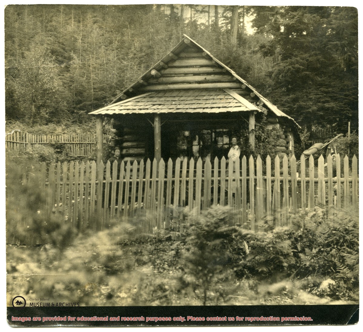
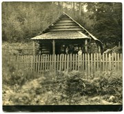
Photograph of a log house with a picket fence around it; a woman is standing on the porch. The picture was once glued into a photograph album. It is possibly a photograph of Mabel Huck's house at "Hell's Half Acre."
Photograph of a log house with a picket fence around it; a woman is standing on the porch. The picture was once glued into a photograph album. It is possibly a photograph of Mabel Huck's house at "Hell's Half Acre."
Photo depicts a group of people who lived at the Von Donop creek logging camp (buildings not shown).
Back: Scotty McKenzie, Clarence Byers, Henry Byers, Ken Hansen
Seated: Ervin McKay, Florence McKay, Ruth Byers
End at right: Hazel Hansen, Amy McKenzie
Babies: Irene and Lorraine Byers
Photo depicts a group of people who lived at the Von Donop creek logging camp (buildings not shown).
Back: Scotty McKenzie, Clarence Byers, Henry Byers, Ken Hansen
Seated: Ervin McKay, Florence McKay, Ruth Byers
End at right: Hazel Hansen, Amy McKenzie
Babies: Irene and Lorraine Byers
Fonds consists of ten photographs (nine black and white; 1 coloured) depicting members of the extended Byers/ Manson families, logging at Seaford and Von Donop Inlet, and the Union Steamship Chelohsin.
Henry and Ruth Byers, Ervin and Florence (Manson) McKay, Clarence and Etta (McKay) Byers, Ken and Hazel (McKay) Hansen, Scotty and Amy (Byers) McKenzie moved to Von Donop Inlet in 1939, where they ran a logging operation.
Custodial History
Found in Information Files folder (Byers family), August 1, 2020 and transferred to Archives.
Scope and Content
Fonds consists of ten photographs (nine black and white; 1 coloured) depicting members of the extended Byers/ Manson families, logging at Seaford and Von Donop Inlet, and the Union Steamship Chelohsin.