Various maps of Cortes Island and surrounding areas with tourist info, trails, provincial parks, local businesses, sites, property lines, topography, charts, etc, 1916-present. Info on Hiking and Orienteering Map of Cortes Island, 2003, and Cortes Island Community Mapping Project, 2011. Info on Discovery Islands Ecosystem Mapping (DIEM), 2012-2014.
Various maps of Cortes Island and surrounding areas with tourist info, trails, provincial parks, local businesses, sites, property lines, topography, charts, etc, 1916-present. Info on Hiking and Orienteering Map of Cortes Island, 2003, and Cortes Island Community Mapping Project, 2011. Info on Discovery Islands Ecosystem Mapping (DIEM), 2012-2014.
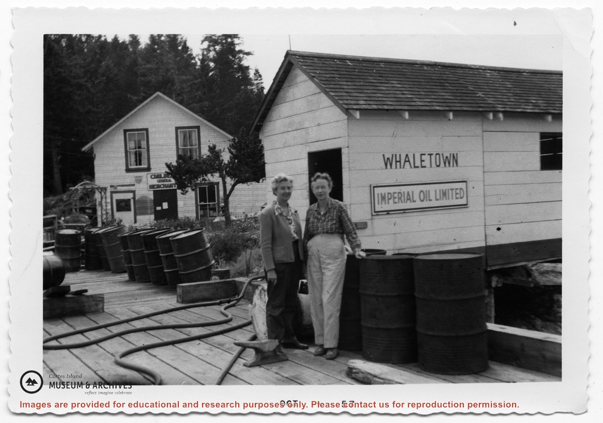
Gilean Douglas fonds info, 1904-1993. Letter, The Whaletown Women's Institute, 1952. Clippings with info on Gilean's life, writing, and home on Chanel Rock, 1960s-2009. Clippings of Gilean's writing in various newspapers including her "Nature Rambles," 1961-1992. Clippings from WNE featuring Gilean Douglas, 1990-1993. Info on: Gilean's memorial, 1993; The Gilean Douglas Project, 1994; Gilean Douglas: Writing Nature, Finding Home, Gillian Milton and Andrea Lebowitz, 1999-2000; and Gilean Douglas featured at CIMAS. Excerpts: From My Window, Gordon Wagner, 1988 and Seven-Knot Summers, Beth Hill, 1994. Pages of magazines from The Country Gentleman, 1978 and Country Journal, 1988. Vintage cards, clippings related to homecare, undated
Gilean Douglas fonds info, 1904-1993. Letter, The Whaletown Women's Institute, 1952. Clippings with info on Gilean's life, writing, and home on Chanel Rock, 1960s-2009. Clippings of Gilean's writing in various newspapers including her "Nature Rambles," 1961-1992. Clippings from WNE featuring Gilean Douglas, 1990-1993. Info on: Gilean's memorial, 1993; The Gilean Douglas Project, 1994; Gilean Douglas: Writing Nature, Finding Home, Gillian Milton and Andrea Lebowitz, 1999-2000; and Gilean Douglas featured at CIMAS. Excerpts: From My Window, Gordon Wagner, 1988 and Seven-Knot Summers, Beth Hill, 1994. Pages of magazines from The Country Gentleman, 1978 and Country Journal, 1988. Vintage cards, clippings related to homecare, undated
Series consists of a hand drawn map of Cortes Island showing places of interest to visitors, maps showing the location of hydro distribution lines on Cortes Island, maps related to zoning and rezoning on Cortes Island, the Official Settlement Plan, and a drawing showing an engineering plan for the Whaletown ferry terminal.
Series consists of a hand drawn map of Cortes Island showing places of interest to visitors, maps showing the location of hydro distribution lines on Cortes Island, maps related to zoning and rezoning on Cortes Island, the Official Settlement Plan, and a drawing showing an engineering plan for the Whaletown ferry terminal.
File contains a photocopied section map of the northern part of Cortes Island (from just south of Gorge Harbour), coloured to indicate areas for which a Crown Grant was located and areas of ungranted Crown land which still appear to be owned by the government. Scale is 1 mile to 1 inch.
File contains a photocopied section map of the northern part of Cortes Island (from just south of Gorge Harbour), coloured to indicate areas for which a Crown Grant was located and areas of ungranted Crown land which still appear to be owned by the government. Scale is 1 mile to 1 inch.
File contains a map key to the areas of Sections 17, 18, 19, 22 and 34 (south of Gorge Harbour) which were researched (Information in Files 3-7).
It contains photocopies of original land grants and subsequent conveyances for the following:
Reginald James Smith: 1946, Crown Grant 165414I for fractional SE 1/4 of Sec 23, 1946 (the Thunder Road subdivision at the eastern end of Gorge Harbour).
(Files 3 through 7 are from the same envelope.)