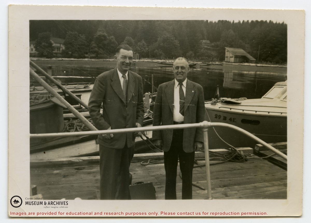
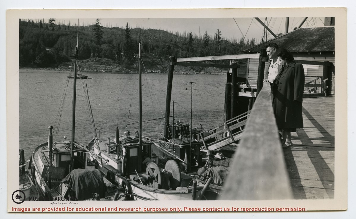
Photograph labelled on the back: "Rendezvous Patrol. Dr. B. Hall and Dr. R. Rose, the dentist, with their black bags, getting ready to go aboard the "Rendezvous". They are being taken to Whaletown for their monthly visit to the Mission clinic."
Photograph labelled on the back: "Rendezvous Patrol. Dr. B. Hall and Dr. R. Rose, the dentist, with their black bags, getting ready to go aboard the "Rendezvous". They are being taken to Whaletown for their monthly visit to the Mission clinic."
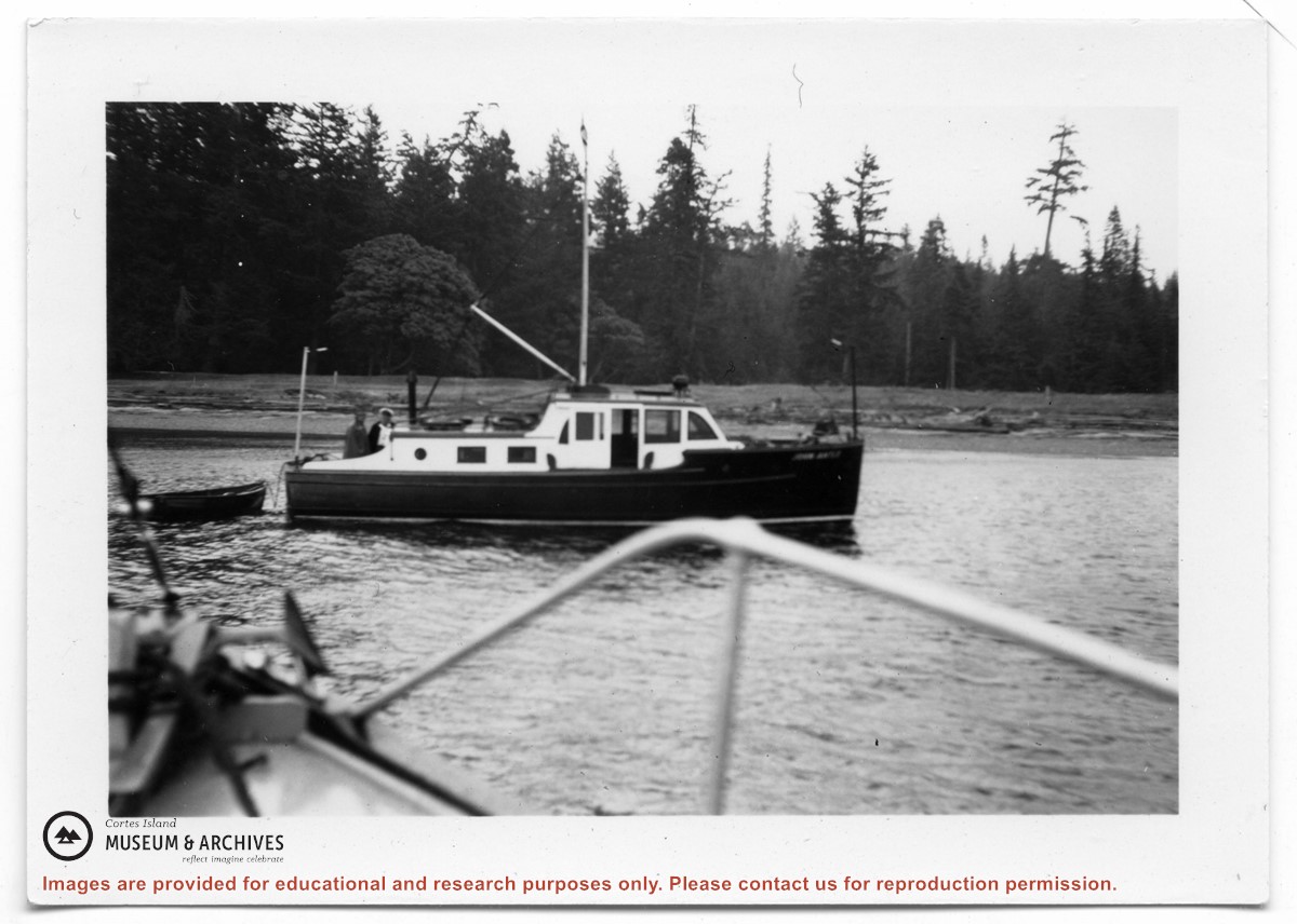
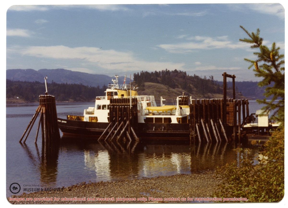
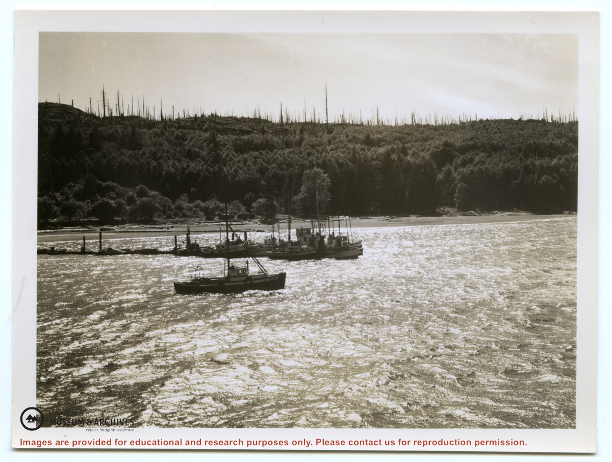
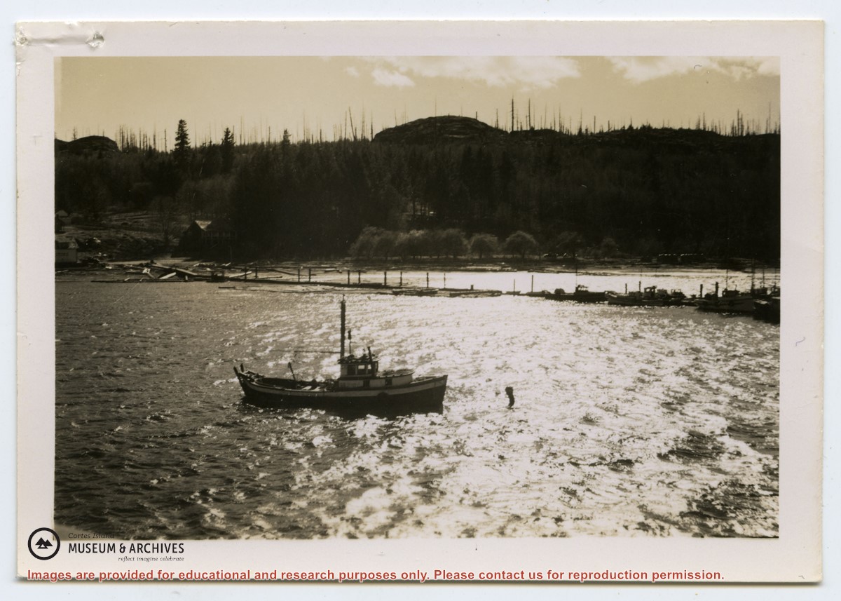
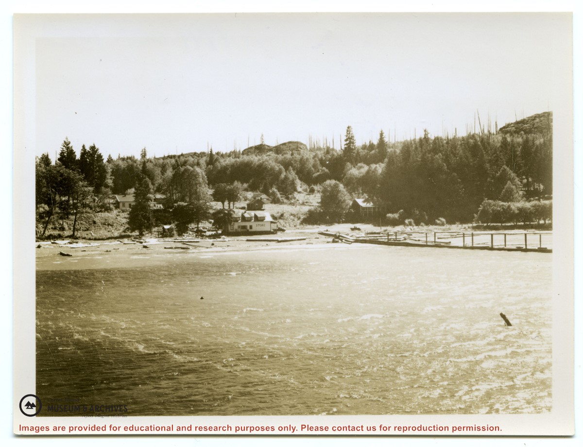
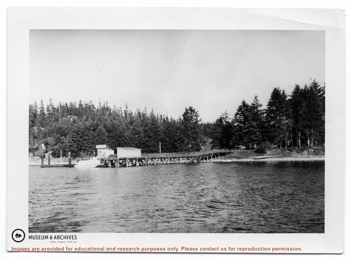
Photograph of the "John Antle" leaving port. An appended caption of the back of A says "The mission ship "Rendezvous" (skipper Rollo Boas) leaving Whaletown her home port." However, the back of B identifies the location as Heriot Bay, and the boat is the "John Antle".
2 photograph prints: b&w; 15.5 x 10.5 (A) and 9 x 6.5 (B)
Scope and Content
Photograph of the "John Antle" leaving port. An appended caption of the back of A says "The mission ship "Rendezvous" (skipper Rollo Boas) leaving Whaletown her home port." However, the back of B identifies the location as Heriot Bay, and the boat is the "John Antle".
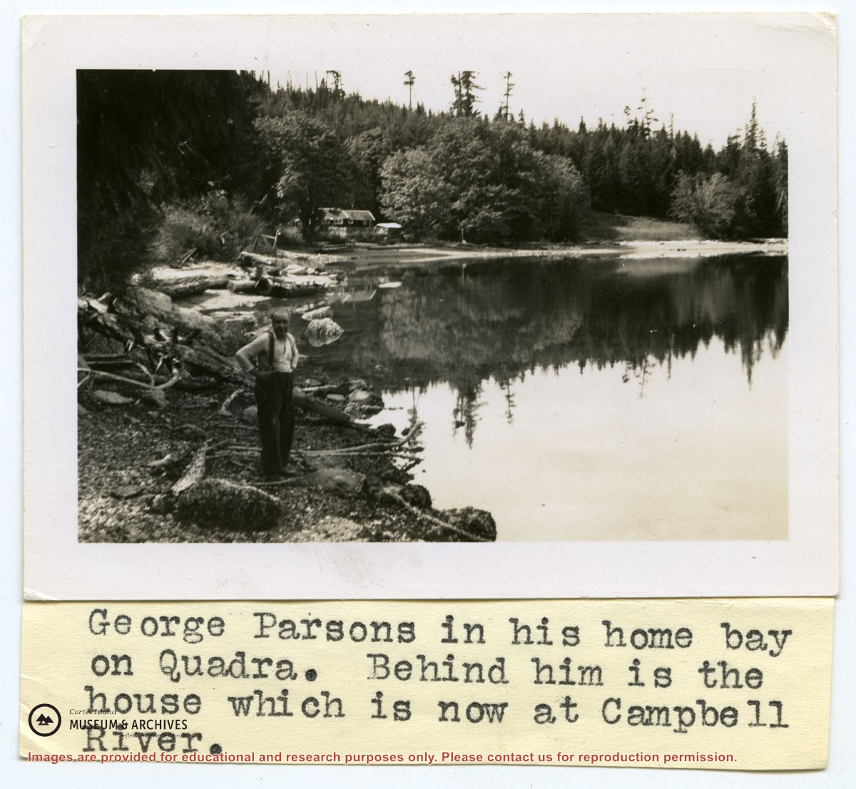
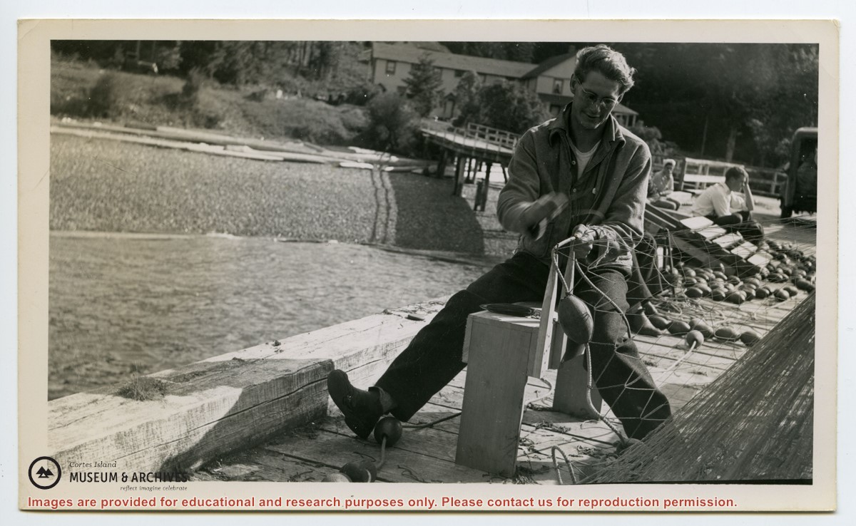
Photograph of "George Parsons in his home bay on Quadra. Behind him is the house which is now at Campbell River." (Gilean Douglas' typed caption, taped to photo)
2 photograph prints: b&w; 9 x 6.5 cm and 17 x 12 cm
Scope and Content
Photograph of "George Parsons in his home bay on Quadra. Behind him is the house which is now at Campbell River." (Gilean Douglas' typed caption, taped to photo)
File contains a key map which was pasted on the front of the envelope indicating the areas researched for Files 12-16; notes on the titles; photocopies of Crown Grants and subsequent title information for:
BC Buildings Corp: 1982, Crown Grant for Block A of SW 1/4 of Sec. 25 (Highways Maintenance Yard)
District Lot 871 (40 acres between Carrington and Coulter Bays): to James Frederick McManus, 1919
To Ernest Henry Vaughn: 1922, Crown Grant for NE 1/4 and NW 1/4 of NE 1/4 of Sec. 24; SE 1/4 of SW 1/4 and SW 1/4 of SE 1/4 of Sec 31
Herbert Proctor: 1928 for fractional SW 1/4 of Sec. 41, bordering Tork Reserve; 159 acres for $159.00 (orig. Crown Grant to Herbert Proctor in 1922)
To William Cowan: 1937, E 1/2 of SE 1/4 of Sec. 26, 89 acres
(Files 12 through 16 are from the same envelope.)
File contains photocopies of original Crown Grants, subsequent title changes and maps for:
To Joseph Gregson: 1926, Crown Grant for fractional W 1/2 of Lot 899 and Lot 901 (between Coulter and Carrington Bays), with a water easement for Wailes
To John Nugent McIllree: 1957, Crown Grant of mineral rights to lots at Coulter Bay surveyed as the "Arrow" and "Bullseye" mineral claims
To Hilda Peterson: 1919, Crown Grant for Lot 878, Carrington Bay, 55 acres
(Files 12 through 16 are from the same envelope.)
File contains information for the following properties:
E. H. Vaughn: 1893, Crown Grant for fractional N 1/2 of Sec. 22; 90 acres for $90.00.
James P. Allen: 1913, Crown Grant for NW 34 acres of Sec. 23; $170.00
Bernard Robinson Allen: 1919, Crown Grant for SW 1/4 of Sec. 23, 159 acres
Charles Allen: 1912, Crown Grant for SW 1/4 of Sec. 33; 160 acres for $160.00
Harold Marshall Wood: Crown Grant for E 1/2 of NE 1/4 of Sec. 46 (east of Carrington Bay); 81 acres for $1.00.
File contains the following maps, stored in the Map Cabinet:
Subdivision Plan of parcel C & E, NW 1/4 of Sec. 21, 1976
Subdivision of the fractional NE 1/4 of Sec 21, 1966; with names of property owners penciled in
Subdivision Plan of Parcel C and part of Parcel E of fractional NE 1/4 of Sec. 21, 1975
Subdivision Plan of fractional NE 1/4 of Sec. 21 and W 1/2 of SW 1/4 of Sec. 34
(Files 17 through 19 are from the same envelope.)