Photograph of Emmeline Pickles and her children at Smelt Bay, with the O'Donnell's boat house in the background. (From an envelope "May Ellingsen photos Manson's Landing")
Photograph of Emmeline Pickles and her children at Smelt Bay, with the O'Donnell's boat house in the background. (From an envelope "May Ellingsen photos Manson's Landing")
Photograph of group of students and parents on graduation day at the Manson's Landing school. Identified people include Tom Lambert, Johnny Manson, Anna Tiber, Babe Tiber, Hazel and Etta McKay, Stuart Lambert, Jack Hayes, Stuart and Elizabeth Lambert, Mike Murwood (?), Patsy McCleanen, the Pickles kids, Helen MacDunst (?). This is a reproduction; #13550 on back (CR reference #?)
Photograph of group of students and parents on graduation day at the Manson's Landing school. Identified people include Tom Lambert, Johnny Manson, Anna Tiber, Babe Tiber, Hazel and Etta McKay, Stuart Lambert, Jack Hayes, Stuart and Elizabeth Lambert, Mike Murwood (?), Patsy McCleanen, the Pickles kids, Helen MacDunst (?). This is a reproduction; #13550 on back (CR reference #?)
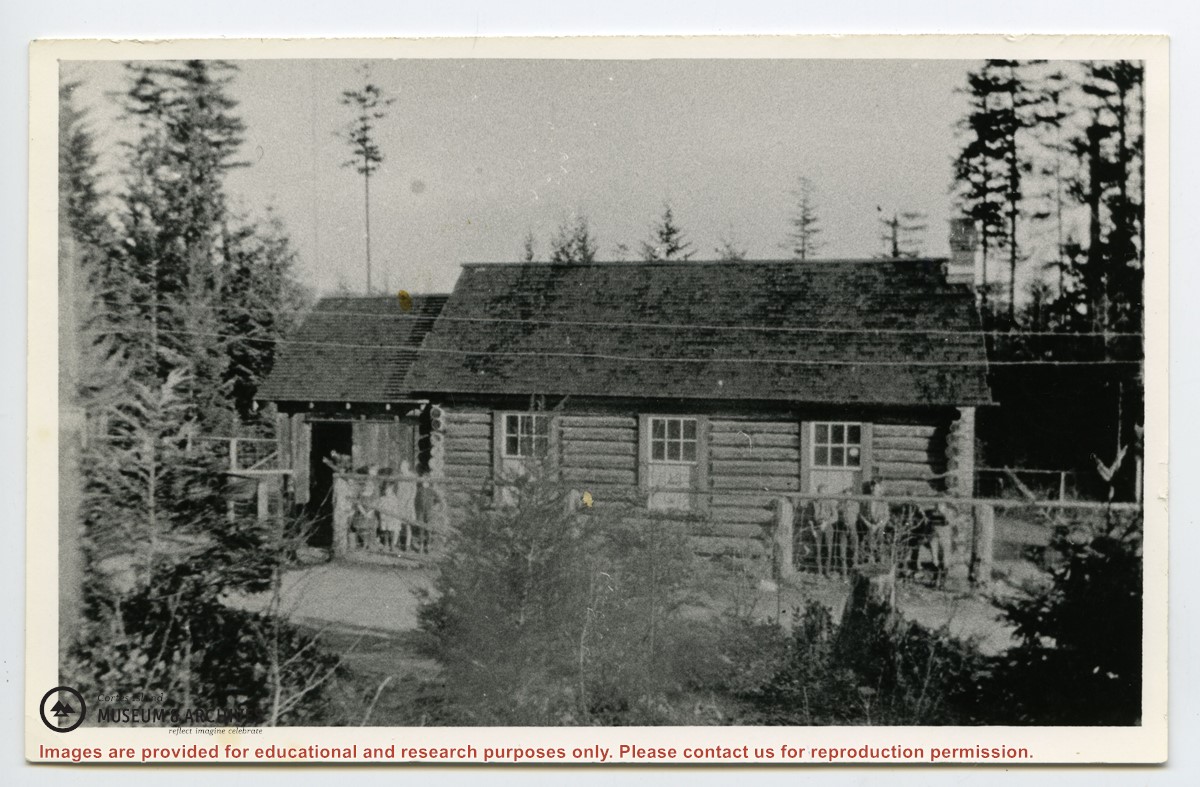
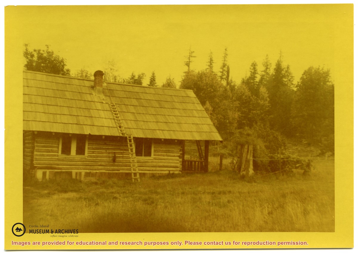
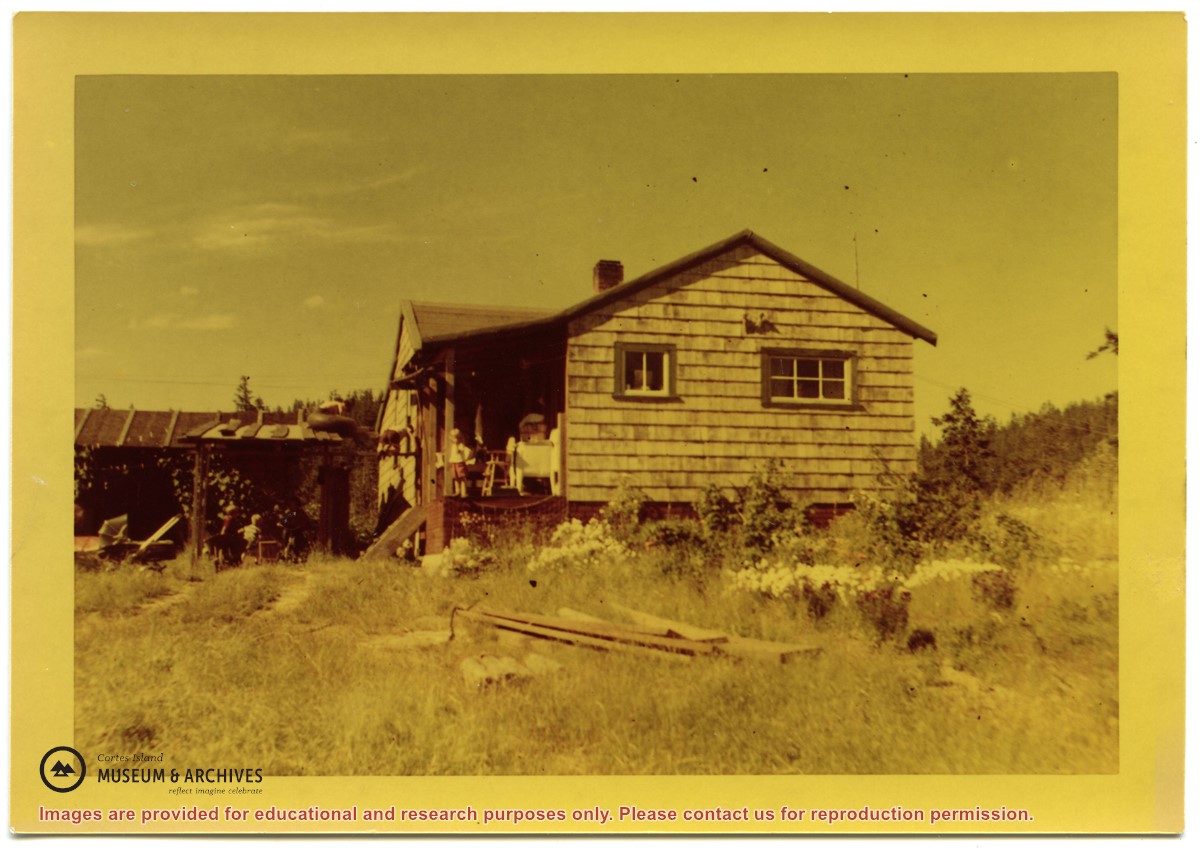
Photograph of a wood shingled house with attached sheds. A child is standing on the porch, next to a washing machine. Coulours on the print are yellowed.
Photograph of a wood shingled house with attached sheds. A child is standing on the porch, next to a washing machine. Coulours on the print are yellowed.
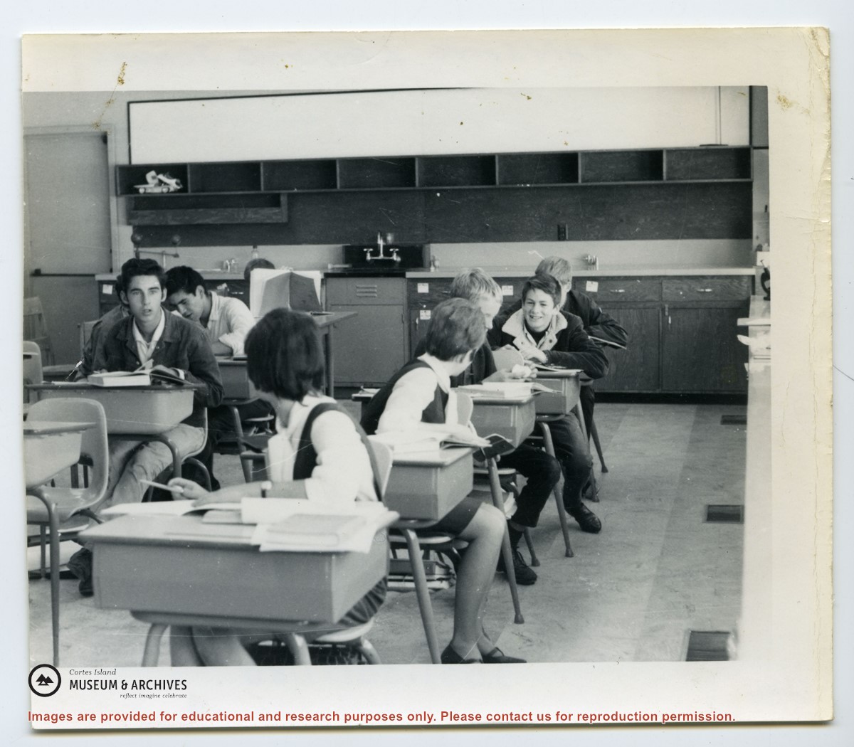
Photograph of the senior room at Manson's Landing school with students, including Patrick Lihou, Gary Burnett, Victor Laurentieff and Brig Weiler (back turned) seated at their desks. Photo has been cut.
Photograph of the senior room at Manson's Landing school with students, including Patrick Lihou, Gary Burnett, Victor Laurentieff and Brig Weiler (back turned) seated at their desks. Photo has been cut.
File contains a key map which was pasted on the front of the envelope indicating the areas researched for Files 12-16; notes on the titles; photocopies of Crown Grants and subsequent title information for:
BC Buildings Corp: 1982, Crown Grant for Block A of SW 1/4 of Sec. 25 (Highways Maintenance Yard)
District Lot 871 (40 acres between Carrington and Coulter Bays): to James Frederick McManus, 1919
To Ernest Henry Vaughn: 1922, Crown Grant for NE 1/4 and NW 1/4 of NE 1/4 of Sec. 24; SE 1/4 of SW 1/4 and SW 1/4 of SE 1/4 of Sec 31
Herbert Proctor: 1928 for fractional SW 1/4 of Sec. 41, bordering Tork Reserve; 159 acres for $159.00 (orig. Crown Grant to Herbert Proctor in 1922)
To William Cowan: 1937, E 1/2 of SE 1/4 of Sec. 26, 89 acres
(Files 12 through 16 are from the same envelope.)
File contains photocopies of original Crown Grants, subsequent title changes and maps for:
To Joseph Gregson: 1926, Crown Grant for fractional W 1/2 of Lot 899 and Lot 901 (between Coulter and Carrington Bays), with a water easement for Wailes
To John Nugent McIllree: 1957, Crown Grant of mineral rights to lots at Coulter Bay surveyed as the "Arrow" and "Bullseye" mineral claims
To Hilda Peterson: 1919, Crown Grant for Lot 878, Carrington Bay, 55 acres
(Files 12 through 16 are from the same envelope.)
File contains a page of notes, and photocopies of a tax sale notice (1938) and list of properties forfeited for non-payment of taxes, Crown Grants and other title information for the following:
William Walter James: 1926, Crown Grant for NW 1/4 of Sec. 38; 156 acres for $1.00; forfeited to Crown in 1939
Tom Albinson: 1919, Crown Grant for Lot 867; forfeited in 1927
Sadie McMurray: 1917, NE 1/4 of Sec. 39; 160 acres for $160
Peter Police: 1925, fractional NW 1/4 of Sec. 39; 103 acres for $1.00
(Files 12 through 16 are from the same envelope.)
File contains information for the following properties:
E. H. Vaughn: 1893, Crown Grant for fractional N 1/2 of Sec. 22; 90 acres for $90.00.
James P. Allen: 1913, Crown Grant for NW 34 acres of Sec. 23; $170.00
Bernard Robinson Allen: 1919, Crown Grant for SW 1/4 of Sec. 23, 159 acres
Charles Allen: 1912, Crown Grant for SW 1/4 of Sec. 33; 160 acres for $160.00
Harold Marshall Wood: Crown Grant for E 1/2 of NE 1/4 of Sec. 46 (east of Carrington Bay); 81 acres for $1.00.
File contains the following maps, stored in the Map Cabinet:
Subdivision Plan of parcel C & E, NW 1/4 of Sec. 21, 1976
Subdivision of the fractional NE 1/4 of Sec 21, 1966; with names of property owners penciled in
Subdivision Plan of Parcel C and part of Parcel E of fractional NE 1/4 of Sec. 21, 1975
Subdivision Plan of fractional NE 1/4 of Sec. 21 and W 1/2 of SW 1/4 of Sec. 34
(Files 17 through 19 are from the same envelope.)
File contains correspondence regarding development in Carrington Bay, between Friends of Cortes Island (FOCI), Regional Director George Sirk, and Klahoose First Nation.
File contains correspondence regarding development in Carrington Bay, between Friends of Cortes Island (FOCI), Regional Director George Sirk, and Klahoose First Nation.
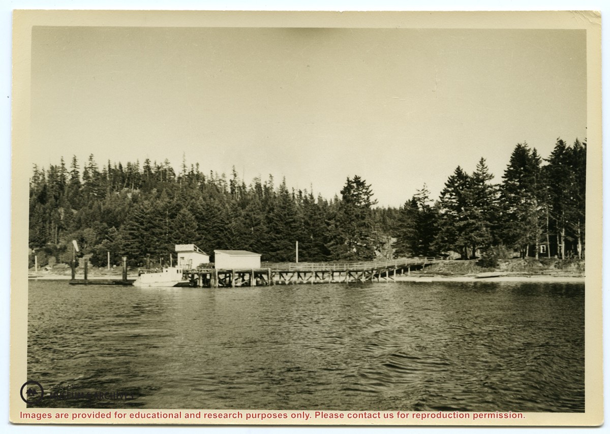
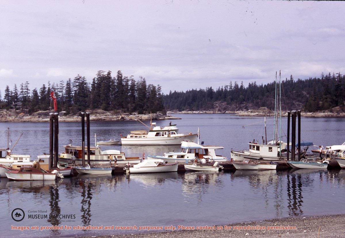
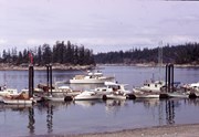
Photograph of the Manson's Landing wharf, taken from the water at high tide. It includes the oil and wharf sheds on the dock, an unknown scow boat with cabin at the float and the store ashore. Note: telephone poles from the original phone line across the mouth of the lagoon; higher banks along the shoreline.
Photograph of the Manson's Landing wharf, taken from the water at high tide. It includes the oil and wharf sheds on the dock, an unknown scow boat with cabin at the float and the store ashore. Note: telephone poles from the original phone line across the mouth of the lagoon; higher banks along the shoreline.
.jpg?width=1200&404=no-img.jpg&watermark=wmk)
.jpg?width=1200&404=no-img.jpg&watermark=wmk)
.jpg?width=180&404=no-img.jpg)
.jpg?width=1200&404=no-img.jpg&watermark=wmk)
.jpg?width=1200&404=no-img.jpg&watermark=wmk)
.jpg?width=180&404=no-img.jpg)


.jpg?width=1200&404=no-img.jpg&watermark=wmk)
.jpg?width=1200&404=no-img.jpg&watermark=wmk)
.jpg?width=1200&404=no-img.jpg&watermark=wmk)
.jpg?width=1200&404=no-img.jpg&watermark=wmk)
.jpg?width=1200&404=no-img.jpg&watermark=wmk)
.jpg?width=1200&404=no-img.jpg&watermark=wmk)
.jpg?width=1200&404=no-img.jpg&watermark=wmk)
.jpg?width=1200&404=no-img.jpg&watermark=wmk)
.jpg?width=1200&404=no-img.jpg&watermark=wmk)
.jpg?width=1200&404=no-img.jpg&watermark=wmk)
.jpg?width=1200&404=no-img.jpg&watermark=wmk)
.jpg?width=1200&404=no-img.jpg&watermark=wmk)
.jpg?width=180&404=no-img.jpg)