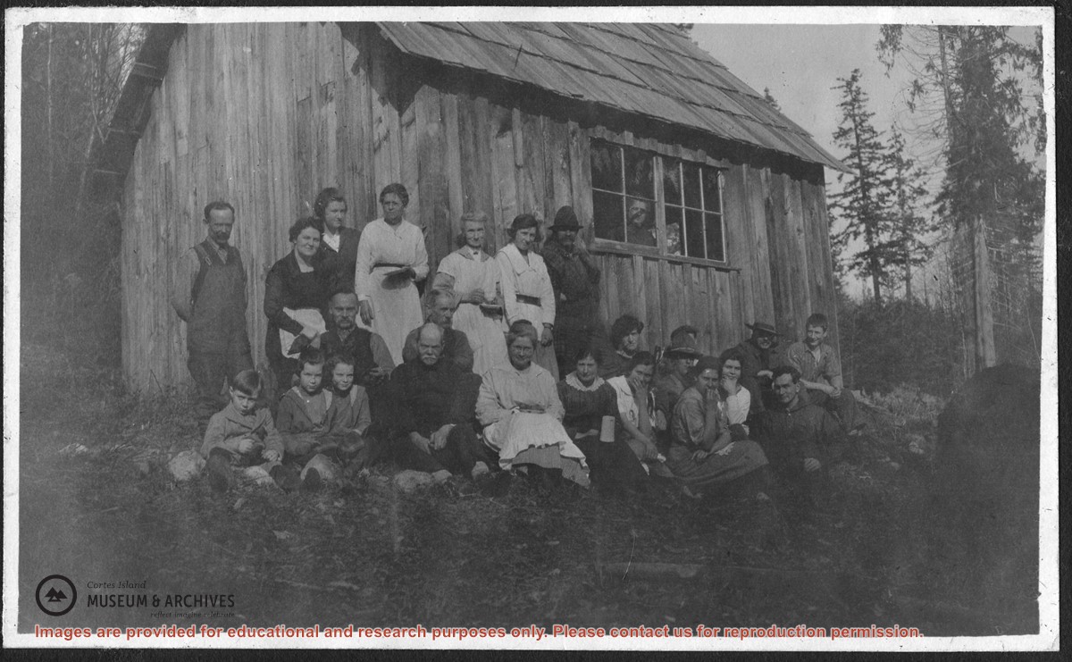
Photograph of a group of people seated outside the first schoolhouse in Whaletown, which was at the corner of present-day Harbour and Carrington Bay Rds. The same photograph, copied from the collection of Meg Robertson Shaw, is found in the "Whaletown to 1930" album compiled by Doreen Huck Thompson.
The date is given as May 1920, and the people are identified by Doreen Thompson as:
(Back row, L to R) Bert Middleton, Elsie Allen, Alice Strange, Mrs. Barrett (Ina's mom), Meg Robertson, Ina Munro, Mr. Neale
(Front row, L to R) Verna, Melva & Jack Munro, Bernie Allen, Jim Allen, Pete (Margaret) Middleton, Violet Stoney, Miss James, Dolly Borden, Mr. & Mrs. Robertson, Roy Borden in hat
Mrs. Stoney in window
File contains a key map which was pasted on the front of the envelope indicating the areas researched for Files 12-16; notes on the titles; photocopies of Crown Grants and subsequent title information for:
BC Buildings Corp: 1982, Crown Grant for Block A of SW 1/4 of Sec. 25 (Highways Maintenance Yard)
District Lot 871 (40 acres between Carrington and Coulter Bays): to James Frederick McManus, 1919
To Ernest Henry Vaughn: 1922, Crown Grant for NE 1/4 and NW 1/4 of NE 1/4 of Sec. 24; SE 1/4 of SW 1/4 and SW 1/4 of SE 1/4 of Sec 31
Herbert Proctor: 1928 for fractional SW 1/4 of Sec. 41, bordering Tork Reserve; 159 acres for $159.00 (orig. Crown Grant to Herbert Proctor in 1922)
To William Cowan: 1937, E 1/2 of SE 1/4 of Sec. 26, 89 acres
(Files 12 through 16 are from the same envelope.)
File contains photocopies of original Crown Grants, subsequent title changes and maps for:
To Joseph Gregson: 1926, Crown Grant for fractional W 1/2 of Lot 899 and Lot 901 (between Coulter and Carrington Bays), with a water easement for Wailes
To John Nugent McIllree: 1957, Crown Grant of mineral rights to lots at Coulter Bay surveyed as the "Arrow" and "Bullseye" mineral claims
To Hilda Peterson: 1919, Crown Grant for Lot 878, Carrington Bay, 55 acres
(Files 12 through 16 are from the same envelope.)
File contains a page of notes, and photocopies of a tax sale notice (1938) and list of properties forfeited for non-payment of taxes, Crown Grants and other title information for the following:
William Walter James: 1926, Crown Grant for NW 1/4 of Sec. 38; 156 acres for $1.00; forfeited to Crown in 1939
Tom Albinson: 1919, Crown Grant for Lot 867; forfeited in 1927
Sadie McMurray: 1917, NE 1/4 of Sec. 39; 160 acres for $160
Peter Police: 1925, fractional NW 1/4 of Sec. 39; 103 acres for $1.00
(Files 12 through 16 are from the same envelope.)
File contains information for the following properties:
E. H. Vaughn: 1893, Crown Grant for fractional N 1/2 of Sec. 22; 90 acres for $90.00.
James P. Allen: 1913, Crown Grant for NW 34 acres of Sec. 23; $170.00
Bernard Robinson Allen: 1919, Crown Grant for SW 1/4 of Sec. 23, 159 acres
Charles Allen: 1912, Crown Grant for SW 1/4 of Sec. 33; 160 acres for $160.00
Harold Marshall Wood: Crown Grant for E 1/2 of NE 1/4 of Sec. 46 (east of Carrington Bay); 81 acres for $1.00.
File contains the following maps, stored in the Map Cabinet:
Subdivision Plan of parcel C & E, NW 1/4 of Sec. 21, 1976
Subdivision of the fractional NE 1/4 of Sec 21, 1966; with names of property owners penciled in
Subdivision Plan of Parcel C and part of Parcel E of fractional NE 1/4 of Sec. 21, 1975
Subdivision Plan of fractional NE 1/4 of Sec. 21 and W 1/2 of SW 1/4 of Sec. 34
(Files 17 through 19 are from the same envelope.)
File contains a proposal to MacMillan Bloedel Ltd., regarding the acquisition by the Klahoose First Nation of certain properties located at Squirrel Cove, Cortes Island.
File contains a proposal to MacMillan Bloedel Ltd., regarding the acquisition by the Klahoose First Nation of certain properties located at Squirrel Cove, Cortes Island.
File contains text of the Memorandum of Understanding developed by Cortes Ecoforestry Society and Klahoose First Nation. Also includes twenty-nine (29) color photographic prints and eleven (11) color inkjet prints, which depict the signing of the MoU at Squirrel Cove and an Ecoforestry display at Smelt Bay. Photographs are stored in Photo Box #3.
File contains text of the Memorandum of Understanding developed by Cortes Ecoforestry Society and Klahoose First Nation. Also includes twenty-nine (29) color photographic prints and eleven (11) color inkjet prints, which depict the signing of the MoU at Squirrel Cove and an Ecoforestry display at Smelt Bay. Photographs are stored in Photo Box #3.
File contains correspondence regarding development in Carrington Bay, between Friends of Cortes Island (FOCI), Regional Director George Sirk, and Klahoose First Nation.
File contains correspondence regarding development in Carrington Bay, between Friends of Cortes Island (FOCI), Regional Director George Sirk, and Klahoose First Nation.
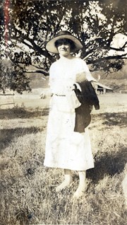
Photograph of Marion Cafferata standing in a clearing in front of a spreading tree. Fields, fences and a building can be seen in the background. The Cafferata family had a homestead at the present-day junction of Carrington Bay Rd. and the old road to Carrington Bay.
Photograph of Marion Cafferata standing in a clearing in front of a spreading tree. Fields, fences and a building can be seen in the background. The Cafferata family had a homestead at the present-day junction of Carrington Bay Rd. and the old road to Carrington Bay.
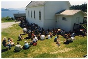
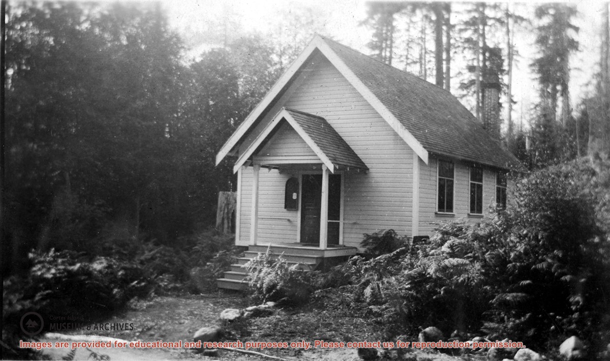
Photograph of the Church Hall in Whaletown, which stood in front of the old cemetery at the corner of Carrington Bay and Harbour roads. It served the community as both church and a venue for social events for almost forty years. The original Whaletown school became its kitchen, and a sleeping place for tired children.
Photograph of the Church Hall in Whaletown, which stood in front of the old cemetery at the corner of Carrington Bay and Harbour roads. It served the community as both church and a venue for social events for almost forty years. The original Whaletown school became its kitchen, and a sleeping place for tired children.
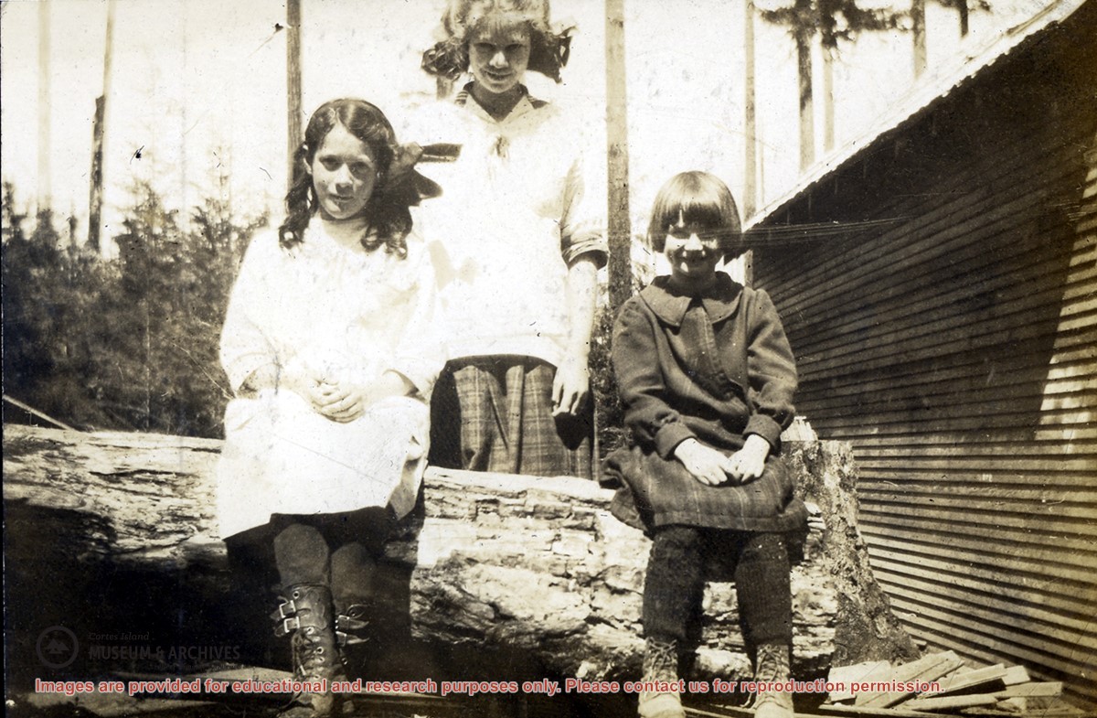
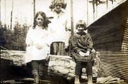
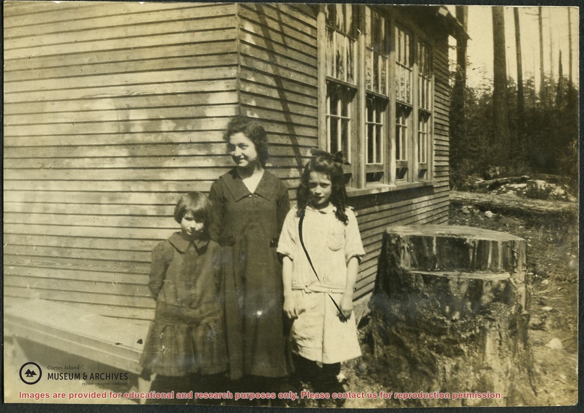
A photograph of "Marg" (Margaret Huck), Flo (last name?) and Marg F. (Margaret Forrest) standing at the corner of the Squirrel Cove school next to a big stump which is right beside the school. The building's siding and a row of windows can be seen clearly.
A photograph of "Marg" (Margaret Huck), Flo (last name?) and Marg F. (Margaret Forrest) standing at the corner of the Squirrel Cove school next to a big stump which is right beside the school. The building's siding and a row of windows can be seen clearly.
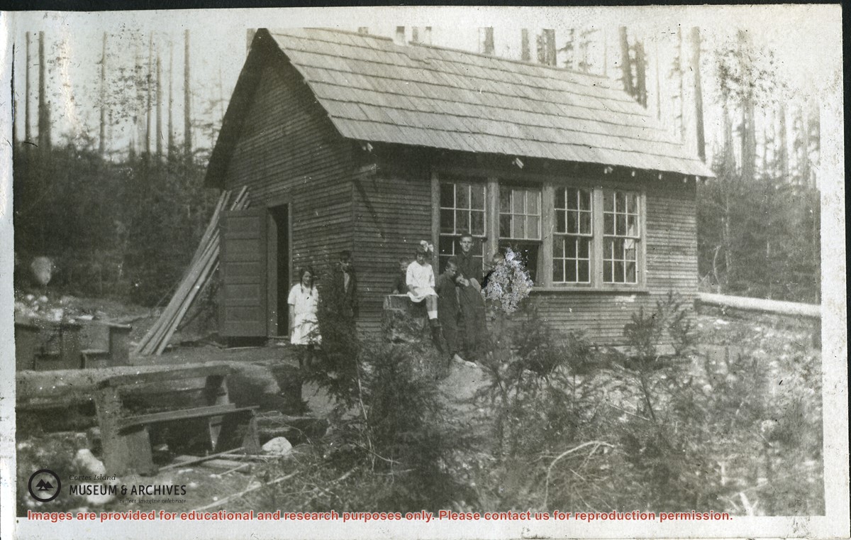
Photograph of the Squirrel Cove school, showing the entrance and side of the building in its clearing. A group of pupils is standing beside the school. Doreen Thompson has identified the pupils in 1917 as Margaret and Laurie Forrest; Harry, John and Dorothy Huck; Dave and Emmett Barrett and teacher Bob Cummings. (same as #2007.001.568)
Photograph of the Squirrel Cove school, showing the entrance and side of the building in its clearing. A group of pupils is standing beside the school. Doreen Thompson has identified the pupils in 1917 as Margaret and Laurie Forrest; Harry, John and Dorothy Huck; Dave and Emmett Barrett and teacher Bob Cummings. (same as #2007.001.568)