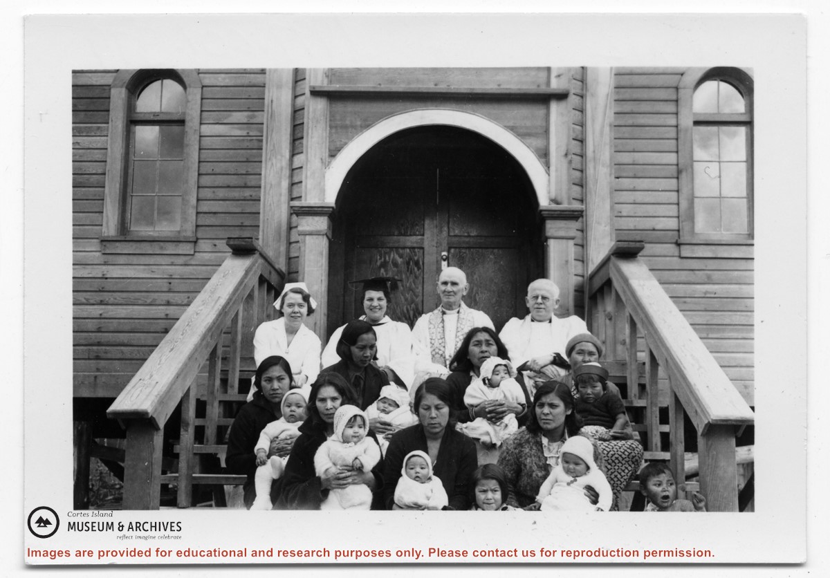
Photograph of people on the steps of the church at Kingcome Inlet. Top row, right, is Alan Greene with another minister and two women to his left. Mothers ad babies are on the lower two steps.
Photograph of people on the steps of the church at Kingcome Inlet. Top row, right, is Alan Greene with another minister and two women to his left. Mothers ad babies are on the lower two steps.
File consists of the agreement between the Whaletown Women's Institute and the Columbia Coast Mission regarding the use and upkeep of the Church Hall and cemetery at the corner of present-day Carrington Bay and Harbour Rd. in Whaletown.
File consists of the agreement between the Whaletown Women's Institute and the Columbia Coast Mission regarding the use and upkeep of the Church Hall and cemetery at the corner of present-day Carrington Bay and Harbour Rd. in Whaletown.
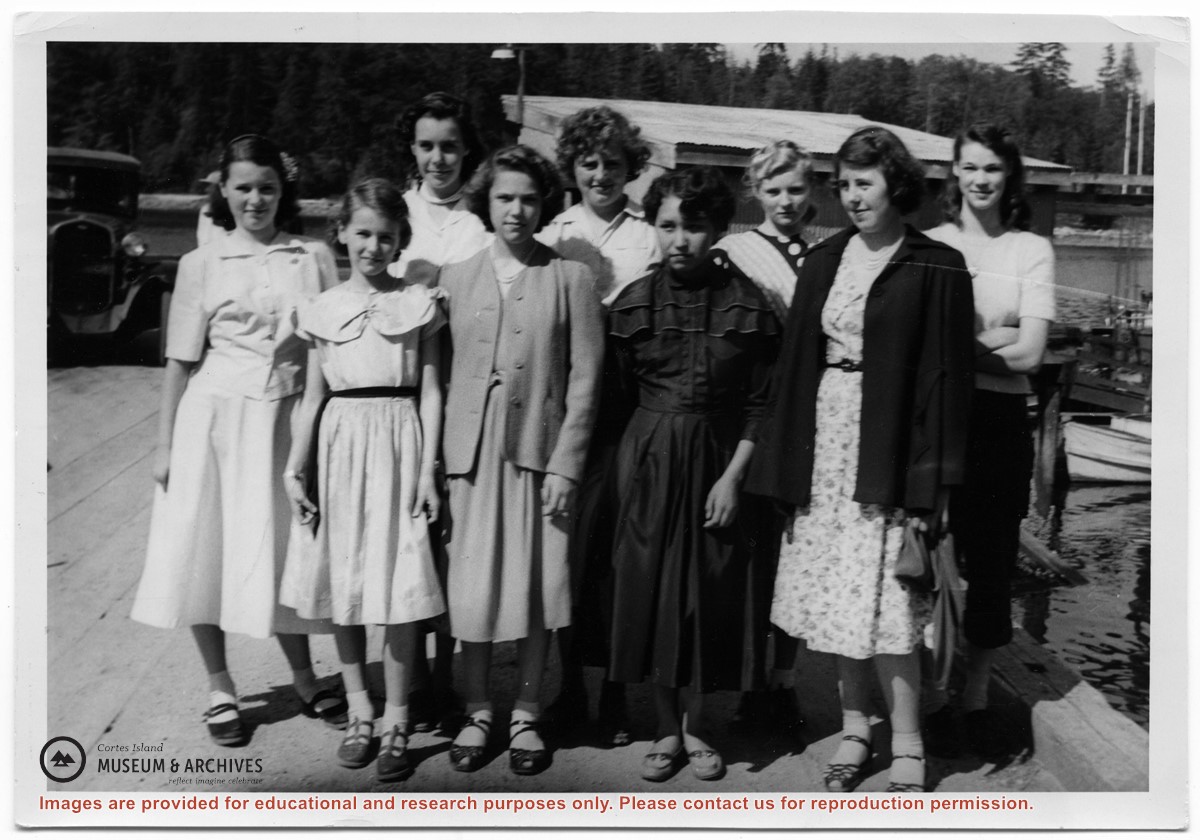
Photograph of a group of girls who were taking part in the Vacation School sponsered by the Columbia Coast Mission standing on the Whaletown wharf, in front of the freight shed. Left to Right: Yvonne and Louise Boas, Beth Hanen, Nola Ogren,Joan Disney, Mary Irwin, Pam Woolsey, Florence Bull, Mary Thompson.
Photograph of a group of girls who were taking part in the Vacation School sponsered by the Columbia Coast Mission standing on the Whaletown wharf, in front of the freight shed. Left to Right: Yvonne and Louise Boas, Beth Hanen, Nola Ogren,Joan Disney, Mary Irwin, Pam Woolsey, Florence Bull, Mary Thompson.
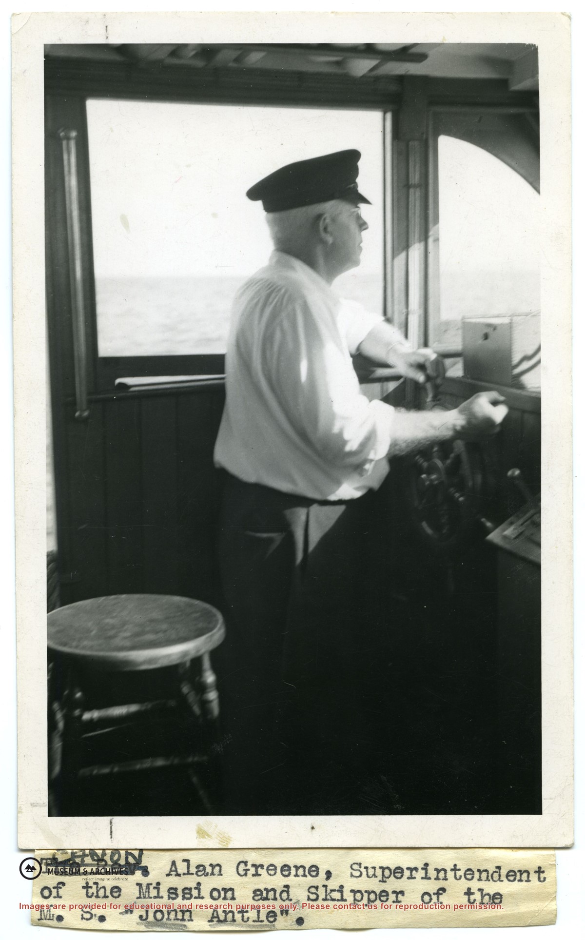
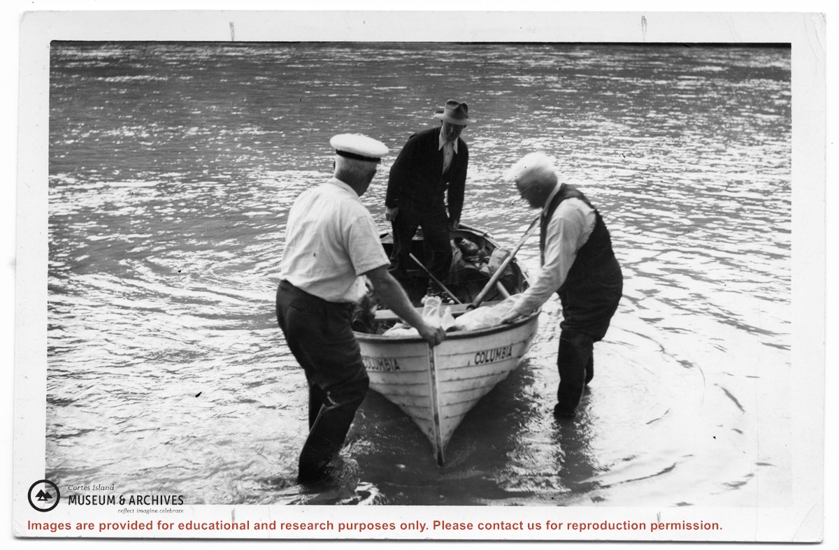
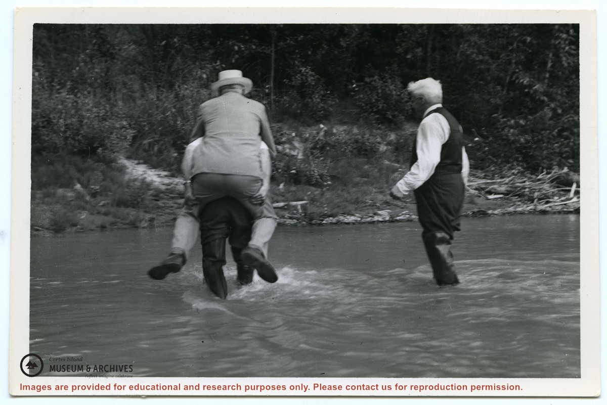
Photograph of an injured logger on a stretcher, being loaded off of a logging camp launch onto the "Columbia". Photo c is in the oversize photo box and has Alan Greene's notations on the back. See #1999.001.958. (see "Anderson, Doris, "The Columbia Is Coming"; Gray's Publishing, 1982, photo inset)
3 photograph prints: b&w; a & b are 13 x 10 cm; c is 25.5 x 20.5 cm
Scope and Content
Photograph of an injured logger on a stretcher, being loaded off of a logging camp launch onto the "Columbia". Photo c is in the oversize photo box and has Alan Greene's notations on the back. See #1999.001.958. (see "Anderson, Doris, "The Columbia Is Coming"; Gray's Publishing, 1982, photo inset)
The base map is a zoning map produced by the Regional District of Comox-
Strathcona for the Cortes Island Land Use Project (Aug 1969). Edwards used
coloured pencil to show land and foreshore zones, and transferred information
about early preemptions and old roads and trails from an earlier map (see
Donald Palmer fonds, 2020.002.011, map of Cortes Island, Sayward District, ca.
1915).


.jpg?width=1200&404=no-img.jpg&watermark=wmk)
.jpg?width=1200&404=no-img.jpg&watermark=wmk)
.jpg?width=1200&404=no-img.jpg&watermark=wmk)
.jpg?width=180&404=no-img.jpg)