Coloured map of southwestern BC showing municipalities, geographical features, land and sea routes, natural resources, etc. The back of the map is fully printed with information about BC and suggested travel itineraries.
Map needs preservation: edges are frayed and there are several tears.
Coloured map of southwestern BC showing municipalities, geographical features, land and sea routes, natural resources, etc. The back of the map is fully printed with information about BC and suggested travel itineraries.
Map needs preservation: edges are frayed and there are several tears.
Materials relating to the formation of the Regional District of Comox-Strathcona and Cortes Island APC including inquiries concerning museums and the legal status of historic artifacts.
Scan of Cortes Marketer 2011 containing Advisory Planning Commissions (APC) for local land use management; agenda from SRD Electoral Area Services Committee (EASC) meeting; and local advertisements on back
Scan of Cortes Marketer 2011 containing Advisory Planning Commissions (APC) for local land use management; agenda from SRD Electoral Area Services Committee (EASC) meeting; and local advertisements on back
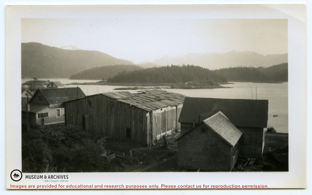
Photograph of a plank-sided, cedar shake roofed long house, seen from the back. There are houses on each side; the view is towards the water, with several small islands close to shore.
Photograph of a plank-sided, cedar shake roofed long house, seen from the back. There are houses on each side; the view is towards the water, with several small islands close to shore.