Series consists of family trees of Cortes Island settler families, with notes on related people and events. These trees are intended to help identify links between families on Cortes. Sources include online databases (e.g. Family Search.org, Ancestry.com and Canada Archives), CIMAS Archives and Information files, interviews and correspondence with family members.
Families researched include: Aldrich; Barrett; Borden; Byers; Cafferata; Froud; Hawkins; Hayes, Ashford and Griffin; Heay; Manson; Marquette; Middleton; Nichols; Percival and Saunders; Petznick; Pickles; Smith; (Carr) Smith& Marflett; Tiber; Tooker; Valley.The family trees and notes are kept in a binder labelled "Cortes Family Trees Project", located above the public access computer in the May Ellingsen Archives Room. Files are not available online due to privacy concerns.
We acknowledge that these trees are of white settler families and reflect colonization of ancestral homelands and displacement of the Indigenous Peoples who have thrived here for generations. We would welcome the opportunity to add those families to our records.
Family trees were researched by Bernice McGowan (1387 Bodington Rd, Whaletown, BC) in 2022. The Manson family tree was provided to CIMAS by Greg Johnson (2837 West 6th Avenue, Vancouver, BC V6K 1X2; phone # 604 897 5925) in 2022.
Scope and Content
Series consists of family trees of Cortes Island settler families, with notes on related people and events. These trees are intended to help identify links between families on Cortes. Sources include online databases (e.g. Family Search.org, Ancestry.com and Canada Archives), CIMAS Archives and Information files, interviews and correspondence with family members.
Families researched include: Aldrich; Barrett; Borden; Byers; Cafferata; Froud; Hawkins; Hayes, Ashford and Griffin; Heay; Manson; Marquette; Middleton; Nichols; Percival and Saunders; Petznick; Pickles; Smith; (Carr) Smith& Marflett; Tiber; Tooker; Valley.The family trees and notes are kept in a binder labelled "Cortes Family Trees Project", located above the public access computer in the May Ellingsen Archives Room. Files are not available online due to privacy concerns.
We acknowledge that these trees are of white settler families and reflect colonization of ancestral homelands and displacement of the Indigenous Peoples who have thrived here for generations. We would welcome the opportunity to add those families to our records.
Binder contains interviews, stories and pictures from Etta (McKay) Byers, Bert and Penny Hansen, Peggy Pyner, Frank Hayes, Vida (Trousdale) Hodgson, Bob Milton, Lorne Musclow, and Elton Anderson.
It was created as part of the Memories of Manson's Landing Exhibit, curated and mounted by Doreen Thompson.
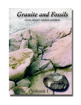
"Granite and Fossils" is a compilation of informatioin about Cortes Island fossils created by Christian Gronau for the Cortes Island Museum in 2002 and updated in 2016 and 2023. It has been digitized as Volume 1 and Volume 2.
Christian Gronau studied palaeontology and geology in Germany. He came to Canada in 1972 and
worked in the mining sector in the N.W.T. (among other places), where he met Aileen.
Christian and Aileen (C&A) moved together to Cortes Island in 1978, where they lived for 34 years on a
water-access-only property, without hydro or telephone (Swamp’s Edge), supporting themselves as beach-
only shellfish farmers (Last Farm Oysters). Throughout, C&A have been avid naturalists, continuing this
tradition from their present home at the south-end of Cortes Island (Tanglebank).
Scope and Content
"Granite and Fossils" is a compilation of informatioin about Cortes Island fossils created by Christian Gronau for the Cortes Island Museum in 2002 and updated in 2016 and 2023. It has been digitized as Volume 1 and Volume 2.
File contains a photocopied section map of the northern part of Cortes Island (from just south of Gorge Harbour), coloured to indicate areas for which a Crown Grant was located and areas of ungranted Crown land which still appear to be owned by the government. Scale is 1 mile to 1 inch.
File contains a photocopied section map of the northern part of Cortes Island (from just south of Gorge Harbour), coloured to indicate areas for which a Crown Grant was located and areas of ungranted Crown land which still appear to be owned by the government. Scale is 1 mile to 1 inch.
File contains a photocopied part of a map showing the locations of researched property in the Whaletown Lagoon and Whaletown Harbour area. The map is glued to an envelope which has a list of Crown grants and other conveyances on the back.
It contains photocopies of original land grants and other conveyances for the following:
Moses Ireland: 1893, Crown Grant for the W 1/2 of SW 1/4 of Sec 35 and W 1/2 of the SW 1/4 of Section 34
Joseph Youart: 1900, Crown Grant for Fractional NE 1/4 of Sec 35 (sold to Alice Robertson in 1908; "Burnside" is still in the Robertson family).
Nicholas Thompson: 1920, Crown Grant for the Fractional SW 1/4 of Sec 35
Charles Strange: 1914, Crown Grant for the NW 1/4 of Sec 35
File contains a map key to the areas of Sections 17, 18, 19, 22 and 34 (south of Gorge Harbour) which were researched (Information in Files 3-7).
It contains photocopies of original land grants and subsequent conveyances for the following:
Reginald James Smith: 1946, Crown Grant 165414I for fractional SE 1/4 of Sec 23, 1946 (the Thunder Road subdivision at the eastern end of Gorge Harbour).
(Files 3 through 7 are from the same envelope.)
File contains title information and photocopies of land grants and subsequent conveyances for the following:
John Williams: 1914, Crown Grant for the fractional SW 1/4 of Sec 22 and fractional NW 1/4 of Sec 22 (east of Gorge Harbour entrance)
John Williams: 1914, Crown Grant for the fractional SW 1/4 of Sec 22 and frac. NW 1/4 of Sec 18 (west of the Gorge Harbour entrance)
File contains three oversize maps which are stored in the map cabinet: Map of Section 22, Plan VIP52378, Lots A,B,C (blueprint map; 85 cm x 54 cm, 1985); map of Plan 27966 (blueprint map; 55 cm x 43 cm, 1974); photocopy of map of fractional NW 1/4 Sec 17 (55 cm x 43 cm, 1973)
(Files 3 through 7 are from the same envelope.)
File contains a photocopy of Crown Grant and documentation of subsequent changes in title for:
William Barrett Lennard: 1928, Crown Grant for the SE and SW 1/4s of Section 23 (on the SE shore of Gorge Harbour)
(Files 3 through 7 are from the same envelope.)
File contains a photocopy of Crown Grant and documentation of subsequent changes in title for:
William Barrett Lennard: 1928, Crown Grant for the SE and SW 1/4s of Section 23 (on the SE shore of Gorge Harbour)
(Files 3 through 7 are from the same envelope.)
File contains a photocopy of Crown Grant and documentation of subsequent changes in title for:
Eliza Breeze: 1920, Crown Grant for Fractional NW 1/4 of Section 18 (east of the entrance to Gorge Harbour)
(Files 3 through 7 are from the same envelope.)
File contains a photocopy of Crown Grant and documentation of subsequent changes in title for:
Eliza Breeze: 1920, Crown Grant for Fractional NW 1/4 of Section 18 (east of the entrance to Gorge Harbour)
(Files 3 through 7 are from the same envelope.)
File contains a coloured map with researched properties coloured in, and title information and photocopies of land grants and subsequent conveyances for the following:
Edward James Breeze: 1931, Crown Grant for District Lot 1373 (parts of Section 23 and Section 17, at the southeast end of Gorge Harbour by Anvil Lake)
Frank Harper: 1913, Crown Grant for the NE 96 acres of Section 23 (at the northeast end of Gorge Harbour)
(Files 3 through 7 are from the same envelope.)