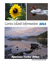
Series of 12 spiral-bound booklets containing information about activities, businesses, events, services and articles about various aspects of island life. There are two copies of 2015.
Cortes Island Information Books were initiated by Carol London, who wanted a handbook to give to guests at Tai Li Lodge. The first issues were created by Carina Verhoeve, and after 2012, by Gina Trzesicka.
Scope and Content
Series of 12 spiral-bound booklets containing information about activities, businesses, events, services and articles about various aspects of island life. There are two copies of 2015.
Cortes Island Museum maintains informational files on subjects of local interest as a research resource. Contents of files may contain clippings or photocopied newspaper and magazine articles, correspondence (including printed email correspondence) and other non-archival material. This is a dynamic file, with changes made on an on-going basis.
Cortes Island Museum maintains informational files on subjects of local interest as a research resource. Contents of files may contain clippings or photocopied newspaper and magazine articles, correspondence (including printed email correspondence) and other non-archival material. This is a dynamic file, with changes made on an on-going basis.
File contains genealogical information, photocopies of pictures, notes, and a CD labelled "Logan Family Photos" (2006.001.040 - stored in CD/DVD Album). Includes a photocopy of a World War I Diary of Dennis Walker.
File contains genealogical information, photocopies of pictures, notes, and a CD labelled "Logan Family Photos" (2006.001.040 - stored in CD/DVD Album). Includes a photocopy of a World War I Diary of Dennis Walker.
Fonds consists of a summary of the results of a questionnaire regarding ferry service composed by the Transportation Committee and sent to Cortes Island residents; the original questionnaires returned by islanders; and notes on other transportation issues such as road pavement and boat launch sites.
A District of Campbell River meeting March 22, 1993 took place in the Campbell River Hall. Present at that meeting were the Chairman of the B.C. Ferry Corporation; Peter Hughes, Operations Manager BC Ferry Corporation for North Islands; representative of the Campbell River Council and Campbell River School District; Gretchen Brewin, Chair Community Relations Committee; Colin Gabelman and his Executive Assistant; various B.C. Ferry Corp personnel including the person responsible for docks and terminals; and Jim Abrams and Ralph Nursall representing the Regional District.
At that meeting Peter Hughes recommended that Cortes Islanders form a Transportation Committee to liaison with B.C. Ferry Corp.
When Ralph returned to Cortes Island he spoke with a number of people he thought might be interested in forming the backbone of such an Island Committee. Eight of the 20+ people Ralph had contacted attended an April 21, 1993 Cortes Island preliminary meeting--Joanne Weyler, Sabina Mense, Joan Bevington, Ken Ferguson, Herbert Havelaar, Norm Gibbons, Tom Bennet and Dick Teams. What was discussed was the convening of a Transportation Committee meeting to bring together all those Islanders interested in transportation issues on the island. No one at that meeting volunteered to convene such a meeting. Ralph contacted then acting Operation Manager for B.C. Ferry Corp., Capt. Norman Craddock, and made arrangements for a public meeting with Capt. Craddock in attendance to answer questions from the floor. Joanne Weyler advertised the event through the Cortes Classifieds.
The May 12, 1993 Transportation Committee consisted of all those who attended that public meeting held at the Gorge Hall. The high turnout (50+) indicated an intense interest in transportation issues on the Island and there was a spirited exchange of questions and answers. Before this meeting, Dennis Mense had agreed to act as convener for an Executive of the Transportation Committee and Ralph Nursall asked for volunteers to serve on the Executive. Volunteers included Harry Breurkens, Glen Carleton, Norm Gibbons, Bertha Jeffery, Ted Pudden, Carol Reese and Joanne Weyler. [ . . . ]
The "mandate" for the Committee and its Executive, as expressed by Ralph Nursall, as as follows: "[I]t is intended that the Transportation Committee be an independent, community committee operating as it sees fit to collect opinions of Islanders to transport to the B.C. Ferry Corp. and getting information from the Corporation for Islanders. [ . . . ] the Committee will also interest itself in Highways and other transportation matters of the Island."
(From "Cortes Island Transportation Committee Background Information," in Regional Director fonds)
Custodial History
The material was compiled by the Cortes Island Transportation Committee. It was made available to islanders at the Manson's Landing library, and later transferred to CIMAS.
Scope and Content
Fonds consists of a summary of the results of a questionnaire regarding ferry service composed by the Transportation Committee and sent to Cortes Island residents; the original questionnaires returned by islanders; and notes on other transportation issues such as road pavement and boat launch sites.
This fonds contains textual records, photographs and other archival material relating to the history and functions of the Cortes Island Museum & Archives Society. It includes material created for exhibits and research on Cortes social and natural history.
This fonds contains textual records, photographs and other archival material relating to the history and functions of the Cortes Island Museum & Archives Society. It includes material created for exhibits and research on Cortes social and natural history.
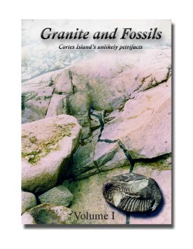
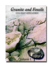
"Granite and Fossils" is a compilation of informatioin about Cortes Island fossils created by Christian Gronau for the Cortes Island Museum in 2002 and updated in 2016 and 2023. It has been digitized as Volume 1 and Volume 2.
Christian Gronau studied palaeontology and geology in Germany. He came to Canada in 1972 and
worked in the mining sector in the N.W.T. (among other places), where he met Aileen.
Christian and Aileen (C&A) moved together to Cortes Island in 1978, where they lived for 34 years on a
water-access-only property, without hydro or telephone (Swamp’s Edge), supporting themselves as beach-
only shellfish farmers (Last Farm Oysters). Throughout, C&A have been avid naturalists, continuing this
tradition from their present home at the south-end of Cortes Island (Tanglebank).
Scope and Content
"Granite and Fossils" is a compilation of informatioin about Cortes Island fossils created by Christian Gronau for the Cortes Island Museum in 2002 and updated in 2016 and 2023. It has been digitized as Volume 1 and Volume 2.
File contains title information and photocopies of land grants and subsequent conveyances for the following:
John Williams: 1914, Crown Grant for the fractional SW 1/4 of Sec 22 and fractional NW 1/4 of Sec 22 (east of Gorge Harbour entrance)
John Williams: 1914, Crown Grant for the fractional SW 1/4 of Sec 22 and frac. NW 1/4 of Sec 18 (west of the Gorge Harbour entrance)
File contains three oversize maps which are stored in the map cabinet: Map of Section 22, Plan VIP52378, Lots A,B,C (blueprint map; 85 cm x 54 cm, 1985); map of Plan 27966 (blueprint map; 55 cm x 43 cm, 1974); photocopy of map of fractional NW 1/4 Sec 17 (55 cm x 43 cm, 1973)
(Files 3 through 7 are from the same envelope.)
File contains a photocopy of Crown Grant and documentation of subsequent changes in title for:
William Barrett Lennard: 1928, Crown Grant for the SE and SW 1/4s of Section 23 (on the SE shore of Gorge Harbour)
(Files 3 through 7 are from the same envelope.)
File contains a photocopy of Crown Grant and documentation of subsequent changes in title for:
William Barrett Lennard: 1928, Crown Grant for the SE and SW 1/4s of Section 23 (on the SE shore of Gorge Harbour)
(Files 3 through 7 are from the same envelope.)
File contains a photocopy of Crown Grant and documentation of subsequent changes in title for:
Eliza Breeze: 1920, Crown Grant for Fractional NW 1/4 of Section 18 (east of the entrance to Gorge Harbour)
(Files 3 through 7 are from the same envelope.)
File contains a photocopy of Crown Grant and documentation of subsequent changes in title for:
Eliza Breeze: 1920, Crown Grant for Fractional NW 1/4 of Section 18 (east of the entrance to Gorge Harbour)
(Files 3 through 7 are from the same envelope.)
File contains a section map showing properties southeast of Gorge Harbour and title information on the property, later owned by Gilean Douglas, and known as Channel Rock.
To John Pool: 1930, Crown Grant of the W 1/2 of the SE 1/4 of Sec. 21 and fractional SW 1/4 of Sec. 21 and Crown Grant fo the fractional E 1/2 of fractional SE 1/4 of Sec. 21
File contains a coloured map with researched properties coloured in, and title information and photocopies of land grants and subsequent conveyances for the following:
Edward James Breeze: 1931, Crown Grant for District Lot 1373 (parts of Section 23 and Section 17, at the southeast end of Gorge Harbour by Anvil Lake)
Frank Harper: 1913, Crown Grant for the NE 96 acres of Section 23 (at the northeast end of Gorge Harbour)
(Files 3 through 7 are from the same envelope.)
File contains title information to 1991 and a photocopy of the original Crown Grant to:
Nicholas Thompson: 1920, Crown Grant of Fractional SW 1/4 of Section 35; 54 acres on the southwest of Whaletown Bay
File contains a small explanatory map if a 5.5 acre portion of fractional SW 1/4 of Sec. 35, 1949, and a Subdivision Plan map of part of fractional SW 1/4 of Sec. 35, 1957 (stored in the Map Cabinet).
(Files 9 and 10 are from the same envelope.)
File contains photocopies of original Crown Grants, subsequent title changes and maps for:
To Joseph Gregson: 1926, Crown Grant for fractional W 1/2 of Lot 899 and Lot 901 (between Coulter and Carrington Bays), with a water easement for Wailes
To John Nugent McIllree: 1957, Crown Grant of mineral rights to lots at Coulter Bay surveyed as the "Arrow" and "Bullseye" mineral claims
To Hilda Peterson: 1919, Crown Grant for Lot 878, Carrington Bay, 55 acres
(Files 12 through 16 are from the same envelope.)