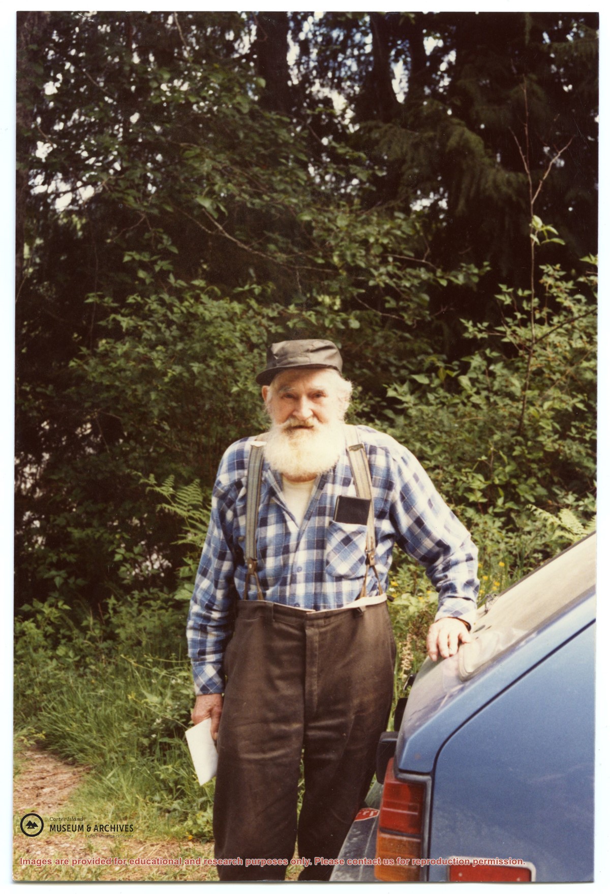
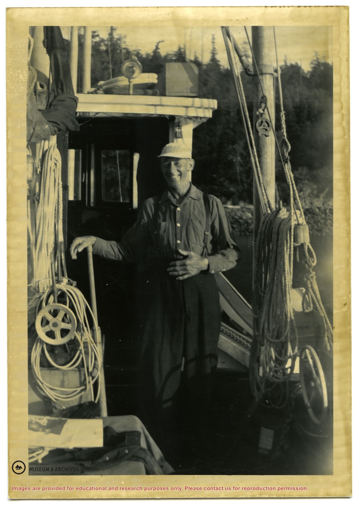
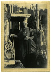
Photograph of Alex McKee standing outside. Notes on a paper with the photograph: "Ann McKee came to Whaletown. Lived in Cousins Thompson's - house burned down early 50's. Moved to Prince Rupert where daughter lived; Mrs. M died. Alec returned early 70s. Lived in a small cabin, fished a bit."
Photograph of Alex McKee standing outside. Notes on a paper with the photograph: "Ann McKee came to Whaletown. Lived in Cousins Thompson's - house burned down early 50's. Moved to Prince Rupert where daughter lived; Mrs. M died. Alec returned early 70s. Lived in a small cabin, fished a bit."
File contains a photocopy image of the Peter Police homestead at Carrington Lagoon, handwritten stories by Bud Dewar, an article about Ned Breeze, a photocopy of Gary and Velma Bergman at the Whaletown store, and a list of Seaford School.
File contains a photocopy image of the Peter Police homestead at Carrington Lagoon, handwritten stories by Bud Dewar, an article about Ned Breeze, a photocopy of Gary and Velma Bergman at the Whaletown store, and a list of Seaford School.
File contains newspaper clippings about a visit of the Whaletown School class to Vancouver; a "Whaletown Round-Up" column written by Gilean Douglas, 1956; a photocopy of an article about the purchase of Smelt Bay Park, 1973; and a craft store in Whaletown, 1975.
File contains newspaper clippings about a visit of the Whaletown School class to Vancouver; a "Whaletown Round-Up" column written by Gilean Douglas, 1956; a photocopy of an article about the purchase of Smelt Bay Park, 1973; and a craft store in Whaletown, 1975.
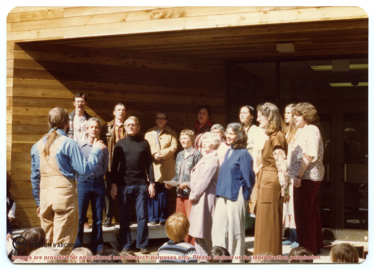
Back, L to R: Bruce Campbell, Duane Campbell, Bonnie Killian, Joan Disney, Peggy Newsham, Wendy Knudson, Kate Hathaway, Donna Norman
Front: David Blinzinger, Conductor; Bruce Ellingsen, Jack Killian, Fay Raymont, Velma Bergman, (ID), Rebecca Campbell
Back, L to R: Bruce Campbell, Duane Campbell, Bonnie Killian, Joan Disney, Peggy Newsham, Wendy Knudson, Kate Hathaway, Donna Norman
Front: David Blinzinger, Conductor; Bruce Ellingsen, Jack Killian, Fay Raymont, Velma Bergman, (ID), Rebecca Campbell
File contains photocopies of original Crown Grants, subsequent title changes and maps for:
To Joseph Gregson: 1926, Crown Grant for fractional W 1/2 of Lot 899 and Lot 901 (between Coulter and Carrington Bays), with a water easement for Wailes
To John Nugent McIllree: 1957, Crown Grant of mineral rights to lots at Coulter Bay surveyed as the "Arrow" and "Bullseye" mineral claims
To Hilda Peterson: 1919, Crown Grant for Lot 878, Carrington Bay, 55 acres
(Files 12 through 16 are from the same envelope.)
File contains a key map which was pasted on the front of the envelope indicating the areas researched for Files 12-16; notes on the titles; photocopies of Crown Grants and subsequent title information for:
BC Buildings Corp: 1982, Crown Grant for Block A of SW 1/4 of Sec. 25 (Highways Maintenance Yard)
District Lot 871 (40 acres between Carrington and Coulter Bays): to James Frederick McManus, 1919
To Ernest Henry Vaughn: 1922, Crown Grant for NE 1/4 and NW 1/4 of NE 1/4 of Sec. 24; SE 1/4 of SW 1/4 and SW 1/4 of SE 1/4 of Sec 31
Herbert Proctor: 1928 for fractional SW 1/4 of Sec. 41, bordering Tork Reserve; 159 acres for $159.00 (orig. Crown Grant to Herbert Proctor in 1922)
To William Cowan: 1937, E 1/2 of SE 1/4 of Sec. 26, 89 acres
(Files 12 through 16 are from the same envelope.)
File contains a photocopy of Crown Grant and documentation of subsequent changes in title for:
Eliza Breeze: 1920, Crown Grant for Fractional NW 1/4 of Section 18 (east of the entrance to Gorge Harbour)
(Files 3 through 7 are from the same envelope.)
File contains a photocopy of Crown Grant and documentation of subsequent changes in title for:
Eliza Breeze: 1920, Crown Grant for Fractional NW 1/4 of Section 18 (east of the entrance to Gorge Harbour)
(Files 3 through 7 are from the same envelope.)
File contains a section map showing properties southeast of Gorge Harbour and title information on the property, later owned by Gilean Douglas, and known as Channel Rock.
To John Pool: 1930, Crown Grant of the W 1/2 of the SE 1/4 of Sec. 21 and fractional SW 1/4 of Sec. 21 and Crown Grant fo the fractional E 1/2 of fractional SE 1/4 of Sec. 21
File contains title information and photocopies of land grants and subsequent conveyances for the following:
John Williams: 1914, Crown Grant for the fractional SW 1/4 of Sec 22 and fractional NW 1/4 of Sec 22 (east of Gorge Harbour entrance)
John Williams: 1914, Crown Grant for the fractional SW 1/4 of Sec 22 and frac. NW 1/4 of Sec 18 (west of the Gorge Harbour entrance)
File contains three oversize maps which are stored in the map cabinet: Map of Section 22, Plan VIP52378, Lots A,B,C (blueprint map; 85 cm x 54 cm, 1985); map of Plan 27966 (blueprint map; 55 cm x 43 cm, 1974); photocopy of map of fractional NW 1/4 Sec 17 (55 cm x 43 cm, 1973)
(Files 3 through 7 are from the same envelope.)
File contains a photocopy of Crown Grant and documentation of subsequent changes in title for:
William Barrett Lennard: 1928, Crown Grant for the SE and SW 1/4s of Section 23 (on the SE shore of Gorge Harbour)
(Files 3 through 7 are from the same envelope.)
File contains a photocopy of Crown Grant and documentation of subsequent changes in title for:
William Barrett Lennard: 1928, Crown Grant for the SE and SW 1/4s of Section 23 (on the SE shore of Gorge Harbour)
(Files 3 through 7 are from the same envelope.)
File contains a map key to the areas of Sections 17, 18, 19, 22 and 34 (south of Gorge Harbour) which were researched (Information in Files 3-7).
It contains photocopies of original land grants and subsequent conveyances for the following:
Reginald James Smith: 1946, Crown Grant 165414I for fractional SE 1/4 of Sec 23, 1946 (the Thunder Road subdivision at the eastern end of Gorge Harbour).
(Files 3 through 7 are from the same envelope.)