The base map is a zoning map produced by the Regional District of Comox-
Strathcona for the Cortes Island Land Use Project (Aug 1969). Edwards used
coloured pencil to show land and foreshore zones, and transferred information
about early preemptions and old roads and trails from an earlier map (see
Donald Palmer fonds, 2020.002.011, map of Cortes Island, Sayward District, ca.
1915).
Fonds consists of photographs of the Gorge Harbour Lodge and Lodge activities, the Corneille and Ballantyne families, and Gladys Ballantyne's house, Gypsy Hill.
Bobby (Elizabeth) Corneille Ballantyne (1914-2009) was born in Vancouver and moved to Cortes Island as a young child. She was 4 years old when her father died suddenly on Marina Island in 1919; she remembers that they had to wait 3 days for a Union Steamship to get the body. Her mother Tena (Sarah Christena) Corneille (1877-1949) bought a tourist lodge at the east end of Gorge Harbour in 1929, and ran it until 1936 with the help of her two teen-age daughters. Gorge Harbour Lodge offered accommodations in the main building or in tents, tennis and badminton courts, and excellent boating, bathing and fishing. Vacationers came up from Vancouver on the Union Steamships for a round-trip ticket price of $6.65. The annual Regatta was the main social event of the season, with people arriving by boat from Cortes and the surrounding islands. It featured boat and swimming races, and a dance in the evening.
Gladys Georgeson Ballantyne (1882-1964), first came to Cortes in about 1910. In about 1920 she bought a property in Whaletown (now 640 Whaletown Rd.) that she called "Gypsy Hill". She was one of the original members of the Whaletown Friendly Circle, later the Whaletown Women's Institute. Gladys, her son Bill, daughter Valerie and her fiance were all on Cortes building a summer cottage when the Depression suddenly hit. Their off-island jobs fell through, and they remained at "Gypsy Hill" for the duration.
Bill Ballantyne (1908-1993) was in the Merchant Marine from 1924-1929. When he was unable to find work on ships during the Depression, he took whatever jobs he could find hand-logging and fishing. Bill and Bobby Corneille were married in 1937. They and other young Whaletown residents formed the Gorge Harbour Dramatic Society to help raise funds to build a community hall, and Bill was the work boss of the building crew for the Gorge Hall. In 1941 they moved to Victoria, and after the war settled in Courtenay with their two sons Peter and Ross. In the late 1950s they returned to Whaletown on Cortes Island where they fished for many years on the gulf troller “Viking”. During that time many young “deckhands” spent time aboard during summer vacations. On retirement, Campbell River became their home.
Custodial History
Electronic records were downloaded in 2012 from an internet address provided by Peter Ballantyne. One photograph was scanned from a photograph temporarily loaned by John and De Clarke.
Scope and Content
Fonds consists of photographs of the Gorge Harbour Lodge and Lodge activities, the Corneille and Ballantyne families, and Gladys Ballantyne's house, Gypsy Hill.
Basil (1910-2012) and Jill Seaton, environmentalists and naturalists, lived on Cortes Island from 1982 to 1992.
Custodial History
The Seatons gave these records to Fred Zwickel when they moved from Cortes Island; they were subsequently given to Nancy Kendel for donation to the museum in 2012.
Scope and Content
Fonds consists of correspondence, notes and maps relating to the establishment of Von Donop Marine Park (now known as Háthayim Marine Park).
Storage Location
Small fonds box
Oversize materials box
Storage Range
Small fonds box 1-14 to 1-17
Oversize materials box
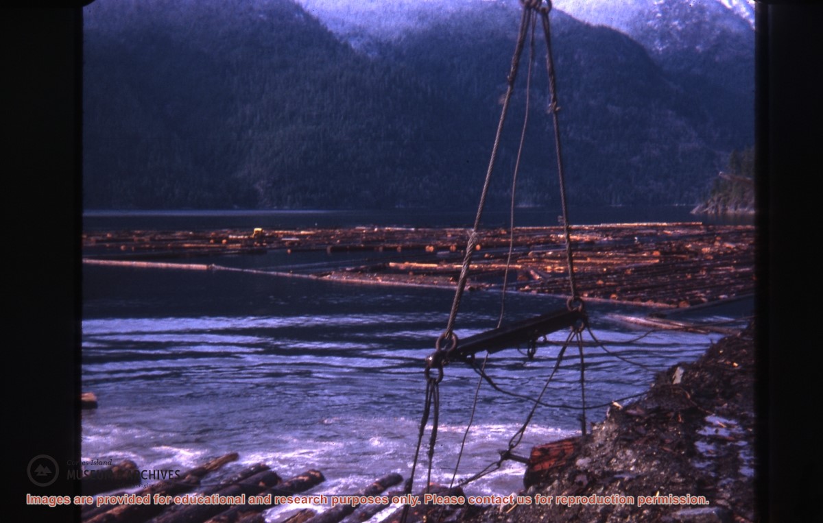
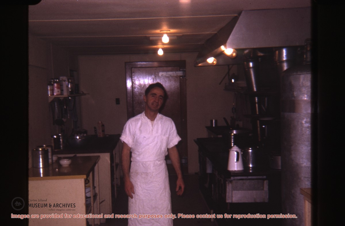
Part of a series of photographs taken by Don Maclean at a logging camp at the Quatam River in Ramsey Arm, BC. The camp was likely one of the stops on his patrol for the Columbia Coast Mission.
Slides were taken by Don Maclean and donated by Janice Kerr Maclean, Sept. 9, 2021.
Scope and Content
Part of a series of photographs taken by Don Maclean at a logging camp at the Quatam River in Ramsey Arm, BC. The camp was likely one of the stops on his patrol for the Columbia Coast Mission.
Coloured map of southwestern BC showing municipalities, geographical features, land and sea routes, natural resources, etc. The back of the map is fully printed with information about BC and suggested travel itineraries.
Map needs preservation: edges are frayed and there are several tears.
Coloured map of southwestern BC showing municipalities, geographical features, land and sea routes, natural resources, etc. The back of the map is fully printed with information about BC and suggested travel itineraries.
Map needs preservation: edges are frayed and there are several tears.
L to R: Kyoshi Kosky, Justin Stirn
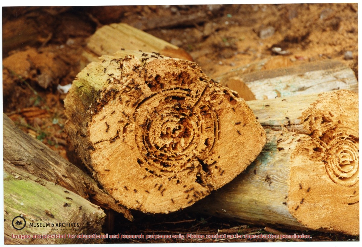
Part of a series of 8 photographs which document a clean-up at the proposed Carrington Bay Park site. The squatters' cabin was built in the 1970s, on the east side of Carrington Bay.
L to R: Kyoshi Kosky, Justin Stirn
Part of a series of 8 photographs which document a clean-up at the proposed Carrington Bay Park site. The squatters' cabin was built in the 1970s, on the east side of Carrington Bay.
Part of a series of photographs taken by Don Maclean at a logging camp at the Quatam River in Ramsey Arm, BC. The camp was likely one of the stops on his patrol for the Columbia Coast Mission.
Slides were taken by Don Maclean and donated by Janice Kerr Maclean, Sept. 9, 2021.
Scope and Content
Part of a series of photographs taken by Don Maclean at a logging camp at the Quatam River in Ramsey Arm, BC. The camp was likely one of the stops on his patrol for the Columbia Coast Mission.
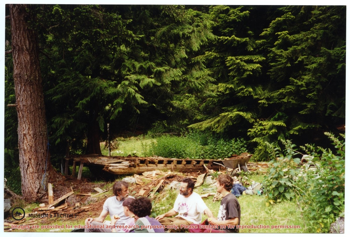
Part of a series of 8 photographs which document a clean-up at the proposed Carrington Bay Park site. The squatters' cabin was built in the 1970s, on the east side of Carrington Bay.
Part of a series of 8 photographs which document a clean-up at the proposed Carrington Bay Park site. The squatters' cabin was built in the 1970s, on the east side of Carrington Bay.
L to R: Cedar DeTrey, Mike ?, John Shook
Part of a series of 8 photographs which document a clean-up at the proposed Carrington Bay Park site. The squatters' cabin was built in the 1970s, on the east side of Carrington Bay.
L to R: Cedar DeTrey, Mike ?, John Shook
Part of a series of 8 photographs which document a clean-up at the proposed Carrington Bay Park site. The squatters' cabin was built in the 1970s, on the east side of Carrington Bay.
One of a series of photographs of volunteers removing the remains of shacks at Carrington Bay when Carrington Bay Marine Park was established.
L to R: Kiyoshi Kosky, Pierre DeTrey, Cedar DeTrey
One of a series of photographs of volunteers removing the remains of shacks at Carrington Bay when Carrington Bay Marine Park was established.
L to R: Kiyoshi Kosky, Pierre DeTrey, Cedar DeTrey
L to R: John Shook, Justin Stirn, Pierre DeTrey, Kiyoshi Kosky, Cedar DeTrey
Part of a series of 8 photographs which document a clean-up at the proposed Carrington Bay Park site. The squatters' cabin was built in the 1970s, on the east side of Carrington Bay.
L to R: John Shook, Justin Stirn, Pierre DeTrey, Kiyoshi Kosky, Cedar DeTrey
Part of a series of 8 photographs which document a clean-up at the proposed Carrington Bay Park site. The squatters' cabin was built in the 1970s, on the east side of Carrington Bay.
L to R: Kiyoshi Kosky, Justin Stirn, Mike ?, John Shook
Part of a series of 8 photographs which document a clean-up at the proposed Carrington Bay Park site. The squatters' cabin was built in the 1970s, on the east side of Carrington Bay.
L to R: Kiyoshi Kosky, Justin Stirn, Mike ?, John Shook
Part of a series of 8 photographs which document a clean-up at the proposed Carrington Bay Park site. The squatters' cabin was built in the 1970s, on the east side of Carrington Bay.