The base map is a zoning map produced by the Regional District of Comox-
Strathcona for the Cortes Island Land Use Project (Aug 1969). Edwards used
coloured pencil to show land and foreshore zones, and transferred information
about early preemptions and old roads and trails from an earlier map (see
Donald Palmer fonds, 2020.002.011, map of Cortes Island, Sayward District, ca.
1915).
Basil (1910-2012) and Jill Seaton, environmentalists and naturalists, lived on Cortes Island from 1982 to 1992.
Custodial History
The Seatons gave these records to Fred Zwickel when they moved from Cortes Island; they were subsequently given to Nancy Kendel for donation to the museum in 2012.
Scope and Content
Fonds consists of correspondence, notes and maps relating to the establishment of Von Donop Marine Park (now known as Háthayim Marine Park).
Storage Location
Small fonds box
Oversize materials box
Storage Range
Small fonds box 1-14 to 1-17
Oversize materials box
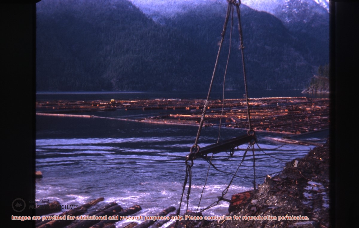
Part of a series of photographs taken by Don Maclean at a logging camp at the Quatam River in Ramsey Arm, BC. The camp was likely one of the stops on his patrol for the Columbia Coast Mission.
Slides were taken by Don Maclean and donated by Janice Kerr Maclean, Sept. 9, 2021.
Scope and Content
Part of a series of photographs taken by Don Maclean at a logging camp at the Quatam River in Ramsey Arm, BC. The camp was likely one of the stops on his patrol for the Columbia Coast Mission.
Coloured map of southwestern BC showing municipalities, geographical features, land and sea routes, natural resources, etc. The back of the map is fully printed with information about BC and suggested travel itineraries.
Map needs preservation: edges are frayed and there are several tears.
Coloured map of southwestern BC showing municipalities, geographical features, land and sea routes, natural resources, etc. The back of the map is fully printed with information about BC and suggested travel itineraries.
Map needs preservation: edges are frayed and there are several tears.
L to R: Kyoshi Kosky, Justin Stirn
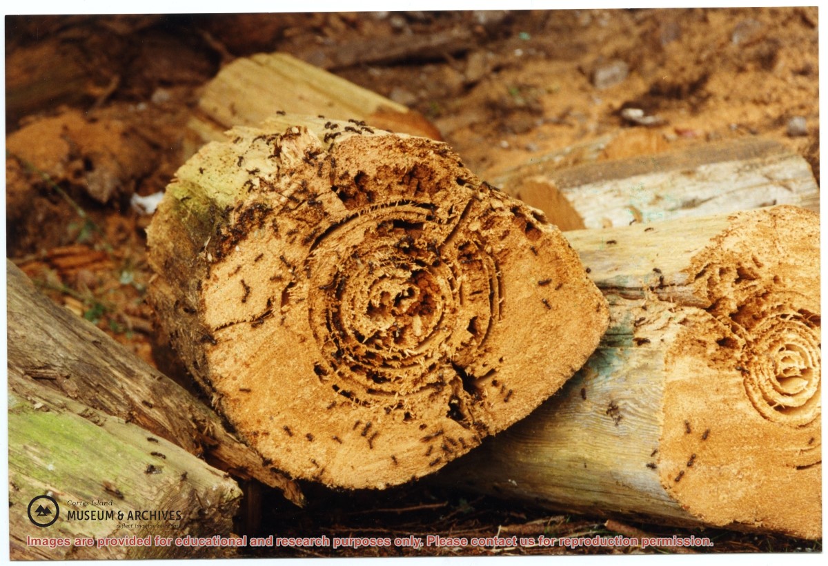
Part of a series of 8 photographs which document a clean-up at the proposed Carrington Bay Park site. The squatters' cabin was built in the 1970s, on the east side of Carrington Bay.
L to R: Kyoshi Kosky, Justin Stirn
Part of a series of 8 photographs which document a clean-up at the proposed Carrington Bay Park site. The squatters' cabin was built in the 1970s, on the east side of Carrington Bay.
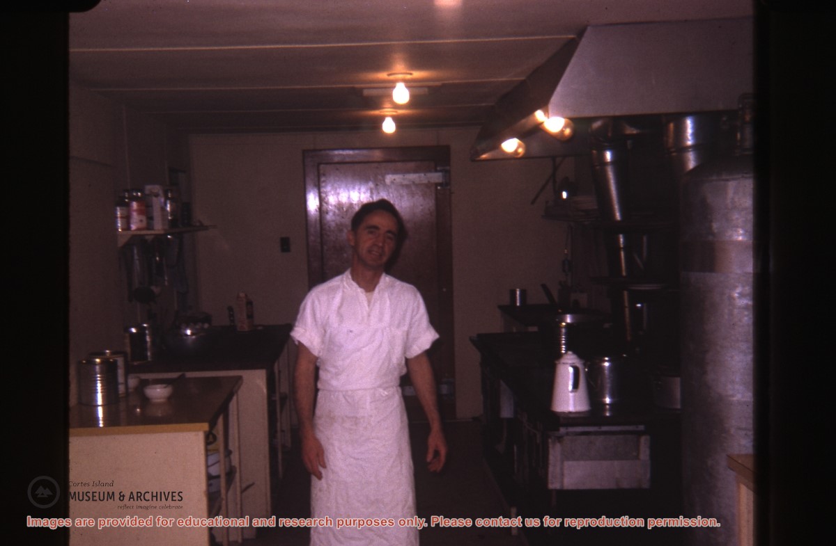
Part of a series of photographs taken by Don Maclean at a logging camp at the Quatam River in Ramsey Arm, BC. The camp was likely one of the stops on his patrol for the Columbia Coast Mission.
Slides were taken by Don Maclean and donated by Janice Kerr Maclean, Sept. 9, 2021.
Scope and Content
Part of a series of photographs taken by Don Maclean at a logging camp at the Quatam River in Ramsey Arm, BC. The camp was likely one of the stops on his patrol for the Columbia Coast Mission.
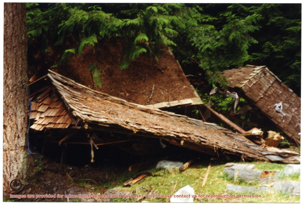
Part of a series of 8 photographs which document a clean-up at the proposed Carrington Bay Park site. The squatters' cabin was built in the 1970s, on the east side of Carrington Bay.
Part of a series of 8 photographs which document a clean-up at the proposed Carrington Bay Park site. The squatters' cabin was built in the 1970s, on the east side of Carrington Bay.
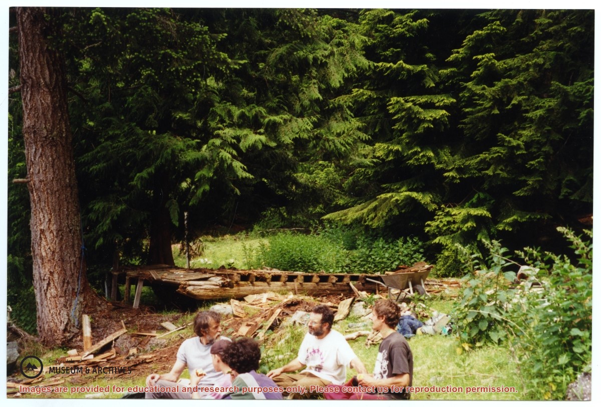
L to R: Cedar DeTrey, Mike ?, John Shook
Part of a series of 8 photographs which document a clean-up at the proposed Carrington Bay Park site. The squatters' cabin was built in the 1970s, on the east side of Carrington Bay.
L to R: Cedar DeTrey, Mike ?, John Shook
Part of a series of 8 photographs which document a clean-up at the proposed Carrington Bay Park site. The squatters' cabin was built in the 1970s, on the east side of Carrington Bay.
One of a series of photographs of volunteers removing the remains of shacks at Carrington Bay when Carrington Bay Marine Park was established.
L to R: Kiyoshi Kosky, Pierre DeTrey, Cedar DeTrey
One of a series of photographs of volunteers removing the remains of shacks at Carrington Bay when Carrington Bay Marine Park was established.
L to R: Kiyoshi Kosky, Pierre DeTrey, Cedar DeTrey
L to R: John Shook, Justin Stirn, Pierre DeTrey, Kiyoshi Kosky, Cedar DeTrey
Part of a series of 8 photographs which document a clean-up at the proposed Carrington Bay Park site. The squatters' cabin was built in the 1970s, on the east side of Carrington Bay.
L to R: John Shook, Justin Stirn, Pierre DeTrey, Kiyoshi Kosky, Cedar DeTrey
Part of a series of 8 photographs which document a clean-up at the proposed Carrington Bay Park site. The squatters' cabin was built in the 1970s, on the east side of Carrington Bay.
L to R: Kiyoshi Kosky, Justin Stirn, Mike ?, John Shook
Part of a series of 8 photographs which document a clean-up at the proposed Carrington Bay Park site. The squatters' cabin was built in the 1970s, on the east side of Carrington Bay.
L to R: Kiyoshi Kosky, Justin Stirn, Mike ?, John Shook
Part of a series of 8 photographs which document a clean-up at the proposed Carrington Bay Park site. The squatters' cabin was built in the 1970s, on the east side of Carrington Bay.