Coloured map of southwestern BC showing municipalities, geographical features, land and sea routes, natural resources, etc. The back of the map is fully printed with information about BC and suggested travel itineraries.
Map needs preservation: edges are frayed and there are several tears.
Coloured map of southwestern BC showing municipalities, geographical features, land and sea routes, natural resources, etc. The back of the map is fully printed with information about BC and suggested travel itineraries.
Map needs preservation: edges are frayed and there are several tears.
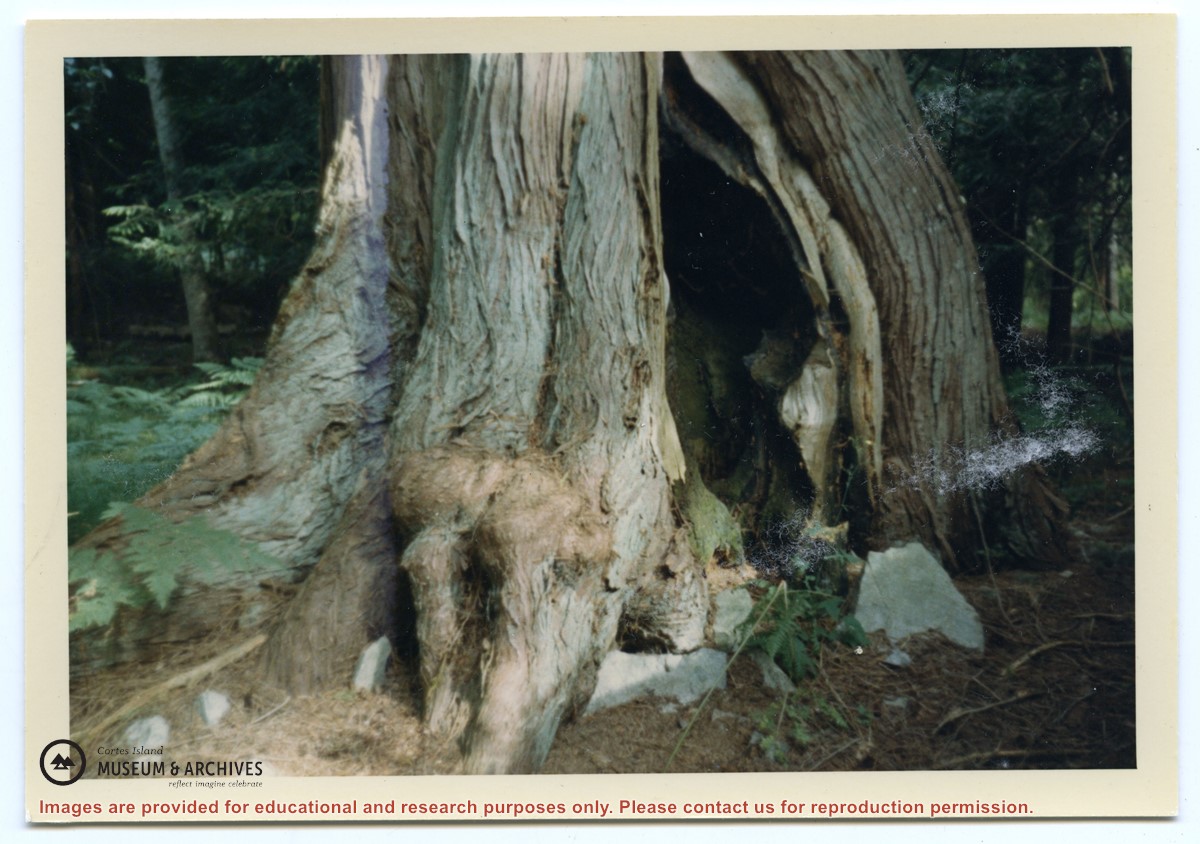
Photograph of what Gilean Douglas called the Indian tree. It was a large cedar tree which grew close to a rock face on the trail between the house and garden at Channel Rock. The bottom facing the rock face was burnt out and formed a natural hearth, where a fire could be built; the rocks would reflect the heat and the cedar branches would give protection from the rain, thus creating a space for people to keep warm and dry.
Photograph of what Gilean Douglas called the Indian tree. It was a large cedar tree which grew close to a rock face on the trail between the house and garden at Channel Rock. The bottom facing the rock face was burnt out and formed a natural hearth, where a fire could be built; the rocks would reflect the heat and the cedar branches would give protection from the rain, thus creating a space for people to keep warm and dry.
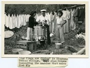
Photograph of Canon Alan Greene standing between two Kingcome village women, who are doing laundry with a wringer washing machine set up outside. Behind them a line of laundry is hanging on a clothesline.
Photograph of Canon Alan Greene standing between two Kingcome village women, who are doing laundry with a wringer washing machine set up outside. Behind them a line of laundry is hanging on a clothesline.

.jpg?width=1200&404=no-img.jpg&watermark=wmk)
.jpg?width=1200&404=no-img.jpg&watermark=wmk)
.jpg?width=180&404=no-img.jpg)