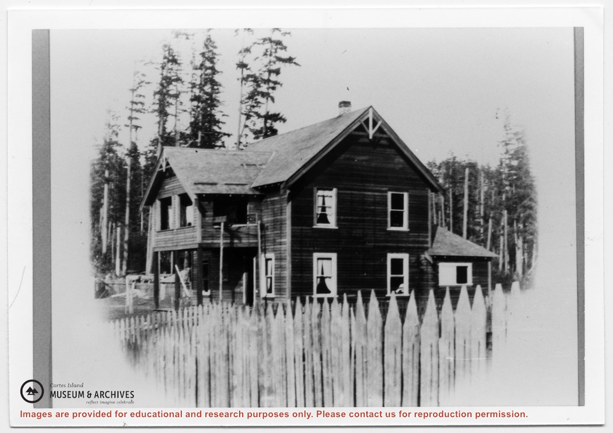
File contains a section map showing properties southeast of Gorge Harbour and title information on the property, later owned by Gilean Douglas, and known as Channel Rock.
To John Pool: 1930, Crown Grant of the W 1/2 of the SE 1/4 of Sec. 21 and fractional SW 1/4 of Sec. 21 and Crown Grant fo the fractional E 1/2 of fractional SE 1/4 of Sec. 21
File contains a Key Map to the sections covered in Files 17-19; a list of the sections researched and two pages of notes.
It contains photocopies of Crown Grants and subsequent title changes for the following:
Charles Allen: 1908, Crown Grant for part of NE 1/4 of Sec. 21 lying north of Gorge Harbour (property known as Bute Ranch); 46 acres for $46.00
Bernard Robinson Allen: 1919, Crown Grant for NW 1/4 of Sec. 21; 162 acres for $247.00
Charles Allen: 1905, Crown Grant for SE 1/4 of Sec. 34
(Files 17 through 19 are from the same envelope.)
File contains information for the following properties:
Frederick James Smith: 1921, Crown Grant for SE 1/4 of Sec. 33; 160 acres for $1.00
Charles Allen: 1912, Crown Grant for SW 1/4 of Sec. 33; 160 acres for $160.
George Robson: 1907, Crown Grant for NW 1/4 of Sec. 21; $247.00 for 142 acres.
(Files 17 through 19 are from the same envelope.)
File contains a map and notes, and information on the following:
Mabel Huck: 1920, Crown Grant for NE 1/4 of Sec. 40; file shows the original grant, a tax sale forfeit in 1939, a regrant in 1957 with immediate sale to MacMillan/Bloedel.
William Barrett: 1916, Crown Grant for NW 1/4 of Sec. 40; $160 for 160 acres.
Herbert Benjamin Middleton: 1916, Crown Grant for SW 1/4 of Sec. 40, 168 acres for $168.00
August Teuber: 1904, Crown Grant for SE 14 of Sec. 40; 160 acres for $160.00.