The base map is a zoning map produced by the Regional District of Comox-
Strathcona for the Cortes Island Land Use Project (Aug 1969). Edwards used
coloured pencil to show land and foreshore zones, and transferred information
about early preemptions and old roads and trails from an earlier map (see
Donald Palmer fonds, 2020.002.011, map of Cortes Island, Sayward District, ca.
1915).
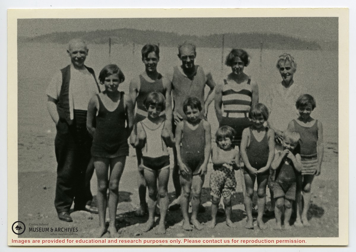
Photograph shows members of the Michael Manson extended family in bathing costumes. The are identified as Mr. Niven, Muriel Hurren, Jim Niven, Dick Parker, Thelma Campbell, Audrey Kenny, Jean Manson, Eileen Kenny, Minerva Campbell, Mrs. Niven, Dorothy Manson and Lorne Campbell.
Photograph shows members of the Michael Manson extended family in bathing costumes. The are identified as Mr. Niven, Muriel Hurren, Jim Niven, Dick Parker, Thelma Campbell, Audrey Kenny, Jean Manson, Eileen Kenny, Minerva Campbell, Mrs. Niven, Dorothy Manson and Lorne Campbell.