File contains minutes, agendas and other material relating to meetings of the Klahoose Table, attended by members of CILAC, Klahoose First Nations and government negotiators. It includes material relating to a proposed park at Carrington Bay.
File contains minutes, agendas and other material relating to meetings of the Klahoose Table, attended by members of CILAC, Klahoose First Nations and government negotiators. It includes material relating to a proposed park at Carrington Bay.
Recording is an oral history interview of Duncan Robertson by Oonagh O'Connor (Part 2 of 2). Topics covered include Dunc's children Ann (Dewar) and Lynn (Summers); oysters; the Whaletown store; early telephone system; mining; the Robertson family; the ferry; changes in wildlife population he has observe over the years; and logging practices. There is a short summary of the interview, written by May Ellingsen, in the cassette case.
Recording is an oral history interview of Duncan Robertson by Oonagh O'Connor (Part 2 of 2). Topics covered include Dunc's children Ann (Dewar) and Lynn (Summers); oysters; the Whaletown store; early telephone system; mining; the Robertson family; the ferry; changes in wildlife population he has observe over the years; and logging practices. There is a short summary of the interview, written by May Ellingsen, in the cassette case.
Recording consists of an interview with Frank Tooker, done to gather information for the "Windows on Whaletown" exhibit. (see also 1999.004.033, for Part 1)
Recording consists of an interview with Frank Tooker, done to gather information for the "Windows on Whaletown" exhibit. (see also 1999.004.033, for Part 1)
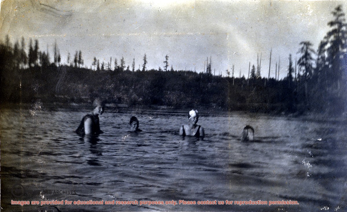
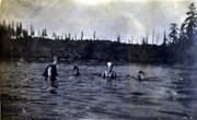
Meg Robertson, Margaret Middleton,and Dorothy Huck, all wearing bathing suits and caps in the lagoon beside the Robertson's home at Burnside in Whaletown. Rankin Robertson's feet are sticking up out of the water at the right.
Meg Robertson, Margaret Middleton,and Dorothy Huck, all wearing bathing suits and caps in the lagoon beside the Robertson's home at Burnside in Whaletown. Rankin Robertson's feet are sticking up out of the water at the right.
Series consists of one photograph album containing 329 black and white photographs with captions, dating from 1922 to 1924. The photographs depict Dorothy Huck, friends and family, on Cortes and in Saskatchewan. There are also some commercial photographs of the Rocky Mountains.
Edges of the cover are frayed; the first five, the eighth and the last four pages are broken along the fold and are loose. The photographs are glued onto the black cardboard pages and show signs of rippling, creasing, dirt and wear but most of the images are very clear. Some of the pictures are loose or missing.
Scope and Content
Series consists of one photograph album containing 329 black and white photographs with captions, dating from 1922 to 1924. The photographs depict Dorothy Huck, friends and family, on Cortes and in Saskatchewan. There are also some commercial photographs of the Rocky Mountains.
File contains a key map which was pasted on the front of the envelope indicating the areas researched for Files 12-16; notes on the titles; photocopies of Crown Grants and subsequent title information for:
BC Buildings Corp: 1982, Crown Grant for Block A of SW 1/4 of Sec. 25 (Highways Maintenance Yard)
District Lot 871 (40 acres between Carrington and Coulter Bays): to James Frederick McManus, 1919
To Ernest Henry Vaughn: 1922, Crown Grant for NE 1/4 and NW 1/4 of NE 1/4 of Sec. 24; SE 1/4 of SW 1/4 and SW 1/4 of SE 1/4 of Sec 31
Herbert Proctor: 1928 for fractional SW 1/4 of Sec. 41, bordering Tork Reserve; 159 acres for $159.00 (orig. Crown Grant to Herbert Proctor in 1922)
To William Cowan: 1937, E 1/2 of SE 1/4 of Sec. 26, 89 acres
(Files 12 through 16 are from the same envelope.)
File contains information for the following properties:
E. H. Vaughn: 1893, Crown Grant for fractional N 1/2 of Sec. 22; 90 acres for $90.00.
James P. Allen: 1913, Crown Grant for NW 34 acres of Sec. 23; $170.00
Bernard Robinson Allen: 1919, Crown Grant for SW 1/4 of Sec. 23, 159 acres
Charles Allen: 1912, Crown Grant for SW 1/4 of Sec. 33; 160 acres for $160.00
Harold Marshall Wood: Crown Grant for E 1/2 of NE 1/4 of Sec. 46 (east of Carrington Bay); 81 acres for $1.00.
File contains the following maps, stored in the Map Cabinet:
Subdivision Plan of parcel C & E, NW 1/4 of Sec. 21, 1976
Subdivision of the fractional NE 1/4 of Sec 21, 1966; with names of property owners penciled in
Subdivision Plan of Parcel C and part of Parcel E of fractional NE 1/4 of Sec. 21, 1975
Subdivision Plan of fractional NE 1/4 of Sec. 21 and W 1/2 of SW 1/4 of Sec. 34
(Files 17 through 19 are from the same envelope.)
File contains a page of notes, and photocopies of a tax sale notice (1938) and list of properties forfeited for non-payment of taxes, Crown Grants and other title information for the following:
William Walter James: 1926, Crown Grant for NW 1/4 of Sec. 38; 156 acres for $1.00; forfeited to Crown in 1939
Tom Albinson: 1919, Crown Grant for Lot 867; forfeited in 1927
Sadie McMurray: 1917, NE 1/4 of Sec. 39; 160 acres for $160
Peter Police: 1925, fractional NW 1/4 of Sec. 39; 103 acres for $1.00
(Files 12 through 16 are from the same envelope.)
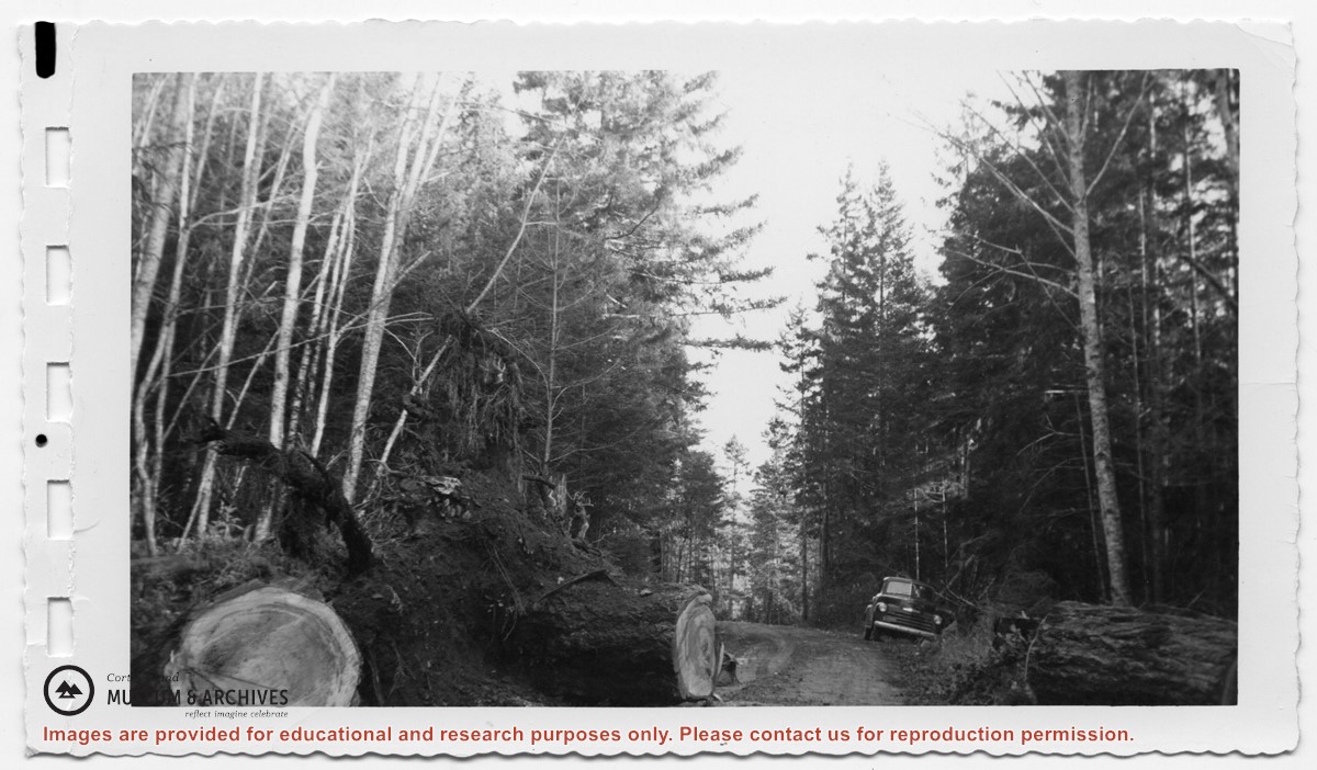
Truck parked to the side of the road at Clinic Hill in Whaletown; a large first-growth fir has fallen across the road and a section of the log has been cut out to clear the road
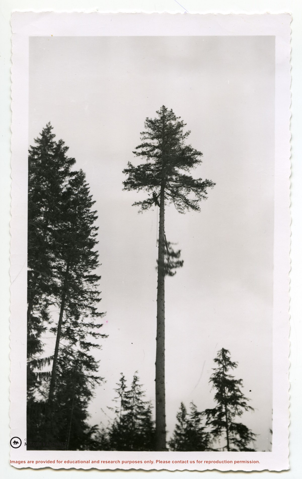
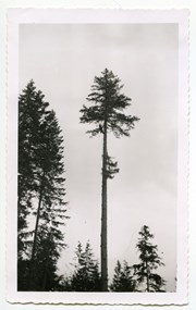
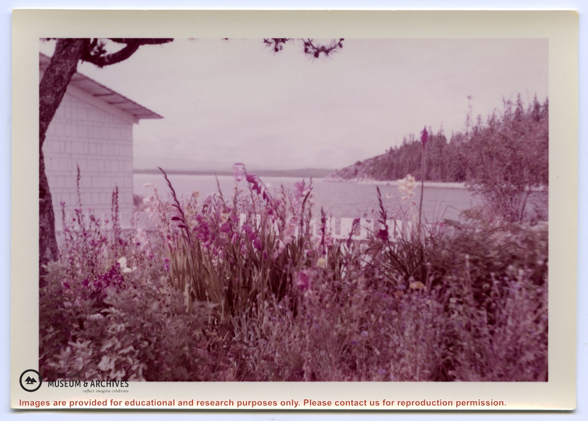
Binder contains interviews, stories and photographs documenting the social history of the Whaletown area. It was created as part of the Windows on Whaletown Exhibit, curated and mounted by Doreen Thompson.
Binder contains interviews, stories and photographs documenting the social history of the Whaletown area. It was created as part of the Windows on Whaletown Exhibit, curated and mounted by Doreen Thompson.