In the realm of "home movies", the film contains vignettes of Cortes island life including Aislinn Sirk and Mayan Wooley bathing a remarkably patient cat and Jim Palmer using an Alaska mill.
Digitized by Doug McCaffry, ScanLab, 2022
In the realm of "home movies", the film contains vignettes of Cortes island life including Aislinn Sirk and Mayan Wooley bathing a remarkably patient cat and Jim Palmer using an Alaska mill.
Digitized by Doug McCaffry, ScanLab, 2022
From the "Out of the Archives" program: "The diverse history of life on yet another island, Papua New Guinea, is revealed in this 40 minute feature documentary. Often wrongly portrayed as "primitive," George attempts to show that the Papuans are indeed modern in their culture and innovation as successfully brought them to the present. This documentary was shot in Mount Hagen, Papua New Guinea, in 1981. A hunting expedition is followed by rare candid footage of a celebratory "Sing-Sing". Permission to film these timeless momnts was acquired and gratefully acknowledged. Shot on Super 8 film with the assistance and perseverance of Isolde Rutheberg."
From the "Out of the Archives" program: "The diverse history of life on yet another island, Papua New Guinea, is revealed in this 40 minute feature documentary. Often wrongly portrayed as "primitive," George attempts to show that the Papuans are indeed modern in their culture and innovation as successfully brought them to the present. This documentary was shot in Mount Hagen, Papua New Guinea, in 1981. A hunting expedition is followed by rare candid footage of a celebratory "Sing-Sing". Permission to film these timeless momnts was acquired and gratefully acknowledged. Shot on Super 8 film with the assistance and perseverance of Isolde Rutheberg."
File contains a copy of the bylaw and map of 1995, a summary of the changes (meant to reconcile 25 year gap between the previous zoning bylaws and the current OCP), and a completion and adoption strategy.
File contains a copy of the bylaw and map of 1995, a summary of the changes (meant to reconcile 25 year gap between the previous zoning bylaws and the current OCP), and a completion and adoption strategy.
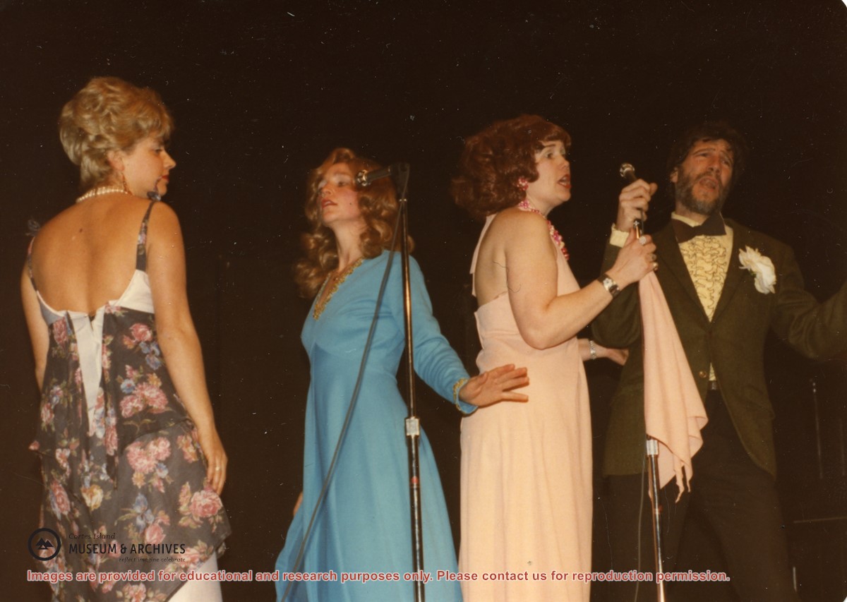
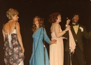
(L to R): Isolde Ruthenberg, Sheril Matthews, Gloria Jorg and Paul Kirmmse performing "Hit the Road Jack" at a Gorge Hall Variety Night. The name of the group was based on the doo-wop band Ray Charles and the Raylettes.
(L to R): Isolde Ruthenberg, Sheril Matthews, Gloria Jorg and Paul Kirmmse performing "Hit the Road Jack" at a Gorge Hall Variety Night. The name of the group was based on the doo-wop band Ray Charles and the Raylettes.
File contains title information and photocopies of land grants and subsequent conveyances for the following:
John Williams: 1914, Crown Grant for the fractional SW 1/4 of Sec 22 and fractional NW 1/4 of Sec 22 (east of Gorge Harbour entrance)
John Williams: 1914, Crown Grant for the fractional SW 1/4 of Sec 22 and frac. NW 1/4 of Sec 18 (west of the Gorge Harbour entrance)
File contains three oversize maps which are stored in the map cabinet: Map of Section 22, Plan VIP52378, Lots A,B,C (blueprint map; 85 cm x 54 cm, 1985); map of Plan 27966 (blueprint map; 55 cm x 43 cm, 1974); photocopy of map of fractional NW 1/4 Sec 17 (55 cm x 43 cm, 1973)
(Files 3 through 7 are from the same envelope.)
File contains a map key to the areas of Sections 17, 18, 19, 22 and 34 (south of Gorge Harbour) which were researched (Information in Files 3-7).
It contains photocopies of original land grants and subsequent conveyances for the following:
Reginald James Smith: 1946, Crown Grant 165414I for fractional SE 1/4 of Sec 23, 1946 (the Thunder Road subdivision at the eastern end of Gorge Harbour).
(Files 3 through 7 are from the same envelope.)
File contains a photocopied part of a map showing the locations of researched property in the Whaletown Lagoon and Whaletown Harbour area. The map is glued to an envelope which has a list of Crown grants and other conveyances on the back.
It contains photocopies of original land grants and other conveyances for the following:
Moses Ireland: 1893, Crown Grant for the W 1/2 of SW 1/4 of Sec 35 and W 1/2 of the SW 1/4 of Section 34
Joseph Youart: 1900, Crown Grant for Fractional NE 1/4 of Sec 35 (sold to Alice Robertson in 1908; "Burnside" is still in the Robertson family).
Nicholas Thompson: 1920, Crown Grant for the Fractional SW 1/4 of Sec 35
Charles Strange: 1914, Crown Grant for the NW 1/4 of Sec 35
File contains information for the following properties:
E. H. Vaughn: 1893, Crown Grant for fractional N 1/2 of Sec. 22; 90 acres for $90.00.
James P. Allen: 1913, Crown Grant for NW 34 acres of Sec. 23; $170.00
Bernard Robinson Allen: 1919, Crown Grant for SW 1/4 of Sec. 23, 159 acres
Charles Allen: 1912, Crown Grant for SW 1/4 of Sec. 33; 160 acres for $160.00
Harold Marshall Wood: Crown Grant for E 1/2 of NE 1/4 of Sec. 46 (east of Carrington Bay); 81 acres for $1.00.
File contains the following maps, stored in the Map Cabinet:
Subdivision Plan of parcel C & E, NW 1/4 of Sec. 21, 1976
Subdivision of the fractional NE 1/4 of Sec 21, 1966; with names of property owners penciled in
Subdivision Plan of Parcel C and part of Parcel E of fractional NE 1/4 of Sec. 21, 1975
Subdivision Plan of fractional NE 1/4 of Sec. 21 and W 1/2 of SW 1/4 of Sec. 34
(Files 17 through 19 are from the same envelope.)
File contains a coloured map with researched properties coloured in, and title information and photocopies of land grants and subsequent conveyances for the following:
Edward James Breeze: 1931, Crown Grant for District Lot 1373 (parts of Section 23 and Section 17, at the southeast end of Gorge Harbour by Anvil Lake)
Frank Harper: 1913, Crown Grant for the NE 96 acres of Section 23 (at the northeast end of Gorge Harbour)
(Files 3 through 7 are from the same envelope.)
File contains a photocopied section map of the northern part of Cortes Island (from just south of Gorge Harbour), coloured to indicate areas for which a Crown Grant was located and areas of ungranted Crown land which still appear to be owned by the government. Scale is 1 mile to 1 inch.
File contains a photocopied section map of the northern part of Cortes Island (from just south of Gorge Harbour), coloured to indicate areas for which a Crown Grant was located and areas of ungranted Crown land which still appear to be owned by the government. Scale is 1 mile to 1 inch.