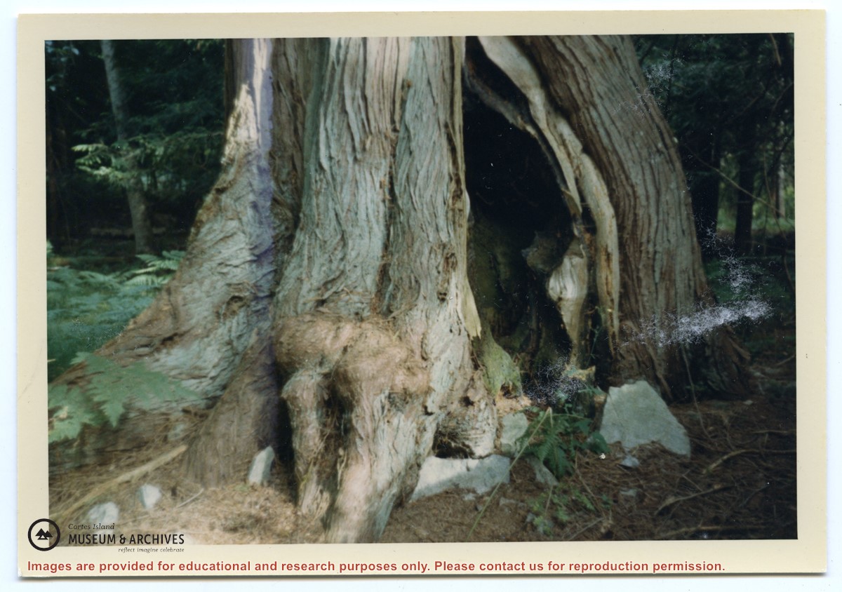
Photograph of what Gilean Douglas called the Indian tree. It was a large cedar tree which grew close to a rock face on the trail between the house and garden at Channel Rock. The bottom facing the rock face was burnt out and formed a natural hearth, where a fire could be built; the rocks would reflect the heat and the cedar branches would give protection from the rain, thus creating a space for people to keep warm and dry.
Photograph of what Gilean Douglas called the Indian tree. It was a large cedar tree which grew close to a rock face on the trail between the house and garden at Channel Rock. The bottom facing the rock face was burnt out and formed a natural hearth, where a fire could be built; the rocks would reflect the heat and the cedar branches would give protection from the rain, thus creating a space for people to keep warm and dry.
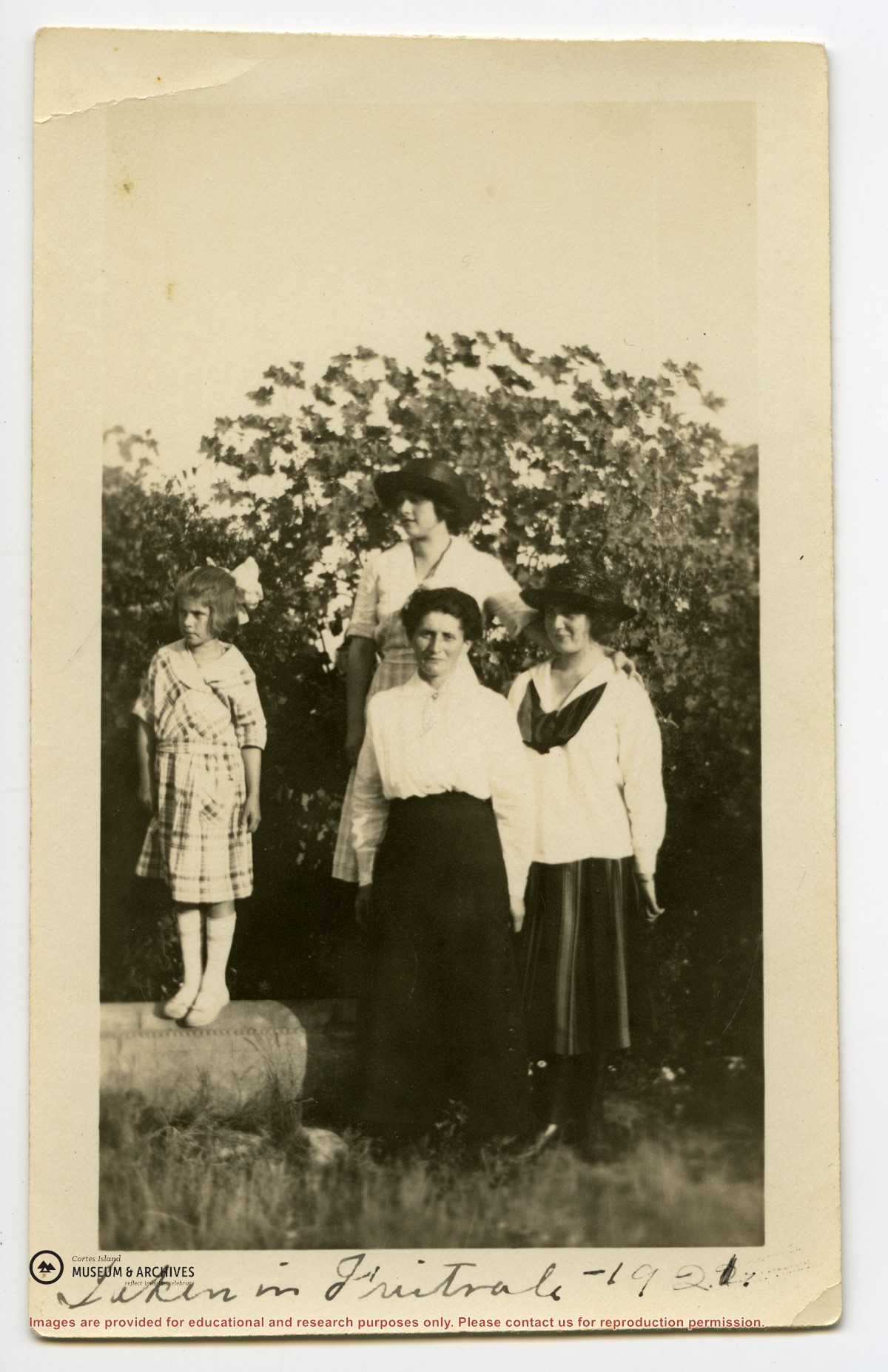
File contains May Ellingsen's notes on a project, sponsored by the Campbell River Museum, to find and preserve old photographs of the area. It also contains correspondence from Sue Hetherington on island settlement history.
File contains May Ellingsen's notes on a project, sponsored by the Campbell River Museum, to find and preserve old photographs of the area. It also contains correspondence from Sue Hetherington on island settlement history.
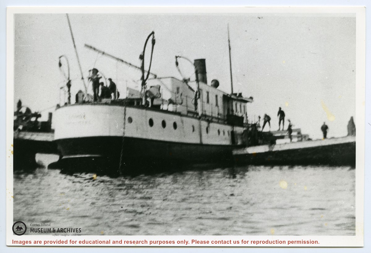
A description of the event may be found in “Whistle Up the Inlet,” by G.A. Rushton (J.J. Douglas Ltd., Vancouver BC,1974; p 50):
"Good teamwork in the handling of the ships by the Union Company’s marine department was evidenced when, on September 19, 1907, at 4:30 a.m., the Comox, running in a heavy fog, went aground on Cortez Island reef. All passengers were landed safely in small boats, then picked up by the Cassiar and taken to Heriot Bay for transfer to their destination aboard the Coquitlam. The Comox was pulled from her rocky perch at high water the following day and beached at Mansons, where a three-foot hole between the boiler and starboard bunker were patched. The vessel was towed back to Vancouver on September 22 by the tug Tartar.”
File contains records for a project undertaken by the St. James Ladies' Guild to mark and name put grave markers for all the plots in the Manson's Landing cemetery. Records are written one to a page on the back sides of a Canadian postal guide; some contain biographical information. Also included is a history of the cemetery and some correspondence.
File contains records for a project undertaken by the St. James Ladies' Guild to mark and name put grave markers for all the plots in the Manson's Landing cemetery. Records are written one to a page on the back sides of a Canadian postal guide; some contain biographical information. Also included is a history of the cemetery and some correspondence.
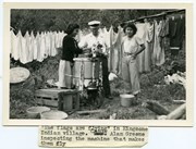
Photograph of Canon Alan Greene standing between two Kingcome village women, who are doing laundry with a wringer washing machine set up outside. Behind them a line of laundry is hanging on a clothesline.
Photograph of Canon Alan Greene standing between two Kingcome village women, who are doing laundry with a wringer washing machine set up outside. Behind them a line of laundry is hanging on a clothesline.
Coloured map of southwestern BC showing municipalities, geographical features, land and sea routes, natural resources, etc. The back of the map is fully printed with information about BC and suggested travel itineraries.
Map needs preservation: edges are frayed and there are several tears.
Coloured map of southwestern BC showing municipalities, geographical features, land and sea routes, natural resources, etc. The back of the map is fully printed with information about BC and suggested travel itineraries.
Map needs preservation: edges are frayed and there are several tears.
"Robina (Manson) Freeman's picture of baby Magnonie (Magnone?) (6 months old) of Union Bay, Vancouver Island. (Mother a girlhood friend when the Mike Manson family lived there.)
"Robina (Manson) Freeman's picture of baby Magnonie (Magnone?) (6 months old) of Union Bay, Vancouver Island. (Mother a girlhood friend when the Mike Manson family lived there.)

.jpg?width=1200&404=no-img.jpg&watermark=wmk)
.jpg?width=1200&404=no-img.jpg&watermark=wmk)
.jpg?width=180&404=no-img.jpg)


.jpg?width=1200&404=no-img.jpg&watermark=wmk)
.jpg?width=1200&404=no-img.jpg&watermark=wmk)
.jpg?width=180&404=no-img.jpg)