Info on Carrington Bay history and early settler homesteaders from late 1800s onward; scans from Whaletown to 1930 album; scan of location for Department of Energy, Mines and Resources, 1945; park brochure; clippings about Carrington from 1982-2014; excerpt from interview with Clarence and Etta Byers, 2001; notes from exhibit curation (labels, photo captions, etc); excerpts rom June Cameron's Destination Cortez; topographic map of Green Mountain; emails about exhibit; printed photographs for exhibit. Keywords: drowing, Island Timberland, Coulter Bay, stream keepers
Info on Carrington Bay history and early settler homesteaders from late 1800s onward; scans from Whaletown to 1930 album; scan of location for Department of Energy, Mines and Resources, 1945; park brochure; clippings about Carrington from 1982-2014; excerpt from interview with Clarence and Etta Byers, 2001; notes from exhibit curation (labels, photo captions, etc); excerpts rom June Cameron's Destination Cortez; topographic map of Green Mountain; emails about exhibit; printed photographs for exhibit. Keywords: drowing, Island Timberland, Coulter Bay, stream keepers
Information packets on the flaura, fauna, and marine life of Manson's Lagoon from CIMAS, Fred and Ruth Zwickel, Sierra Sullivan, and others, 1990-2007. Transcript from Ken Summers in conversation with Susan Ellingsen, Dianne Hentschel and Doreen Thompson, 2005.
Information packets on the flaura, fauna, and marine life of Manson's Lagoon from CIMAS, Fred and Ruth Zwickel, Sierra Sullivan, and others, 1990-2007. Transcript from Ken Summers in conversation with Susan Ellingsen, Dianne Hentschel and Doreen Thompson, 2005.
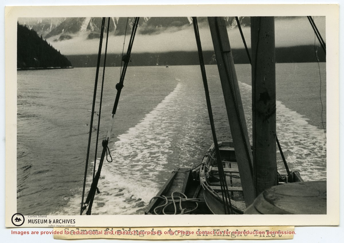
Photograph of a ship's wake taken from a boat stern, with the mountains of Knight Inlet in the background. Titled by Douglas: "Salmon fishing is tops in Knight Inlet."
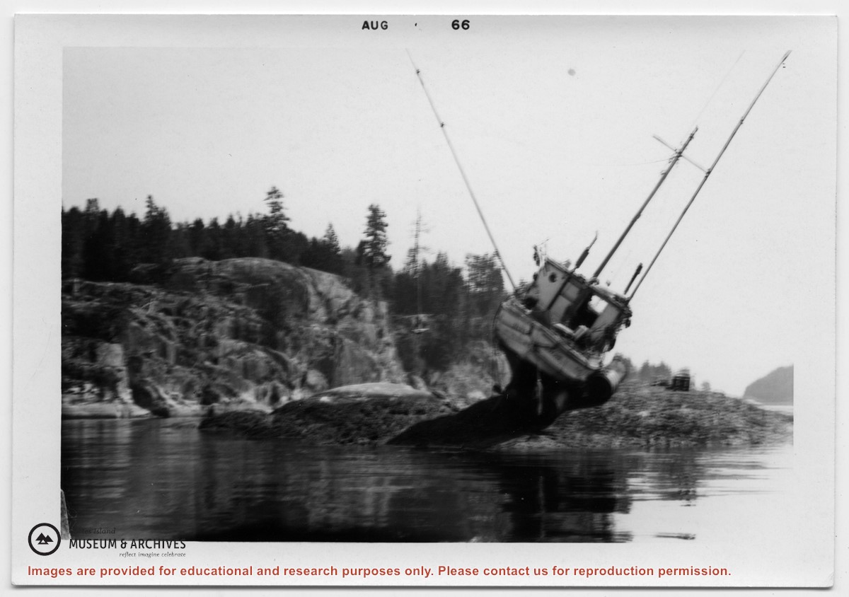
One of a series of photographs taken at Clarence and Doug Boardman's Dot Logging Co. camp in Knight Inlet.
3 photograph prints: b&w ; 15 x 10 cm, 21.5 x 16.5 cm & 25 x 20 cm
Scope and Content
Photograph of a ship's wake taken from a boat stern, with the mountains of Knight Inlet in the background. Titled by Douglas: "Salmon fishing is tops in Knight Inlet."
One of a series of photographs taken at Clarence and Doug Boardman's Dot Logging Co. camp in Knight Inlet.
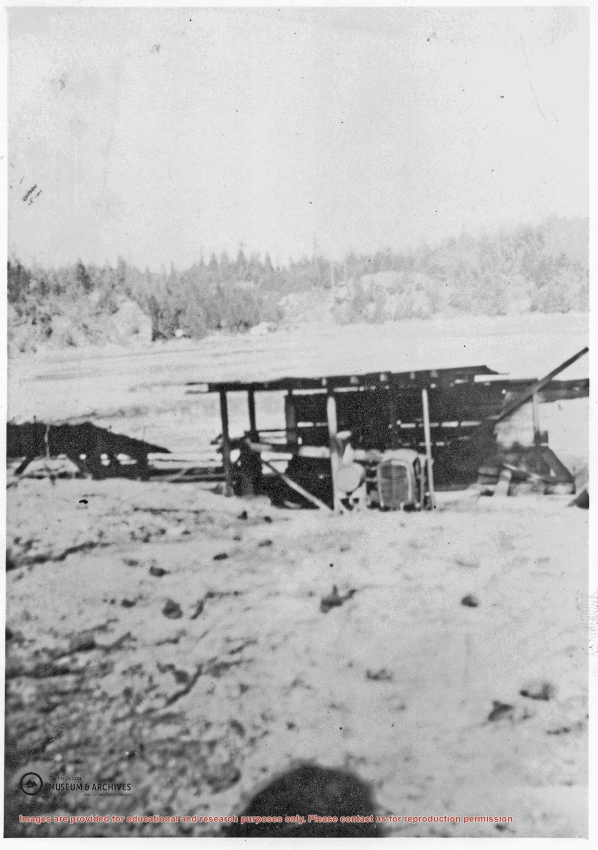
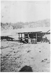
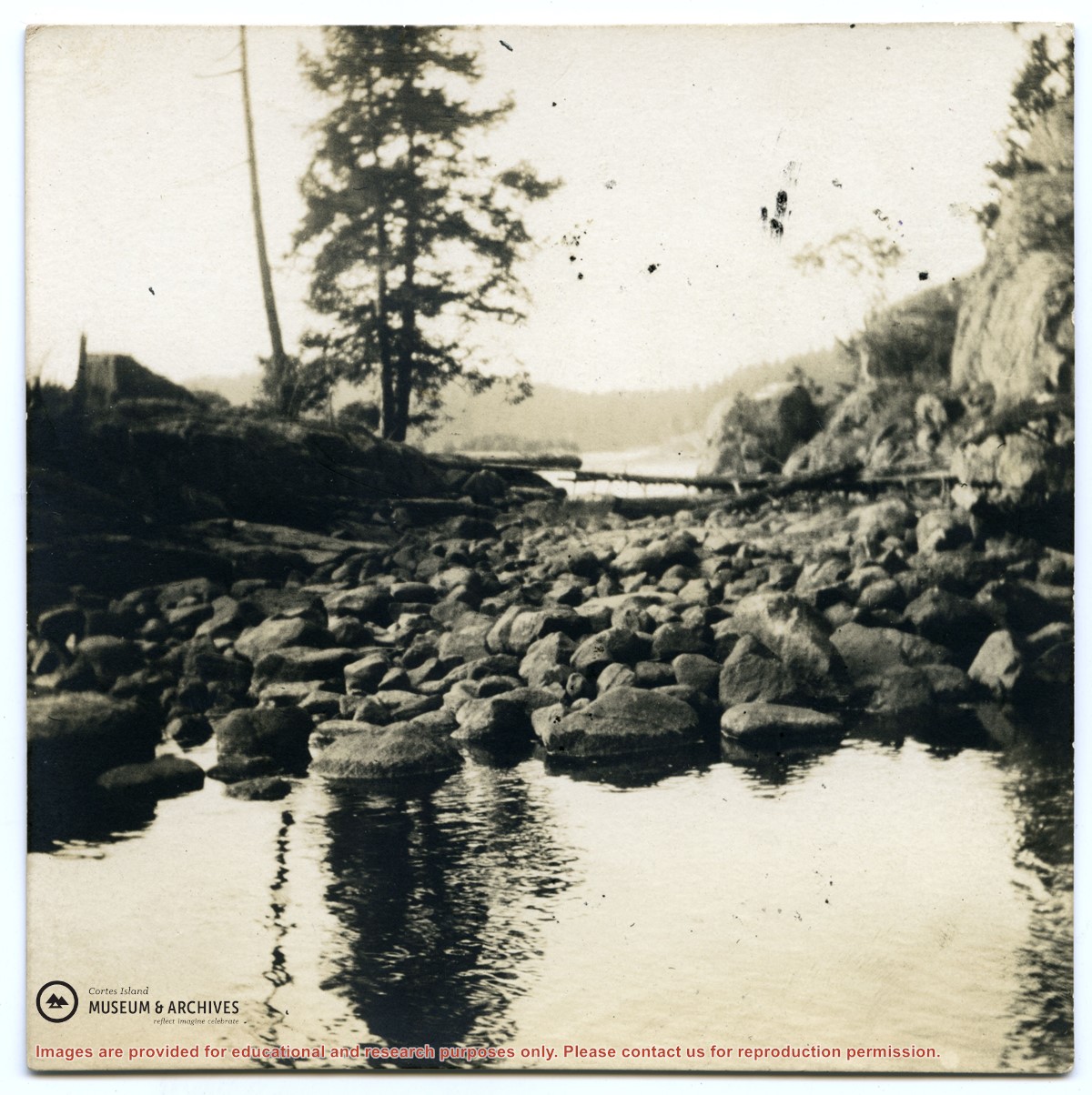
A small lumber mill which was located on the west side of Manson's Lagoon. Some ot the lumber cut with it was used to build the Manson's Landing store put up after Mr. Percy owned the property. Roland (Rollie) Woolsey worked there at the time.
A small lumber mill which was located on the west side of Manson's Lagoon. Some ot the lumber cut with it was used to build the Manson's Landing store put up after Mr. Percy owned the property. Roland (Rollie) Woolsey worked there at the time.
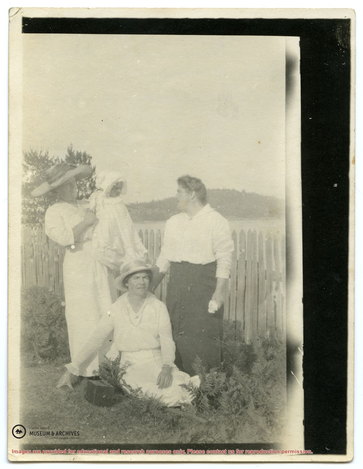
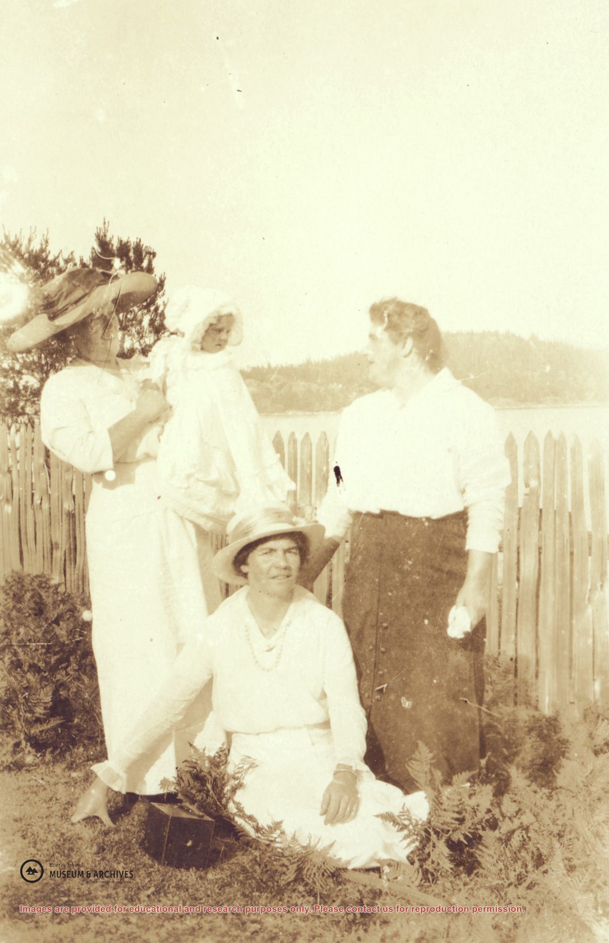
Left to right: Mrs. Frank Petznick, daughter Bernadette, Mrs. John (Margaret) Manson and Miss Katherine Lettice (seated) by a picket fence at Sunny Brae farm with Twin Islands in the background. (This picture is a duplicate of photograph 2004.002.073)
Left to right: Mrs. Frank Petznick, daughter Bernadette, Mrs. John (Margaret) Manson and Miss Katherine Lettice (seated) by a picket fence at Sunny Brae farm with Twin Islands in the background. (This picture is a duplicate of photograph 2004.002.073)
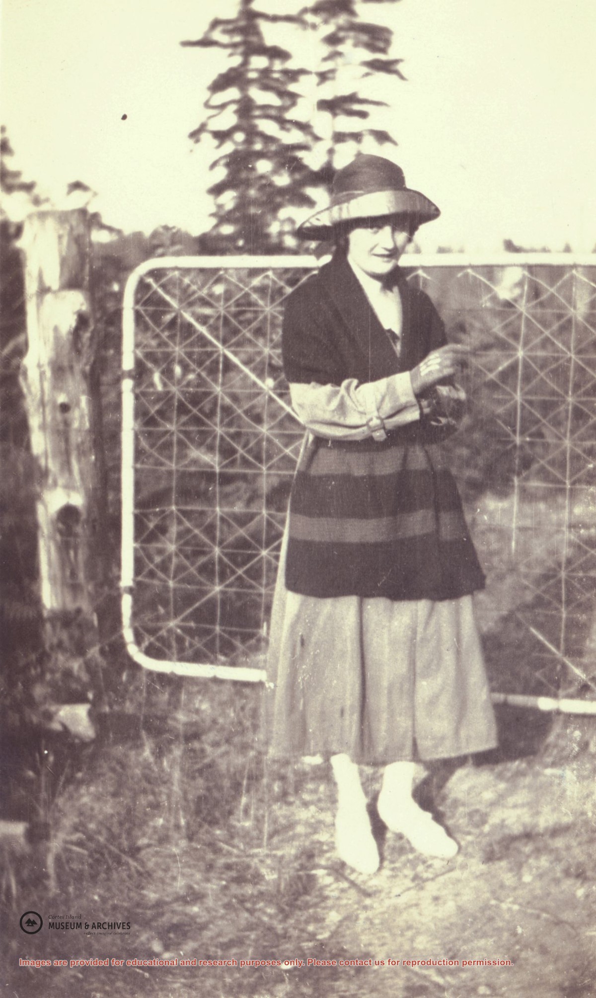
Marjorie Hayes in a long dress with puffed sleeves posing in front of the top gate at "Spit House", Manson's Lagoon.. (Photograph from the Hayes family.)
Marjorie Hayes in a long dress with puffed sleeves posing in front of the top gate at "Spit House", Manson's Lagoon.. (Photograph from the Hayes family.)
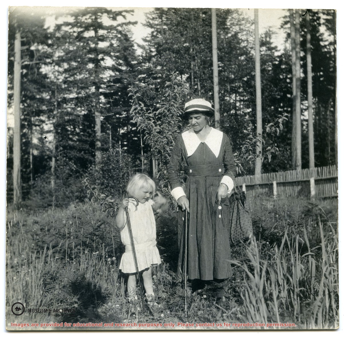
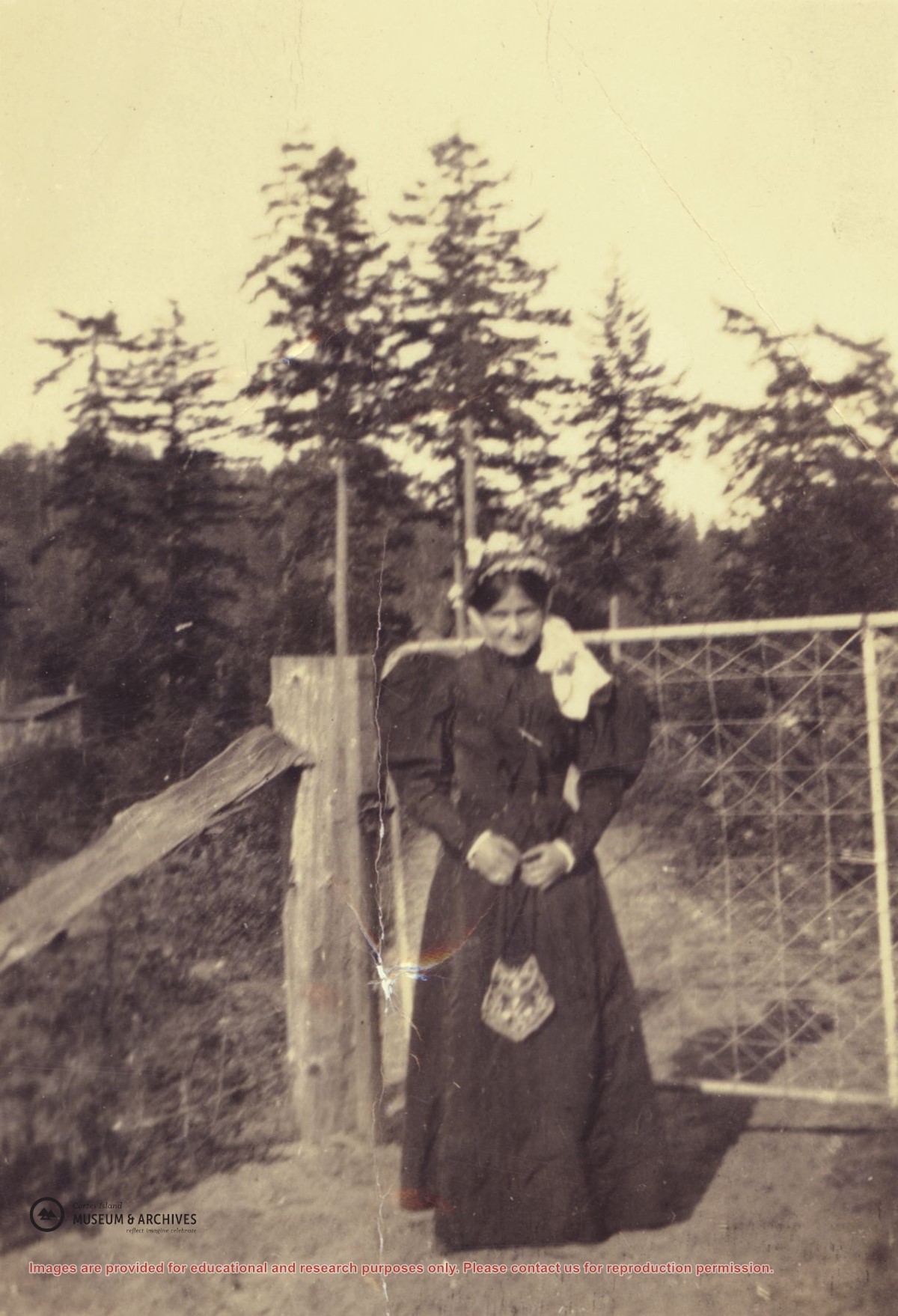
Myrtle (Nerine) Hayes standing in front of the top gate at "Spit House", Manson's Lagoon. When the Hayes family arrived on Cortes Island in 1917, they rented the "Big House", formerly the house of the Michael Manson family at Manson's Lagoon. The first Manson home, a cottage, was past the "Big House" towards the end of the sand spit. (Photograph from the Hayes family.)
Myrtle (Nerine) Hayes standing in front of the top gate at "Spit House", Manson's Lagoon. When the Hayes family arrived on Cortes Island in 1917, they rented the "Big House", formerly the house of the Michael Manson family at Manson's Lagoon. The first Manson home, a cottage, was past the "Big House" towards the end of the sand spit. (Photograph from the Hayes family.)
Left to right: Mrs. Frank Petznick, daughter Bernadette, Mrs. John (Margaret) Manson and Miss Katherine Lettice (seated) by a picket fence at Sunny Brae farm with Twin Islands in the background. (This picture is a duplicate of photograph #2004.002.016)
Left to right: Mrs. Frank Petznick, daughter Bernadette, Mrs. John (Margaret) Manson and Miss Katherine Lettice (seated) by a picket fence at Sunny Brae farm with Twin Islands in the background. (This picture is a duplicate of photograph #2004.002.016)
File contains a key map which was pasted on the front of the envelope indicating the areas researched for Files 12-16; notes on the titles; photocopies of Crown Grants and subsequent title information for:
BC Buildings Corp: 1982, Crown Grant for Block A of SW 1/4 of Sec. 25 (Highways Maintenance Yard)
District Lot 871 (40 acres between Carrington and Coulter Bays): to James Frederick McManus, 1919
To Ernest Henry Vaughn: 1922, Crown Grant for NE 1/4 and NW 1/4 of NE 1/4 of Sec. 24; SE 1/4 of SW 1/4 and SW 1/4 of SE 1/4 of Sec 31
Herbert Proctor: 1928 for fractional SW 1/4 of Sec. 41, bordering Tork Reserve; 159 acres for $159.00 (orig. Crown Grant to Herbert Proctor in 1922)
To William Cowan: 1937, E 1/2 of SE 1/4 of Sec. 26, 89 acres
(Files 12 through 16 are from the same envelope.)
File contains photocopies of original Crown Grants, subsequent title changes and maps for:
To Joseph Gregson: 1926, Crown Grant for fractional W 1/2 of Lot 899 and Lot 901 (between Coulter and Carrington Bays), with a water easement for Wailes
To John Nugent McIllree: 1957, Crown Grant of mineral rights to lots at Coulter Bay surveyed as the "Arrow" and "Bullseye" mineral claims
To Hilda Peterson: 1919, Crown Grant for Lot 878, Carrington Bay, 55 acres
(Files 12 through 16 are from the same envelope.)
File contains a page of notes, and photocopies of a tax sale notice (1938) and list of properties forfeited for non-payment of taxes, Crown Grants and other title information for the following:
William Walter James: 1926, Crown Grant for NW 1/4 of Sec. 38; 156 acres for $1.00; forfeited to Crown in 1939
Tom Albinson: 1919, Crown Grant for Lot 867; forfeited in 1927
Sadie McMurray: 1917, NE 1/4 of Sec. 39; 160 acres for $160
Peter Police: 1925, fractional NW 1/4 of Sec. 39; 103 acres for $1.00
(Files 12 through 16 are from the same envelope.)