Series consists of 80 photographs with typed explanatory captions, depicting scenes and activities relating to the Manson's Landing school, general scenes of Cortes Island, and James Nixon family of Twin Islands. Many of the the photographs have information written on their backs.
May Ellingsen compiled this album from photographs in the possession of the Manson family and wrote the explanatory captions. The photographs of Manson's school were taken by Katherine Lettice, the teacher at the time; photographs of Twin Islands were taken by the Nixon family, who lived there and were friends of the Manson family. Photographs were turned over to May by Rose or John Manson. Some photographs were in May's possession as her mother, Robina (Manson) Freeman, was a daughter of Michael Manson.
Scope and Content
Series consists of 80 photographs with typed explanatory captions, depicting scenes and activities relating to the Manson's Landing school, general scenes of Cortes Island, and James Nixon family of Twin Islands. Many of the the photographs have information written on their backs.
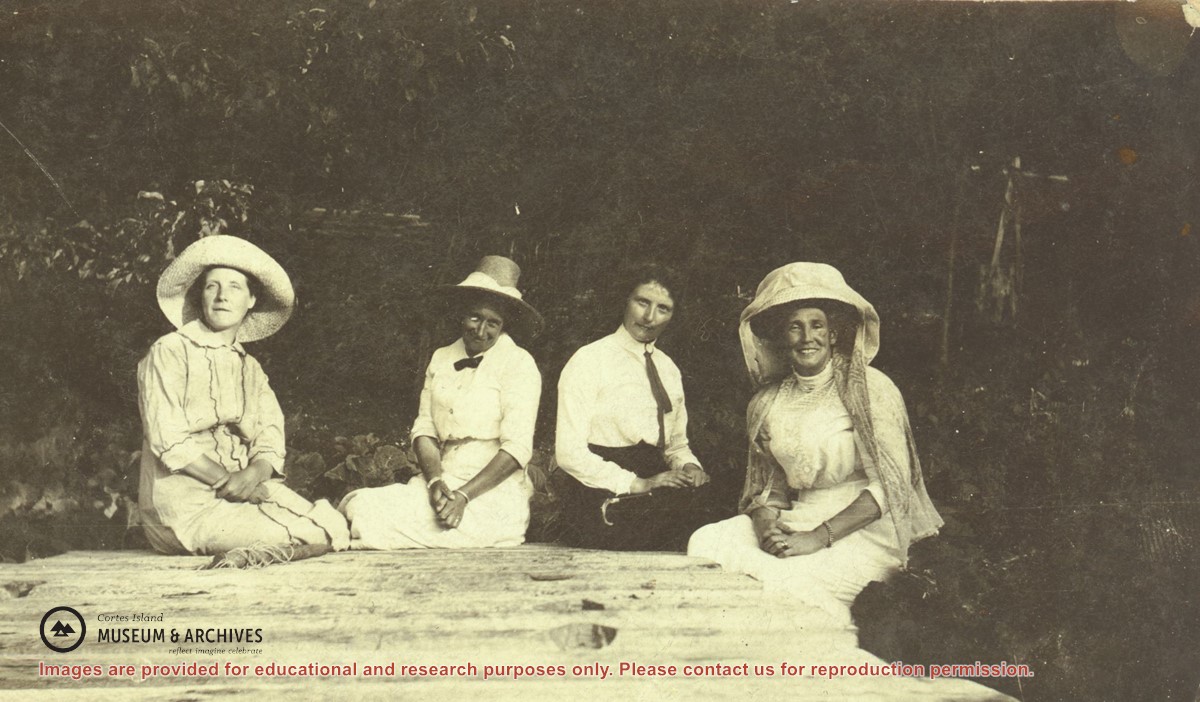
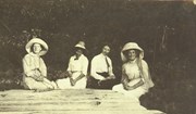
Left to right: Mrs. Frank Petznick, daughter Bernadette, Mrs. John (Margaret) Manson and Miss Katherine Lettice (seated) by a picket fence at Sunny Brae farm with Twin Islands in the background. (This picture is a duplicate of photograph 2004.002.073)
Left to right: Mrs. Frank Petznick, daughter Bernadette, Mrs. John (Margaret) Manson and Miss Katherine Lettice (seated) by a picket fence at Sunny Brae farm with Twin Islands in the background. (This picture is a duplicate of photograph 2004.002.073)
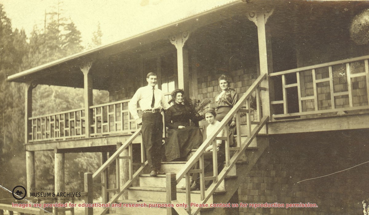
Mr. and Mrs. James A. Nixon (left), Mrs. John (Margaret) Manson and her daughter Anna (seated in front) on the steps of the new Nixon home on Twin Islands.
Mr. and Mrs. James A. Nixon (left), Mrs. John (Margaret) Manson and her daughter Anna (seated in front) on the steps of the new Nixon home on Twin Islands.
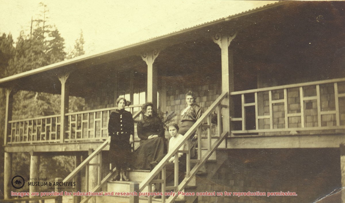
Rose Manson (left), Mrs. James A. Nixon, Mrs. John (Margaret) Manson, Anna Manson (seated in front) on the steps of the new Nixon home on Twin Islands.
This picture was taken at the same time as photograph #2002.002.055. Rose Manson has replaced Mr. James Nixon who is now taking the picture.
Rose Manson (left), Mrs. James A. Nixon, Mrs. John (Margaret) Manson, Anna Manson (seated in front) on the steps of the new Nixon home on Twin Islands.
This picture was taken at the same time as photograph #2002.002.055. Rose Manson has replaced Mr. James Nixon who is now taking the picture.
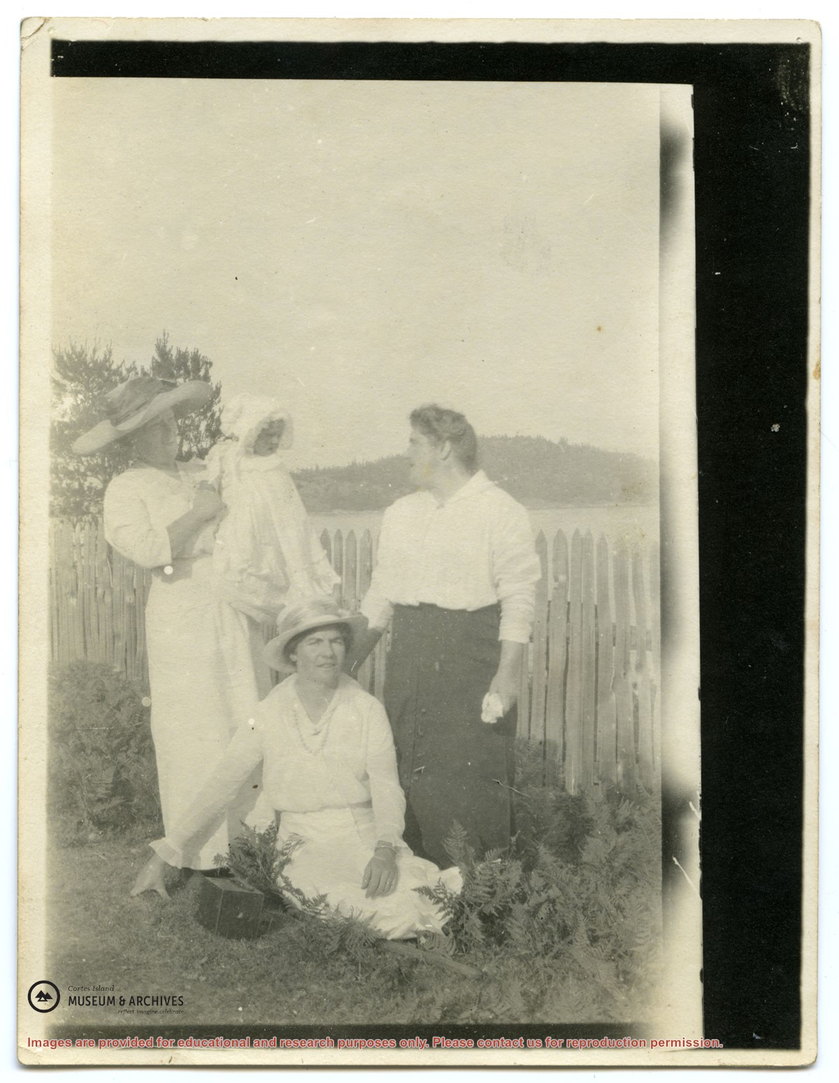
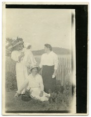
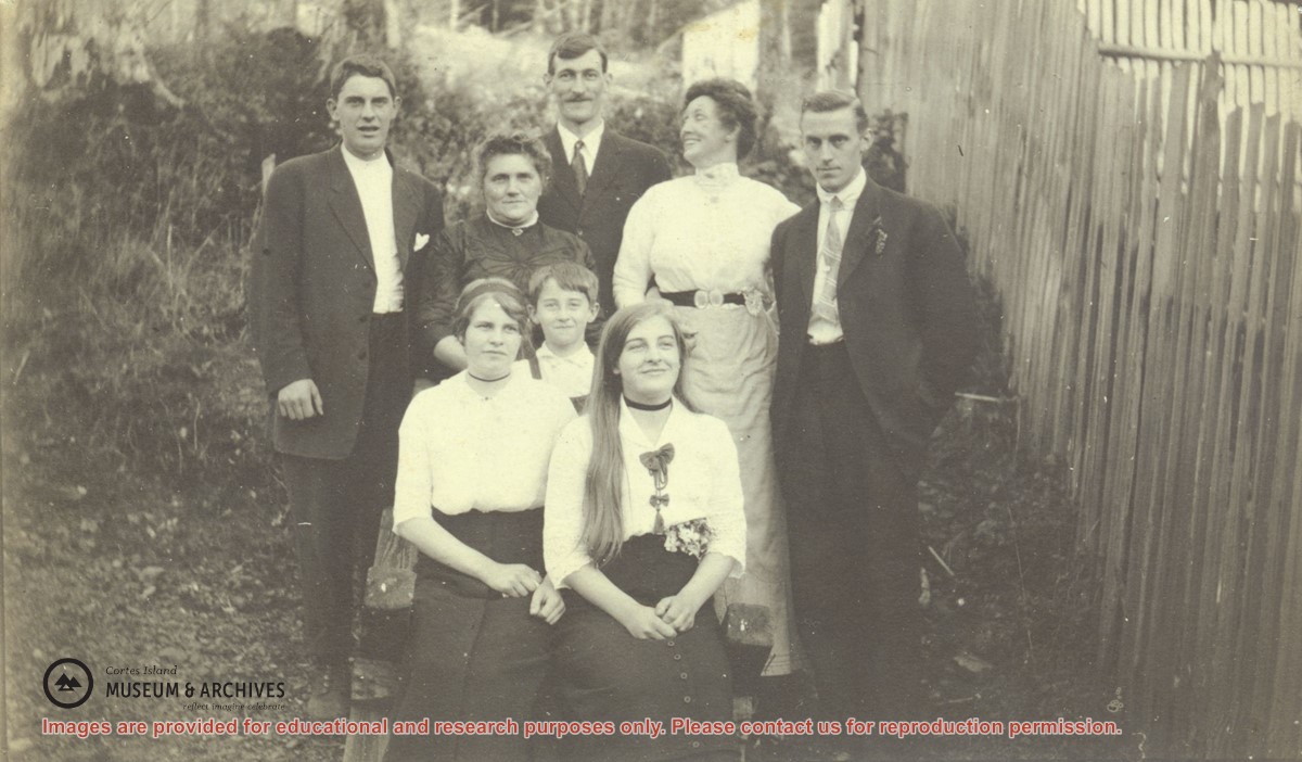
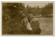
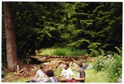
A group posing beside a picket fence on Twin Islands.
Back, left to right, Jack Manson, his mother Mrs. John (Margaret) Manson, Mr. and Mrs. James A. Nixon, and Bert Froud.
Front, left to right, Anna, Nicol, and Rose Manson.
A group posing beside a picket fence on Twin Islands.
Back, left to right, Jack Manson, his mother Mrs. John (Margaret) Manson, Mr. and Mrs. James A. Nixon, and Bert Froud.
Front, left to right, Anna, Nicol, and Rose Manson.
Left to right: Mrs. Frank Petznick, daughter Bernadette, Mrs. John (Margaret) Manson and Miss Katherine Lettice (seated) by a picket fence at Sunny Brae farm with Twin Islands in the background. (This picture is a duplicate of photograph #2004.002.016)
Left to right: Mrs. Frank Petznick, daughter Bernadette, Mrs. John (Margaret) Manson and Miss Katherine Lettice (seated) by a picket fence at Sunny Brae farm with Twin Islands in the background. (This picture is a duplicate of photograph #2004.002.016)
File contains a key map which was pasted on the front of the envelope indicating the areas researched for Files 12-16; notes on the titles; photocopies of Crown Grants and subsequent title information for:
BC Buildings Corp: 1982, Crown Grant for Block A of SW 1/4 of Sec. 25 (Highways Maintenance Yard)
District Lot 871 (40 acres between Carrington and Coulter Bays): to James Frederick McManus, 1919
To Ernest Henry Vaughn: 1922, Crown Grant for NE 1/4 and NW 1/4 of NE 1/4 of Sec. 24; SE 1/4 of SW 1/4 and SW 1/4 of SE 1/4 of Sec 31
Herbert Proctor: 1928 for fractional SW 1/4 of Sec. 41, bordering Tork Reserve; 159 acres for $159.00 (orig. Crown Grant to Herbert Proctor in 1922)
To William Cowan: 1937, E 1/2 of SE 1/4 of Sec. 26, 89 acres
(Files 12 through 16 are from the same envelope.)
File contains photocopies of original Crown Grants, subsequent title changes and maps for:
To Joseph Gregson: 1926, Crown Grant for fractional W 1/2 of Lot 899 and Lot 901 (between Coulter and Carrington Bays), with a water easement for Wailes
To John Nugent McIllree: 1957, Crown Grant of mineral rights to lots at Coulter Bay surveyed as the "Arrow" and "Bullseye" mineral claims
To Hilda Peterson: 1919, Crown Grant for Lot 878, Carrington Bay, 55 acres
(Files 12 through 16 are from the same envelope.)
File contains a page of notes, and photocopies of a tax sale notice (1938) and list of properties forfeited for non-payment of taxes, Crown Grants and other title information for the following:
William Walter James: 1926, Crown Grant for NW 1/4 of Sec. 38; 156 acres for $1.00; forfeited to Crown in 1939
Tom Albinson: 1919, Crown Grant for Lot 867; forfeited in 1927
Sadie McMurray: 1917, NE 1/4 of Sec. 39; 160 acres for $160
Peter Police: 1925, fractional NW 1/4 of Sec. 39; 103 acres for $1.00
(Files 12 through 16 are from the same envelope.)
John Manson (1868-1959) was born in the Shetland Islands and migrated to British Columbia in 1887, where he joined his brother Michael Manson on Cortes Island. He married Margaret Ellen Smith in 1894 and they had four children: Jack (born 1896), Anna (1898), Rose (1900) and Nicol (1906). The family lived at Sunny Brae Farm, on the south-east side of Cortes, across from Twin Islands.
Custodial History
Most of the files in this series were in an old wooden box when transferred to the archives, suggesting that they were collected from John Manson's house as a unit.
Scope and Content
Series consists of records created by John Manson of Sunny Brae farm, including legal documents, financial records, correspondence and ephemera.
File consists of the agreement between the Whaletown Women's Institute and the Columbia Coast Mission regarding the use and upkeep of the Church Hall and cemetery at the corner of present-day Carrington Bay and Harbour Rd. in Whaletown.
File consists of the agreement between the Whaletown Women's Institute and the Columbia Coast Mission regarding the use and upkeep of the Church Hall and cemetery at the corner of present-day Carrington Bay and Harbour Rd. in Whaletown.
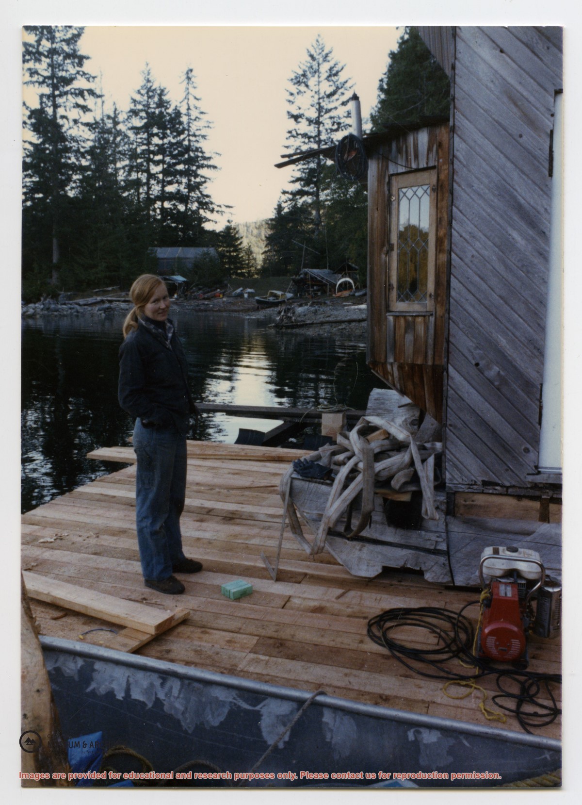
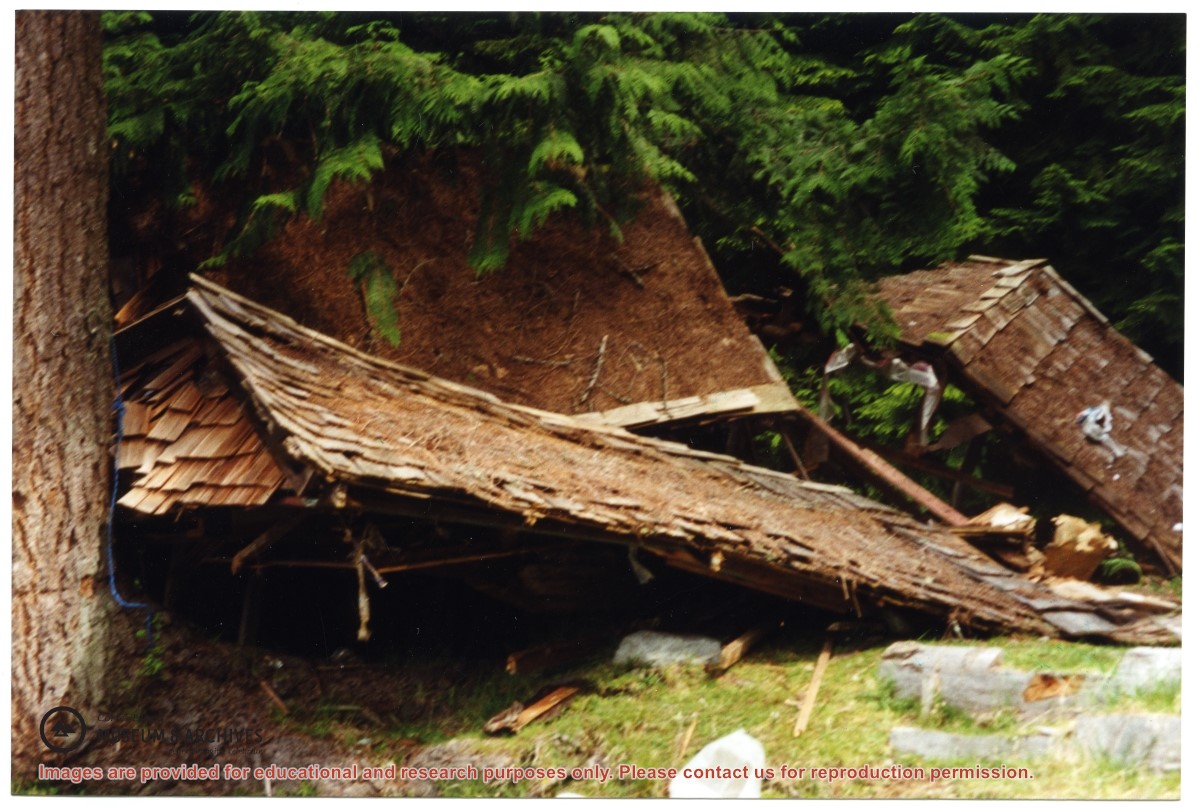
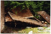
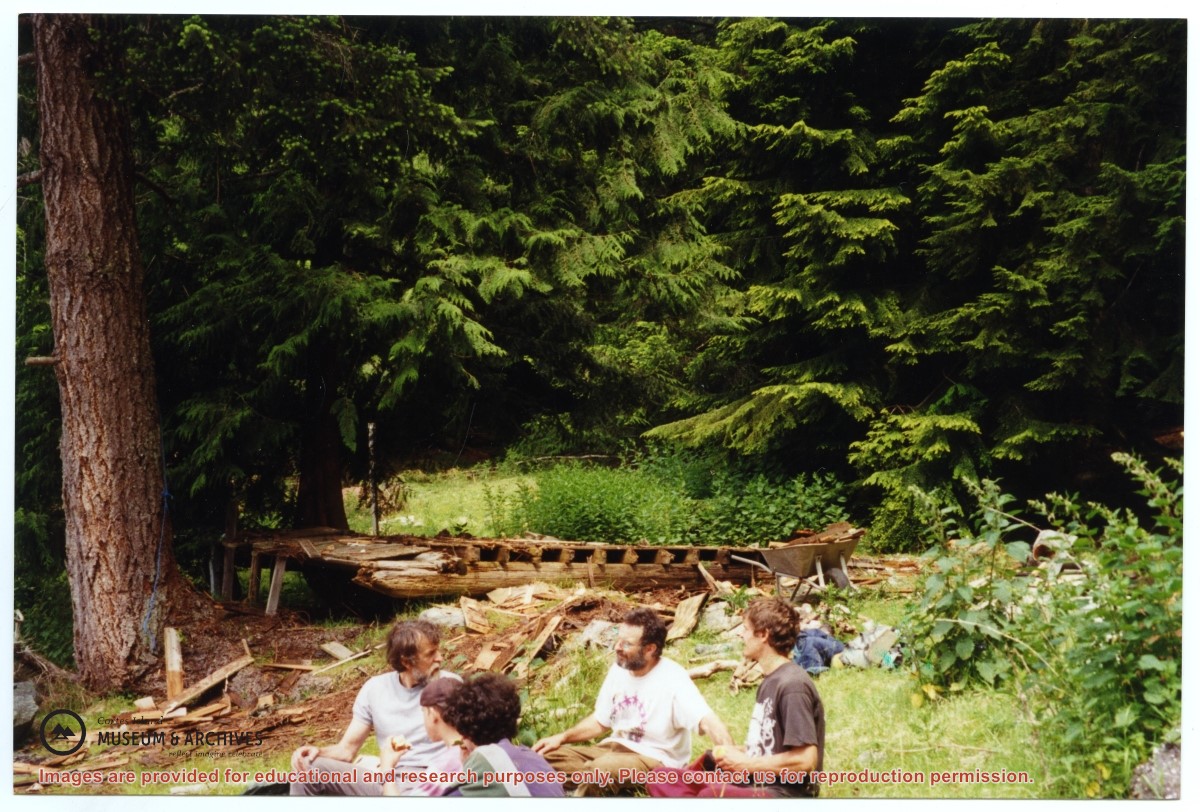
One of a series of photographs of volunteers removing the remains of shacks at Carrington Bay when Carrington Bay Marine Park was established.
L to R: Kiyoshi Kosky, Pierre DeTrey, Cedar DeTrey
One of a series of photographs of volunteers removing the remains of shacks at Carrington Bay when Carrington Bay Marine Park was established.
L to R: Kiyoshi Kosky, Pierre DeTrey, Cedar DeTrey