Photograph of Emmeline Pickles and her children at Smelt Bay, with the O'Donnell's boat house in the background. (From an envelope "May Ellingsen photos Manson's Landing")
Photograph of Emmeline Pickles and her children at Smelt Bay, with the O'Donnell's boat house in the background. (From an envelope "May Ellingsen photos Manson's Landing")
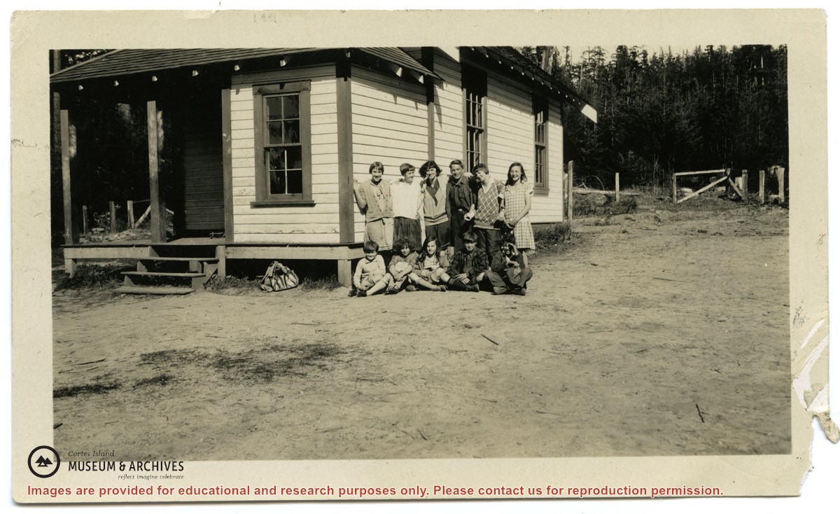
Photographs depict the pupils at the second Whaletown school standing beside the school. The photograph was taken by Evelyn Dow, who taught there from February 1928 to June 1929. This school was built in 1918 near the corner of Coulter Bay Road and Carrington Bay Road, and was used (with improvements) until 1950. The front, side and surroundings of the school are clearly shown.
Front row third from left is Marion Borden; Vernon Borden next to her fourth from left.
Top row, far right: Lorna Borden
(IDs by Terrill Marlow, Marion’s daughter, and Rob Borden, Vernon’s son).
Photographs are from an album created by Evelyn Dow and were donated to CIMAS by her niece, Sharon Thomas.
Scope and Content
Photographs depict the pupils at the second Whaletown school standing beside the school. The photograph was taken by Evelyn Dow, who taught there from February 1928 to June 1929. This school was built in 1918 near the corner of Coulter Bay Road and Carrington Bay Road, and was used (with improvements) until 1950. The front, side and surroundings of the school are clearly shown.
Front row third from left is Marion Borden; Vernon Borden next to her fourth from left.
Top row, far right: Lorna Borden
(IDs by Terrill Marlow, Marion’s daughter, and Rob Borden, Vernon’s son).
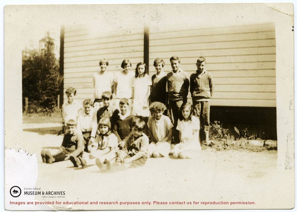
Photograph depicts the pupils at the second Whaletown school beside the corner of the school. The photograph was taken by Evelyn Dow, who taught there from February 1928 to June 1929. This school was built in 1918 near the corner of Coulter Bay Road and Carrington Bay Road, and was used (with improvements) until 1950.
Top Row: third from left, Lorna Borden; second from right, Doris Houghton-Brown
Middle row: second from left, Ken Houghton-Brown, third from left, Vernon Borden; far right, Marion Borden
Front row: far right, Claude Borden
(IDs by Terrill Marlow, Marion’s daughter, Rob Borden, Vernon’s son, and Joan Bevington, Ken Houghton-Brown's daughter).
Photograph is from an album created by Evelyn Dow and was donated to CIMAS by her niece, Sharon Thomas.
Scope and Content
Photograph depicts the pupils at the second Whaletown school beside the corner of the school. The photograph was taken by Evelyn Dow, who taught there from February 1928 to June 1929. This school was built in 1918 near the corner of Coulter Bay Road and Carrington Bay Road, and was used (with improvements) until 1950.
Top Row: third from left, Lorna Borden; second from right, Doris Houghton-Brown
Middle row: second from left, Ken Houghton-Brown, third from left, Vernon Borden; far right, Marion Borden
Front row: far right, Claude Borden
(IDs by Terrill Marlow, Marion’s daughter, Rob Borden, Vernon’s son, and Joan Bevington, Ken Houghton-Brown's daughter).
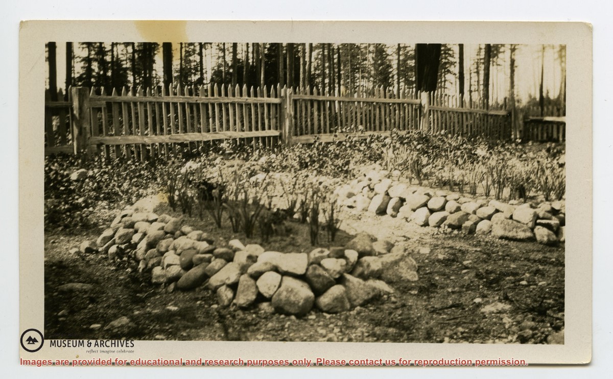
File consists of twenty pages of notes, lists, and handwritten letters relating to the Whaletown Women's Institutes 1952 Cemetery Project to clean up the old Whaletown cemetery at the corner of Carrington Bay & Harbour Rds. and replace grave markers.
File consists of twenty pages of notes, lists, and handwritten letters relating to the Whaletown Women's Institutes 1952 Cemetery Project to clean up the old Whaletown cemetery at the corner of Carrington Bay & Harbour Rds. and replace grave markers.
File contains information for the following properties:
E. H. Vaughn: 1893, Crown Grant for fractional N 1/2 of Sec. 22; 90 acres for $90.00.
James P. Allen: 1913, Crown Grant for NW 34 acres of Sec. 23; $170.00
Bernard Robinson Allen: 1919, Crown Grant for SW 1/4 of Sec. 23, 159 acres
Charles Allen: 1912, Crown Grant for SW 1/4 of Sec. 33; 160 acres for $160.00
Harold Marshall Wood: Crown Grant for E 1/2 of NE 1/4 of Sec. 46 (east of Carrington Bay); 81 acres for $1.00.
File contains the following maps, stored in the Map Cabinet:
Subdivision Plan of parcel C & E, NW 1/4 of Sec. 21, 1976
Subdivision of the fractional NE 1/4 of Sec 21, 1966; with names of property owners penciled in
Subdivision Plan of Parcel C and part of Parcel E of fractional NE 1/4 of Sec. 21, 1975
Subdivision Plan of fractional NE 1/4 of Sec. 21 and W 1/2 of SW 1/4 of Sec. 34
(Files 17 through 19 are from the same envelope.)
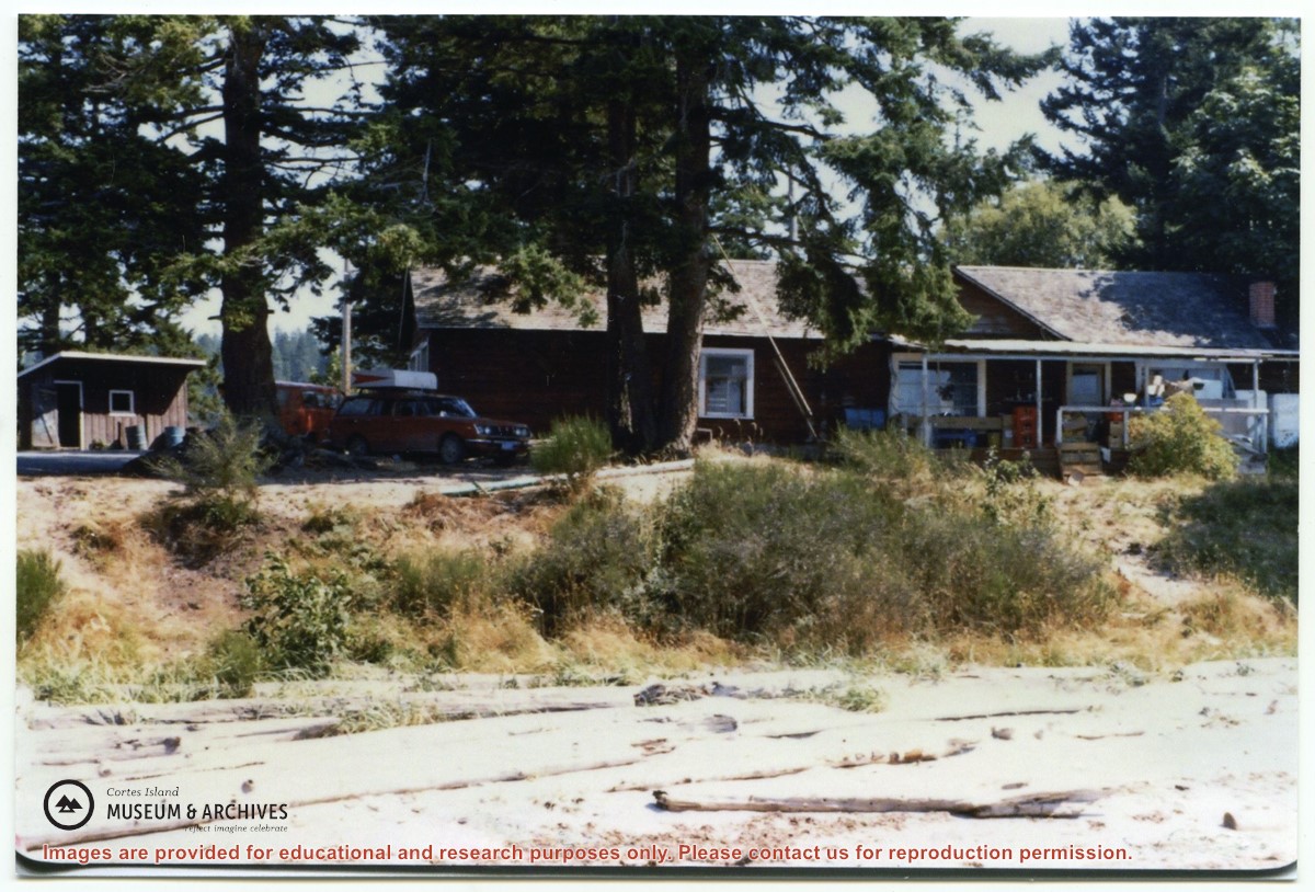
Binder contains interviews, stories, clippings and photographs documenting the social history of the Coulter Bay and Carrington Bay areas. It was created as part of the Windows on Whaletown Exhibit, curated and mounted by Doreen Thompson.
Binder contains interviews, stories, clippings and photographs documenting the social history of the Coulter Bay and Carrington Bay areas. It was created as part of the Windows on Whaletown Exhibit, curated and mounted by Doreen Thompson.
Binder contains interviews, stories, clippings and photographs documenting the social history of the Green Valley/Bluejay Lake area. It was created as part of the Windows on Whaletown Exhibit, curated and mounted by Doreen Thompson.
Binder contains interviews, stories, clippings and photographs documenting the social history of the Green Valley/Bluejay Lake area. It was created as part of the Windows on Whaletown Exhibit, curated and mounted by Doreen Thompson.
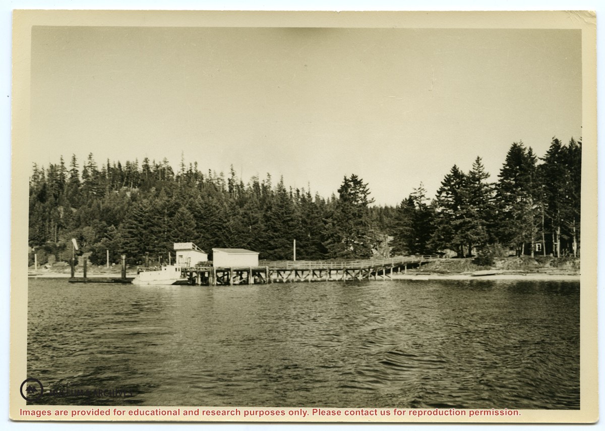
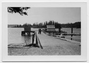
Photograph of the Manson's Landing wharf, taken from the water at high tide. It includes the oil and wharf sheds on the dock, an unknown scow boat with cabin at the float and the store ashore. Note: telephone poles from the original phone line across the mouth of the lagoon; higher banks along the shoreline.
Photograph of the Manson's Landing wharf, taken from the water at high tide. It includes the oil and wharf sheds on the dock, an unknown scow boat with cabin at the float and the store ashore. Note: telephone poles from the original phone line across the mouth of the lagoon; higher banks along the shoreline.
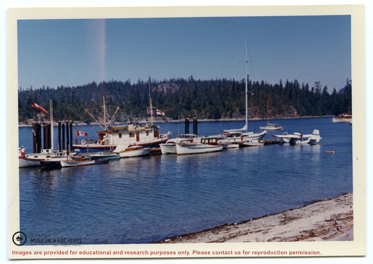
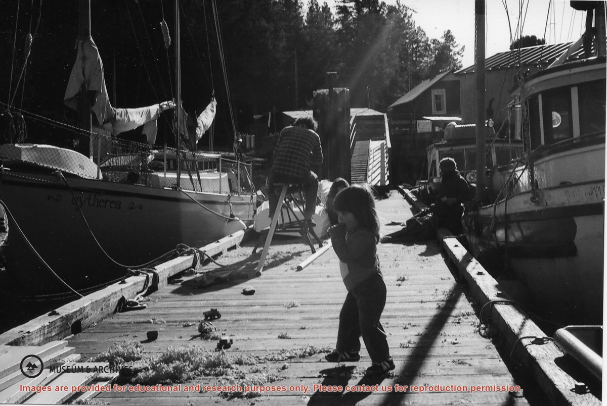
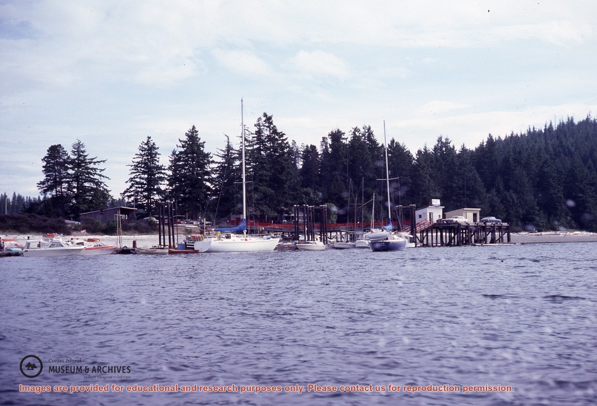
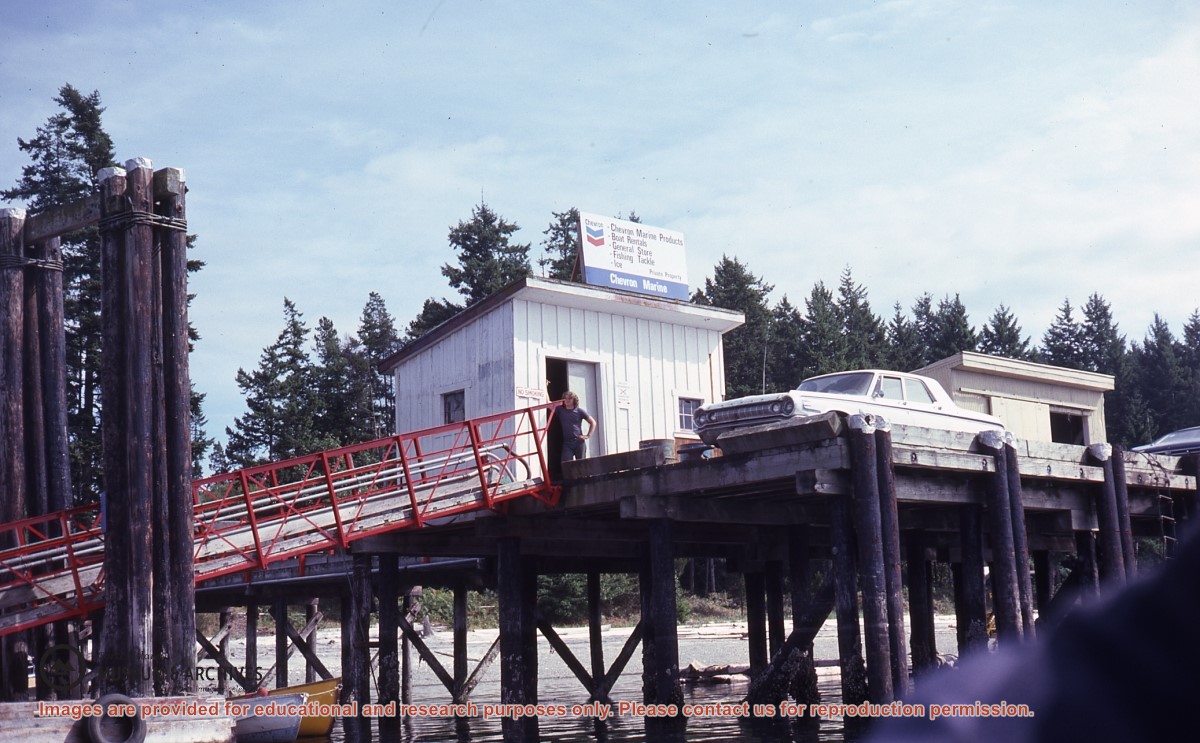
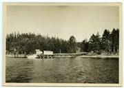
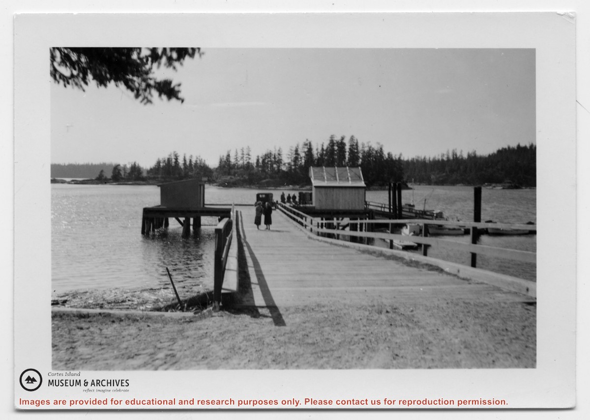
Photograph of Manson's Landing wharf, with Cat and Kitten Islands in the bacckground. Their are two sheds at the end of the dock above the ramp, and an old car is parked beside them. (date?)
Photograph of Manson's Landing wharf, with Cat and Kitten Islands in the bacckground. Their are two sheds at the end of the dock above the ramp, and an old car is parked beside them. (date?)
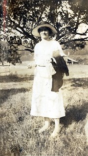
Photograph of Marion Cafferata standing in a clearing in front of a spreading tree. Fields, fences and a building can be seen in the background. The Cafferata family had a homestead at the present-day junction of Carrington Bay Rd. and the old road to Carrington Bay.
Photograph of Marion Cafferata standing in a clearing in front of a spreading tree. Fields, fences and a building can be seen in the background. The Cafferata family had a homestead at the present-day junction of Carrington Bay Rd. and the old road to Carrington Bay.
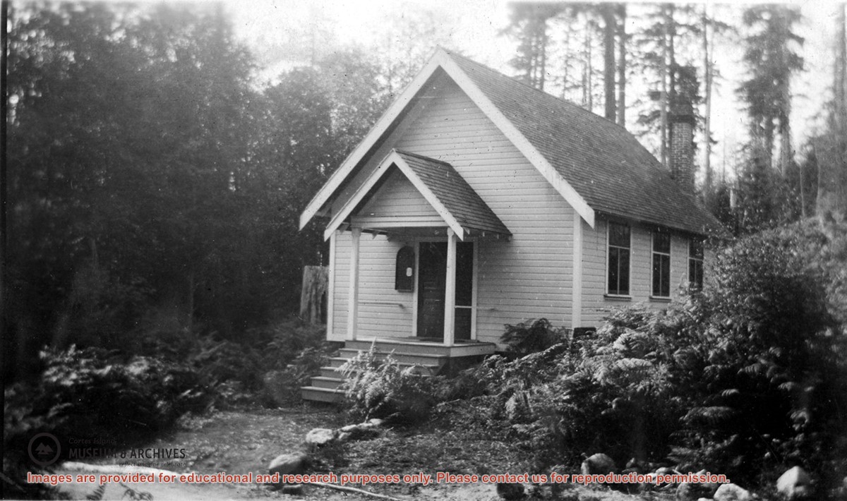
Photograph of the Church Hall in Whaletown, which stood in front of the old cemetery at the corner of Carrington Bay and Harbour roads. It served the community as both church and a venue for social events for almost forty years. The original Whaletown school became its kitchen, and a sleeping place for tired children.
Photograph of the Church Hall in Whaletown, which stood in front of the old cemetery at the corner of Carrington Bay and Harbour roads. It served the community as both church and a venue for social events for almost forty years. The original Whaletown school became its kitchen, and a sleeping place for tired children.
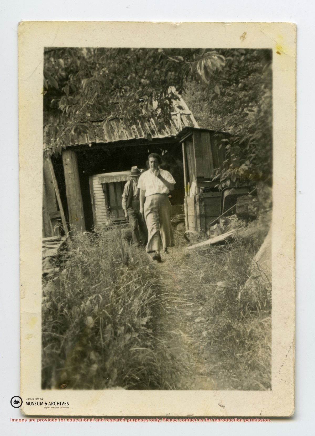
Photograph of Emmeline Pickles and two others, labelled on the back "Mrs. Pickles, Dad and I". From an envelope "May Ellingsen photos Manson's Landing")
Photograph of Emmeline Pickles and two others, labelled on the back "Mrs. Pickles, Dad and I". From an envelope "May Ellingsen photos Manson's Landing")
.jpg?width=1200&404=no-img.jpg&watermark=wmk)
.jpg?width=1200&404=no-img.jpg&watermark=wmk)
.jpg?width=180&404=no-img.jpg)


.jpg?width=1200&404=no-img.jpg&watermark=wmk)
.jpg?width=1200&404=no-img.jpg&watermark=wmk)
.jpg?width=180&404=no-img.jpg)