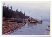
Photograph is labelled on the back: "Tiber Bay. The last of the Cat logging, with the tug "General Caldwell, skipper John Charltown, taking out 2 ections of fir." (From a group of photographs labelled "Frank Tooker photos").
Photograph is labelled on the back: "Tiber Bay. The last of the Cat logging, with the tug "General Caldwell, skipper John Charltown, taking out 2 ections of fir." (From a group of photographs labelled "Frank Tooker photos").
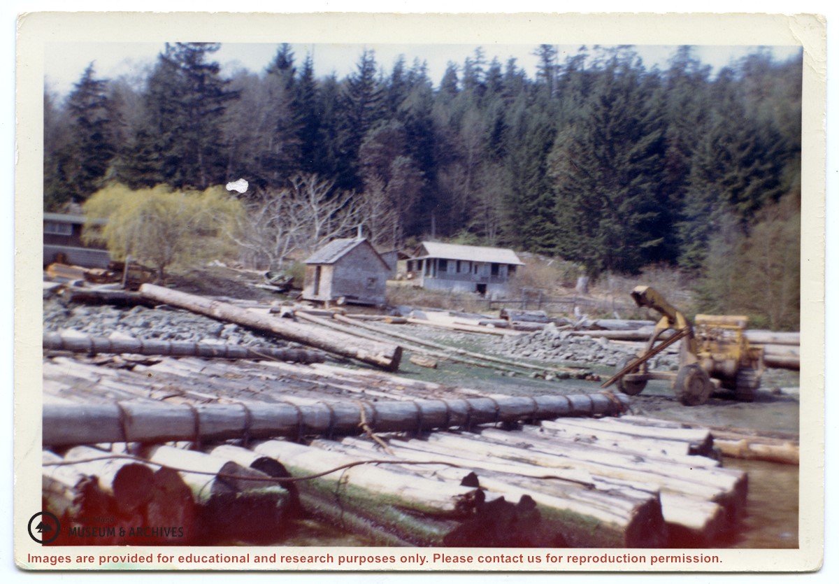
Photograph of a D8 Cat beside a log raft on the beach at Tiber Bay. A house is on the shore, along with a logging trailer and shed. Labelled on the back: "Tiber Bay. The selling out of Tooker Logging at Tiber Bay, loading of machinery." (From a group of photographs labelled "Frank Tooker photos").
Photograph of a D8 Cat beside a log raft on the beach at Tiber Bay. A house is on the shore, along with a logging trailer and shed. Labelled on the back: "Tiber Bay. The selling out of Tooker Logging at Tiber Bay, loading of machinery." (From a group of photographs labelled "Frank Tooker photos").
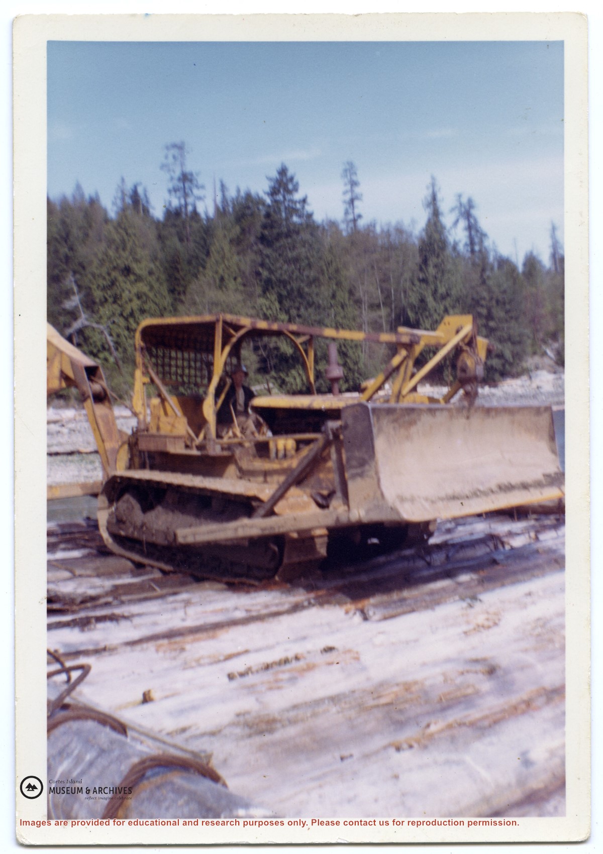
"Fred's cat, 1969" on verso.
Fred Reedel was skidding into Strange's Bay in 1969 with this beautiful 40 foot long, 6 foot diameter fir log in the arch.
"Fred's cat, 1969" on verso.
Fred Reedel was skidding into Strange's Bay in 1969 with this beautiful 40 foot long, 6 foot diameter fir log in the arch.
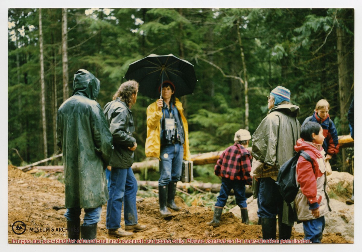
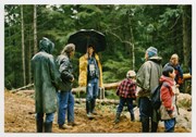
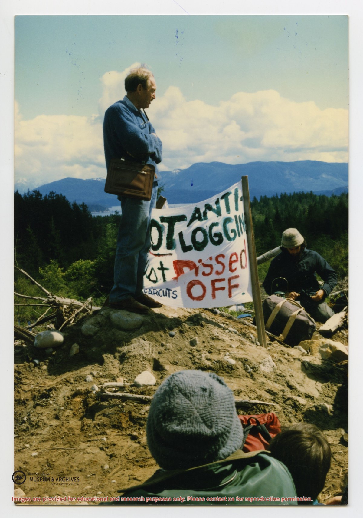
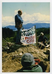
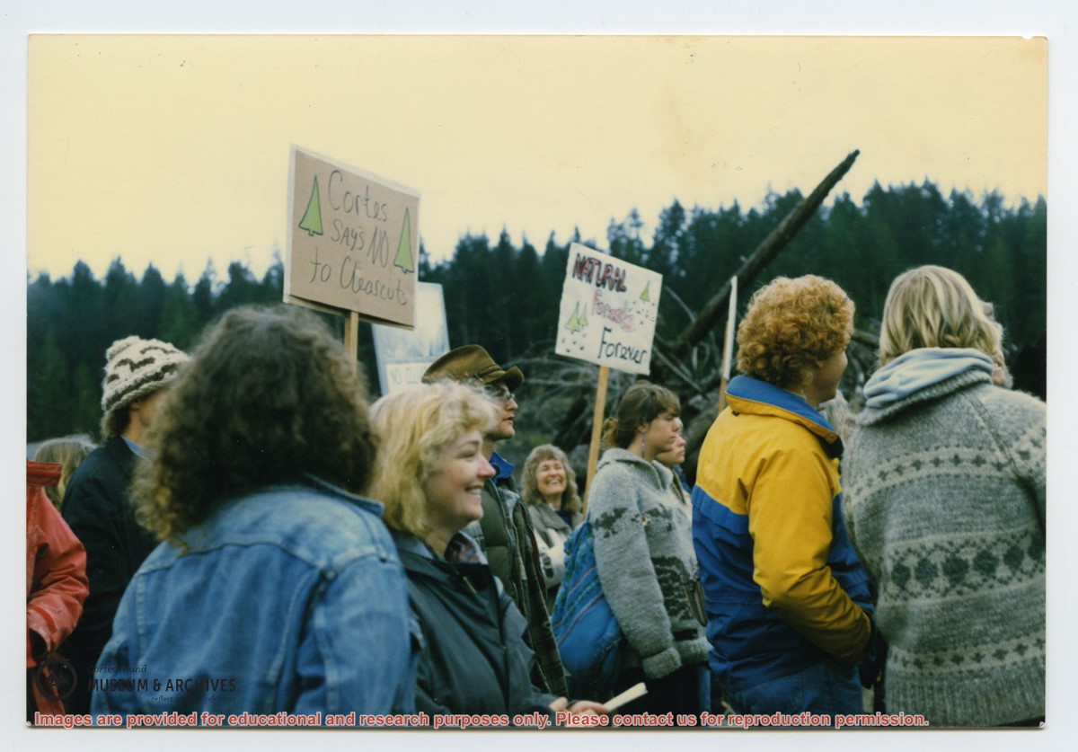
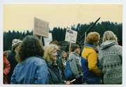
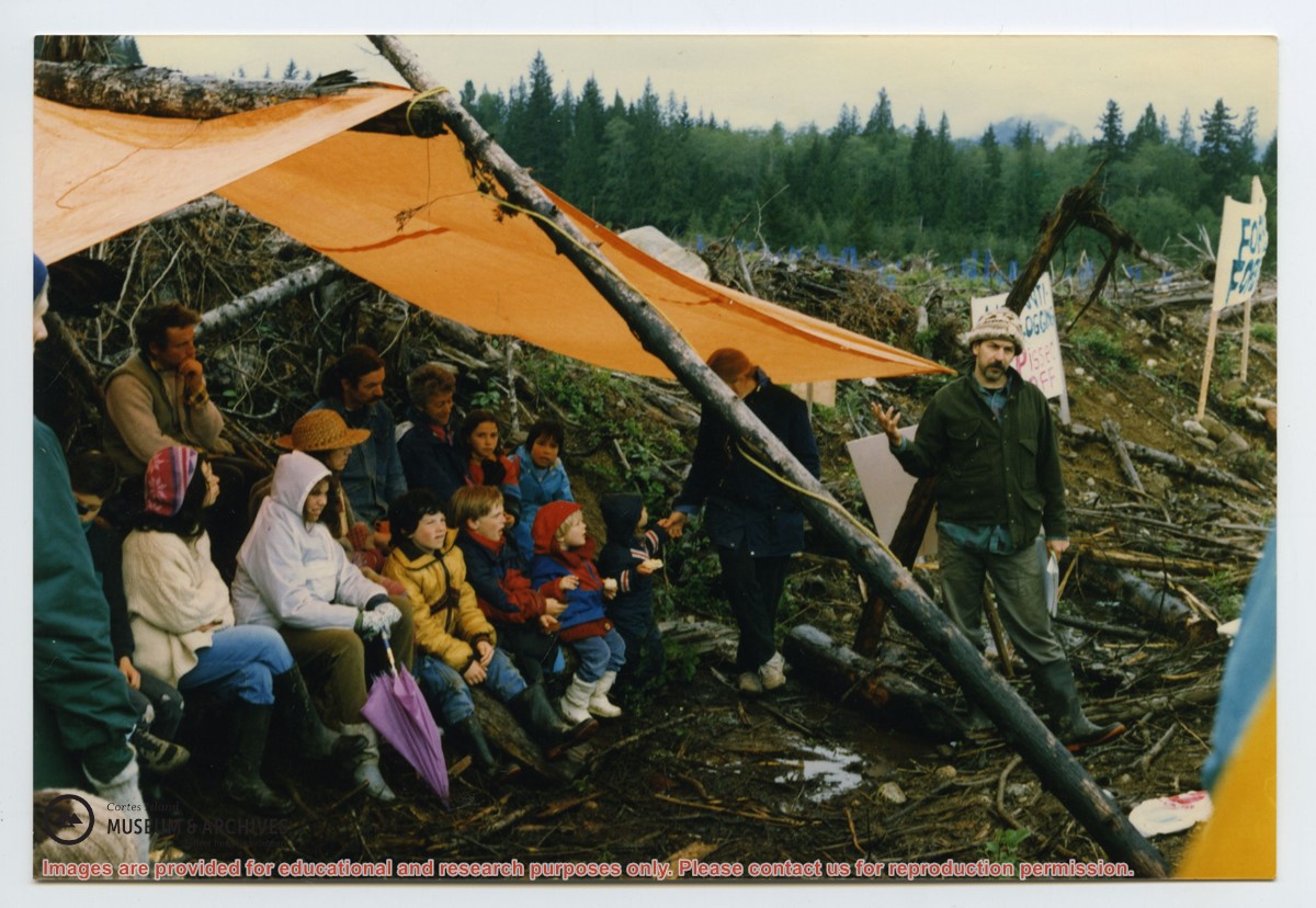
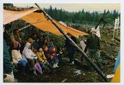
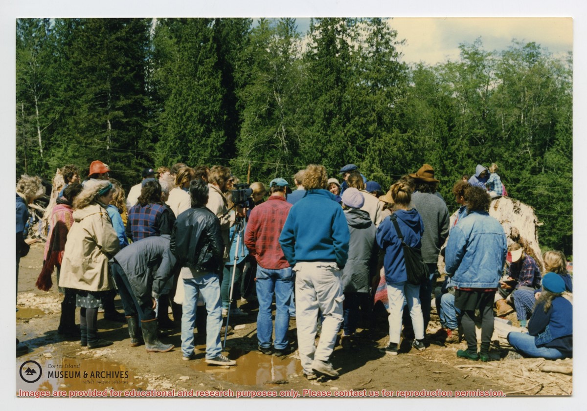
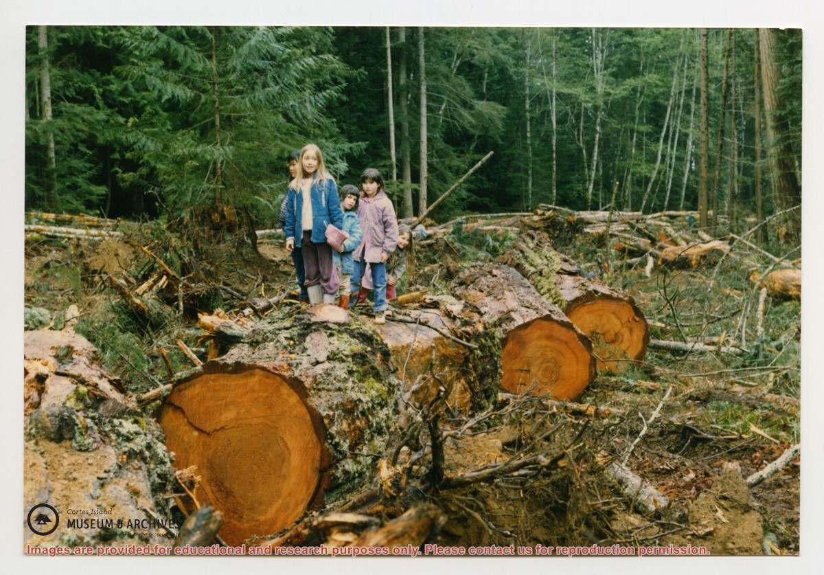
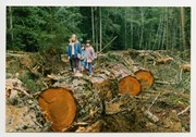
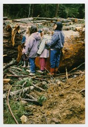
Photograph taken at a blockade to protest clear-cut logging by MacMillan Bloedel Ltd. near Squirrel Cove. The photo is taken from behind, and people are not identified.
Photograph taken at a blockade to protest clear-cut logging by MacMillan Bloedel Ltd. near Squirrel Cove. The photo is taken from behind, and people are not identified.
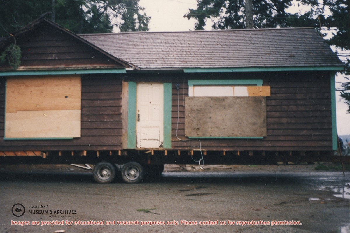
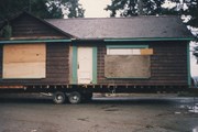
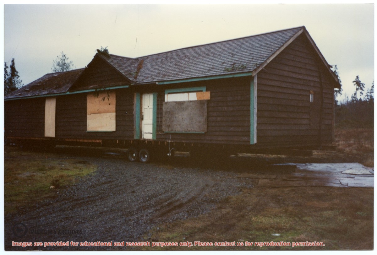
One of a series of 20 photographs documenting the move of the old Manson's Landing store from its position by the wharf in Mansons Landing Provincial Park to the present Museum site on Beasley Rd. The photographs are from an envelope labelled "Moving Museum, Dec. 1995. Moved by Able Transport. Paid for by Elmer and May Ellingsen."
Found in Information Files folder (Cortes Island Museum & Archives info"), Jan. 2021
Scope and Content
One of a series of 20 photographs documenting the move of the old Manson's Landing store from its position by the wharf in Mansons Landing Provincial Park to the present Museum site on Beasley Rd. The photographs are from an envelope labelled "Moving Museum, Dec. 1995. Moved by Able Transport. Paid for by Elmer and May Ellingsen."
One of a series of 20 photographs documenting the move of the old Manson's Landing store from its position by the wharf in Mansons Landing Provincial Park to the present Museum site on Beasley Rd. The photographs are from an envelope labelled "Moving Museum, Dec. 1995. Moved by Able Transport. Paid for by Elmer and May Ellingsen."
Found in Information Files folder (Cortes Island Museum & Archives info"), Jan. 2021
Scope and Content
One of a series of 20 photographs documenting the move of the old Manson's Landing store from its position by the wharf in Mansons Landing Provincial Park to the present Museum site on Beasley Rd. The photographs are from an envelope labelled "Moving Museum, Dec. 1995. Moved by Able Transport. Paid for by Elmer and May Ellingsen."
File contains a photocopied section map of the northern part of Cortes Island (from just south of Gorge Harbour), coloured to indicate areas for which a Crown Grant was located and areas of ungranted Crown land which still appear to be owned by the government. Scale is 1 mile to 1 inch.
File contains a photocopied section map of the northern part of Cortes Island (from just south of Gorge Harbour), coloured to indicate areas for which a Crown Grant was located and areas of ungranted Crown land which still appear to be owned by the government. Scale is 1 mile to 1 inch.
File contains a photocopied part of a map showing the locations of researched property in the Whaletown Lagoon and Whaletown Harbour area. The map is glued to an envelope which has a list of Crown grants and other conveyances on the back.
It contains photocopies of original land grants and other conveyances for the following:
Moses Ireland: 1893, Crown Grant for the W 1/2 of SW 1/4 of Sec 35 and W 1/2 of the SW 1/4 of Section 34
Joseph Youart: 1900, Crown Grant for Fractional NE 1/4 of Sec 35 (sold to Alice Robertson in 1908; "Burnside" is still in the Robertson family).
Nicholas Thompson: 1920, Crown Grant for the Fractional SW 1/4 of Sec 35
Charles Strange: 1914, Crown Grant for the NW 1/4 of Sec 35