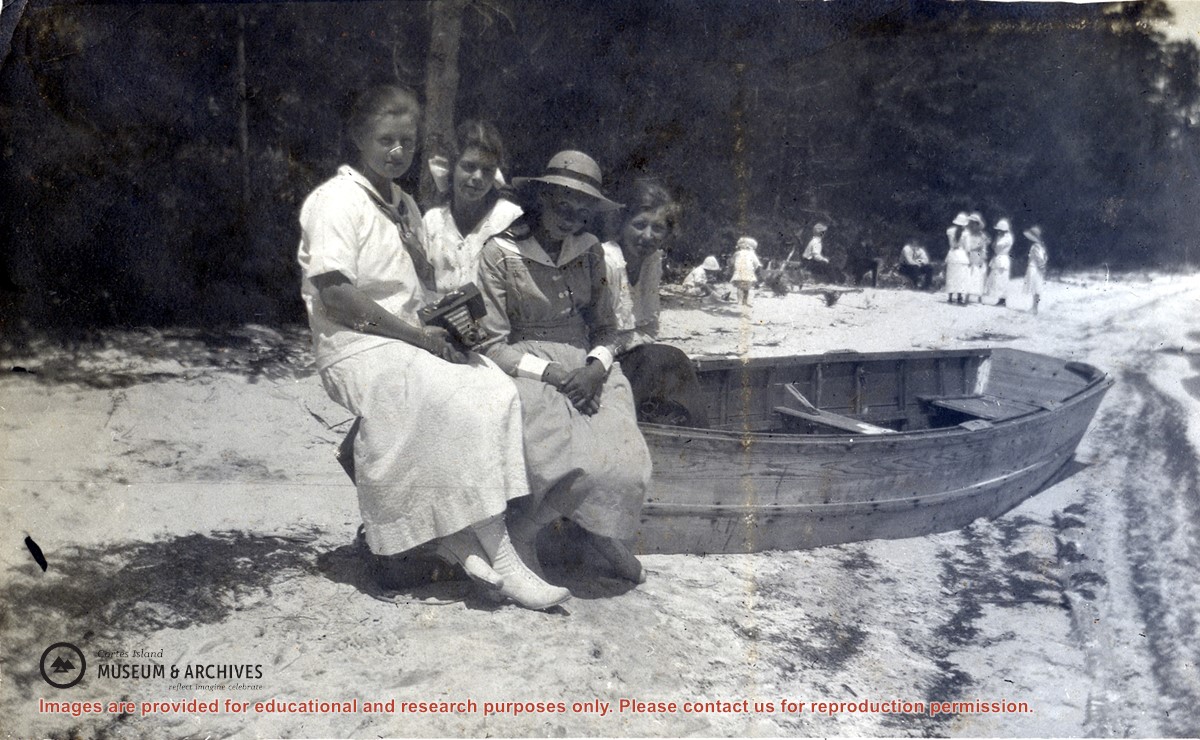
Meg Robertson (Shaw), Margaret Middleton, Margaret Copland and Elsie Allen seated on a beached rowboat at a sandy beach at the lake at Manson's Landing. Other people, including children, can be seen in the background.
Meg Robertson (Shaw), Margaret Middleton, Margaret Copland and Elsie Allen seated on a beached rowboat at a sandy beach at the lake at Manson's Landing. Other people, including children, can be seen in the background.
Coloured map of southwestern BC showing municipalities, geographical features, land and sea routes, natural resources, etc. The back of the map is fully printed with information about BC and suggested travel itineraries.
Map needs preservation: edges are frayed and there are several tears.
Coloured map of southwestern BC showing municipalities, geographical features, land and sea routes, natural resources, etc. The back of the map is fully printed with information about BC and suggested travel itineraries.
Map needs preservation: edges are frayed and there are several tears.
File contains a hand-drawn map of Hernando Island showing original pre-emptions, with information about settlement, schools and changes of title written on it.
File contains a hand-drawn map of Hernando Island showing original pre-emptions, with information about settlement, schools and changes of title written on it.