File contains two letters, written in pencil, to "Mother and Dad" by "Freddie" (surname unknown) on July 9, 1942 (7 pages) and July 13, 1942 (5 pages). Freddie was aboard the mission ship "John Antle", based in Whaletown with Canon Alan Greene, and writes of his experiences as part of the mission patrol. Places visited include Redonda Bay, Alert Bay, Rock Bay, Surge Narrows and Cortes Island settlements.
Donated by Bill Bartlett, of the Gerald Wellburn Philatelic Foundation, Victoria BC, in 2021. The letters were part of a stamp collection given to the Foundation. Bartlett recognized the connection to Cortes Island and mailed the letters to the Museum.
Scope and Content
File contains two letters, written in pencil, to "Mother and Dad" by "Freddie" (surname unknown) on July 9, 1942 (7 pages) and July 13, 1942 (5 pages). Freddie was aboard the mission ship "John Antle", based in Whaletown with Canon Alan Greene, and writes of his experiences as part of the mission patrol. Places visited include Redonda Bay, Alert Bay, Rock Bay, Surge Narrows and Cortes Island settlements.
Coloured map of southwestern BC showing municipalities, geographical features, land and sea routes, natural resources, etc. The back of the map is fully printed with information about BC and suggested travel itineraries.
Map needs preservation: edges are frayed and there are several tears.
Coloured map of southwestern BC showing municipalities, geographical features, land and sea routes, natural resources, etc. The back of the map is fully printed with information about BC and suggested travel itineraries.
Map needs preservation: edges are frayed and there are several tears.
The base map is a zoning map produced by the Regional District of Comox-
Strathcona for the Cortes Island Land Use Project (Aug 1969). Edwards used
coloured pencil to show land and foreshore zones, and transferred information
about early preemptions and old roads and trails from an earlier map (see
Donald Palmer fonds, 2020.002.011, map of Cortes Island, Sayward District, ca.
1915).
Map of the British Empire, drawn by Eric Dinickel for publication in the June, 1953 issue of Maclean’s (the month of the coronation of Queen Elizabeth II). Printed in full colour.
Map of the British Empire, drawn by Eric Dinickel for publication in the June, 1953 issue of Maclean’s (the month of the coronation of Queen Elizabeth II). Printed in full colour.
A small 36 page notebook (4 x 6 inches); cover is blue with a gilt art nouveau design. There are pages for "First Hims", "Childhood Hims" etc. in which Douglas has listed her significant relationships, from her childhood through the years on Cortes Island.
A small 36 page notebook (4 x 6 inches); cover is blue with a gilt art nouveau design. There are pages for "First Hims", "Childhood Hims" etc. in which Douglas has listed her significant relationships, from her childhood through the years on Cortes Island.
File contains six small leather-bound memo books with entries and jottings by Wm. Douglas which include such things as household accounts, trip diaries, appointments, and golf scores.
File contains six small leather-bound memo books with entries and jottings by Wm. Douglas which include such things as household accounts, trip diaries, appointments, and golf scores.
Photograph of an injured logger on a stretcher, being loaded off of a logging camp launch onto the "Columbia". Photo c is in the oversize photo box and has Alan Greene's notations on the back. See #1999.001.958. (see "Anderson, Doris, "The Columbia Is Coming"; Gray's Publishing, 1982, photo inset)
3 photograph prints: b&w; a & b are 13 x 10 cm; c is 25.5 x 20.5 cm
Scope and Content
Photograph of an injured logger on a stretcher, being loaded off of a logging camp launch onto the "Columbia". Photo c is in the oversize photo box and has Alan Greene's notations on the back. See #1999.001.958. (see "Anderson, Doris, "The Columbia Is Coming"; Gray's Publishing, 1982, photo inset)
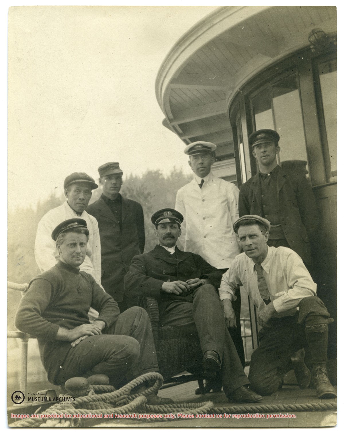
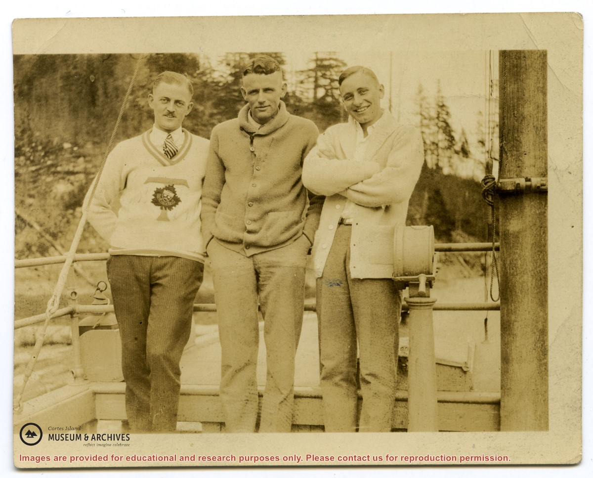
Photograph of Rev. John Antle (center) and the crew of the first "Columbia". (see "Anderson, Doris, "The Columbia Is Coming"; Gray's Publishing, 1982, photo inset)
Photograph of Rev. John Antle (center) and the crew of the first "Columbia". (see "Anderson, Doris, "The Columbia Is Coming"; Gray's Publishing, 1982, photo inset)
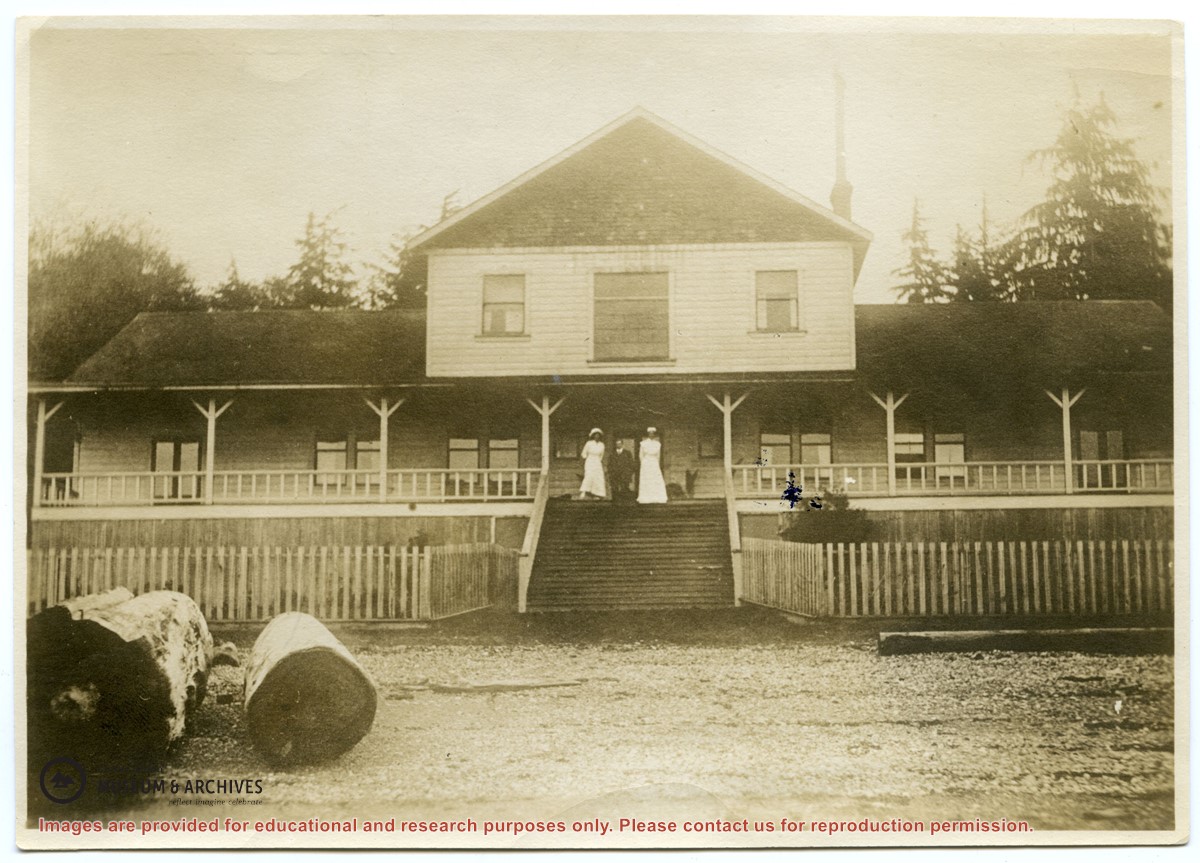
Photograph of St. George's Hospital in Alert Bay, five years after it was built. (see "Anderson, Doris, "The Columbia Is Coming"; Gray's Publishing, 1982, photo inset)
Photograph of St. George's Hospital in Alert Bay, five years after it was built. (see "Anderson, Doris, "The Columbia Is Coming"; Gray's Publishing, 1982, photo inset)
.jpg?width=1200&404=no-img.jpg&watermark=wmk)
.jpg?width=1200&404=no-img.jpg&watermark=wmk)
.jpg?width=1200&404=no-img.jpg&watermark=wmk)
.jpg?width=180&404=no-img.jpg)