Phoograph of Jeannie Dominick sitting beside a cedar basket at the surprise going away party for Mary Weiler held in the field at the Whaletown. The large lidded basket, woven by Jeannie Dominick, was a farewell gift to Mary Weiler from the women of Klahoose.
Phoograph of Jeannie Dominick sitting beside a cedar basket at the surprise going away party for Mary Weiler held in the field at the Whaletown. The large lidded basket, woven by Jeannie Dominick, was a farewell gift to Mary Weiler from the women of Klahoose.
Photograph of Mary Weiler walking onto the ferry after a surprise farewell party on the day she moved away from the island. Mary Weiler is facing the camera; John Ashby is center, with pipe; Brigid Weiler in the long skirt.
Photograph of Mary Weiler walking onto the ferry after a surprise farewell party on the day she moved away from the island. Mary Weiler is facing the camera; John Ashby is center, with pipe; Brigid Weiler in the long skirt.
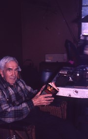
Series contains two books : "The Whale People", written by Roderick Haig-Brown and illustrated by Mary Weiler, and an annotated guide book to birds which belonged to Brigid Weiler as a child.
Series contains two books : "The Whale People", written by Roderick Haig-Brown and illustrated by Mary Weiler, and an annotated guide book to birds which belonged to Brigid Weiler as a child.
Two men standing beside a car in the valley at Knight Inlet. Logging camp buildings may be seen in the background. This is a near-duplicate of 1999.001.1053.
One of a series of photographs taken at Clarence and Doug Boardman's Dot Logging Co. camp in Knight Inlet.
2 photograph prints: b&w ; 18 x 12 cm & 21.5 x 16.5
Scope and Content
Two men standing beside a car in the valley at Knight Inlet. Logging camp buildings may be seen in the background. This is a near-duplicate of 1999.001.1053.
One of a series of photographs taken at Clarence and Doug Boardman's Dot Logging Co. camp in Knight Inlet.
Coloured map of southwestern BC showing municipalities, geographical features, land and sea routes, natural resources, etc. The back of the map is fully printed with information about BC and suggested travel itineraries.
Map needs preservation: edges are frayed and there are several tears.
Coloured map of southwestern BC showing municipalities, geographical features, land and sea routes, natural resources, etc. The back of the map is fully printed with information about BC and suggested travel itineraries.
Map needs preservation: edges are frayed and there are several tears.