Fonds consists of the records of the Cortes Island Ratepayers Association, an organization of the property owners and residents of Cortes Island from 1963 to 1984. They include administrative documents such as the constitution and membership lists, minutes of CIRA meetings, annual reports, newsletters to members, correspondence and materials related to the provision of services, land use planning and other issues of island concern.
The fonds is composed of the following series: Administrative Documents; Minutes; Financial; Newsletters and Notices; Correspondence; Subject; Community Planning and Land Use (Advisory Planning Commission); Clippings; and Maps and Plans.
The Cortes Island Ratepayers Association (CIRA) was an association of property owners and residents formed in 1963 to "further the development of the island and to have a representative body in dealing with the Provincial government."
The first activity initiated by CIRA was to lobby the provincial government for the provision of electricity and ferry service to Cortes Island. Their efforts met with success. Electricity was brought to the island in 1970 and ferry service from Quadra Island to Cortes Island began in 1969. CIRA also became an important forum for the discussion of other important services on Cortes Island, including roads, fire protection, garbage disposal, water quality, rural mail delivery and library facilities.
As a result of CIRA's efforts to bring electricity to Cortes Island, in 1967 the Minister of Municipal Affairs, Dan Campbell, designated Cortes Island a Local Improvement District. This made Cortes Island into a legal entity for the purpose of negotiating with the province for electrical power. In that same year, Minister Campbell invited CIRA to participate in discussions and committee work on the formation of a regional district level of government.
In 1968, Cortes Island was designated 'Electoral Area I' in the Regional District of Comox-Strathcona (RDCS) with an elected director. Under this system, a Regional Director is elected who in turn sits on the Board of the RDCS. Each Regional Director appoints an Advisory Planning Commission (APC), a committee of island residents who advise the Director on matters of island concern. In 1968, CIRA determined that the elected members of the executive of CIRA would form the APC for Cortes Island. This arrangement lasted until the dissolution of CIRA in 1984. The first zoning by-law was completed in 1970 and an Official Settlement Plan and zoning by-law in 1979.
In 1982, CIRA initiated a court case against Raven Lumber for non-compliance with the Cortes Island Official Settlement Plan and zoning by-law. CIRA won the case upon appeal, but in 1984 an Order in Council allowed Raven Lumber to proceed with their development. The court case had absorbed a great deal of CIRA energy and fund raising effort over a four year period. At the General Meeting in November, 1984 there were no candidates willing to stand for the executive. CIRA was declared inactive at that meeting and was never reactivated.
Custodial History
During the term of the last president of CIRA, the records were kept in the Gorge Harbour Community Hall on Cortes Island. After the dissolution of the CIRA in 1984, the records continued to be stored in the hall. The records were transferred to the Cortes Island Museum and Archives by the Whaletown Community Club (owner of the hall) in 2000.
Scope and Content
Fonds consists of the records of the Cortes Island Ratepayers Association, an organization of the property owners and residents of Cortes Island from 1963 to 1984. They include administrative documents such as the constitution and membership lists, minutes of CIRA meetings, annual reports, newsletters to members, correspondence and materials related to the provision of services, land use planning and other issues of island concern.
The fonds is composed of the following series: Administrative Documents; Minutes; Financial; Newsletters and Notices; Correspondence; Subject; Community Planning and Land Use (Advisory Planning Commission); Clippings; and Maps and Plans.
Regional Director of Electoral Area I (Cortes Island) fonds
Gilean Douglas fonds
Finding Aid
File list available
Arrangement
Materials were received in their original file folders, however the files were not in any discernible order. In the absence of original order, materials were arranged by function and subject at the series level and chronologically within series.
Collection consists of photographs of Cortes Island people, places and events. Photographs not belonging to another fonds or collection in the Archives have been described as part of this collection.
Photographs have been donated to or collected by Cortes Island Museum & Archives. Where it is known, provenance is described at the item level.
Scope and Content
Collection consists of photographs of Cortes Island people, places and events. Photographs not belonging to another fonds or collection in the Archives have been described as part of this collection.
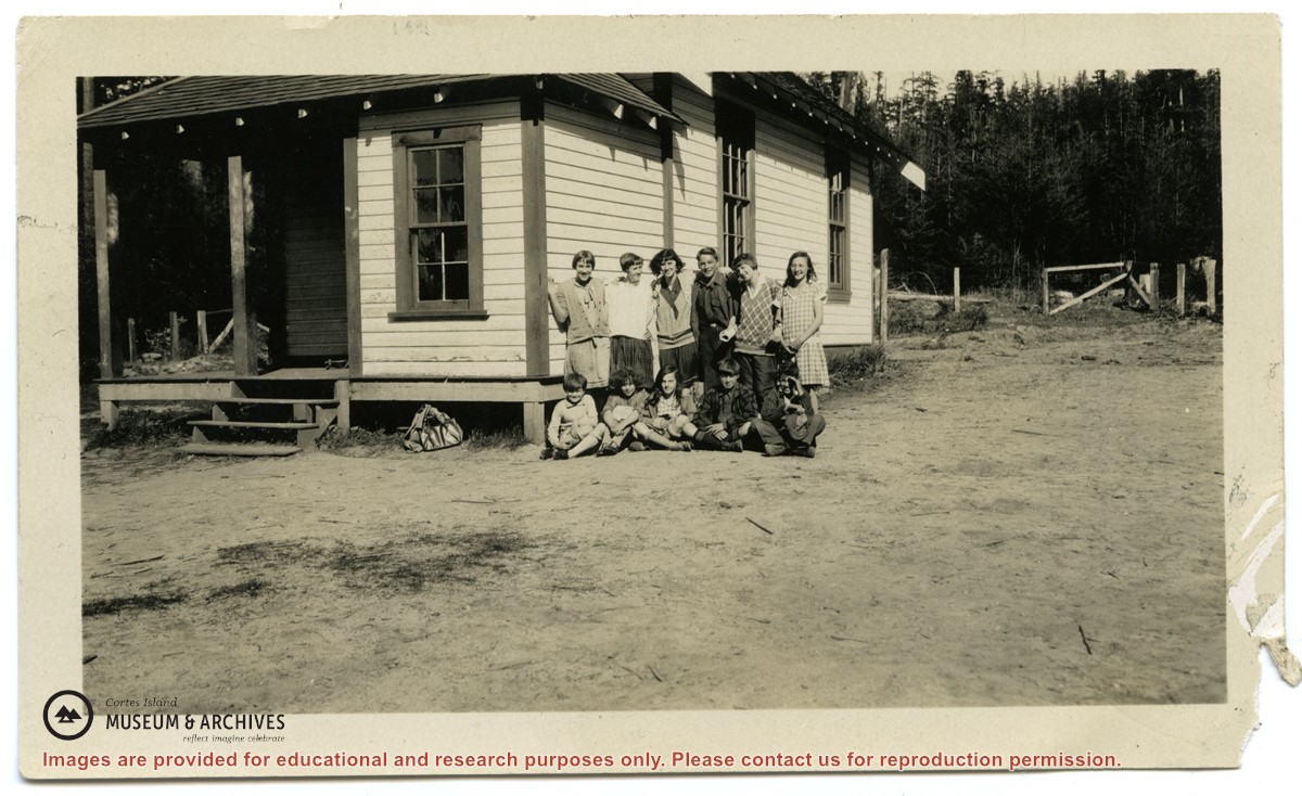
Photographs depict the pupils at the second Whaletown school standing beside the school. The photograph was taken by Evelyn Dow, who taught there from February 1928 to June 1929. This school was built in 1918 near the corner of Coulter Bay Road and Carrington Bay Road, and was used (with improvements) until 1950. The front, side and surroundings of the school are clearly shown.
Front row third from left is Marion Borden; Vernon Borden next to her fourth from left.
Top row, far right: Lorna Borden
(IDs by Terrill Marlow, Marion’s daughter, and Rob Borden, Vernon’s son).
Photographs are from an album created by Evelyn Dow and were donated to CIMAS by her niece, Sharon Thomas.
Scope and Content
Photographs depict the pupils at the second Whaletown school standing beside the school. The photograph was taken by Evelyn Dow, who taught there from February 1928 to June 1929. This school was built in 1918 near the corner of Coulter Bay Road and Carrington Bay Road, and was used (with improvements) until 1950. The front, side and surroundings of the school are clearly shown.
Front row third from left is Marion Borden; Vernon Borden next to her fourth from left.
Top row, far right: Lorna Borden
(IDs by Terrill Marlow, Marion’s daughter, and Rob Borden, Vernon’s son).
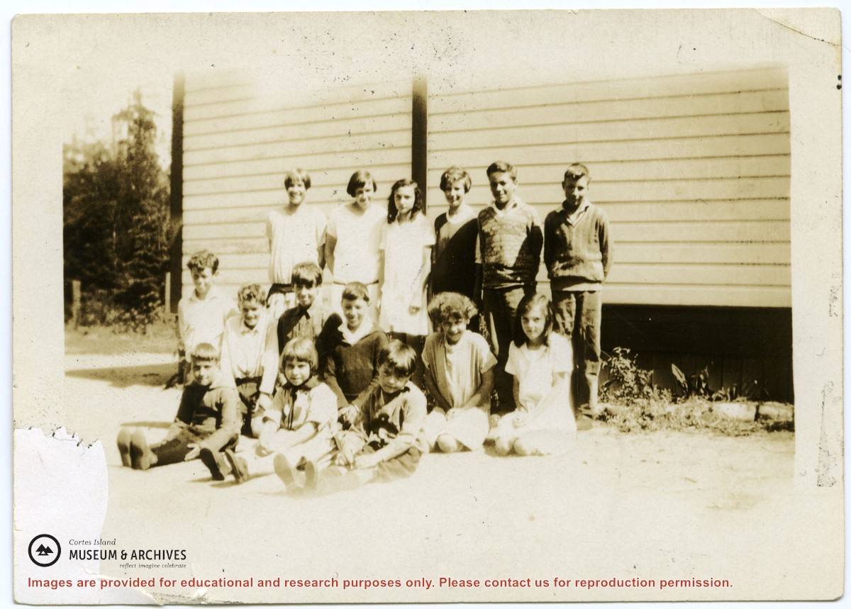
Photograph depicts the pupils at the second Whaletown school beside the corner of the school. The photograph was taken by Evelyn Dow, who taught there from February 1928 to June 1929. This school was built in 1918 near the corner of Coulter Bay Road and Carrington Bay Road, and was used (with improvements) until 1950.
Top Row: third from left, Lorna Borden; second from right, Doris Houghton-Brown
Middle row: second from left, Ken Houghton-Brown, third from left, Vernon Borden; far right, Marion Borden
Front row: far right, Claude Borden
(IDs by Terrill Marlow, Marion’s daughter, Rob Borden, Vernon’s son, and Joan Bevington, Ken Houghton-Brown's daughter).
Photograph is from an album created by Evelyn Dow and was donated to CIMAS by her niece, Sharon Thomas.
Scope and Content
Photograph depicts the pupils at the second Whaletown school beside the corner of the school. The photograph was taken by Evelyn Dow, who taught there from February 1928 to June 1929. This school was built in 1918 near the corner of Coulter Bay Road and Carrington Bay Road, and was used (with improvements) until 1950.
Top Row: third from left, Lorna Borden; second from right, Doris Houghton-Brown
Middle row: second from left, Ken Houghton-Brown, third from left, Vernon Borden; far right, Marion Borden
Front row: far right, Claude Borden
(IDs by Terrill Marlow, Marion’s daughter, Rob Borden, Vernon’s son, and Joan Bevington, Ken Houghton-Brown's daughter).
Fonds consists of sixteen photographs depicting people and scenes, primarily of the Manson's Landing area. Identification was provided by Fred Brooks Jr. in an interview with Cathy Jenks.
Alethea and Frederick (Fred) James Brooks Sr. and their two sons, Frederick (Fred) Earl, Jr. and Bob, lived on Cortes Island from ca. 1941 to 1944, near Manson's Landing. Fred Sr. logged in Cortes Bay and employed two of the Hawkins boys, Bill and George.
Fred Jr. attended grades three to six at Cortes Island school before the family moved to Pender Harbour. Some of the names he recalls are: the Christiansen kids (Robert, Jim, and a sister), the Tibers on the west side of Cortes Island, and the Jefferys of Smelt Bay.
Custodial History
Fred Brooks Jr. gave the photographs to Cathy Brooks of Pender Harbour Living Heritage Society, who facilitated the donation by collecting the photographs, donation form and information from Brooks and sending the materials to CIMAS.
Scope and Content
Fonds consists of sixteen photographs depicting people and scenes, primarily of the Manson's Landing area. Identification was provided by Fred Brooks Jr. in an interview with Cathy Jenks.
Pender Harbour Living Heritage holds related material from the Brooks family: https://penderharbourheritage.pastperfectonline.com/bysearchterm?keyword=Brooks+family
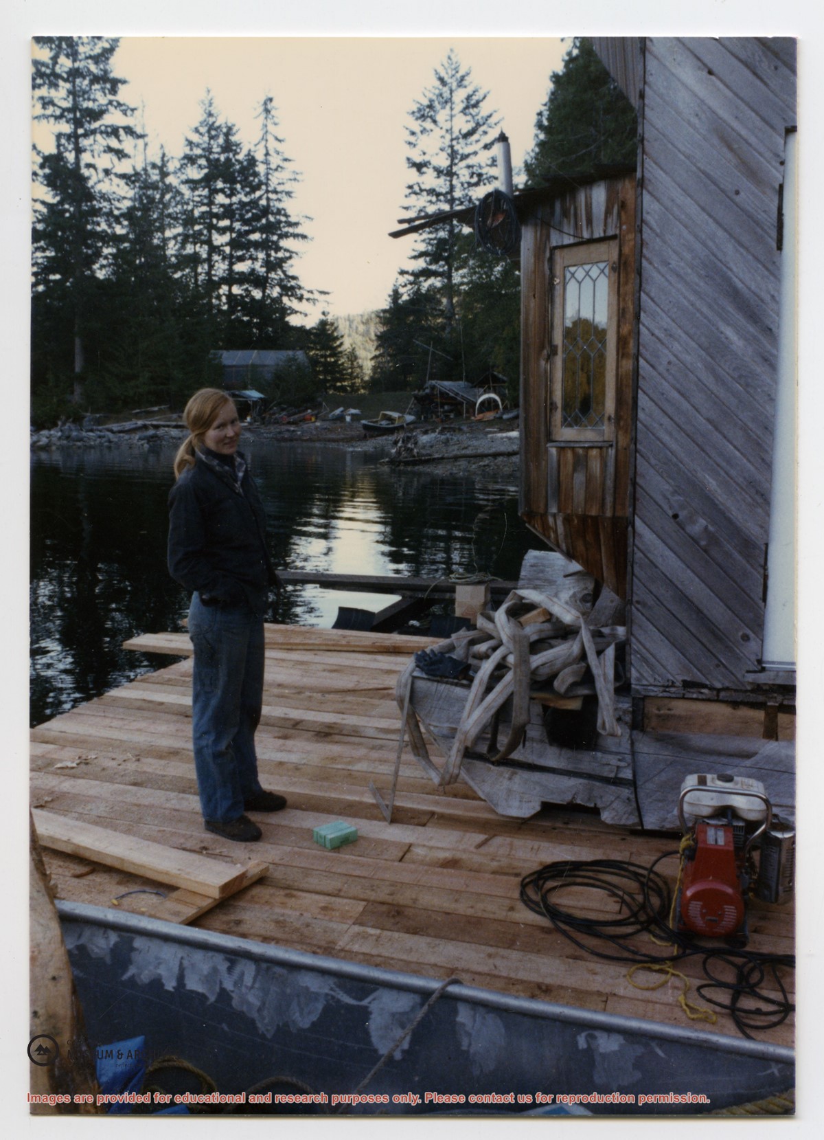
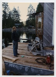
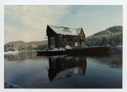
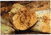
This floathouse was built at John and Anna Gregg's property in Manson's Landing, moved to Carrington Bay beside the entrance to Carrington Lagoon (ca. 1978), and then towed into Gorge Harbour by Bob Thompson with the "Sutil Chief" in 1985.
Transferred from Information Files August 20, 2020
Scope and Content
This floathouse was built at John and Anna Gregg's property in Manson's Landing, moved to Carrington Bay beside the entrance to Carrington Lagoon (ca. 1978), and then towed into Gorge Harbour by Bob Thompson with the "Sutil Chief" in 1985.
Fonds consists of ten photographs (nine black and white; 1 coloured) depicting members of the extended Byers/ Manson families, logging at Seaford and Von Donop Inlet, and the Union Steamship Chelohsin.
Henry and Ruth Byers, Ervin and Florence (Manson) McKay, Clarence and Etta (McKay) Byers, Ken and Hazel (McKay) Hansen, Scotty and Amy (Byers) McKenzie moved to Von Donop Inlet in 1939, where they ran a logging operation.
Custodial History
Found in Information Files folder (Byers family), August 1, 2020 and transferred to Archives.
Scope and Content
Fonds consists of ten photographs (nine black and white; 1 coloured) depicting members of the extended Byers/ Manson families, logging at Seaford and Von Donop Inlet, and the Union Steamship Chelohsin.
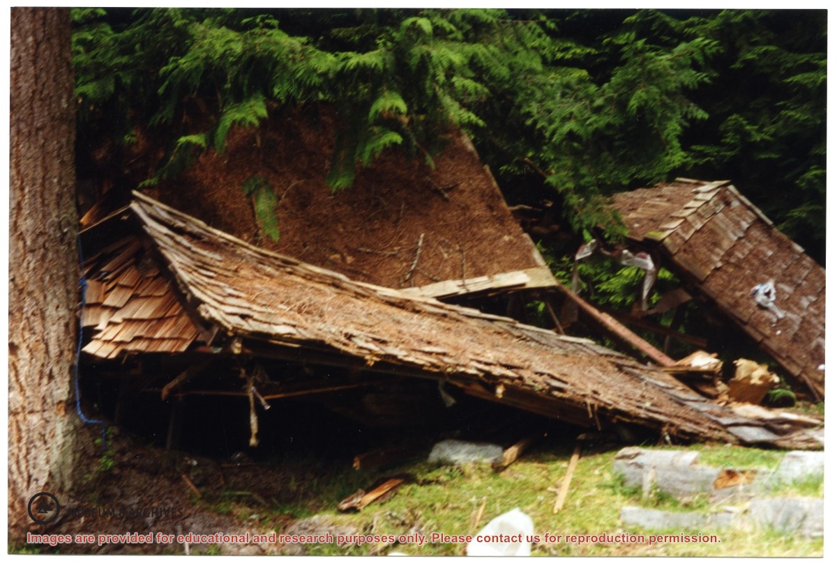
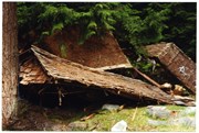
One of a series of photographs of volunteers removing the remains of shacks at Carrington Bay when Carrington Bay Marine Park was established.
L to R: Cedar DeTrey, Mike ?, John Shook
One of a series of photographs of volunteers removing the remains of shacks at Carrington Bay when Carrington Bay Marine Park was established.
L to R: Cedar DeTrey, Mike ?, John Shook
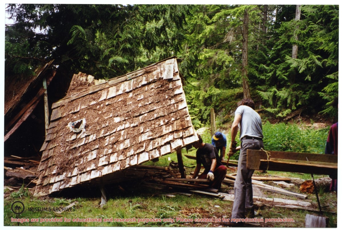
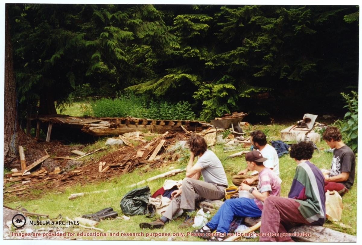
One of a series of photographs of volunteers removing the remains of shacks at Carrington Bay when Carrington Bay Marine Park was established.
L to R: John Shook, Justin Stirn, Pierre DeTrey, Kiyoshi Kosky, Cedar DeTrey.
One of a series of photographs of volunteers removing the remains of shacks at Carrington Bay when Carrington Bay Marine Park was established.
L to R: John Shook, Justin Stirn, Pierre DeTrey, Kiyoshi Kosky, Cedar DeTrey.
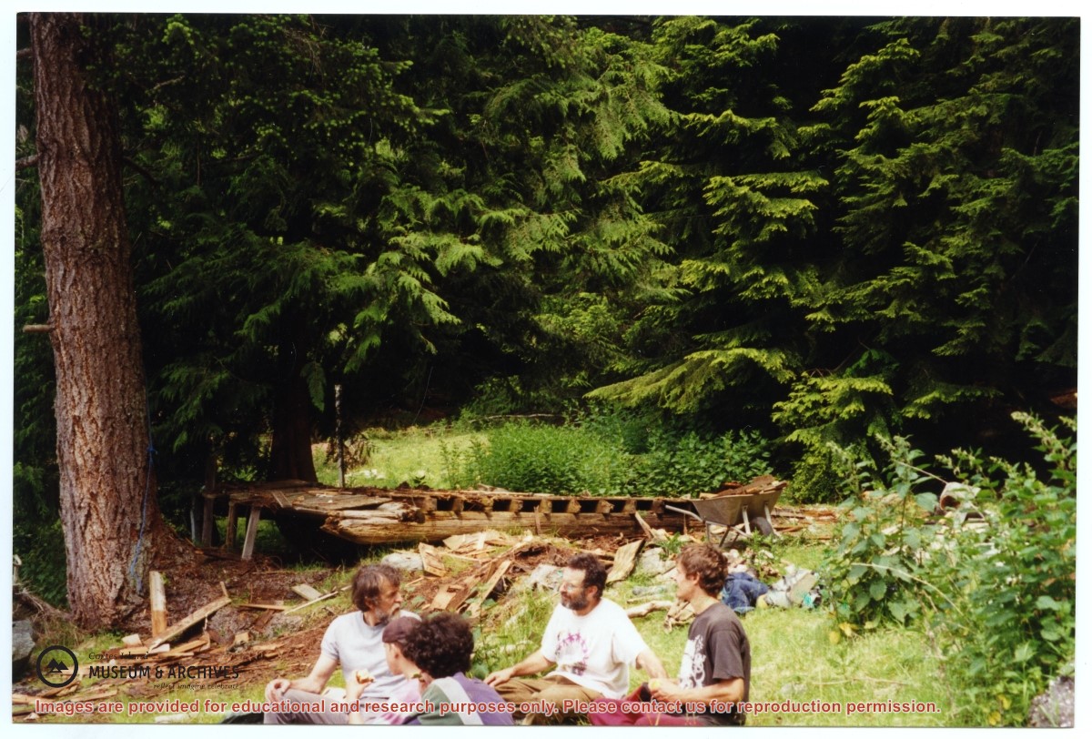
One of a series of photographs of volunteers removing the remains of shacks at Carrington Bay when Carrington Bay Marine Park was established.
L to R: Kiyoshi Kosky, Pierre DeTrey, Cedar DeTrey
One of a series of photographs of volunteers removing the remains of shacks at Carrington Bay when Carrington Bay Marine Park was established.
L to R: Kiyoshi Kosky, Pierre DeTrey, Cedar DeTrey
Eva Freeman (L) and Jean Campbell in Eva's kitchen. Tthe Marswells wood cookstove, now part of the Museum's Pioneer Kitchen display, is in the background. This photo and #2019.003.249 were glued to a greeting card.
Eva Freeman (L) and Jean Campbell in Eva's kitchen. Tthe Marswells wood cookstove, now part of the Museum's Pioneer Kitchen display, is in the background. This photo and #2019.003.249 were glued to a greeting card.