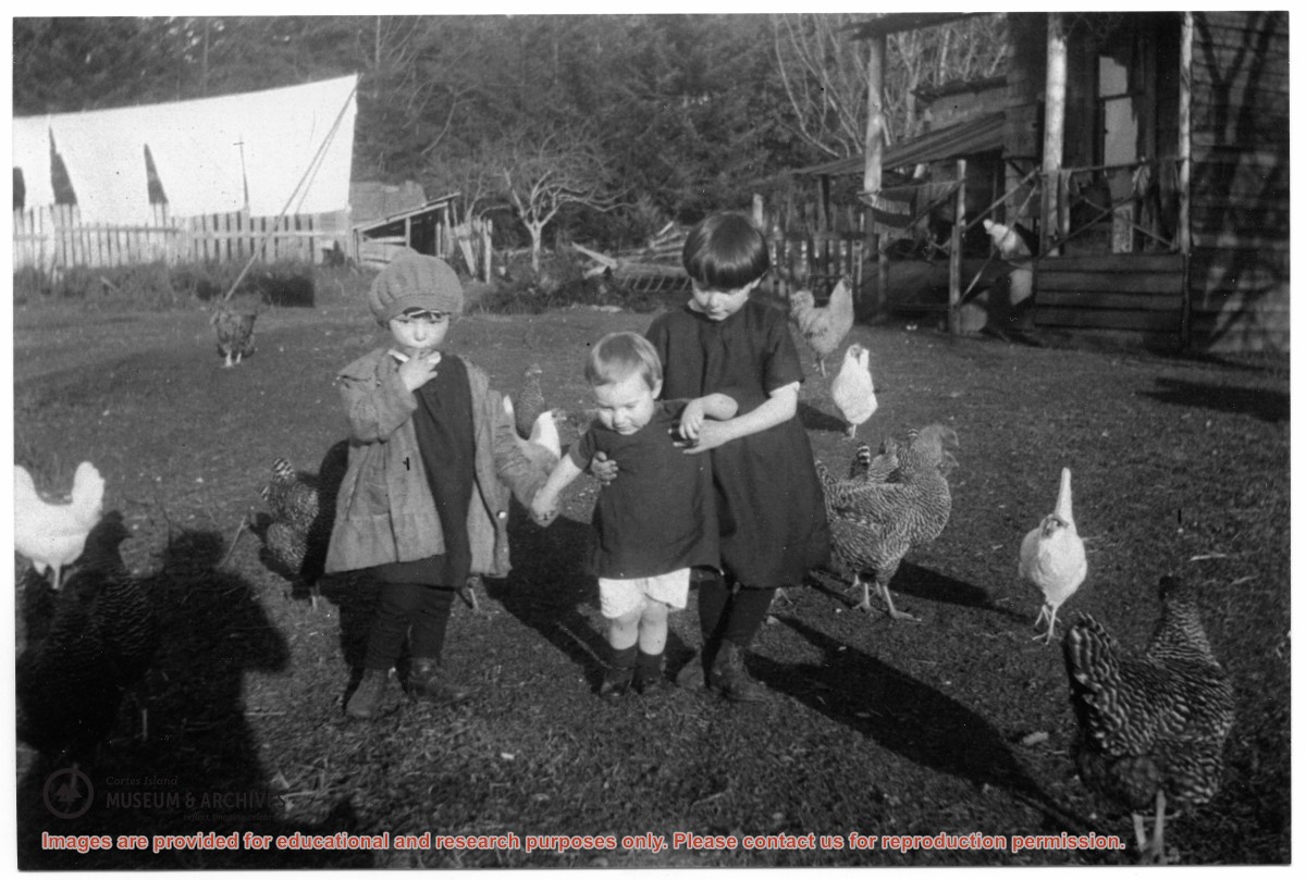
Photograph depicts three children with a flock of chickens, in front of a house. This is a reprint of an original photograph which was likely from Florence McKay's family (see 2004.001.014).
Found in CIMAS Information Files folder (Hernando Island), with May Ellingsen's handwriting on the verso. (January 2021)
Scope and Content
Photograph depicts three children with a flock of chickens, in front of a house. This is a reprint of an original photograph which was likely from Florence McKay's family (see 2004.001.014).
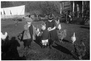
Photograph of Jane Manson, granddaughter Thelma Campbell, Fraser Campbell with Shep the dog, Gwen Campbell with baby Minerva, Ervin (Ervie) McKay with Hazel, and Etta McKay in front.
This is a reprint of an original photograph from the collection of Florence McKay. It is part of the Campbell River Museum collection (CR 13650) and is also reproduced in the May Ellingsen Historic Photograph Collection: Album Nine, page 28.
Found in CIMAS Information Files folder (Hernando Island), with May Ellingsen's handwriting on the verso. (January 2021)
Scope and Content
Photograph of Jane Manson, granddaughter Thelma Campbell, Fraser Campbell with Shep the dog, Gwen Campbell with baby Minerva, Ervin (Ervie) McKay with Hazel, and Etta McKay in front.
This is a reprint of an original photograph from the collection of Florence McKay. It is part of the Campbell River Museum collection (CR 13650) and is also reproduced in the May Ellingsen Historic Photograph Collection: Album Nine, page 28.
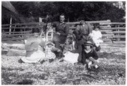
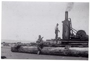
Photograph of Wilfred Manson on steam donkey, and Ervin McKay with a bundle of drift wood to fire the donkey.
This is a reprint of an original photograph from the collection of Florence McKay. It is part of the Campbell River Museum collection (CR 13644) and is also reproduced in the May Ellingsen Historic Photograph Collection: Album Nine, page 25.
Found in CIMAS Information Files folder (Hernando Island), with May Ellingsen's handwriting on the verso. (January 2021)
Scope and Content
Photograph of Wilfred Manson on steam donkey, and Ervin McKay with a bundle of drift wood to fire the donkey.
This is a reprint of an original photograph from the collection of Florence McKay. It is part of the Campbell River Museum collection (CR 13644) and is also reproduced in the May Ellingsen Historic Photograph Collection: Album Nine, page 25.
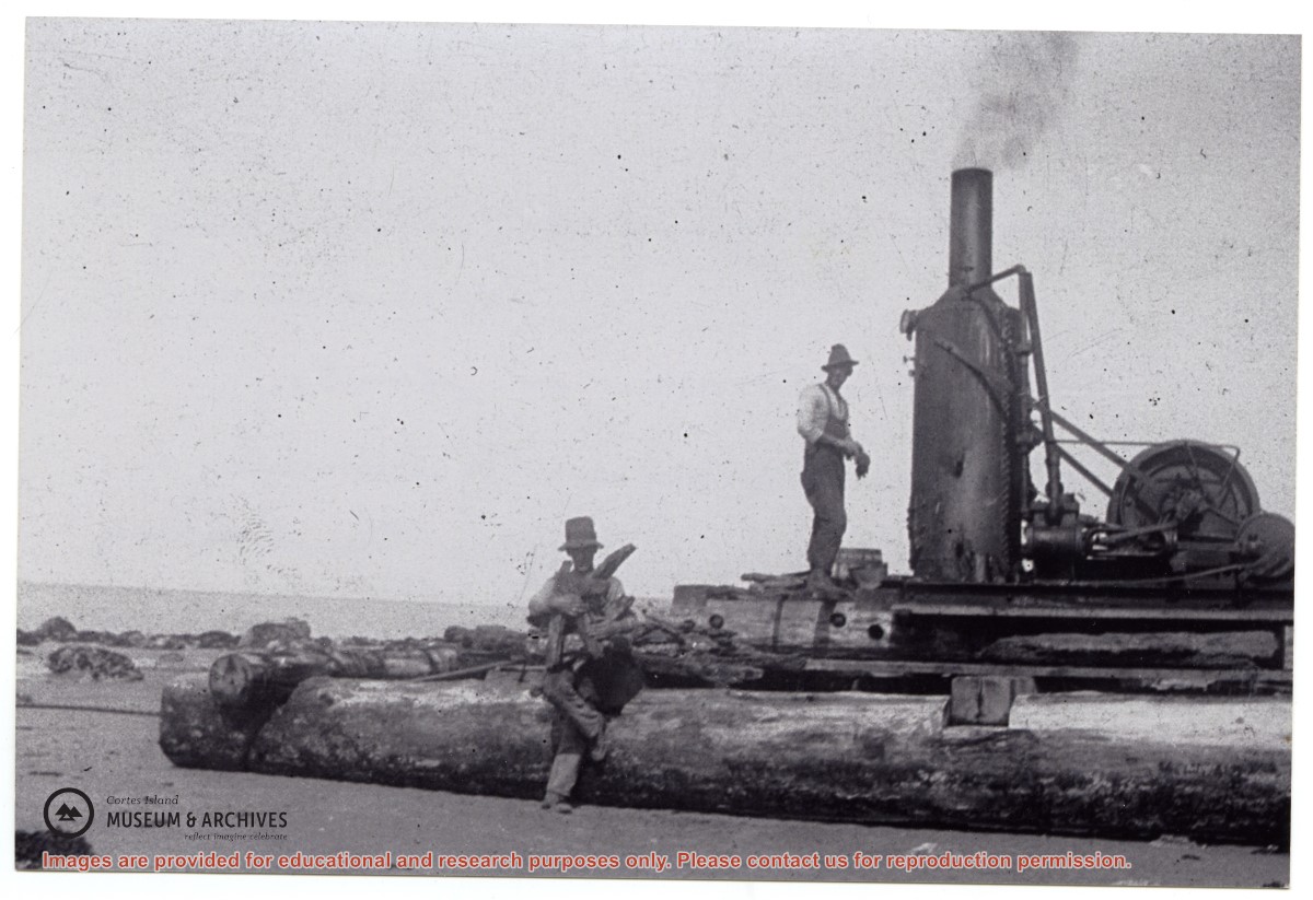
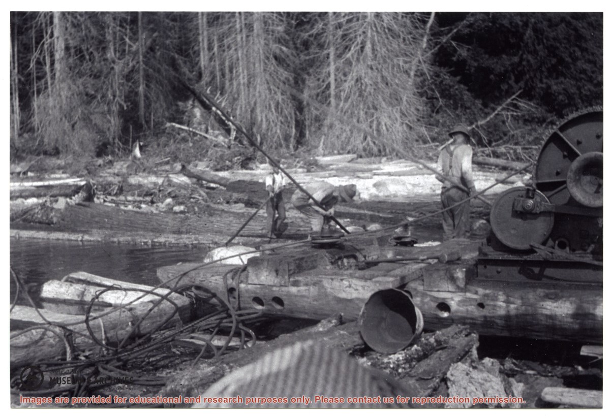
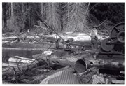
Photograph of a steam donkey on a float, pulling in logs from the beach.
L to R: Ervie McKay, Nicol Manson, Wilf Manson
This is a reprint of an original photograph from the collection of Florence McKay. It is part of the Campbell River Museum collection (CR 13644) and is also reproduced in the May Ellingsen Historic Photograph Collection: Album Five, page 32.
Found in CIMAS Information Files folder (Hernando Island), with May Ellingsen's handwriting on the verso. (January 2021)
Scope and Content
Photograph of a steam donkey on a float, pulling in logs from the beach.
L to R: Ervie McKay, Nicol Manson, Wilf Manson
This is a reprint of an original photograph from the collection of Florence McKay. It is part of the Campbell River Museum collection (CR 13644) and is also reproduced in the May Ellingsen Historic Photograph Collection: Album Five, page 32.
Two men standing beside a car in the valley at Knight Inlet. Logging camp buildings may be seen in the background. This is a near-duplicate of 1999.001.1053.
One of a series of photographs taken at Clarence and Doug Boardman's Dot Logging Co. camp in Knight Inlet.
2 photograph prints: b&w ; 18 x 12 cm & 21.5 x 16.5
Scope and Content
Two men standing beside a car in the valley at Knight Inlet. Logging camp buildings may be seen in the background. This is a near-duplicate of 1999.001.1053.
One of a series of photographs taken at Clarence and Doug Boardman's Dot Logging Co. camp in Knight Inlet.
Coloured map of southwestern BC showing municipalities, geographical features, land and sea routes, natural resources, etc. The back of the map is fully printed with information about BC and suggested travel itineraries.
Map needs preservation: edges are frayed and there are several tears.
Coloured map of southwestern BC showing municipalities, geographical features, land and sea routes, natural resources, etc. The back of the map is fully printed with information about BC and suggested travel itineraries.
Map needs preservation: edges are frayed and there are several tears.
The base map is a zoning map produced by the Regional District of Comox-
Strathcona for the Cortes Island Land Use Project (Aug 1969). Edwards used
coloured pencil to show land and foreshore zones, and transferred information
about early preemptions and old roads and trails from an earlier map (see
Donald Palmer fonds, 2020.002.011, map of Cortes Island, Sayward District, ca.
1915).