Fonds contains six oversize photograph albums, CDs, administrative documents, ephemera, newsletters, yearbooks, and articles created by Linnaea School. It is arranged in eight series: Administrative records; Creative projects; Linnaea Learner; Yearbooks; Publicity materials; School photo descriptions; Linnaea School photograph albums; and CDs. Electronic records include an overview of Linnaea; Linnaea philosophy and curriculum, and class and attendance lists.
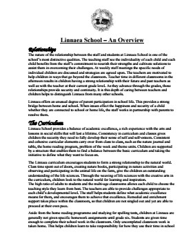
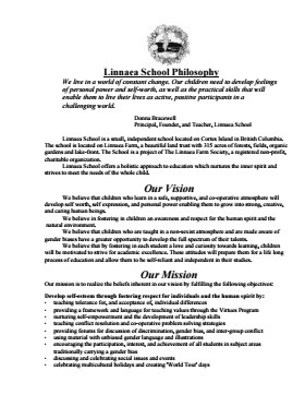
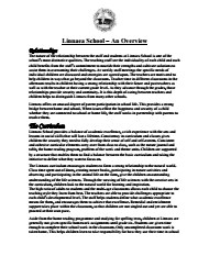
Linnaea School was a small independent school located on Linnaea Farm, a land trust with 315 acres of forests, fields, organic gardens and lake-front which is governed by The Linnaea Farm Society, a registered non-profit. Linnaea School offered its holistic, community-based approach to education for 23 years, from 1987 until its closing in 2010.
The school was founded by Donna Bracewell in 1987. It expanded from a first-year enrollment of eleven students to take in close to half of the island's school-age children. Linnaea offered a program of creative, nature-based, alternative learning for Kindergarten to Grade 6. Strong academics were enhanced by farm classes, environmental and outdoor education, mentorship programmes, music classes and service projects. A notable project was the annual spring musical play. Bracewell left in June, 2009 to take a teaching position in Vietnam and the school closed a year later.
Custodial History
Records were donated to CIMAS on 22 October 2014 by a representative of Linnaea Education Centre/Linnaea Farm Society. An accrual of electronic records was donated by Donna Bracewell in 2019. A sticky note attached to the CD file box said they were brought to the Museum in 2017 by Miensje Vlaming.
Scope and Content
Fonds contains six oversize photograph albums, CDs, administrative documents, ephemera, newsletters, yearbooks, and articles created by Linnaea School. It is arranged in eight series: Administrative records; Creative projects; Linnaea Learner; Yearbooks; Publicity materials; School photo descriptions; Linnaea School photograph albums; and CDs. Electronic records include an overview of Linnaea; Linnaea philosophy and curriculum, and class and attendance lists.
Series contains information on historic Crown Grants and subsequent title changes compiled by Doreen Thompson during her research for the CIMAS Windows on Whaletown exhibit in 1999. The area covered includes the northern part of Cortes Island, from just south of Gorge Harbour. Material includes maps, photocopies of original Crown Grants and other title documents, lists of subdivisions, and notes on changes of title.
Records were organized by Section or Plan number in large envelopes with a cover map and notes about the properties researched on the envelope back. They trace the ownership of parcels of land from the first grant or purchase from the Crown to 1999. Original order has been maintained.
File contains a photocopied section map of the northern part of Cortes Island (from just south of Gorge Harbour), coloured to indicate areas for which a Crown Grant was located and areas of ungranted Crown land which still appear to be owned by the government. Scale is 1 mile to 1 inch.
File contains a photocopied section map of the northern part of Cortes Island (from just south of Gorge Harbour), coloured to indicate areas for which a Crown Grant was located and areas of ungranted Crown land which still appear to be owned by the government. Scale is 1 mile to 1 inch.
File contains a photocopied part of a map showing the locations of researched property in the Whaletown Lagoon and Whaletown Harbour area. The map is glued to an envelope which has a list of Crown grants and other conveyances on the back.
It contains photocopies of original land grants and other conveyances for the following:
Moses Ireland: 1893, Crown Grant for the W 1/2 of SW 1/4 of Sec 35 and W 1/2 of the SW 1/4 of Section 34
Joseph Youart: 1900, Crown Grant for Fractional NE 1/4 of Sec 35 (sold to Alice Robertson in 1908; "Burnside" is still in the Robertson family).
Nicholas Thompson: 1920, Crown Grant for the Fractional SW 1/4 of Sec 35
Charles Strange: 1914, Crown Grant for the NW 1/4 of Sec 35
File contains a map key to the areas of Sections 17, 18, 19, 22 and 34 (south of Gorge Harbour) which were researched (Information in Files 3-7).
It contains photocopies of original land grants and subsequent conveyances for the following:
Reginald James Smith: 1946, Crown Grant 165414I for fractional SE 1/4 of Sec 23, 1946 (the Thunder Road subdivision at the eastern end of Gorge Harbour).
(Files 3 through 7 are from the same envelope.)
File contains title information and photocopies of land grants and subsequent conveyances for the following:
John Williams: 1914, Crown Grant for the fractional SW 1/4 of Sec 22 and fractional NW 1/4 of Sec 22 (east of Gorge Harbour entrance)
John Williams: 1914, Crown Grant for the fractional SW 1/4 of Sec 22 and frac. NW 1/4 of Sec 18 (west of the Gorge Harbour entrance)
File contains three oversize maps which are stored in the map cabinet: Map of Section 22, Plan VIP52378, Lots A,B,C (blueprint map; 85 cm x 54 cm, 1985); map of Plan 27966 (blueprint map; 55 cm x 43 cm, 1974); photocopy of map of fractional NW 1/4 Sec 17 (55 cm x 43 cm, 1973)
(Files 3 through 7 are from the same envelope.)
File contains a coloured map with researched properties coloured in, and title information and photocopies of land grants and subsequent conveyances for the following:
Edward James Breeze: 1931, Crown Grant for District Lot 1373 (parts of Section 23 and Section 17, at the southeast end of Gorge Harbour by Anvil Lake)
Frank Harper: 1913, Crown Grant for the NE 96 acres of Section 23 (at the northeast end of Gorge Harbour)
(Files 3 through 7 are from the same envelope.)
File contains information for the following properties:
E. H. Vaughn: 1893, Crown Grant for fractional N 1/2 of Sec. 22; 90 acres for $90.00.
James P. Allen: 1913, Crown Grant for NW 34 acres of Sec. 23; $170.00
Bernard Robinson Allen: 1919, Crown Grant for SW 1/4 of Sec. 23, 159 acres
Charles Allen: 1912, Crown Grant for SW 1/4 of Sec. 33; 160 acres for $160.00
Harold Marshall Wood: Crown Grant for E 1/2 of NE 1/4 of Sec. 46 (east of Carrington Bay); 81 acres for $1.00.
File contains the following maps, stored in the Map Cabinet:
Subdivision Plan of parcel C & E, NW 1/4 of Sec. 21, 1976
Subdivision of the fractional NE 1/4 of Sec 21, 1966; with names of property owners penciled in
Subdivision Plan of Parcel C and part of Parcel E of fractional NE 1/4 of Sec. 21, 1975
Subdivision Plan of fractional NE 1/4 of Sec. 21 and W 1/2 of SW 1/4 of Sec. 34
(Files 17 through 19 are from the same envelope.)
File contains newspaper clippings about a visit of the Whaletown School class to Vancouver; a "Whaletown Round-Up" column written by Gilean Douglas, 1956; a photocopy of an article about the purchase of Smelt Bay Park, 1973; and a craft store in Whaletown, 1975.
File contains newspaper clippings about a visit of the Whaletown School class to Vancouver; a "Whaletown Round-Up" column written by Gilean Douglas, 1956; a photocopy of an article about the purchase of Smelt Bay Park, 1973; and a craft store in Whaletown, 1975.