Coloured map of southwestern BC showing municipalities, geographical features, land and sea routes, natural resources, etc. The back of the map is fully printed with information about BC and suggested travel itineraries.
Map needs preservation: edges are frayed and there are several tears.
Coloured map of southwestern BC showing municipalities, geographical features, land and sea routes, natural resources, etc. The back of the map is fully printed with information about BC and suggested travel itineraries.
Map needs preservation: edges are frayed and there are several tears.
The base map is a zoning map produced by the Regional District of Comox-
Strathcona for the Cortes Island Land Use Project (Aug 1969). Edwards used
coloured pencil to show land and foreshore zones, and transferred information
about early preemptions and old roads and trails from an earlier map (see
Donald Palmer fonds, 2020.002.011, map of Cortes Island, Sayward District, ca.
1915).
Map of the British Empire, drawn by Eric Dinickel for publication in the June, 1953 issue of Maclean’s (the month of the coronation of Queen Elizabeth II). Printed in full colour.
Map of the British Empire, drawn by Eric Dinickel for publication in the June, 1953 issue of Maclean’s (the month of the coronation of Queen Elizabeth II). Printed in full colour.
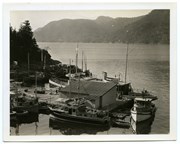
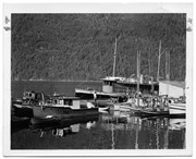
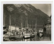
Photograph of The "Columbia" and the "John Antle" at the end of the wharf on Stuart Island, along with other boats. This is cropped from #1999.001.947.
Photograph of The "Columbia" and the "John Antle" at the end of the wharf on Stuart Island, along with other boats. This is cropped from #1999.001.947.
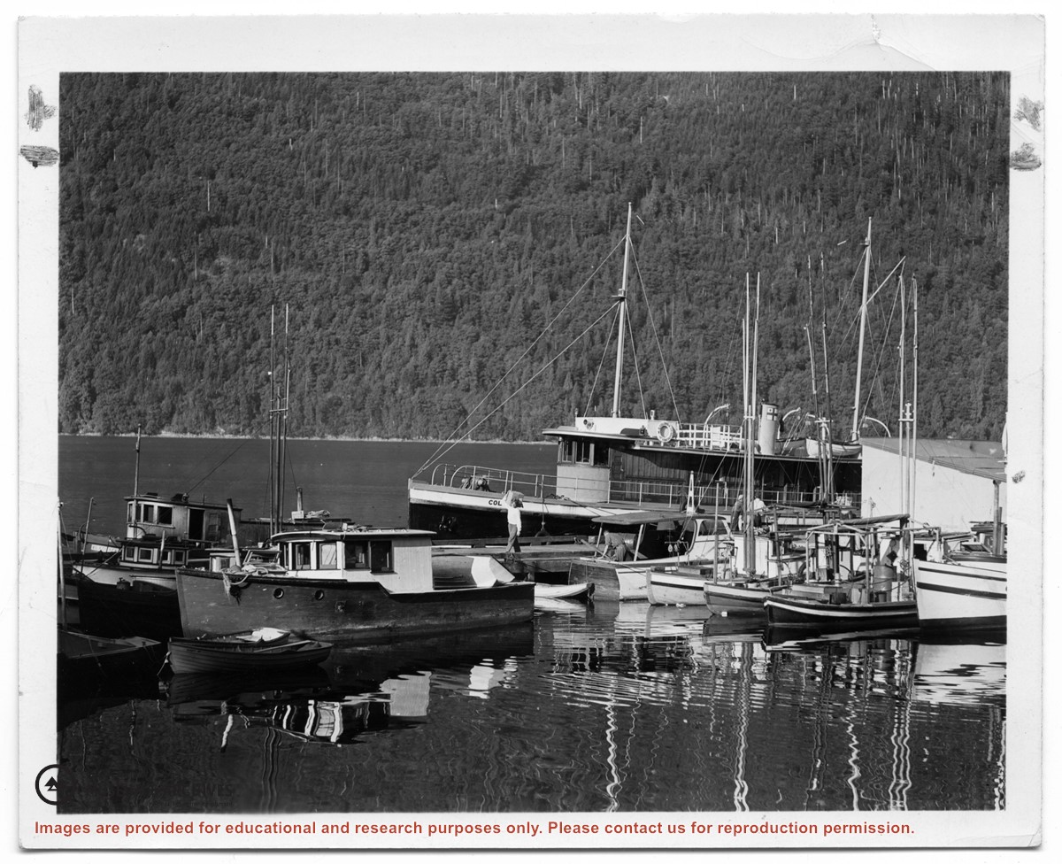
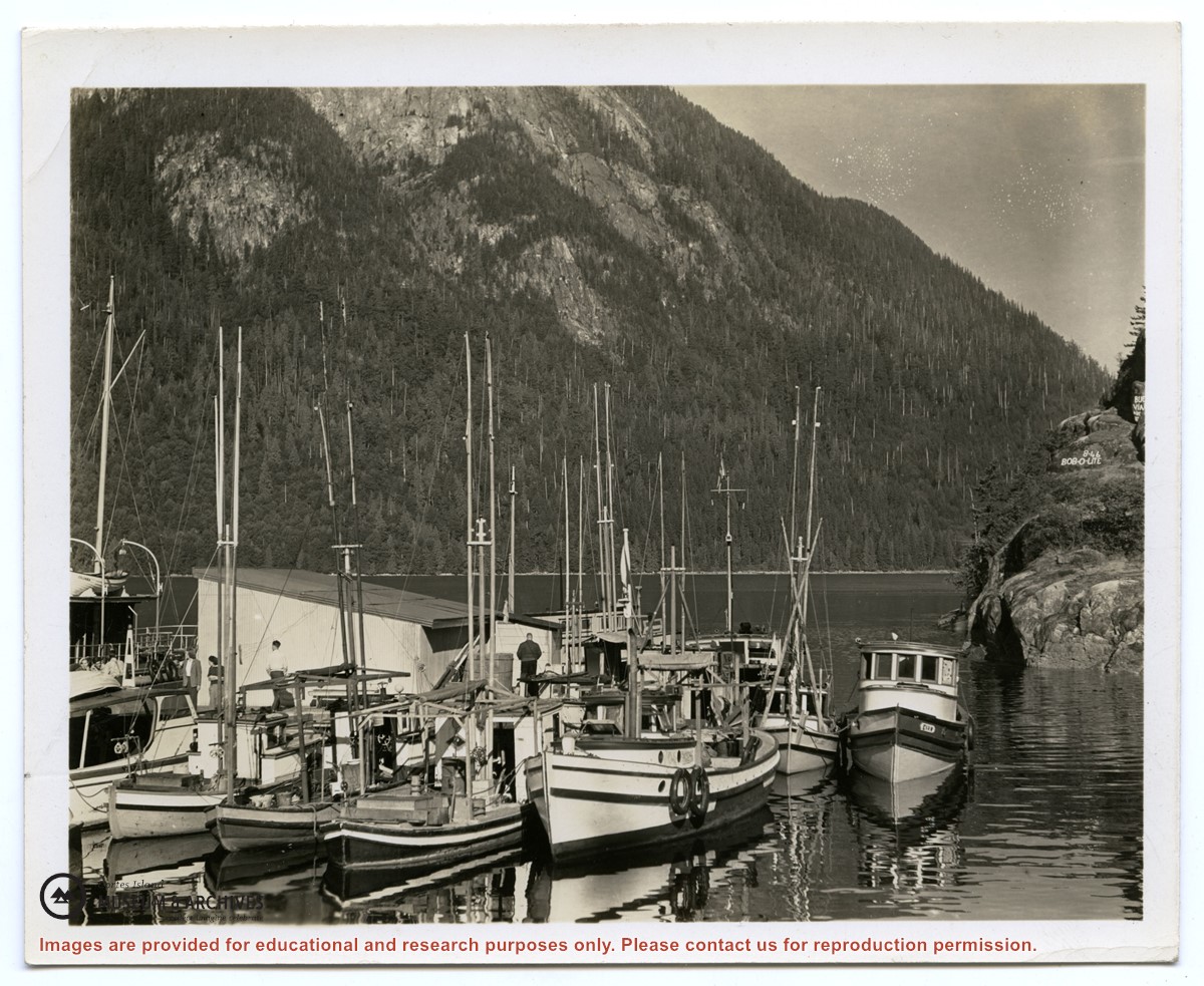
Photograph of the "Columbia" and the "John Antle" at the wharf on Stuart Island. Other boats are also tied up at the dock; there are buildings at the head of the wharf. See also #1999.001.938, which is a crop from this photo.
2 photograph prints: b&w; 12.5 x 10 cm and 25.5 x 12 cm
Scope and Content
Photograph of the "Columbia" and the "John Antle" at the wharf on Stuart Island. Other boats are also tied up at the dock; there are buildings at the head of the wharf. See also #1999.001.938, which is a crop from this photo.
Series consists of original drawings, watercolours and pastels created by residents of Cortes or Read Island, and a series of pen and ink drawings meant to illustrate Douglas' book, "Silence Is My Homeland".
Series consists of original drawings, watercolours and pastels created by residents of Cortes or Read Island, and a series of pen and ink drawings meant to illustrate Douglas' book, "Silence Is My Homeland".
Three greeting cards designed by artist Mary Weiler, who lived in Whaletown, and a series of four pen and ink drawings illustrating life aboard a fish boat. The latter were probably used as illustrations for an article written by Douglas (see Box 1 folder 29).
Three greeting cards designed by artist Mary Weiler, who lived in Whaletown, and a series of four pen and ink drawings illustrating life aboard a fish boat. The latter were probably used as illustrations for an article written by Douglas (see Box 1 folder 29).
File contains six pencil drawings and one watercolour of Channel Rock by Marge Des Marais, a friend of Douglas who lived at Seaford, and one pen and watercolour picture of the cabin by Margery Greene.
File contains six pencil drawings and one watercolour of Channel Rock by Marge Des Marais, a friend of Douglas who lived at Seaford, and one pen and watercolour picture of the cabin by Margery Greene.

.jpg?width=1200&404=no-img.jpg&watermark=wmk)
.jpg?width=1200&404=no-img.jpg&watermark=wmk)
.jpg?width=1200&404=no-img.jpg&watermark=wmk)
.jpg?width=180&404=no-img.jpg)
.jpg?width=1200&404=no-img.jpg&watermark=wmk)
.jpg?width=1200&404=no-img.jpg&watermark=wmk)
.jpg?width=180&404=no-img.jpg)