Fonds consists of records of the Harbour Authority of Cortes Island and includes meeting minutes, financial statements, administrative documents, correspondence, leases and newsletters. Original order has been maintained.
In 1995, Canada's Department of Fisheries and Oceans (DFO) was directed to divest all its recreational harbours managed under the Small Craft Harbours program. In the following years, the DFO launched a program to encourage local non-profit groups to assume day-to-day management and operation of fishing harbours.
The Harbour Authority of Cortes Island was formed in 1998 or 1999 to "[r]epresent the community of Cortes Island to preserve and promote the present and future marine infrastructure and maritime transportation links, including wharves; docking launch and moorage facilities until being replaced by a suitable public representative or government agency".
The Harbour Authority of Cortes Island manages five locations, Cortes Bay, Squirrel Cove Dock, Gorge Harbour Government Dock, Manson’s Landing Dock and Whaletown Dock. All provide safe well-maintained moorage facilities for a wide-ranging group of marine users year round.
Custodial History
Records were donated to CIMAS by Lynne Jordan in 2012.
Scope and Content
Fonds consists of records of the Harbour Authority of Cortes Island and includes meeting minutes, financial statements, administrative documents, correspondence, leases and newsletters. Original order has been maintained.
File contains May Ellingsen's notes on Cortes history, including pre-emptions, a trip to Mexico, and information about Squirrel Cove and Redonda Island.
File contains May Ellingsen's notes on Cortes history, including pre-emptions, a trip to Mexico, and information about Squirrel Cove and Redonda Island.
File contains text of the Memorandum of Understanding developed by Cortes Ecoforestry Society and Klahoose First Nation. Also includes twenty-nine (29) color photographic prints and eleven (11) color inkjet prints, which depict the signing of the MoU at Squirrel Cove and an Ecoforestry display at Smelt Bay. Photographs are stored in Photo Box #3.
File contains text of the Memorandum of Understanding developed by Cortes Ecoforestry Society and Klahoose First Nation. Also includes twenty-nine (29) color photographic prints and eleven (11) color inkjet prints, which depict the signing of the MoU at Squirrel Cove and an Ecoforestry display at Smelt Bay. Photographs are stored in Photo Box #3.
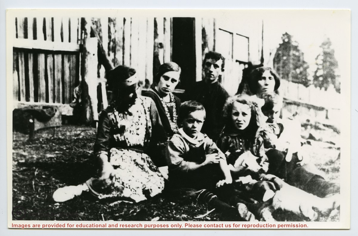
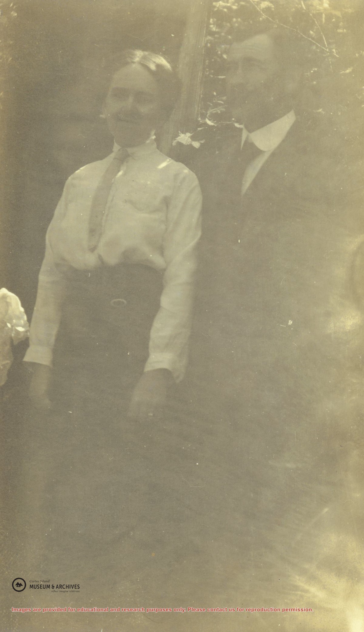
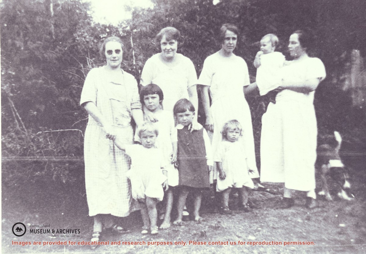
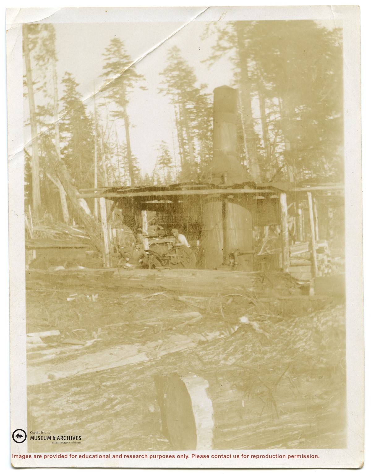
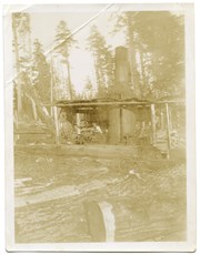
Families of Hernando Island men who worked together in a very small logging enterprise.
L to R: Mrs. Gwen (Fraser) Campbell holding Thelma's hand, Mrs. C. Owen (friend) behind Etta and Hazel McKay, Mrs. Jean (Wilfred) Manson behind Dorothy, Mrs. Florence (Ervin) McKay holding Minerva Campbell.
Families of Hernando Island men who worked together in a very small logging enterprise.
L to R: Mrs. Gwen (Fraser) Campbell holding Thelma's hand, Mrs. C. Owen (friend) behind Etta and Hazel McKay, Mrs. Jean (Wilfred) Manson behind Dorothy, Mrs. Florence (Ervin) McKay holding Minerva Campbell.
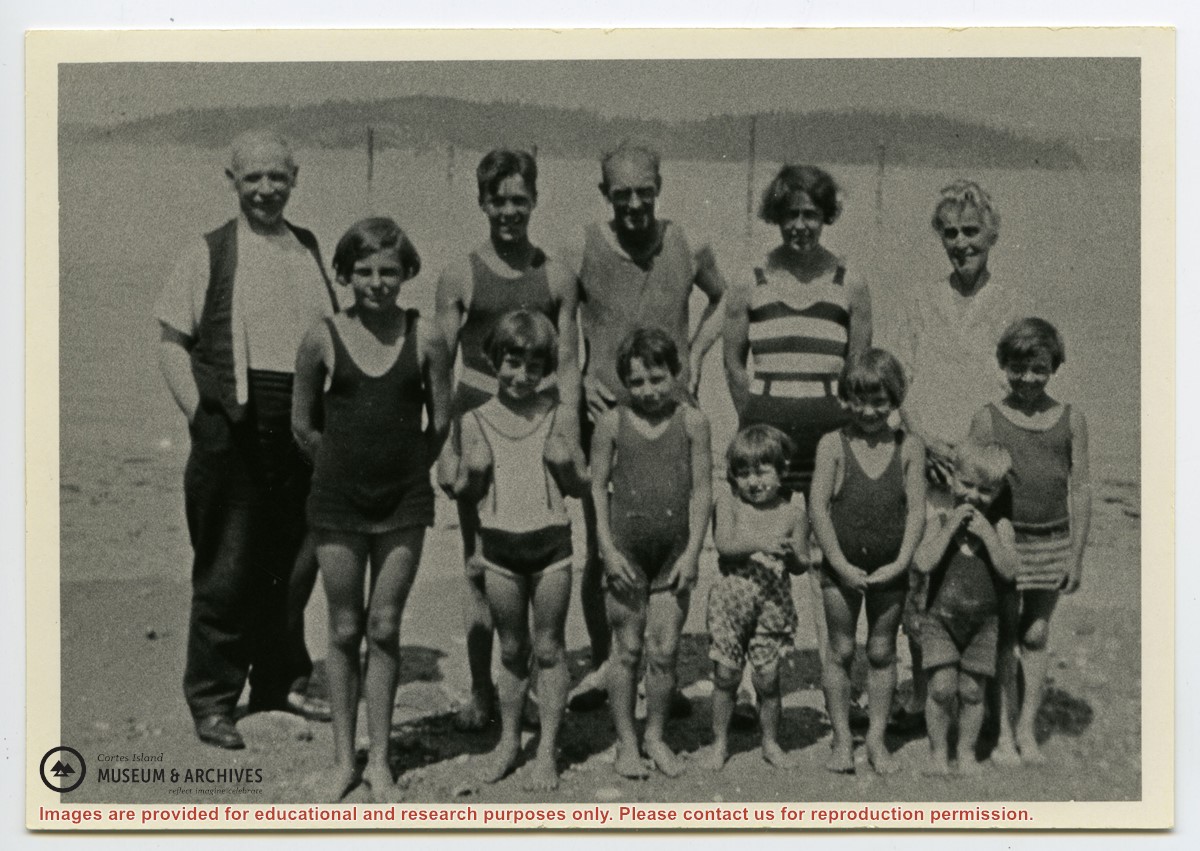
Photograph shows members of the Michael Manson extended family in bathing costumes. The are identified as Mr. Niven, Muriel Hurren, Jim Niven, Dick Parker, Thelma Campbell, Audrey Kenny, Jean Manson, Eileen Kenny, Minerva Campbell, Mrs. Niven, Dorothy Manson and Lorne Campbell.
Photograph shows members of the Michael Manson extended family in bathing costumes. The are identified as Mr. Niven, Muriel Hurren, Jim Niven, Dick Parker, Thelma Campbell, Audrey Kenny, Jean Manson, Eileen Kenny, Minerva Campbell, Mrs. Niven, Dorothy Manson and Lorne Campbell.
File contains five maps of Hernando Island: two showing plans of pre-emptions, 1891-1892; two copies of an old hand-drawn map, 1955; and one map of a later proposed development (undated). Some maps have notes on homesteads.
File contains five maps of Hernando Island: two showing plans of pre-emptions, 1891-1892; two copies of an old hand-drawn map, 1955; and one map of a later proposed development (undated). Some maps have notes on homesteads.
File contains a hand-drawn map of Hernando Island showing original pre-emptions, with information about settlement, schools and changes of title written on it.
File contains a hand-drawn map of Hernando Island showing original pre-emptions, with information about settlement, schools and changes of title written on it.
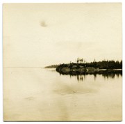
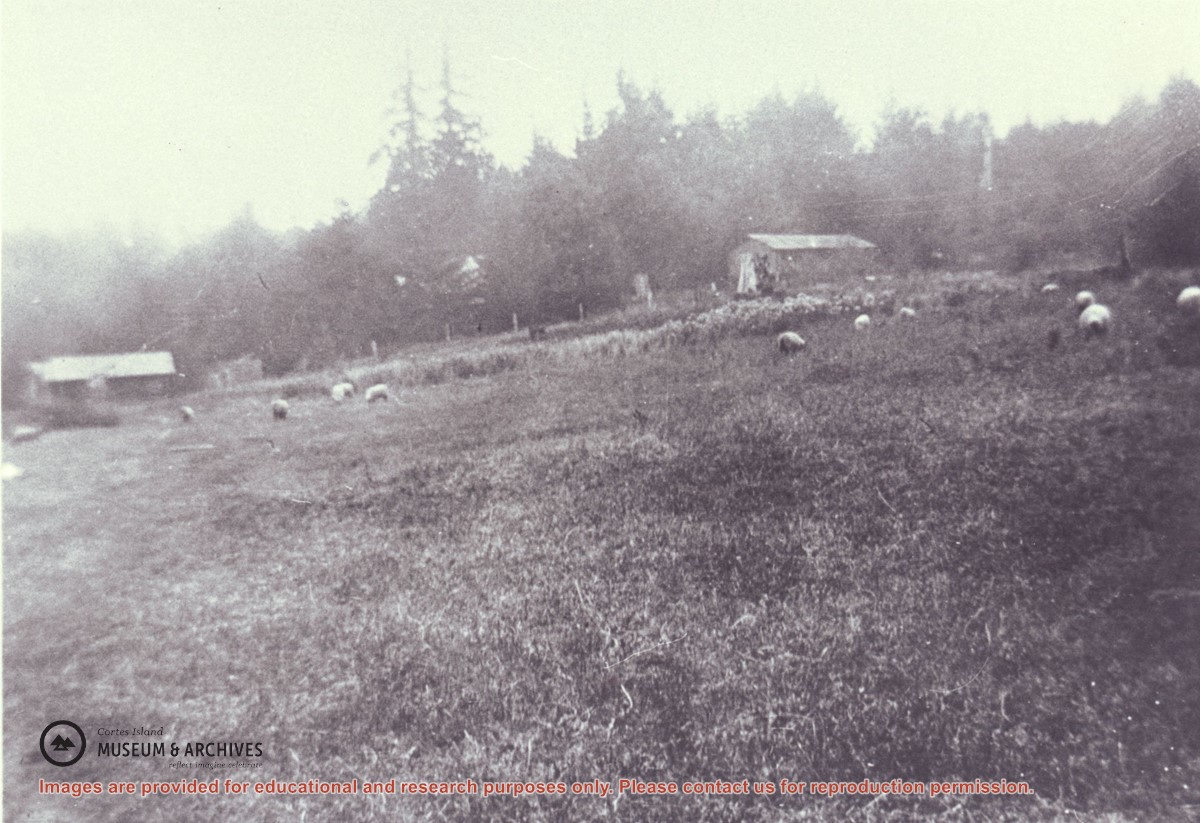
Manson's sheep grazing in the field on Hernando Island which was created by removing the old logging camp buildings. On the left is a one-time camp family house and on the right is the former cookhouse, now a barn.
Manson's sheep grazing in the field on Hernando Island which was created by removing the old logging camp buildings. On the left is a one-time camp family house and on the right is the former cookhouse, now a barn.