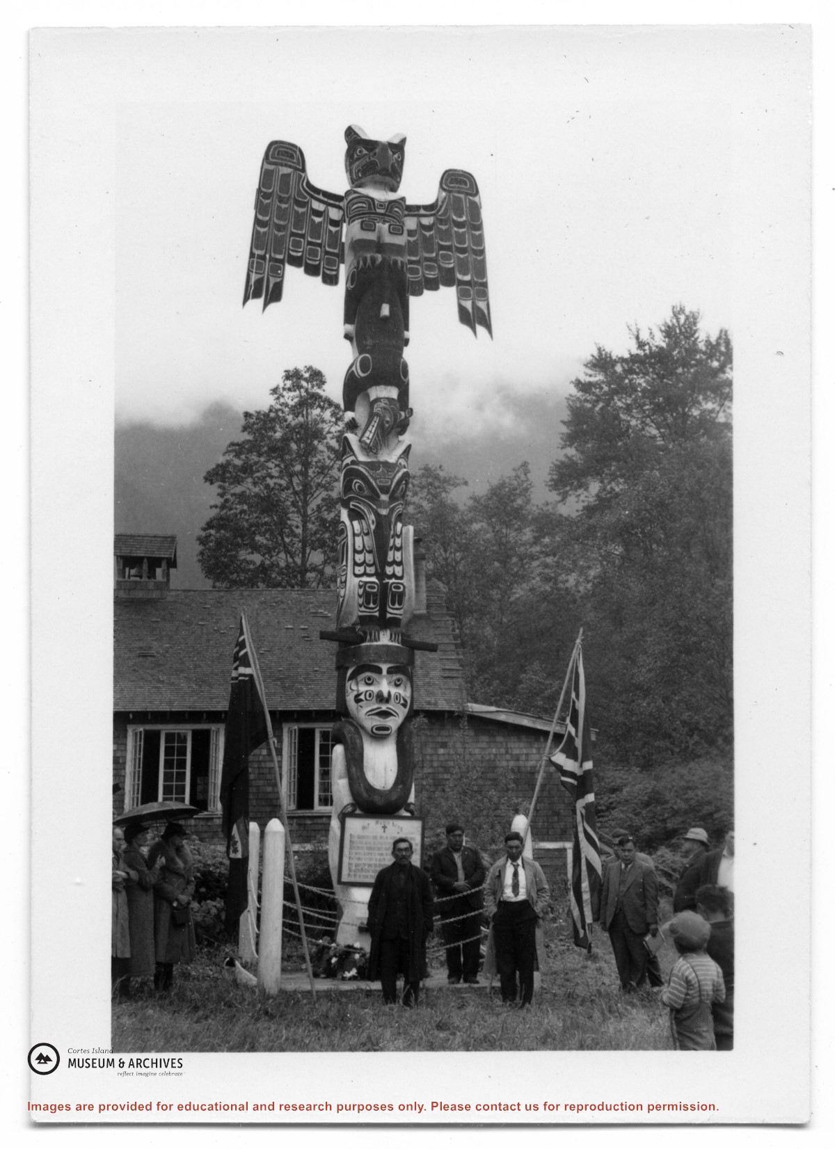
Photograph of a totem pole in front of a cedar shingled building. The bottom of the pole is a carved man holding a sign. A group of First Nations men is standing by the pole; a woman is on the left.
Photograph of a totem pole in front of a cedar shingled building. The bottom of the pole is a carved man holding a sign. A group of First Nations men is standing by the pole; a woman is on the left.
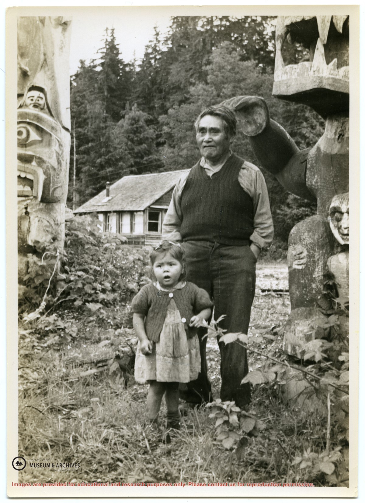
Photograph of Dick Flanders and his grandchild Louise at Mamalilliculla on Village Island. The paw of a carved bear on the totem is almost touching his head; there is another totem to the right, and a house in the bacground. See also #1999.001.0976.
Photograph of Dick Flanders and his grandchild Louise at Mamalilliculla on Village Island. The paw of a carved bear on the totem is almost touching his head; there is another totem to the right, and a house in the bacground. See also #1999.001.0976.
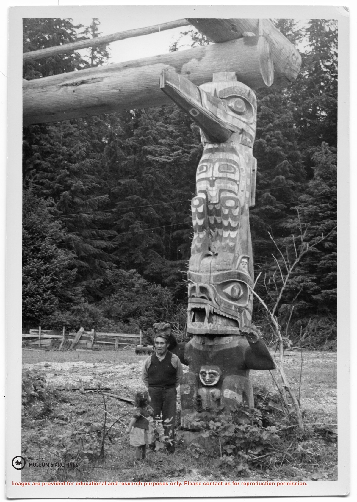
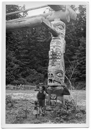
Photograph of Dick Flanders and his grandchild Louise at Mamalillaculla, Village Island. They are standing beside a carved totem pole which is supporting cross beams.
Photograph of Dick Flanders and his grandchild Louise at Mamalillaculla, Village Island. They are standing beside a carved totem pole which is supporting cross beams.
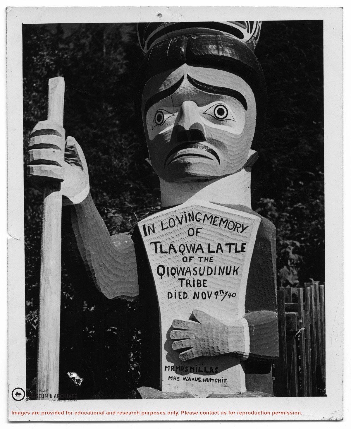
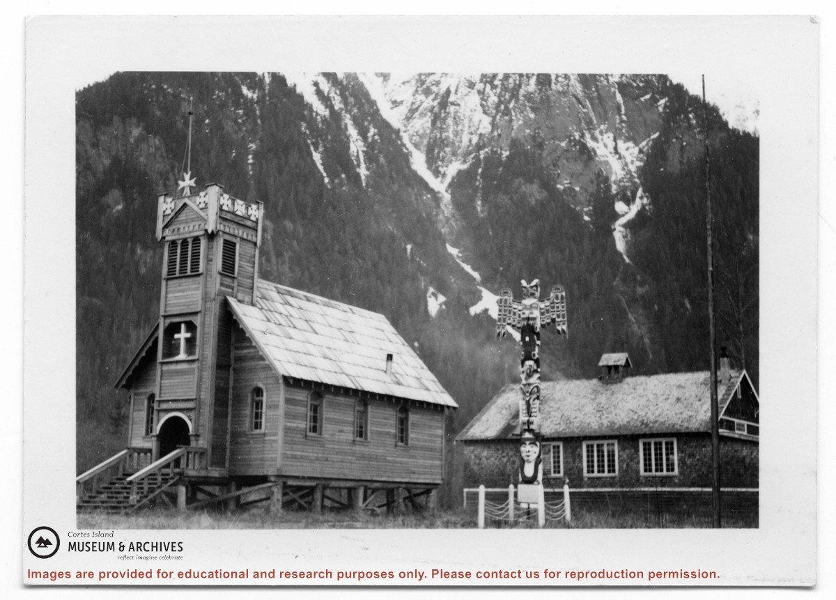
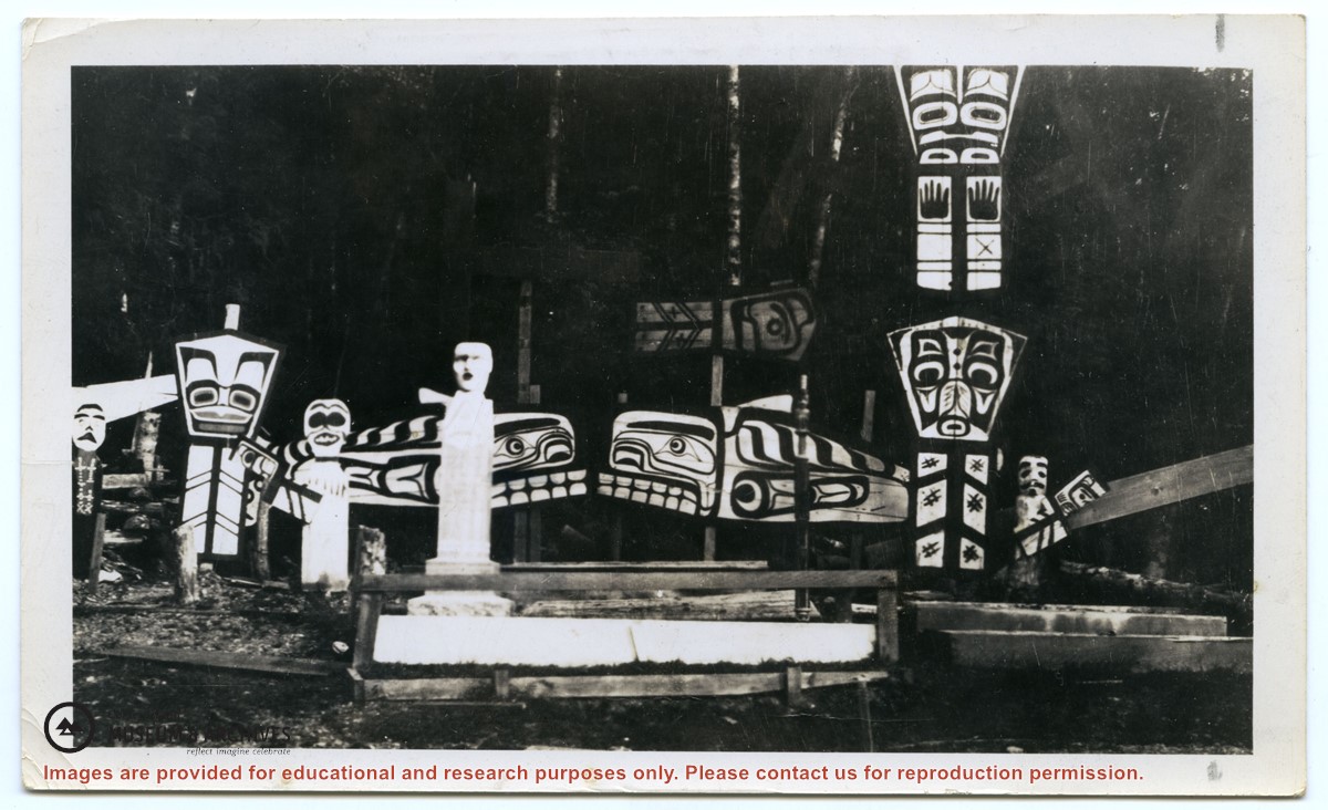
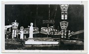
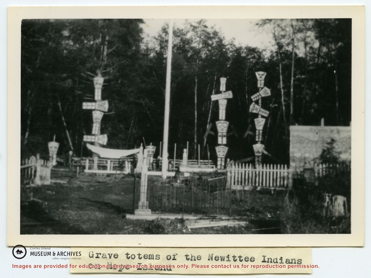
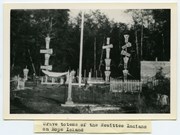
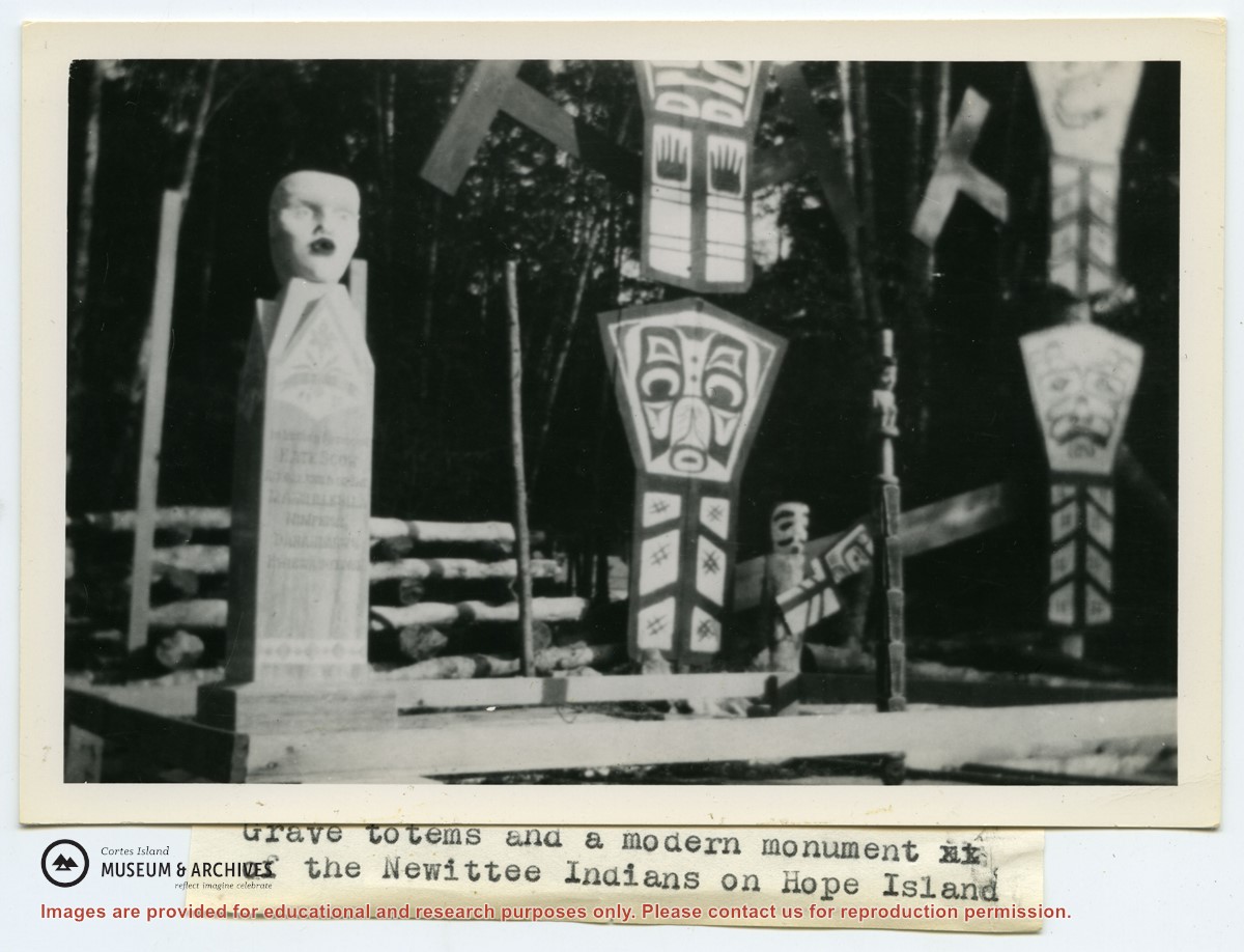
Photograph of a grave totem with a carved tablet at Alert Bay. Greene's title is "An Indian totem and tomb-stone in an Indian graveyard at Alret Bay, BC."
Photograph of a grave totem with a carved tablet at Alert Bay. Greene's title is "An Indian totem and tomb-stone in an Indian graveyard at Alret Bay, BC."
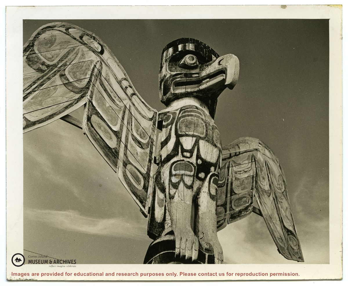
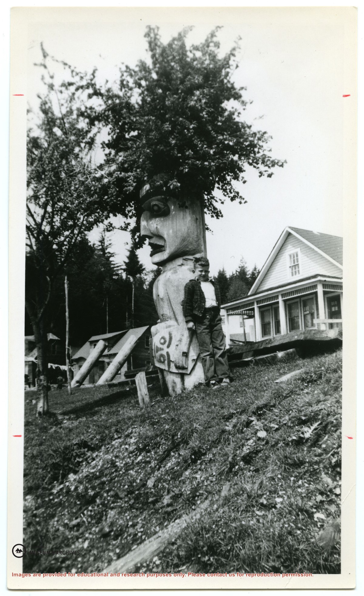
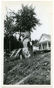
Photograph of a boy leaning against a totem figure, which has salal sprouting from its head. Note: this is the same boy seen in #1999.001.0965 and .0966.
Photograph of a boy leaning against a totem figure, which has salal sprouting from its head. Note: this is the same boy seen in #1999.001.0965 and .0966.
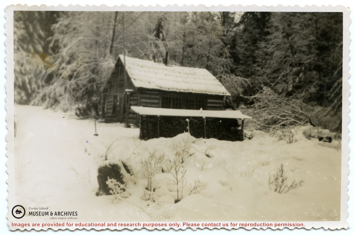
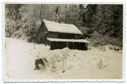
Photograph of the old log school on Read Island, which was about a mile back from the water .A woodshed is to its side; the ground and roofs are covered in snow.
Photograph of the old log school on Read Island, which was about a mile back from the water .A woodshed is to its side; the ground and roofs are covered in snow.
File contains title information and photocopies of land grants and subsequent conveyances for the following:
John Williams: 1914, Crown Grant for the fractional SW 1/4 of Sec 22 and fractional NW 1/4 of Sec 22 (east of Gorge Harbour entrance)
John Williams: 1914, Crown Grant for the fractional SW 1/4 of Sec 22 and frac. NW 1/4 of Sec 18 (west of the Gorge Harbour entrance)
File contains three oversize maps which are stored in the map cabinet: Map of Section 22, Plan VIP52378, Lots A,B,C (blueprint map; 85 cm x 54 cm, 1985); map of Plan 27966 (blueprint map; 55 cm x 43 cm, 1974); photocopy of map of fractional NW 1/4 Sec 17 (55 cm x 43 cm, 1973)
(Files 3 through 7 are from the same envelope.)
File contains a photocopy of Crown Grant and documentation of subsequent changes in title for:
William Barrett Lennard: 1928, Crown Grant for the SE and SW 1/4s of Section 23 (on the SE shore of Gorge Harbour)
(Files 3 through 7 are from the same envelope.)
File contains a photocopy of Crown Grant and documentation of subsequent changes in title for:
William Barrett Lennard: 1928, Crown Grant for the SE and SW 1/4s of Section 23 (on the SE shore of Gorge Harbour)
(Files 3 through 7 are from the same envelope.)
File contains a photocopy of Crown Grant and documentation of subsequent changes in title for:
Eliza Breeze: 1920, Crown Grant for Fractional NW 1/4 of Section 18 (east of the entrance to Gorge Harbour)
(Files 3 through 7 are from the same envelope.)
File contains a photocopy of Crown Grant and documentation of subsequent changes in title for:
Eliza Breeze: 1920, Crown Grant for Fractional NW 1/4 of Section 18 (east of the entrance to Gorge Harbour)
(Files 3 through 7 are from the same envelope.)
File contains a section map showing properties southeast of Gorge Harbour and title information on the property, later owned by Gilean Douglas, and known as Channel Rock.
To John Pool: 1930, Crown Grant of the W 1/2 of the SE 1/4 of Sec. 21 and fractional SW 1/4 of Sec. 21 and Crown Grant fo the fractional E 1/2 of fractional SE 1/4 of Sec. 21